Category:Pentney
Aller à la navigation
Aller à la recherche
English: Pentney is a village and civil parish in the English county of Norfolk, located about south east of Kings Lynn placing it about halfway between Kings Lynn and Swaffham on the A47 road.
localité britannique du comté anglais de Norfolk  | |||||
| Téléverser des médias | |||||
| Nature de l’élément | |||||
|---|---|---|---|---|---|
| Lieu | King's Lynn and West Norfolk, Norfolk, Angleterre de l'Est, Angleterre | ||||
| Superficie |
| ||||
 | |||||
Sous-catégories
Cette catégorie comprend 4 sous-catégories, dont les 4 ci-dessous.
M
P
- Pentney Abbey Gatehouse (5 F)
- Pentney Hoard (5 F)
- Pentney War Memorial (1 F)
Média dans la catégorie « Pentney »
Cette catégorie comprend 89 fichiers, dont les 89 ci-dessous.
-
 A shelter for anglers - geograph.org.uk - 1639078.jpg 480 × 640 ; 178 kio
-
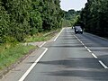
 A47 approaching B1153 junction - geograph.org.uk - 5001266.jpg 1 600 × 1 022 ; 450 kio
-
 A47 near Narborough - geograph.org.uk - 4628079.jpg 640 × 480 ; 424 kio
-
 An alley of ivy-clad trees beside the River Nar - geograph.org.uk - 1639097.jpg 640 × 468 ; 167 kio
-
 Ancient wayside cross - geograph.org.uk - 6169314.jpg 3 456 × 2 592 ; 3,59 Mio
-
 Ancient wayside cross - geograph.org.uk - 6169315.jpg 3 456 × 2 592 ; 2,11 Mio
-
 Ancient wayside cross - geograph.org.uk - 6169317.jpg 3 456 × 2 592 ; 3,62 Mio
-
 Augustinian Priory Gatehouse - geograph.org.uk - 5949649.jpg 1 024 × 768 ; 209 kio
-
 Bench Mark at Pentney church, Norfolk - geograph.org.uk - 1936963.jpg 640 × 480 ; 106 kio
-
 Bilney Road just before the entrance to Church Farm - geograph.org.uk - 6169321.jpg 3 456 × 2 592 ; 3,76 Mio
-
 Bradmoor Plantation, Narford - geograph.org.uk - 3555036.jpg 480 × 640 ; 272 kio
-
 Carrstone 004.JPG 1 802 × 833 ; 715 kio
-
 Carrstone 008.JPG 978 × 1 222 ; 630 kio
-
 Church Meadow, Pentney - geograph.org.uk - 1936655.jpg 640 × 480 ; 90 kio
-
 Clodbuster on the edge of a field - geograph.org.uk - 1936866.jpg 640 × 480 ; 103 kio
-
 Cockle shells by Denton's Farm - geograph.org.uk - 3678195.jpg 640 × 427 ; 135 kio
-
 Cows grazing in the late afternoon sunshine - geograph.org.uk - 4363090.jpg 1 024 × 768 ; 191 kio
-
 Cross roads among the sand pits - geograph.org.uk - 3678278.jpg 640 × 427 ; 84 kio
-
 Eastbound A47 near Narborough - geograph.org.uk - 4628089.jpg 640 × 480 ; 420 kio
-
 Eastbound A47, Little Eight Acre Plantation - geograph.org.uk - 4628085.jpg 640 × 480 ; 418 kio
-
 Elevators dropping graded sand into piles for distribution - geograph.org.uk - 6169241.jpg 3 456 × 2 592 ; 3,63 Mio
-
 Entrance to Pentney Lakes and the water ski school - geograph.org.uk - 6169267.jpg 3 456 × 2 592 ; 3,67 Mio
-
 Field boundary - geograph.org.uk - 823194.jpg 640 × 480 ; 97 kio
-
 Fields north of Pentney - geograph.org.uk - 1936656.jpg 640 × 480 ; 103 kio
-
 Footbridge and gate house - geograph.org.uk - 823174.jpg 640 × 480 ; 89 kio
-
 Footpath junction - geograph.org.uk - 823205.jpg 640 × 480 ; 72 kio
-
 Footpath to the River Nar, Narford - geograph.org.uk - 3555050.jpg 640 × 480 ; 266 kio
-
 Gravel pit lakes - geograph.org.uk - 5949637.jpg 1 024 × 768 ; 137 kio
-
 Grey Cottages, Low Road, Pentney - geograph.org.uk - 3619288.jpg 1 600 × 1 200 ; 765 kio
-
 Heaps of aggregate at the Nar Valley sand and gravel quarry - geograph.org.uk - 6169239.jpg 3 456 × 2 592 ; 3,78 Mio
-
 HGV on the A47 near to Pentney - geograph.org.uk - 4645069.jpg 640 × 480 ; 464 kio
-
 Hollow oak tree by the Nar Valley Walk - geograph.org.uk - 2980462.jpg 480 × 640 ; 130 kio
-
 Jackdaw at Pentney church - geograph.org.uk - 1931843.jpg 640 × 480 ; 115 kio
-
 Minor Junction on the A47 - geograph.org.uk - 4670814.jpg 640 × 427 ; 429 kio
-
 Nar Valley Green Burials - geograph.org.uk - 1936657.jpg 640 × 480 ; 157 kio
-
 Nar valley way marker - geograph.org.uk - 823332.jpg 480 × 640 ; 85 kio
-
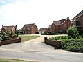
 New houses in Church Meadow, Pentney - geograph.org.uk - 1936654.jpg 640 × 480 ; 114 kio
-
 Norfolk Woods Resort - geograph.org.uk - 6124532.jpg 3 456 × 2 592 ; 3,94 Mio
-
 Norfolk Woods Resort ^ Spa - geograph.org.uk - 6124529.jpg 3 456 × 2 592 ; 3,86 Mio
-
 Old stone cross - geograph.org.uk - 630832.jpg 480 × 640 ; 55 kio
-
-
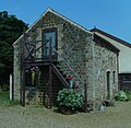 Pentney Barn.JPG 1 580 × 1 536 ; 1,01 Mio
-
 Pentney Lane, Pentney - geograph.org.uk - 6124517.jpg 3 296 × 2 472 ; 4,16 Mio
-
 Pentney Park camping and caravan site entrance - geograph.org.uk - 594283.jpg 600 × 450 ; 119 kio
-
 Pentney Priory Gatehouse as seen from Nar Valley Way - geograph.org.uk - 5620930.jpg 5 184 × 2 920 ; 5,5 Mio
-
 Pentney St. Mary Magdalene's church - geograph.org.uk - 4346691.jpg 640 × 480 ; 160 kio
-
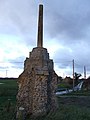
 Pentneycross.jpg 1 024 × 690 ; 191 kio
-
 Pentneysign.jpg 696 × 1 000 ; 309 kio
-
 Petney Lakes - geograph.org.uk - 5949626.jpg 1 024 × 768 ; 99 kio
-
 Poplars in pasture - geograph.org.uk - 1639071.jpg 640 × 480 ; 161 kio
-
 Poplars in pasture south of the River Nar - geograph.org.uk - 1639086.jpg 480 × 640 ; 197 kio
-
 Private woodland near Pentney Lodge - geograph.org.uk - 3770516.jpg 4 320 × 3 240 ; 5,62 Mio
-
 Projects 018.JPG 1 637 × 1 429 ; 982 kio
-
 Recently created gated entrance off Abbey Road, Pentney - geograph.org.uk - 6169292.jpg 3 456 × 2 592 ; 3,91 Mio
-
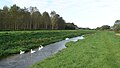
 River Nar - geograph.org.uk - 630805.jpg 640 × 480 ; 80 kio
-

-
 Road to the sand quarry and the fishing lakes - geograph.org.uk - 6169252.jpg 3 456 × 2 592 ; 3,61 Mio
-
 Savepentney.jpg 1 024 × 761 ; 443 kio
-
 Shady crossing - geograph.org.uk - 823188.jpg 480 × 640 ; 124 kio
-
 Sign on Nar Valley Way at junction with Pentney Drove - geograph.org.uk - 5620933.jpg 5 184 × 2 920 ; 7,03 Mio
-
 Sluice on the river Nar - geograph.org.uk - 630800.jpg 640 × 480 ; 57 kio
-
 Sluice on the river Nar - geograph.org.uk - 823218.jpg 640 × 480 ; 88 kio
-

-

-
 St Mary Magdalene's church in Pentney - geograph.org.uk - 1936662.jpg 640 × 480 ; 113 kio
-
 St Mary Magdalene's church in Pentney - geograph.org.uk - 1936666.jpg 640 × 480 ; 124 kio
-
 St Mary Magdalene's church in Pentney - geograph.org.uk - 1936667.jpg 640 × 480 ; 128 kio
-
 St Mary Magdalene's church in Pentney - geograph.org.uk - 1936668.jpg 640 × 480 ; 124 kio
-
 St Mary Magdalene's church in Pentney - geograph.org.uk - 1936671.jpg 640 × 480 ; 130 kio
-

-

-
 The River Nar - geograph.org.uk - 3555060.jpg 480 × 640 ; 278 kio
-

-
 Track to Church Farm, Pentney - geograph.org.uk - 6169323.jpg 3 456 × 2 592 ; 2,9 Mio
-
 Track to Church Farm, Pentney, Norfolk - geograph.org.uk - 3770518.jpg 4 320 × 3 240 ; 5,4 Mio
-
 Tree plantation - geograph.org.uk - 5949643.jpg 1 024 × 768 ; 256 kio
-

-
 Uprooted poplars - geograph.org.uk - 1639072.jpg 640 × 480 ; 173 kio
-
 View south along Paws Lane - geograph.org.uk - 1743568.jpg 640 × 480 ; 141 kio
-
 Waterwheel at Narborough Bone Mill - geograph.org.uk - 3972488.jpg 1 600 × 1 200 ; 762 kio
-
 Westbound A47 near Pentney - geograph.org.uk - 4645068.jpg 640 × 480 ; 464 kio
-
 Westbound A47 near to Narborough - geograph.org.uk - 4645065.jpg 640 × 480 ; 462 kio
-
 Western end of Abbey Road, Pentney - geograph.org.uk - 6169293.jpg 3 456 × 2 592 ; 3,77 Mio
-
 Wind damaged trees - geograph.org.uk - 632728.jpg 640 × 480 ; 140 kio
-
 X1 Service to King's Lynn - geograph.org.uk - 4670811.jpg 640 × 480 ; 536 kio
-
 Cookes Cottage - geograph.org.uk - 621530.jpg 640 × 480 ; 103 kio
-
 Pentney cow meadow - geograph.org.uk - 615164.jpg 600 × 450 ; 148 kio
-
 Pentney village sign - geograph.org.uk - 422101.jpg 492 × 640 ; 98 kio
-
 South of Pentney in autumn - geograph.org.uk - 615162.jpg 600 × 450 ; 154 kio


