Category:Pentrich
Vai alla navigazione
Vai alla ricerca

village and civil parish in Amber Valley district, Derbyshire, England  | |||||
| Carica un file multimediale | |||||
| Istanza di | |||||
|---|---|---|---|---|---|
| Luogo | Amber Valley, Derbyshire, Midlands Orientali, Inghilterra | ||||
 | |||||
Sottocategorie
Questa categoria contiene le 2 sottocategorie indicate di seguito, su un totale di 2.
B
- Jeremiah Brandreth (5 F)
M
File nella categoria "Pentrich"
Questa categoria contiene 159 file, indicati di seguito, su un totale di 159.
-
 "Fresh Farm Eggs" sign at Weir Mill Farm - geograph.org.uk - 4841310.jpg 4 577 × 3 741; 3,8 MB
-
 "The Mill" west of Pentrich - by The River Amber - geograph.org.uk - 4841357.jpg 4 909 × 3 687; 5,09 MB
-
 A tree in full leaf - geograph.org.uk - 5827201.jpg 2 000 × 1 333; 3,28 MB
-
 A view of Pentrich from the west - geograph.org.uk - 4841350.jpg 5 043 × 3 548; 4,85 MB
-
 A38 near Asherfields - geograph.org.uk - 5137359.jpg 640 × 481; 36 KB
-
 A610 at Lower Hartshay - geograph.org.uk - 5137360.jpg 640 × 481; 46 KB
-
 A610 bend near The George inn - geograph.org.uk - 3530298.jpg 640 × 404; 96 KB
-
 A610 near Lower Hartsay - geograph.org.uk - 1810723.jpg 640 × 480; 65 KB
-
 A610 nears Buckland Hollow - geograph.org.uk - 5137372.jpg 640 × 481; 46 KB
-
 Amberley Farmhouse - geograph.org.uk - 938429.jpg 589 × 442; 55 KB
-
 Amberside Farm - geograph.org.uk - 1278362.jpg 640 × 479; 74 KB
-
 Amberside Farmhouse.jpg 4 930 × 3 635; 3,92 MB
-
 An old stone barn - geograph.org.uk - 5827208.jpg 2 000 × 1 333; 2,96 MB
-
 Another Hammersmith Station - geograph.org.uk - 4989469.jpg 800 × 600; 141 KB
-
 Asher Lane - geograph.org.uk - 1306567.jpg 640 × 479; 129 KB
-
 Asher Lane - geograph.org.uk - 1307384.jpg 640 × 479; 132 KB
-
 Asher Lane - geograph.org.uk - 4944955.jpg 3 072 × 1 728; 2,18 MB
-
 Asher Lane - geograph.org.uk - 4989018.jpg 800 × 600; 121 KB
-
 Asher Lane and timber yard - geograph.org.uk - 2679457.jpg 2 048 × 1 536; 671 KB
-
 Asher Lane towards Pentrich - geograph.org.uk - 2333917.jpg 1 600 × 1 200; 278 KB
-
 B6013 towards Belper - geograph.org.uk - 2335130.jpg 1 600 × 1 200; 539 KB
-
 B6016 across A38 - geograph.org.uk - 4578894.jpg 640 × 339; 162 KB
-
 B6016 bridge over A38 - geograph.org.uk - 4045999.jpg 1 600 × 1 065; 291 KB
-
 Back Lane, near Pentrich - geograph.org.uk - 2117678.jpg 640 × 480; 41 KB
-
 Bacon Lane - geograph.org.uk - 1306581.jpg 479 × 640; 107 KB
-
 Bacon Lane - geograph.org.uk - 1306590.jpg 479 × 640; 157 KB
-
 Bacon Lane - geograph.org.uk - 1306594.jpg 640 × 479; 115 KB
-
 Bacon Lane near Pentrich - geograph.org.uk - 2899379.jpg 3 296 × 2 472; 1,27 MB
-
 Barn with tractors - geograph.org.uk - 1278367.jpg 640 × 479; 125 KB
-
 Behind the trees - geograph.org.uk - 1304943.jpg 640 × 479; 199 KB
-
 Between the tracks - geograph.org.uk - 2046754.jpg 640 × 480; 82 KB
-
 Bluebells - geograph.org.uk - 3006191.jpg 1 600 × 1 200; 1 001 KB
-
 Bridge over Asher Lane - geograph.org.uk - 2333912.jpg 1 600 × 1 200; 316 KB
-
 Broad Oaks Farm - geograph.org.uk - 1306585.jpg 640 × 479; 79 KB
-
 Broad Oaks Farm - geograph.org.uk - 2117691.jpg 640 × 480; 68 KB
-
 Bull Hill Cottage - geograph.org.uk - 5827179.jpg 2 000 × 1 333; 2,97 MB
-
 Bus stop on the A610 - geograph.org.uk - 1810724.jpg 640 × 480; 67 KB
-
 Butterley Reservoir - geograph.org.uk - 2436820.jpg 1 024 × 768; 238 KB
-
 Butterley Reservoir - geograph.org.uk - 4775017.jpg 2 416 × 764; 409 KB
-
 Butterley Reservoir - geograph.org.uk - 4947383.jpg 800 × 600; 128 KB
-
 Butterley Reservoir - geograph.org.uk - 6461856.jpg 5 184 × 3 888; 3,29 MB
-
 Butterley Reservoir and Midland Steam Centre - geograph.org.uk - 2435537.jpg 1 024 × 768; 166 KB
-
 Butterley Reservoir and train - geograph.org.uk - 2046768.jpg 640 × 480; 65 KB
-
 Butterley Reservoir outflow - geograph.org.uk - 2436822.jpg 1 024 × 768; 260 KB
-
 Causeway across Butterley Reservoir, Ripley, Derbyshire - geograph.org.uk - 5575469.jpg 5 472 × 3 648; 4,66 MB
-
 Coneygrey Farm - geograph.org.uk - 1306591.jpg 640 × 479; 116 KB
-
 Coneygrey Farmhouse.jpg 3 570 × 4 750; 2,88 MB
-
 Corner Cottage, Pentrich - geograph.org.uk - 6201423.jpg 5 013 × 3 759; 4,24 MB
-
 Cow at Coneygrey Farm - geograph.org.uk - 6201419.jpg 4 882 × 3 768; 4,6 MB
-
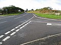
 Crossroad north of Pentrich - geograph.org.uk - 6201427.jpg 5 087 × 3 427; 3,28 MB
-
 Crossroads near Pentrich - geograph.org.uk - 1306583.jpg 640 × 479; 115 KB
-
 Crown of thorns - geograph.org.uk - 1210160.jpg 503 × 640; 93 KB
-
 Derbyshire UK parish map highlighting Pentrich.svg 888 × 1 308; 2,34 MB
-
 Devonshire Arms, Pentrichlane-end - geograph.org.uk - 1278366.jpg 640 × 479; 66 KB
-
 English apples - geograph.org.uk - 2117452.jpg 640 × 424; 80 KB
-
 Entering Swanwick from the west - geograph.org.uk - 6201428.jpg 5 013 × 3 759; 3,41 MB
-
 Entrance to Asher Lane Business Park - geograph.org.uk - 2899056.jpg 3 216 × 2 362; 1,64 MB
-
 Factory wall - geograph.org.uk - 1307414.jpg 640 × 479; 116 KB
-
 Factory wall - geograph.org.uk - 1307510.jpg 640 × 479; 113 KB
-
 Farmland near Pentrich Church - geograph.org.uk - 2333923.jpg 1 600 × 1 200; 580 KB
-
 Farmland off Bacon Lane, Pentrich - geograph.org.uk - 2333926.jpg 1 600 × 1 200; 325 KB
-
 Farmland off Millstone Lane - geograph.org.uk - 2333974.jpg 1 600 × 1 200; 339 KB
-
 Fields Farm - geograph.org.uk - 5827191.jpg 2 000 × 1 333; 3,26 MB
-
 Fields near Lower Hartshay - geograph.org.uk - 4255675.jpg 4 000 × 3 000; 2,52 MB
-
 Fieldscape near Pentrich - geograph.org.uk - 1306593.jpg 640 × 479; 124 KB
-
 Fishing Peg ^23 - geograph.org.uk - 4989477.jpg 800 × 600; 168 KB
-
 Footbridge over the River Amber - geograph.org.uk - 2335122.jpg 1 600 × 1 200; 820 KB
-
 Footpath crossing the tracks - geograph.org.uk - 2679478.jpg 1 536 × 2 048; 872 KB
-
 Footpath near Pentrich - geograph.org.uk - 1304941.jpg 640 × 479; 195 KB
-
 Footpath off the A610 - geograph.org.uk - 2335132.jpg 1 600 × 1 200; 990 KB
-
 Former mill on the River Amber - geograph.org.uk - 2335123.jpg 1 600 × 1 200; 189 KB
-
 Gated track to Asherfields - geograph.org.uk - 2333913.jpg 1 600 × 1 200; 587 KB
-
 Greater Stitchwort - geograph.org.uk - 1306586.jpg 640 × 479; 202 KB
-
 Gritter lorries at rest - geograph.org.uk - 2046747.jpg 640 × 480; 76 KB
-
 Half a mile to junction for Ripley - geograph.org.uk - 4567767.jpg 640 × 287; 132 KB
-
 Hammersmith Station - geograph.org.uk - 2046751.jpg 640 × 480; 95 KB
-
 Hammersmith station - geograph.org.uk - 4944948.jpg 3 072 × 1 728; 2,13 MB
-
 Hammersmith Station and Signal Box - geograph.org.uk - 6457522.jpg 4 520 × 3 147; 3,88 MB
-
 Head of Steam - geograph.org.uk - 4775030.jpg 1 730 × 1 217; 250 KB
-
 House on Asher Lane, Pentrich - geograph.org.uk - 4841333.jpg 4 974 × 3 641; 4,6 MB
-
 Jackson's Lane - geograph.org.uk - 2415930.jpg 1 024 × 768; 252 KB
-
 K&H Doyle bus Optare Solo in Pentrich, Derbyshire 30 April 2009.jpg 640 × 479; 127 KB
-
 Kilby Bridge Signal box - geograph.org.uk - 118149.jpg 480 × 640; 276 KB
-
 Lane End Farm - geograph.org.uk - 1278363.jpg 640 × 479; 87 KB
-
-
 Lych Gate at St Mathew's Church. Pentrich, Derbyshire. - geograph.org.uk - 5575042.jpg 5 358 × 3 648; 4,62 MB
-
 Main Road, Pentrich - geograph.org.uk - 1306569.jpg 640 × 479; 99 KB
-
 Main Road, Pentrich - geograph.org.uk - 3005907.jpg 1 600 × 1 200; 362 KB
-
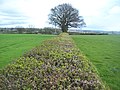 Managed Hedgerow to the North of Pentrich - geograph.org.uk - 2899403.jpg 3 296 × 2 472; 1,06 MB
-
 Meter manhole - geograph.org.uk - 1306589.jpg 479 × 640; 170 KB
-

-
 Milepost at Pentrichlane-end - geograph.org.uk - 1278364.jpg 478 × 640; 99 KB
-
 Mill near Pentrichlane end - geograph.org.uk - 2117477.jpg 640 × 480; 119 KB
-
 Mill turbine - geograph.org.uk - 1278353.jpg 640 × 479; 152 KB
-
 Millstone Lane - geograph.org.uk - 1306584.jpg 640 × 479; 146 KB
-

-
-
 Millstone lane towards Oakerthorpe - geograph.org.uk - 2333971.jpg 1 600 × 1 200; 572 KB
-
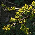 New thorn leaves in the spring sun - geograph.org.uk - 1210157.jpg 640 × 640; 99 KB
-
 Northern end of Butterley Reservoir - geograph.org.uk - 2436843.jpg 1 024 × 768; 268 KB
-
 Old Milepost by the B6013, Pentrichlane-end (geograph 5623787).jpg 986 × 1 554; 205 KB
-
 On Riley Lane, Pentrich - geograph.org.uk - 4841316.jpg 5 048 × 3 661; 5,32 MB
-
 Path beside the A610 towards Ripley - geograph.org.uk - 2335136.jpg 1 600 × 1 200; 565 KB
-
 Path by Butterley Reservoir - geograph.org.uk - 2436837.jpg 1 024 × 768; 301 KB
-
 Pentrich - geograph.org.uk - 1306595.jpg 640 × 479; 97 KB
-
 Pentrich - Riley Lane - geograph.org.uk - 1023737.jpg 640 × 480; 91 KB
-
 Pentrich Church - geograph.org.uk - 2333921.jpg 1 600 × 1 200; 395 KB
-
 Pentrich farmland - geograph.org.uk - 2117494.jpg 640 × 480; 93 KB
-
 Pentrich from the west - geograph.org.uk - 1304603.jpg 640 × 479; 84 KB
-
 Pentrich Home Farm - geograph.org.uk - 1304942.jpg 640 × 479; 126 KB
-
 Pentrich Lane - geograph.org.uk - 1306582.jpg 640 × 479; 82 KB
-
 Pentrich Mill by the River Amber - geograph.org.uk - 3076676.jpg 4 000 × 3 000; 2,73 MB
-
 Pentrich Plaque, Village Hall - geograph.org.uk - 1306578.jpg 640 × 479; 129 KB
-
 Pentrich Revolution plaque - geograph.org.uk - 1278348.jpg 640 × 570; 108 KB
-
 Pentrich Viewed from Back Lane - geograph.org.uk - 2899094.jpg 3 254 × 2 226; 1,23 MB
-
 Pentrich Village Hall - geograph.org.uk - 1306576.jpg 640 × 479; 87 KB
-
 Pentrich Village Hall - geograph.org.uk - 4705378.jpg 3 264 × 2 448; 2,01 MB
-
 Pylons cross a field - geograph.org.uk - 2117669.jpg 640 × 480; 46 KB
-
 Rainbows - geograph.org.uk - 506860.jpg 640 × 480; 64 KB
-
 Riley Lane - geograph.org.uk - 1306580.jpg 640 × 479; 144 KB
-
 Riley Lane View - geograph.org.uk - 1023745.jpg 640 × 480; 90 KB
-
 Ripley from near Asherfields, Asher Lane, Pentrich - geograph.org.uk - 3005938.jpg 1 600 × 1 200; 460 KB
-

-
 Site of Roman Fortlet, Coneygrey Farm - geograph.org.uk - 3006064.jpg 1 600 × 1 200; 458 KB
-
 Southern End of Pentrich Village - geograph.org.uk - 2899116.jpg 3 200 × 2 338; 1,2 MB
-
 St Mathew's Church, Pentrich, Derbyshire - geograph.org.uk - 5575034.jpg 5 472 × 3 648; 4,41 MB
-
 St Matthew's church - geograph.org.uk - 4568455.jpg 640 × 480; 48 KB
-
 St Matthew's Church, Pentrich - geograph.org.uk - 4841345.jpg 5 063 × 3 888; 5,81 MB
-
 St Matthews, Pentrich - geograph.org.uk - 3005896.jpg 1 600 × 1 200; 464 KB
-

-
 The Devonshire Arms, Buckland Hollow - geograph.org.uk - 2335126.jpg 1 600 × 1 200; 296 KB
-
 The Dog Inn - geograph.org.uk - 1306566.jpg 640 × 479; 88 KB
-
 The Dog Inn, Pentrich - geograph.org.uk - 3005915.jpg 1 600 × 1 200; 386 KB
-
 The George Inn, Lower Hartshay - geograph.org.uk - 5574978.jpg 5 358 × 3 648; 3,37 MB
-
 The lights are changing - geograph.org.uk - 4705348.jpg 3 264 × 2 448; 1,27 MB
-
 The Mill, Pentrich - geograph.org.uk - 1278358.jpg 640 × 471; 82 KB
-
 The River Amber - geograph.org.uk - 2335121.jpg 1 600 × 1 044; 430 KB
-
 This way the Romans came - geograph.org.uk - 1304535.jpg 640 × 479; 99 KB
-
 This way the Romans came - geograph.org.uk - 1304559.jpg 640 × 479; 115 KB
-
 Tower, St Matthews, Pentrich - geograph.org.uk - 3005902.jpg 3 240 × 4 320; 3,01 MB
-
 Tracks over Butterley Causeway - geograph.org.uk - 2436834.jpg 1 024 × 768; 371 KB
-
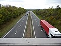
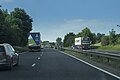 Travelling on the A38 - geograph.org.uk - 5799606.jpg 2 000 × 1 333; 1,74 MB
-
 Travelling on the A38 - geograph.org.uk - 5799864.jpg 2 000 × 1 333; 1,81 MB
-
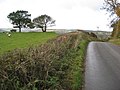
 Trees on a ridge west of Pentrich (I) - geograph.org.uk - 4841323.jpg 5 021 × 3 703; 4,64 MB
-
 Trees on a ridge west of Pentrich (II) - geograph.org.uk - 4841328.jpg 5 121 × 3 783; 5,17 MB
-
 Turbine at The Mill - geograph.org.uk - 1256007.jpg 640 × 479; 158 KB
-
 View from field in Swanwick - geograph.org.uk - 2117721.jpg 640 × 480; 67 KB
-
 View from here - geograph.org.uk - 3006056.jpg 1 600 × 1 200; 405 KB
-
 Village Water Pump in Pentrich - geograph.org.uk - 2899122.jpg 3 296 × 2 472; 1,17 MB
-
 Weed removal - geograph.org.uk - 2046757.jpg 640 × 480; 78 KB
-
 Weir Mill - geograph.org.uk - 1304508.jpg 640 × 479; 133 KB
-
 Weir Mill - geograph.org.uk - 1304516.jpg 640 × 479; 182 KB
-
 Welcome to Pentrich - geograph.org.uk - 4705358.jpg 3 264 × 2 448; 2,3 MB
-
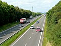 A38 trunk road near Swanwick - geograph.org.uk - 1480177.jpg 640 × 480; 224 KB
-

-
 Asherfields Farm and Barn - geograph.org.uk - 153097.jpg 640 × 480; 141 KB
-

-
 Rock and Blues Custom Show - geograph.org.uk - 506855.jpg 640 × 480; 73 KB
-
 Swanwick countryside - geograph.org.uk - 97788.jpg 640 × 480; 62 KB


.jpg)


_-_geograph.org.uk_-_4841323.jpg)
_-_geograph.org.uk_-_4841328.jpg)


