Category:Perche
Zur Navigation springen
Zur Suche springen
Provinces of France: Alsace · Angoumois · Anjou · Artois · Aunis · Auvergne · Béarn · Beaujolais · Berry · Bourbonnais · Bourgogne · Bretagne · Champagne · Dauphiné · Forez · Gascogne · Guyenne · Île-de-France · Île-de-France · Languedoc · Limousin · Lyonnais · Maine · Marche · Montbéliard · Mulhouse · Nivernais · Normandie · Orléanais · Perche · Picardie · Poitou · Saintonge · Savoie · Touraine · Comtat Venaissin ·
former province of France | |||||
| Medium hochladen | |||||
| Ist ein(e) | |||||
|---|---|---|---|---|---|
| Ort |
| ||||
| Auflösungsdatum |
| ||||
 | |||||
Unterkategorien
Es werden 3 von insgesamt 3 Unterkategorien in dieser Kategorie angezeigt:
In Klammern die Anzahl der enthaltenen Kategorien (K), Seiten (S), Dateien (D)
*
C
P
Medien in der Kategorie „Perche“
Folgende 21 Dateien sind in dieser Kategorie, von 21 insgesamt.
-
 CARTE DE LA RÉGION NATURELLE DU PERCHE.png 3.508 × 2.481; 396 KB
-
 Carte du Perche.svg 1.516 × 1.341; 387 KB
-
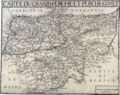 Carte Perche.jpg 1.524 × 1.202; 688 KB
-
 Blason ville fr Chambellay (Maine-et-Loire).svg 600 × 660; 10 KB
-
 Chene de l'étoile.jpg 3.216 × 4.288; 2,12 MB
-
 Cime du chêne de l'étoile.jpg 4.288 × 3.216; 2,05 MB
-
 Le Perche logo.svg 512 × 94; 5 KB
-
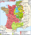
 Map France 1180-br.svg 988 × 1.124; 1,9 MB
-
 Map France 1180-de.svg 988 × 1.124; 1,94 MB
-
 Map France 1180-es.svg 988 × 1.124; 1,97 MB
-
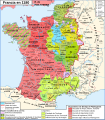
 Map France 1180-fr.svg 988 × 1.124; 1,88 MB
-
 Map France 1180-ru.svg 988 × 1.124; 1,88 MB
-
 Map France 1180-uk.svg 988 × 1.124; 1,68 MB
-
 Perche - Balles de foin.JPG 1.600 × 1.066; 1,74 MB
-
 Perche - Cigogne.JPG 1.259 × 840; 355 KB
-
 Perche - Couleurs automne.JPG 1.069 × 1.600; 1,77 MB
-
 Perche - Province.jpg 1.950 × 1.050; 1,48 MB
-
 Perche in France (1789).svg 2.000 × 1.922; 1,05 MB
-
 Perche province.png 894 × 899; 34 KB
-
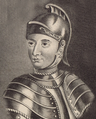 Portrait de René d'Alençon (cropped).png 408 × 507; 482 KB
-
 Portrait de René d'Alençon.png 938 × 1.317; 2,44 MB


.svg)


.svg)

.png)
