Category:Peterhead
Zur Navigation springen
Zur Suche springen
Stadt in Aberdeenshire, Schottland  | |||||
| Medium hochladen | |||||
| Ist ein(e) |
| ||||
|---|---|---|---|---|---|
| Ort |
| ||||
| Einwohnerzahl |
| ||||
| offizielle Website | |||||
 | |||||
Български: Питърхед (на английски Peterhead, на гаелски Ceann Phàdraig и Inbhir Ùigidh) е пристанищен град в Североизточна Шотландия.
Deutsch: Peterhead ist eine Stadt in Aberdeenshire, Schottland mit etwa 17.330 Einwohnern (Schätzung 2006).
English: Peterhead is a town in Aberdeenshire, Scotland. It is Aberdeenshire's largest settlement, having a population of 17,947 at the 2001 Census and estimated to have fallen to 17,330 by 2006. Peterhead sits at the easternmost point in mainland Scotland. Peterhead is often referred to as 'The Blue Toon' and people who were born there as Blue Tooners. More correctly they are called Bloomogganners, supposedly from the blue worsted stockings that the fishermen originally wore.
Gàidhlig: 'S e baile ann an Alba an ear-thuath a tha ann an Ceann Phàdraig. 'S e Inbhir Uigidh an t-ainm a bha air aig aon àm.
Nederlands: Peterhead is een plaats ( town) in het Schotse Aberdeenshire met ong. 17.560 inwoners. Het is de meest bevolkte plaats van Aberdeenshire. Het herbergt diverse industrieën en is de belangrijkste haven van witvis in Europa. Het werd in 1587 gesticht door de Keith Earls Marischal . In 1593 werd de eerste haven van Peterhead gebouwd, Port Henry. In de jaren 1970 werd Peterhead een belangrijk dienstencentrum voor de petroleum- en gasindustrie.
Simple English: Peterhead is a town in Aberdeenshire, Scotland. It is Aberdeenshire's largest settlement, having a population of 17,947 at the 2001 Census. Peterhead sits at the easternmost point in mainland Scotland. Peterhead is often referred to as 'The Blue Toon' and people who were born there as Blue Tooners. More correctly they are called Bloomogganners, supposedly from the blue worsted stockings that the fishermen originally wore.
Unterkategorien
Es werden 9 von insgesamt 9 Unterkategorien in dieser Kategorie angezeigt:
In Klammern die Anzahl der enthaltenen Kategorien (K), Seiten (S), Dateien (D)
G
- Glenugie distillery (2 D)
O
P
- Peterhead Old Parish Church (6 D)
- Peterhead Town House (10 D)
- Peterhead prison (11 D)
S
Medien in der Kategorie „Peterhead“
Folgende 94 Dateien sind in dieser Kategorie, von 94 insgesamt.
-
 1 Harbour Street.jpg 1.024 × 660; 117 KB
-
 59 Broad Street.jpg 427 × 640; 116 KB
-
 75 Broad Street, Peterhead.jpg 640 × 427; 369 KB
-
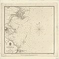
 Admiralty Chart No 115 Peterhead to Pentland Firth including Moray Firth, Published 1972.jpg 15.927 × 14.410; 36,3 MB
-
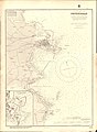
 Admiralty Chart No 115 Peterhead to Pentland Firth, Published 1916.jpg 14.025 × 13.084; 53,75 MB
-
 Admiralty Chart No 1438 Peterhead, Published 1842.jpg 5.197 × 5.226; 3,79 MB
-
 Admiralty Chart No 1438 Peterhead, Published 1884.jpg 8.099 × 11.075; 24,9 MB
-
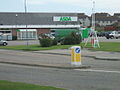 ASDA supermarket, Peterhead - geograph.org.uk - 232038.jpg 640 × 480; 75 KB
-
 Broad Street Peterhead.jpg 640 × 427; 317 KB
-
 Captain Donald Manson.jpg 1.000 × 1.200; 116 KB
-
 Clydesdale Bank, Peterhead - geograph.org.uk - 1375396.jpg 640 × 480; 73 KB
-
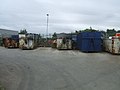 Council Recycling Skip site - geograph.org.uk - 220123.jpg 640 × 480; 56 KB
-
 Craigewan beach - geograph.org.uk - 138172.jpg 640 × 480; 60 KB
-

-
 Drinnies Observatory - panoramio (1).jpg 4.320 × 3.240; 4,02 MB
-
 DSV Toisa Polaris - geograph.org.uk - 2165637.jpg 3.488 × 2.616; 4,29 MB
-
 Entering Peterhead from the north - geograph.org.uk - 231095.jpg 640 × 480; 75 KB
-
 Fisher Jessie statue, Peterhead - geograph.org.uk - 1077905.jpg 427 × 640; 60 KB
-
 Fisher Jessie Statue, Peterhead - geograph.org.uk - 159781.jpg 640 × 480; 145 KB
-
 Fishing Vessels - geograph.org.uk - 6253370.jpg 640 × 418; 309 KB
-
 Foreshore at Roanheads - geograph.org.uk - 6254214.jpg 640 × 410; 348 KB
-
 Foreshore at Roanheads - geograph.org.uk - 6254226.jpg 640 × 418; 416 KB
-
 Foreshore at The Gadle - geograph.org.uk - 6254234.jpg 640 × 427; 444 KB
-
 George Birnie Memorial footbridge.jpg 1.024 × 768; 191 KB
-
 Hareshowe Farm in Aden Country Park - panoramio.jpg 3.888 × 2.592; 5,25 MB
-
 Howe o' Buchan House, Peterhead.jpg 3.488 × 2.616; 4,2 MB
-
 Inscription above Howe O' Buchan House.jpg 3.488 × 2.616; 4,48 MB
-
 Jacobite broadside - Jacobite Uprising 1715.jpg 2.500 × 2.296; 3,68 MB
-
 Lido Caravan Park, Peterhead - geograph.org.uk - 159763.jpg 640 × 480; 110 KB
-
 North Breakwater, Peterhead - geograph.org.uk - 215770.jpg 640 × 480; 63 KB
-
 Oil Storage Depot, Peterhead - geograph.org.uk - 159735.jpg 640 × 480; 102 KB
-
 Olympus digital camera (5179506867).jpg 3.712 × 2.792; 1,18 MB
-
 Olympus digital camera (5180104140).jpg 3.712 × 2.792; 1,03 MB
-
 Ordnance Survey Half-inch Sheet 15 Aberdeen and Banff, Published 1912.jpg 8.376 × 11.256; 38,57 MB
-
 Ordnance Survey One-Inch Sheet 31 Peterhead, Published 1930.jpg 8.734 × 12.478; 40,36 MB
-
 Ordnance Survey One-Inch Sheet 31 Peterhead, Published 1958.jpg 8.270 × 9.883; 9,45 MB
-

-
 Peterhead - Second Beach.jpg 4.608 × 3.456; 4,95 MB
-
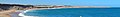 Peterhead banner Beach.jpg 3.500 × 500; 430 KB
-
 Peterhead Golf Club House.jpg 3.488 × 2.616; 4,24 MB
-
 Peterhead Golf Club.jpg 1.024 × 772; 203 KB
-
 Peterhead harbour from the air - geograph.org.uk - 3710493.jpg 1.024 × 520; 177 KB
-
 Peterhead Lido - geograph.org.uk - 159757.jpg 640 × 480; 137 KB
-
 Peterhead Lifeboat - geograph.org.uk - 3794500.jpg 2.016 × 1.512; 772 KB
-
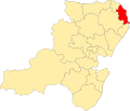 Peterhead North and Rattaray.svg 1.488 × 1.279; 109 KB
-
 Peterhead South and Cruden.svg 1.488 × 1.279; 109 KB
-
 Peterhead South Breakwater Lighthouse (32645243862).jpg 4.999 × 3.333; 2,99 MB
-
 Peterhead South Harbour - geograph.org.uk - 4547931.jpg 1.600 × 1.064; 352 KB
-
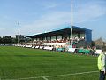 Peterhead, Balmoor Stadium.jpg 480 × 360; 42 KB
-
 Peterhead, Broad Street.jpg 640 × 425; 54 KB
-
 Pillbox near "Jenny's Burn" - geograph.org.uk - 1594788.jpg 640 × 478; 68 KB
-
 Reform Monument (geograph 6752443).jpg 1.200 × 1.600; 344 KB
-
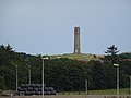 Reform Tower, Peterhead (geograph 6602197).jpg 1.024 × 768; 100 KB
-
 Salmon Smoke House.jpg 3.488 × 2.616; 4,17 MB
-
 Sandford Lodge 2.jpg 1.024 × 678; 674 KB
-
 Sandford Lodge.jpg 1.024 × 736; 781 KB
-
 Seven Petrel at rest - geograph.org.uk - 4547903.jpg 1.598 × 1.600; 388 KB
-
 Slains Castle - panoramio (2).jpg 2.560 × 1.677; 657 KB
-
 South Breakwater - geograph.org.uk - 2150267.jpg 3.488 × 2.616; 4,2 MB
-
 South Harbour, Peterhead - geograph.org.uk - 4522156.jpg 1.024 × 768; 154 KB
-
 St Peter's Episcopal Church, Peterhead.jpg 1.024 × 768; 161 KB
-
 Steps down to North Head.... - geograph.org.uk - 330322.jpg 640 × 480; 98 KB
-
 Sunset over Peterhead - geograph.org.uk - 2048667.jpg 3.488 × 2.616; 4,62 MB
-
 Swans at the mouth of the River Ugie - geograph.org.uk - 482141.jpg 640 × 483; 73 KB
-

-

-

-
 Field Marshal Keith statue, Peterhead.jpg 1.303 × 1.600; 487 KB
-
 The Buzzard Oilrig, NE of St Fergus - geograph.org.uk - 5837144.jpg 1.600 × 1.065; 410 KB
-
 The graveyard wall, Old St Fergus Kirk - geograph.org.uk - 725865.jpg 640 × 388; 489 KB
-
 The Old Church of St Fergus - geograph.org.uk - 725855.jpg 640 × 304; 128 KB
-
 Towards the Habour in Winter.jpg 376 × 282; 23 KB
-
 Trawlers in Peterhead's South Harbour - geograph.org.uk - 2567612.jpg 2.799 × 2.100; 1,13 MB
-

-

-

-
-
-

-
 Woolworths in Peterhead - geograph.org.uk - 1077908.jpg 640 × 427; 72 KB
-
 Beach at Sandford Bay - geograph.org.uk - 159726.jpg 640 × 480; 86 KB
-
 Dales Park Dyslexic Graffiti - geograph.org.uk - 215244.jpg 640 × 480; 83 KB
-
 Fishermen's Mission - geograph.org.uk - 468564.jpg 640 × 480; 68 KB
-
 Peterhead Academy - geograph.org.uk - 468550.jpg 640 × 480; 95 KB
-
 Peterhead Fishermen's Mission Sign - geograph.org.uk - 468569.jpg 640 × 480; 86 KB
-
 Peterhead, Gadle Braes - geograph.org.uk - 215843.jpg 640 × 480; 91 KB
-
 Peterhead, path over the links - geograph.org.uk - 219707.jpg 640 × 480; 104 KB
-
 Peterhead, St Peter's Street Flats - geograph.org.uk - 217743.jpg 640 × 480; 79 KB
-
 Queen Street, Peterhead - geograph.org.uk - 159786.jpg 640 × 480; 121 KB
-
 Sandford Bay, Peterhead - geograph.org.uk - 159723.jpg 640 × 480; 112 KB
-
 Shoreline south of Kirkton Head - geograph.org.uk - 467381.jpg 640 × 480; 91 KB
-
 Station Bar, Peterhead - geograph.org.uk - 444652.jpg 480 × 360; 39 KB
-
 The Gadle rocks - geograph.org.uk - 263835.jpg 640 × 480; 117 KB
-
 Windmill Street, Peterhead - geograph.org.uk - 215768.jpg 640 × 480; 72 KB


.jpg)


.jpg)
.jpg)


_by_William_Henry_Bartlett_-_William_Henry_Bartlett_-_ABDAG005163.jpg)


.jpg)


.jpg)
.jpg)


.jpg)


.jpg)
.jpg)
.jpg)


.jpg)
.jpg)
.jpg)
.jpg)
.jpg)
.jpg)


