Category:Petrus Plancius
Zur Navigation springen
Zur Suche springen
niederländischer Theologe, Astronom und Kartograf  | |||||
| Medium hochladen | |||||
| Naam in de Moderspraak |
| ||||
|---|---|---|---|---|---|
| Tied boren | 1552 Dranouter | ||||
| Tied doodbleven | 15. Mai 1622 Amsterdam | ||||
| Staatsbörger von | |||||
| Beroop | |||||
| Fackrebeed | |||||
| Moderspraak | |||||
| Kind |
| ||||
| Steed von dat Warken | |||||
| offizielle Websteed | |||||
| |||||
Ünnerkategorien
De Kategorie hett disse Ünnerkategorien, vun 2 Ünnerkategorien alltohoop:
G
- Gebouw Plancius (0 K, 0 S, 13 D)
M
- Maps of Ceylon by Petrus Plancius (0 K, 0 S, 12 D)
Mediendatein in de Kategorie „Petrus Plancius“
De Kategorie bargt disse Datein, vun 54 Datein alltohoop:
-
 Petrusplancius.gif 261 × 437; 120 KB
-
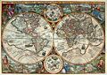
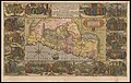
 1590 Orbis Terrarum Plancius.jpg 1.747 × 994; 2,27 MB
-
 1592 4 Nova Doetecum mr.jpg 2.000 × 1.418; 3,49 MB
-
 1592 Insullae Moluc. Plancius.jpg 1.876 × 1.338; 875 KB
-
 1594 double hemisphere world map by Petrus Plancius detail Japan Colunas.png 980 × 882; 1,93 MB
-
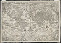
 1594 double hemisphere world map by Petrus Plancius.jpg 13.925 × 9.789; 39,23 MB
-
 1594 Orbis Plancius 2,12 MB.jpg 2.671 × 1.891; 2,13 MB
-
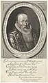
 1622 Petrus Plancius.jpg 461 × 776; 127 KB
-
 23 Petrus Plancius (1552-1622).jpg 447 × 735; 121 KB
-

-
 Cartouche on the 1592 Moluccae map by Plancius.jpg 520 × 537; 177 KB
-

-
-
 GSVA Petrus Plancius logo.jpg 130 × 66; 3 KB
-
 Guercino - Personification of Astrology - circa 1650-1655.jpg 2.149 × 2.700; 1,1 MB
-
 Java indo 1595 map 01 gnangarra.jpg 2.576 × 1.932; 2,05 MB
-
 Kaart van de landen in het Noord-Oosten van de Middellandse Zee, RP-P-1990-415.jpg 6.264 × 4.250; 7,14 MB
-

-
 Map - Special Collections University of Amsterdam - OTM- HB-KZL 31-01-12.tif 6.140 × 3.458; 60,75 MB
-
-
 Orbis Terrarum Typus de Integro Multis in Locis Emendatus, 1592 by Pieter Plattevoet.jpg 2.671 × 1.891; 8,19 MB
-
 Petrus Plancius Instructing Students in the Science of Navigation MET DP801045.jpg 3.617 × 3.257; 3,35 MB
-
 Petrus Plancius Instructing Students in the Science of Navigation.jpg 3.617 × 3.257; 3,35 MB
-
 Petrus Plancius, Antverpia (FL167448944 2370987).jpg 4.587 × 1.770; 10,51 MB
-
 Petrus Plancius, Brugae (FL167448970 2370932).jpg 4.615 × 1.826; 11,39 MB
-
 Petrus Plancius, Bruxella (FL167449014 2370998).jpg 4.629 × 1.827; 11,37 MB
-
 Petrus Plancius, Carte Routière de l'Europe divisée en ses principaux états (FL33132706 2524202).jpg 18.907 × 13.740; 373,55 MB
-
 Petrus Plancius, Gandavum (FL167448959 2371005).jpg 4.598 × 1.822; 11,54 MB
-
 Petrus Plancius, geograag en theoloog in Leiden PK-P-121.745, PK-P-139.006.tiff 1.796 × 2.984; 15,36 MB
-
 Petrus Plancius, Lovanium (FL167448956 2370992).jpg 4.589 × 1.852; 10,91 MB
-
 Petrus Plancius, Sylva-Ducis (FL167448969 2371008).jpg 4.727 × 2.000; 11,66 MB
-

-

-

-

-

-

-

-

-

-

-
-
 Petrus Plancius, Terra Sancta (FL36565991 3901769).jpg 9.390 × 7.324; 101,29 MB
-
-
 Petrus Plancius.jpg 2.739 × 4.176; 3,06 MB
-
 Portret van Petrus Plancius op 70-jarige leeftijd, RP-P-BI-6903.jpg 3.194 × 5.444; 4,29 MB
-
 Portret van Petrus Plancius op 70-jarige leeftijd, RP-P-BI-6904.jpg 3.450 × 5.598; 5,28 MB
-
 Pp94vp.png 660 × 426; 637 KB
-
 Reinier van Persijn - Portret van Christian Martin Anhaltin - 1659.jpg 4.188 × 5.474; 4,36 MB
-
 Reinier Vinkeles, Afb 010097009014.jpg 1.206 × 1.915; 574 KB
-
 Thalassographica Tabula totius maris mediterranei (1594).jpg 11.457 × 6.093; 13,25 MB
-

-
 UBBasel Map 1592 Kartenslg Mappe 252-32.tif 10.991 × 6.865, 2 2 Sieden; 215,9 MB
-
 UBBasel Map 1592 Kartenslg Mappe 252-32a.tif 10.934 × 6.959, 2 2 Sieden; 217,72 MB


.jpg)


_Palus_Meotides,_Fluminaque_Tanais_et_Duina.jpg)


_De_woestijnreis,_RP-P-1990-416.jpg)


.jpg)
.jpg)
.jpg)
.jpg)
.jpg)
.jpg)
.jpg)
.jpg)
.jpg)
.jpg)
.jpg)
.jpg)
.jpg)
.jpg)
.jpg)


.jpg)

.jpg)
.jpg)
.jpg)
.jpg)
.jpg)