Category:Phantom islands
পরিভ্রমণে চলুন
অনুসন্ধানে চলুন
English: A phantom island is a island which appeared on maps for a period of time (sometimes centuries) during recorded history, but was removed from later maps after it was proven not to exist.
Français : Une îles fantôme est une île qui a été découverte, a figuré sur des cartes pendant une longue période de temps, parfois des siècles, puis en a été enlevée quand il a été prouvé qu'elle n'existait pas.
island that was believed to exist but later proven to be nonexistent  | |||||
| মিডিয়া আপলোড করুন | |||||
| যার উপশ্রেণী | |||||
|---|---|---|---|---|---|
| |||||
উপবিষয়শ্রেণীসমূহ
এই বিষয়শ্রেণীতে অন্তর্ভুক্ত মোট ১৭টি উপবিষয়শ্রেণীর মধ্যে ১৭টি উপবিষয়শ্রেণী নিচে দেখানো হয়েছে।
-
B
- Brasil (mythical island) (5 F)
C
E
- Estotiland (6 F)
F
G
- Ganges Island (8 F)
K
M
- Mayda (island) (6 F)
N
- Nimrod Islands (2 F)
R
S
- Saint Brendan's Island (7 F)
- Saxemberg Island (5 F)
"Phantom islands" বিষয়শ্রেণীতে অন্তর্ভুক্ত মিডিয়া ফাইলগুলি
এই বিষয়শ্রেণীতে অন্তর্ভুক্ত মোট ১২টি পাতার মধ্যে ১২টি পাতা নিচে দেখানো হলো।
-
 1598 map of the Polar Regions by Willem Barentsz.jpg ১৩,৭১৯ × ১০,১৬০; ৩০.৬৬ মেগাবাইট
-
 Barents third voyage.jpg ২,০০০ × ১,৫১১; ৯৬৫ কিলোবাইট
-
 Barentskartet, 1598 (12068020364).jpg ২,৮৪২ × ২,০৯১; ৩.৮৫ মেগাবাইট
-
 Barentsz Full Map.jpg ১,০০০ × ৭৪২; ২৫৮ কিলোবাইট
-
 Forminsket utgave av Barentskartet - no-nb krt 00487.jpg ৪,৪১৮ × ৩,৪৪৯; ৩.৪৫ মেগাবাইট
-

-

-
 Kianida Island or Cianeis Insula.png ৯৫১ × ৬৩৭; ১.৭৪ মেগাবাইট
-
 Lwsam 1808.jpg ৫৫৪ × ৭৩৩; ১৭৮ কিলোবাইট
-
 Mer Orientale, où l'on trouve l'isle de Jedso, de laquelle on doutoit si c'étoit une isle ou non - btv1b550030195.jpg ৯,৬৩৮ × ১২,৭১৫; ৭.৩৫ মেগাবাইট
-
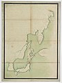
 Pepys island.JPG ২১৬ × ২৬৪; ১১ কিলোবাইট
-
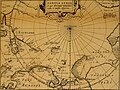 Pontanus 1611 Arctic Map.jpg ২,৮৫২ × ২,১৪২; ৮০২ কিলোবাইট


.jpg)


_door_Willem_Barendsz_(titel_op_object),_NG-800.jpg)


