Category:Philippine Sea
Vai alla navigazione
Vai alla ricerca
mare .jpg)     | |||||
| Carica un file multimediale | |||||
| Istanza di | |||||
|---|---|---|---|---|---|
| Parte di | |||||
| Luogo |
| ||||
| Superficie |
| ||||
| Immissario |
| ||||
 | |||||
Sottocategorie
Questa categoria contiene le 18 sottocategorie indicate di seguito, su un totale di 18.
File nella categoria "Philippine Sea"
Questa categoria contiene 38 file, indicati di seguito, su un totale di 38.
-
 210203-M-PZ755-1014M.jpg 3 386 × 2 257; 1,38 MB
-
 210224-M-MR595-0479M.jpg 5 184 × 3 456; 2,99 MB
-
 210224-M-MR595-0494T.jpg 4 076 × 2 718; 1,05 MB
-
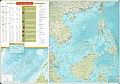 75967 South-China-Sea-1.jpg 9 570 × 6 660; 30,8 MB
-
 75967 South-China-Sea-1.pdf 1 754 × 1 239; 3,71 MB
-
 A Sailor stands watch aboard USS Charleston (LCS 18). (51618558178).jpg 4 630 × 3 087; 1,5 MB
-

-
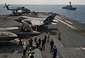 An F-35B Lightning II aircraft maneuver on the flight deck of USS Wasp.jpg 3 004 × 2 047; 1 020 KB
-
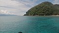
 Batanes waters and cliffs.jpg 5 312 × 2 988; 9,45 MB
-
 Benham Bank Namria (cropped).jpg 612 × 374; 160 KB
-
 Benham Rise (Philippine Rise) NAMRIA layout 2 May 24 2017.jpg 4 576 × 3 210; 7,4 MB
-
 Cape Omaezaki and Pacific Ocean.jpg 6 000 × 4 000; 8,37 MB
-
 Cloudscape Over the Philippine Sea.jpg 4 928 × 3 280; 4,86 MB
-
 Divilacan Isabela.jpg 2 100 × 1 400; 698 KB
-
 In Sea - panoramio (1).jpg 3 072 × 2 304; 2,44 MB
-
Islands in the Philippine Sea at Night.ogv 28 s, 840 × 560; 5,11 MB
-
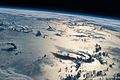 ISS-48 Sheared thunderstorms over the Philippine Sea.jpg 4 928 × 3 280; 2,01 MB
-
 Locatie Filipijnenzee.PNG 651 × 499; 19 KB
-
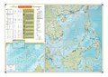
 MAP Philippine sea.jpg 499 × 383; 85 KB
-
 Papegaaivis op het droge.jpg 2 048 × 1 536; 471 KB
-
Pass over Eastern Asia to Philippine Sea and Guam.ogv 34 s, 640 × 425; 2,97 MB
-
 Philippine sea bathymetry He.jpg 972 × 1 136; 515 KB
-
 Philippine Sea in its region.svg 500 × 281; 4,82 MB
-
 Philippine Sea location.jpg 750 × 625; 142 KB
-
 Seawater intake-outlet of Yanbaru Power Station.jpg 450 × 338; 45 KB
-
 The Blue Sea.jpg 1 280 × 720; 309 KB
-
 The Philippine Sea.jpg 569 × 824; 104 KB
-
 Txu-oclc-6557994-index-453.jpg 5 000 × 3 759; 5,74 MB
-
 Txu-oclc-6557994-index-454.jpg 5 000 × 3 794; 4,52 MB
-
 Txu-oclc-6557994-index-459.jpg 5 000 × 3 704; 6,15 MB
-
-
-
 UK Carrier Strike Group 2021-HMS Kent Gunnery Exercise MOD 45169224.jpg 8 192 × 5 464; 3,72 MB
-
 UK Carrier Strike Group 2021-HMS Kent Gunnery Exercise MOD 45169225.jpg 8 192 × 5 464; 3,94 MB
-
-

-
 W. B. Duncan Map of the China Seas 1898 Cornell CUL PJM 1131 01.jpg 4 790 × 7 245; 6,09 MB
-
 West Philippine Sea and Philippine Sea 西菲律賓海與菲律賓海.jpg 466 × 467; 49 KB


._(51618558178).jpg)


.jpg)
_NAMRIA_layout_2_May_24_2017.jpg)


_monitor_the_Chinese_aircraft_carrier_Liaoning_in_Apirl_2021.jpg)


,_front,_and_USS_Shiloh_(CG_67)_conduct_a_replenishment-at-sea_with_USNS_Washington_Chambers_(T-AKE_11)._(51540114185).jpg)


