Category:Piceance Basin
Vai alla navigazione
Vai alla ricerca
| Carica un file multimediale | |||||
| Istanza di | |||||
|---|---|---|---|---|---|
| Luogo | Colorado, Stati Uniti d'America | ||||
 | |||||
Sottocategorie
Questa categoria contiene le 2 sottocategorie indicate di seguito, su un totale di 2.
M
R
File nella categoria "Piceance Basin"
Questa categoria contiene 47 file, indicati di seguito, su un totale di 47.
-

-

-
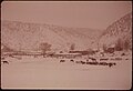
 CATTLE HERD IN PICEANCE BASIN - NARA - 552698.jpg 3 000 × 2 020; 872 KB
-
 Cooper's hawk and long-eared owl nest occupancy and productivity in Piceance Basin, Colorado (IA coopershawklonge00smit).pdf 1 275 × 1 650, 32 pagine; 1,46 MB
-
 DEER ENTANGLED IN A BARBED WIRE RANCH FENCE IN PICEANCE BASIN - NARA - 552699.jpg 3 000 × 2 013; 1,05 MB
-
-
 Draft Piceance basin resource management plan and environmental impact statement (IA draftpiceancebas01unit).pdf 1 704 × 2 210, 306 pagine; 84,78 MB
-
 Draft Roan Plateau resource management plan amendment and environmental impact statement (IA draftroanplateau00unit).pdf 1 697 × 2 200, 618 pagine; 192,66 MB
-
 FEDERAL OIL SHALE LEASE SITE IN PICEANCE BASIN - NARA - 552548.jpg 3 000 × 2 011; 965 KB
-
-
 Mesaverde Gas Fields.png 914 × 559; 223 KB
-
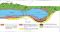 Nahcolite deposition model.png 985 × 534; 87 KB
-
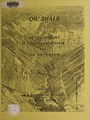 Oil shale development in the Piceance Basin and the Uinta Basin (IA oilshaledevelopm00unse).pdf 1 645 × 2 200, 330 pagine; 98,37 MB
-
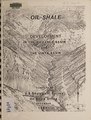 Oil shale development in the Piceance Basin and the Uinta Basin (IA oilshaledevelopm00unse 0).pdf 1 656 × 2 181, 192 pagine; 14,09 MB
-
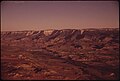
 PICEANCE BASIN, SEMI-ARID RANGE LAND - NARA - 552551.jpg 3 000 × 2 012; 829 KB
-
 PICEANCE BASIN, SEMI-ARID RANGE LAND - NARA - 552552.jpg 3 000 × 2 023; 586 KB
-

-
 Piceance basin expansion project - final environmental impact statement (IA piceancebasinexp00ferc).pdf 1 377 × 1 785, 606 pagine; 124,57 MB
-
 Piceance basin expansion project - draft environmental impact statement (IA piceancebasinexp00unit).pdf 1 347 × 1 768, 516 pagine; 110,18 MB
-
 Piceance Basin resource management plan management situation analysis (IA piceancebasinres5467unit).pdf 635 × 827, 154 pagine; 24,93 MB
-
 Piceance Basin wildlife habitat management plan - CO-1WHA-1-Piceance Basin (IA piceancebasinwil10ward).pdf 1 233 × 1 645, 600 pagine; 75,97 MB
-
 RANCH LAND IN THE PICEANCE BASIN - NARA - 552691.jpg 2 029 × 3 000; 710 KB
-
 Record of decision, Piceance Basin resource management plan (IA recordofdecision00whit).pdf 1 631 × 2 183, 80 pagine; 20,95 MB
-
 Record of decision, Piceance Basin resource management plan (IA recordofdecision60unit).pdf 1 225 × 1 620, 77 pagine; 16,65 MB
-
 Resource management in Piceance Basin, Northwest Colorado (IA resourcemanageme008806).pdf 637 × 822, 114 pagine; 14,11 MB
-
-

-

-

-
-

-

-

-
-

-

-
 Shell insitu.gif 816 × 367; 257 KB
-
 Southwestern US Sedimentary Basins.tif 5 067 × 4 133; 80,44 MB
-
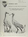 Status of greater sandhill cranes in Piceance Basin (IA statusofgreaters00getm).pdf 1 175 × 1 558, 40 pagine; 1,6 MB
-

-

-

-
 Uinta Piceance Basin stratigraphic column.gif 1 274 × 1 048; 122 KB
-
 Uinta Piceance Basin stratigraphic column.png 531 × 544; 59 KB
-
 Uinta Piceance Basins geologic map.gif 1 782 × 1 115; 170 KB
-
 Uinta Piceance Basins geologic map.png 1 008 × 545; 185 KB
-
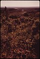
 WILDFLOWERS BLOOM IN THE SEMI-ARID RANGE LAND OF PICEANCE BASIN - NARA - 552554.jpg 2 033 × 3 000; 452 KB

,_OIL_SHALE_ROCKS_IN_THE_PICEANCE_BASIN_OF_WESTERN_COLORADO._DEVELOPMENT_OF_AN..._-_NARA_-_552690.jpg)


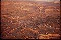
_CLIFFS,_IS_THE_MAJOR_COMMUNITY..._-_NARA_-_552593.jpg)
_CLIFFS,_IS_THE_MAJOR_COMMUNITY..._-_NARA_-_552594.jpg)
_CLIFFS,_IS_THE_MAJOR_COMMUNITY..._-_NARA_-_552607.jpg)
_CLIFFS,_IS_THE_MAJOR_COMMUNITY..._-_NARA_-_552608.jpg)
_CLIFFS,_IS_THE_MAJOR_COMMUNITY..._-_NARA_-_552595.jpg)


_AFTER_YEARS_OF_RESEARCH,_HAS_TAKEN_OIL_SHALE_FROM_AN..._-_NARA_-_552687.jpg)
_AFTER_YEARS_OF_RESEARCH,_HAS_TAKEN_OIL_SHALE_FROM_AN..._-_NARA_-_552688.jpg)


