Category:Piddlehinton
Aller à la navigation
Aller à la recherche
English: Piddlehinton is a village in west Dorset, England situated in the Piddle valley five miles north of Dorchester. The village has a population of around 600 .
village britannique _-_geograph.org.uk_-_886709.jpg) | |||||
| Téléverser des médias | |||||
| Nature de l’élément | |||||
|---|---|---|---|---|---|
| Lieu | Dorset, Angleterre du Sud-Ouest, Angleterre | ||||
| Réputé identique à | Piddlehinton (page en doublon, paroisse civile) | ||||
 | |||||
Sous-catégories
Cette catégorie comprend 3 sous-catégories, dont les 3 ci-dessous.
Média dans la catégorie « Piddlehinton »
Cette catégorie comprend 129 fichiers, dont les 129 ci-dessous.
-
 Above the Piddle Valley - geograph.org.uk - 865873.jpg 640 × 480 ; 138 kio
-
 Access Road for Little Puddle Farm - geograph.org.uk - 491977.jpg 640 × 480 ; 92 kio
-
 Access road, Heaves Farm - geograph.org.uk - 3264862.jpg 640 × 480 ; 92 kio
-
 Across the Fields at Higher Waterston - geograph.org.uk - 491174.jpg 640 × 480 ; 122 kio
-
 An old footpath at New Buildings - geograph.org.uk - 5880698.jpg 640 × 427 ; 74 kio
-

-
 Assorted Junk - geograph.org.uk - 491336.jpg 640 × 480 ; 135 kio
-
 At Work in the Fields - geograph.org.uk - 492003.jpg 640 × 480 ; 77 kio
-
 Avenue leading away from Bourne Farm - geograph.org.uk - 95272.jpg 640 × 480 ; 191 kio
-
 Badger Sett at Dole's Hill Plantation - geograph.org.uk - 1957561.jpg 640 × 480 ; 113 kio
-
 Badger Track in Wheat Field - geograph.org.uk - 1957550.jpg 640 × 480 ; 120 kio
-
 Bales in Coombe Bottom - geograph.org.uk - 1116979.jpg 640 × 428 ; 49 kio
-
 Barn on Little Puddle Hill - geograph.org.uk - 5656237.jpg 640 × 480 ; 50 kio
-
 Bourne Drove Road-Bridleway - geograph.org.uk - 491347.jpg 640 × 477 ; 98 kio
-
 Bourne Park - geograph.org.uk - 1957601.jpg 640 × 480 ; 79 kio
-
 Bourne Park Enterprise Park - geograph.org.uk - 1098559.jpg 640 × 428 ; 55 kio
-
 Bourne park Enterprise Park - geograph.org.uk - 1098560.jpg 640 × 428 ; 47 kio
-

-
 Bridleway - geograph.org.uk - 491185.jpg 640 × 480 ; 149 kio
-
 Bridleway at New Buildings - geograph.org.uk - 5880702.jpg 640 × 427 ; 76 kio
-
 Bridleway east of Muston Copse - geograph.org.uk - 5129979.jpg 640 × 480 ; 89 kio
-
 Bridleway gate - geograph.org.uk - 865827.jpg 640 × 480 ; 126 kio
-
 Bridleway in Dole's Hill Plantation - geograph.org.uk - 5129987.jpg 640 × 480 ; 156 kio
-
 Bridleway on Little Puddle Hill - geograph.org.uk - 865834.jpg 640 × 467 ; 130 kio
-
 Bridleway, Coombe Bottom - geograph.org.uk - 654865.jpg 480 × 640 ; 161 kio
-
 Carter's Barn on Carter's Barn Farm - geograph.org.uk - 95271.jpg 640 × 480 ; 124 kio
-
 Carters Barn Farm - geograph.org.uk - 1957526.jpg 640 × 480 ; 61 kio
-
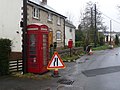
 Communications hot spot in Piddlehinton - geograph.org.uk - 3124035.jpg 640 × 480 ; 74 kio
-
 Coombe Bottom - geograph.org.uk - 651246.jpg 640 × 480 ; 159 kio
-
 Coombe Bottom - geograph.org.uk - 654863.jpg 640 × 480 ; 138 kio
-
 Coombe Bottom - geograph.org.uk - 865866.jpg 468 × 640 ; 125 kio
-
 Cottages, Piddlehinton - geograph.org.uk - 654854.jpg 640 × 480 ; 123 kio
-
 Cottages, Piddlehinton - geograph.org.uk - 654858.jpg 640 × 480 ; 141 kio
-
 Cottages, Piddlehinton - geograph.org.uk - 654861.jpg 640 × 480 ; 136 kio
-
 Countryside at Heaves Farm Piddlehinton - geograph.org.uk - 1115665.jpg 640 × 442 ; 44 kio
-
 Countryside near Piddlehinton - geograph.org.uk - 1098561.jpg 640 × 428 ; 82 kio
-
 Countryside near Piddlehinton - geograph.org.uk - 1098562.jpg 640 × 428 ; 91 kio
-
 Cows Under The Brooding Sky - geograph.org.uk - 491964.jpg 640 × 480 ; 72 kio
-
 Cross country jump at Heave Coppice - geograph.org.uk - 1115668.jpg 640 × 418 ; 97 kio
-
 Datum Marker - geograph.org.uk - 2434862.jpg 640 × 480 ; 114 kio
-
 Dole's Hill Plantation - geograph.org.uk - 1957559.jpg 640 × 480 ; 86 kio
-
 Dorset Farmland - geograph.org.uk - 491967.jpg 640 × 480 ; 115 kio
-
 Dorset Farmland - geograph.org.uk - 491971.jpg 640 × 480 ; 96 kio
-
 Earthworks at Little Puddle Farm - geograph.org.uk - 5656233.jpg 640 × 480 ; 66 kio
-
 East Entrance to Little Puddle Farm - geograph.org.uk - 491342.jpg 640 × 480 ; 138 kio
-
 Enterprise Business Park - geograph.org.uk - 491306.jpg 640 × 480 ; 89 kio
-
 Enterprise Business Park - geograph.org.uk - 491321.jpg 640 × 480 ; 74 kio
-
 Farm Access Road - geograph.org.uk - 491992.jpg 640 × 480 ; 110 kio
-
 Farm Buildings Below the Ridge - geograph.org.uk - 491999.jpg 640 × 480 ; 106 kio
-
 Farm Crop in the Field - geograph.org.uk - 491996.jpg 640 × 480 ; 110 kio
-
 Farm Track across Coombe Bottom - geograph.org.uk - 1116978.jpg 640 × 428 ; 71 kio
-
 Farm Track Coombe Bottom - geograph.org.uk - 1116981.jpg 640 × 428 ; 73 kio
-
 Farmland above Piddlehinton - geograph.org.uk - 655259.jpg 640 × 480 ; 121 kio
-
 Farmland, Piddlehinton - geograph.org.uk - 651282.jpg 640 × 480 ; 155 kio
-
 Farmland, Piddlehinton - geograph.org.uk - 655262.jpg 640 × 480 ; 94 kio
-
 Fields of Little Puddle Farm - geograph.org.uk - 491352.jpg 640 × 480 ; 83 kio
-
 Ford by Dole's Hill Plantation - geograph.org.uk - 2318257.jpg 800 × 600 ; 219 kio
-
 Former Guard House - geograph.org.uk - 491331.jpg 640 × 391 ; 52 kio
-
 Hacking around the Piddle Valley - geograph.org.uk - 865862.jpg 640 × 480 ; 131 kio
-
 Heave Coppice Piddlehinton - geograph.org.uk - 1115667.jpg 640 × 428 ; 54 kio
-
 Heaves Farm - geograph.org.uk - 3264856.jpg 640 × 480 ; 95 kio
-
 Heaves Farm - geograph.org.uk - 3264858.jpg 640 × 480 ; 89 kio
-
 Higher Waterston, Near Puddletown , Dorset - geograph.org.uk - 1098185.jpg 640 × 398 ; 93 kio
-
 Holcombe Barn - geograph.org.uk - 654926.jpg 640 × 480 ; 149 kio
-
 Holcombe Bottom - geograph.org.uk - 1115663.jpg 640 × 443 ; 46 kio
-
 Inside Enterprise Business Park - geograph.org.uk - 491310.jpg 640 × 478 ; 76 kio
-
 Lea Farm, Higher Waterston - geograph.org.uk - 491169.jpg 640 × 291 ; 55 kio
-
 Little Piddle Down - geograph.org.uk - 865858.jpg 640 × 480 ; 82 kio
-
 Little Puddle Bottom - geograph.org.uk - 654931.jpg 640 × 480 ; 124 kio
-
 Little Puddle Farm - geograph.org.uk - 5656286.jpg 640 × 480 ; 66 kio
-
 Little Puddle Hill - geograph.org.uk - 654932.jpg 640 × 480 ; 132 kio
-
 Little Puddle Hill - geograph.org.uk - 654934.jpg 640 × 480 ; 125 kio
-
 Little Puddle Hill Farm - geograph.org.uk - 865840.jpg 640 × 480 ; 137 kio
-

-
 Maniola jurtina - geograph.org.uk - 491211.jpg 640 × 480 ; 74 kio
-
 Meadows by the Piddle - geograph.org.uk - 865686.jpg 640 × 480 ; 111 kio
-
 Millennium Green, Piddlehinton - geograph.org.uk - 865689.jpg 640 × 464 ; 101 kio
-
 MotoCross meet near Piddlehinton - geograph.org.uk - 2434814.jpg 640 × 427 ; 59 kio
-
 New Buildings, near Piddlehinton - geograph.org.uk - 1117015.jpg 640 × 428 ; 69 kio
-

-
 Old Army Buildings - geograph.org.uk - 491315.jpg 640 × 480 ; 106 kio
-

-
 Old Dorset finger post, Piddlehinton, Dorset - geograph.org.uk - 4204824.jpg 1 200 × 899 ; 280 kio
-
 Old Farm Track near Piddlehinton - geograph.org.uk - 1116980.jpg 640 × 428 ; 82 kio
-
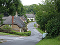
 Piddlehinton - geograph.org.uk - 1098563.jpg 640 × 428 ; 49 kio
-
 Piddlehinton - geograph.org.uk - 1098586.jpg 640 × 428 ; 86 kio
-
 Piddlehinton Bridge - geograph.org.uk - 1374780.jpg 640 × 480 ; 104 kio
-
 Piddlehinton Bridge, warning sign - geograph.org.uk - 1374781.jpg 640 × 480 ; 111 kio
-
 Piddlehinton Village Hall - geograph.org.uk - 3124020.jpg 480 × 640 ; 76 kio
-
 Piddlehinton, Bridge across the River Puddle - geograph.org.uk - 1800450.jpg 799 × 474 ; 404 kio
-
 Piddlehinton, detail of finger-post - geograph.org.uk - 1878178.jpg 640 × 480 ; 98 kio
-
 Piddlehinton, finger post - geograph.org.uk - 1374792.jpg 640 × 480 ; 109 kio
-
 Piddlehinton, junction of Rectory Road - geograph.org.uk - 1343363.jpg 640 × 480 ; 86 kio
-
 Piddlehinton, old finger-post - geograph.org.uk - 1343358.jpg 640 × 480 ; 104 kio
-
-
 Piddlehinton, Piddleside cottages - geograph.org.uk - 1343368.jpg 640 × 480 ; 90 kio
-

-
 Piddlehinton, pump and war memorial - geograph.org.uk - 1343353.jpg 480 × 640 ; 130 kio
-
 Piddlehinton, Rectory Road - geograph.org.uk - 1343374.jpg 640 × 480 ; 60 kio
-
 Piddlehinton, River Piddle - geograph.org.uk - 3365259.jpg 768 × 1 024 ; 225 kio
-
 Piddlehinton, River Puddle - geograph.org.uk - 1374804.jpg 480 × 640 ; 97 kio
-
 Piddlehinton, Road westward at sunset - geograph.org.uk - 2863420.jpg 900 × 546 ; 89 kio
-
 Piddlehinton, View from Crossroads - geograph.org.uk - 1800432.jpg 800 × 469 ; 468 kio
-
 Piddlehinton, Village Hall - geograph.org.uk - 1800437.jpg 800 × 514 ; 403 kio
-
 Rectory Lane, Piddlehinton - geograph.org.uk - 865696.jpg 640 × 480 ; 136 kio
-
 Rectory Road, Piddlehinton, Dorset - geograph.org.uk - 4204879.jpg 1 200 × 888 ; 224 kio
-
 Rectory Road, Piddlehinton, Dorset - geograph.org.uk - 4204891.jpg 1 200 × 900 ; 194 kio
-
 Reservoir - geograph.org.uk - 1957578.jpg 640 × 480 ; 83 kio
-
 River Piddle at Piddlehinton - geograph.org.uk - 5130001.jpg 640 × 480 ; 122 kio
-
 River Piddle, Piddlehinton - geograph.org.uk - 1199510.jpg 479 × 640 ; 166 kio
-
 Riverpiddle1.jpg 3 072 × 2 304 ; 2,63 Mio
-
 Road above Piddlehinton - geograph.org.uk - 654866.jpg 640 × 480 ; 118 kio
-
 Rural Buildings - geograph.org.uk - 491986.jpg 640 × 480 ; 73 kio
-
 Straight Road - geograph.org.uk - 491984.jpg 640 × 480 ; 88 kio
-
 Straight road near New Buildings - geograph.org.uk - 5880732.jpg 640 × 427 ; 58 kio
-
 Stuck in the Mud - geograph.org.uk - 2434856.jpg 640 × 435 ; 54 kio
-

-

-
 The Northern Flank of Little Puddle Farm - geograph.org.uk - 491355.jpg 640 × 480 ; 117 kio
-
 Tumulus on Little Puddle Hill - geograph.org.uk - 5656248.jpg 640 × 480 ; 46 kio
-
 View towards Muston Manor and Muston Farm - geograph.org.uk - 1261175.jpg 640 × 427 ; 418 kio
-
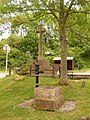
 Village pump, Piddlehinton - geograph.org.uk - 1199549.jpg 480 × 640 ; 169 kio
-
 Vineyard near Muston Farm - geograph.org.uk - 5656260.jpg 640 × 480 ; 74 kio
-
 Weather vane, Piddlehinton - geograph.org.uk - 1066493.jpg 640 × 443 ; 38 kio
-
 Wheat Field - geograph.org.uk - 1957570.jpg 640 × 480 ; 63 kio
-
 Wheat Field. - geograph.org.uk - 1957542.jpg 640 × 480 ; 84 kio
-
 Wooden Flower - geograph.org.uk - 865693.jpg 469 × 640 ; 163 kio
-
 Farmland east of Piddlehinton - geograph.org.uk - 24403.jpg 640 × 480 ; 427 kio
-
 Moss and hazel in the Dole's Hill Plantation - geograph.org.uk - 95244.jpg 480 × 640 ; 216 kio


