Category:Pidley
Aller à la navigation
Aller à la recherche
village britannique .jpg) | |||||
| Téléverser des médias | |||||
| Nature de l’élément | |||||
|---|---|---|---|---|---|
| Lieu | Pidley cum Fenton, Huntingdonshire, Cambridgeshire, Angleterre de l'Est, Angleterre | ||||
 | |||||
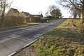
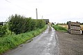
English: Pidley – in Huntingdonshire (now part of Cambridgeshire), England – is a village north of St Ives. It is known as the home of the Pidley Mountain Rescue Team, a charity which does not actually carry out mountain rescue (the area is one of the flattest in the country), but raises money for people with disabilities. [1]
Sous-catégories
Cette catégorie comprend seulement la sous-catégorie ci-dessous.
M
- The Mad Cat, Pidley (2 F)
Média dans la catégorie « Pidley »
Cette catégorie comprend 14 fichiers, dont les 14 ci-dessous.
-
 All Saints Church, Pidley Cambridgeshire (430095740).jpg 1 280 × 925 ; 230 kio
-
 Pidley Hill - geograph.org.uk - 718797.jpg 640 × 425 ; 90 kio
-
 Pidley Sign.jpg 381 × 640 ; 72 kio
-

-
 Buss Drove - geograph.org.uk - 632287.jpg 640 × 427 ; 85 kio
-

-
 Fenton Hill - geograph.org.uk - 617876.jpg 640 × 427 ; 110 kio
-
 Gipsy Lane - geograph.org.uk - 612991.jpg 640 × 425 ; 91 kio
-
 Long Drove up to Rookery Waters - geograph.org.uk - 498068.jpg 640 × 425 ; 76 kio
-
 Long Drove, Pidley Fen - geograph.org.uk - 631570.jpg 640 × 427 ; 71 kio
-

-
 Pond at Lakeside Lodge Golf Course - geograph.org.uk - 632307.jpg 427 × 640 ; 88 kio
-
 Public footpath to Pidley church - geograph.org.uk - 481368.jpg 640 × 480 ; 90 kio
-
 Somersham to Pidley - geograph.org.uk - 540414.jpg 640 × 327 ; 49 kio


