Category:Pilling
Vai alla navigazione
Vai alla ricerca
English: Pilling is a village and civil parish within the Wyre borough of Lancashire, England. It is northwest of Preston, in a part of the Fylde known as Over Wyre. (→Pilling)
Nederlands: Pilling is een plaats en civil parish in het bestuurlijke gebied Wyre, in het Engelse graafschap Lancashire met 1.739 inwoners. (→Pilling)
Polski: Pilling – wieś w Anglii, w hrabstwie Lancashire, w dystrykcie Wyre. Leży 68 km na północny zachód od miasta Manchester i 328 km na północny zachód od Londynu. W 2001 miejscowość liczyła 1739 mieszkańców. (→Pilling (Anglia))

village and civil parish in Lancashire, England, United Kingdom  | |||||
| Carica un file multimediale | |||||
| Istanza di | |||||
|---|---|---|---|---|---|
| Luogo | Wyre, Lancashire, Nord Ovest dell'Inghilterra, Inghilterra | ||||
 | |||||
Sottocategorie
Questa categoria contiene le 8 sottocategorie indicate di seguito, su un totale di 8.
E
G
- Golden Ball, Pilling (5 F)
O
- The Old Ship, Pilling (1 F)
P
- Pilling War Memorial (1 F)
S
- Scronkey (10 F)
File nella categoria "Pilling"
Questa categoria contiene 200 file, indicati di seguito, su un totale di 379.
(pagina precedente) (pagina successiva)-
 A bend in Backsands Lane - geograph.org.uk - 4263191.jpg 640 × 480; 81 KB
-
 A bend in Green Dicks Lane - geograph.org.uk - 5936482.jpg 4 592 × 2 942; 7,73 MB
-
 A bend in Head Dyke Lane (A588) - geograph.org.uk - 4262791.jpg 640 × 480; 67 KB
-
 A bend in Lancaster Road - geograph.org.uk - 4262571.jpg 640 × 417; 45 KB
-
 A cockerel in the car park - geograph.org.uk - 4165707.jpg 1 500 × 1 215; 239 KB
-
 A converted Windmill - geograph.org.uk - 5920646.jpg 3 017 × 3 884; 7,77 MB
-
 A field and two wind turbines - geograph.org.uk - 5937796.jpg 4 592 × 2 601; 7,81 MB
-
 A holding pen for cattle with their field beyond - geograph.org.uk - 5919814.jpg 4 384 × 2 917; 7,74 MB
-
 A long straight road at New Eskham - geograph.org.uk - 5959953.jpg 4 592 × 2 594; 7 MB
-
 A nursery - greenhouses - geograph.org.uk - 5919785.jpg 4 288 × 2 853; 6,45 MB
-
 A path through the wood at Lane Ends Amenity Area - geograph.org.uk - 5945670.jpg 4 592 × 3 056; 7,96 MB
-
 A sharp bend - geograph.org.uk - 5938278.jpg 4 535 × 2 792; 7,82 MB
-
 A swan family (2) - geograph.org.uk - 5920334.jpg 4 123 × 2 756; 7,87 MB
-
 A swan family - geograph.org.uk - 5920313.jpg 4 592 × 2 917; 7,83 MB
-
 A588 at Cockerham village boundary - geograph.org.uk - 3293495.jpg 640 × 480; 32 KB
-
 A588 at Lamb's Lane - geograph.org.uk - 3293421.jpg 640 × 480; 42 KB
-
 A588 heading out of Scronkey - geograph.org.uk - 2306035.jpg 640 × 463; 30 KB
-

-
 A588 north of Lane Ends Farm - geograph.org.uk - 3293446.jpg 640 × 481; 28 KB
-

-
 Back Sands Lane - geograph.org.uk - 1757987.jpg 640 × 427; 90 KB
-
 Back Sands Lane - geograph.org.uk - 5920695.jpg 4 299 × 2 861; 6,4 MB
-
 Backsands Lane - geograph.org.uk - 1563179.jpg 640 × 459; 27 KB
-
 Backsands Lane - geograph.org.uk - 2584311.jpg 4 320 × 3 240; 1,84 MB
-
 Backsands Lane to Pilling - geograph.org.uk - 4158690.jpg 1 500 × 999; 153 KB
-
 Backsands Lane to Pilling - geograph.org.uk - 4165708.jpg 1 500 × 999; 154 KB
-
 Backsands Lane, Pilling - geograph.org.uk - 2296213.jpg 1 024 × 739; 83 KB
-
 Backsands Lane, Pilling - geograph.org.uk - 2296365.jpg 1 024 × 768; 94 KB
-
 Baldwin's Wood - geograph.org.uk - 4262796.jpg 640 × 402; 66 KB
-
 Bankfield - footpath Barn Hill Farm - geograph.org.uk - 5938227.jpg 4 292 × 2 856; 6,24 MB
-
 Bankfield - geograph.org.uk - 4262536.jpg 640 × 480; 84 KB
-
 Bankfield - geograph.org.uk - 5147106.jpg 5 184 × 3 183; 1,65 MB
-
 Barley field, North Wood's Hill Farm - geograph.org.uk - 2468018.jpg 800 × 600; 192 KB
-
 Barns at Moss House - geograph.org.uk - 2583949.jpg 640 × 480; 77 KB
-
 Beach, Pilling Sands - geograph.org.uk - 1242616.jpg 640 × 480; 33 KB
-
 Bench mark on gatepost, Bone Hill Lane - geograph.org.uk - 2467867.jpg 480 × 640; 206 KB
-
 Bend in the road, Skronkey - geograph.org.uk - 2245602.jpg 1 600 × 1 109; 257 KB
-
 Bibby's farm - geograph.org.uk - 5936538.jpg 4 001 × 2 385; 7,84 MB
-
 Black Footpath - geograph.org.uk - 1171129.jpg 640 × 480; 133 KB
-
 Bone Hill bridge - geograph.org.uk - 5962116.jpg 4 078 × 2 714; 7,08 MB
-
 Bone Hill Farm - geograph.org.uk - 1190733.jpg 623 × 415; 130 KB
-
 Bradshaw Lane - geograph.org.uk - 4262770.jpg 640 × 398; 54 KB
-
 Bradshaw Lane - geograph.org.uk - 5147437.jpg 5 184 × 3 456; 1,94 MB
-
 Bradshaw Lane at Woodcroft (2) - geograph.org.uk - 5961162.jpg 3 056 × 4 592; 7,46 MB
-
 Bradshaw Lane at Woodcroft - geograph.org.uk - 5961083.jpg 4 255 × 2 642; 7,9 MB
-
 Bradshaw Lane Farm - geograph.org.uk - 5147137.jpg 5 184 × 2 607; 1,49 MB
-
 Bridleway to Cumming Carr - geograph.org.uk - 1190813.jpg 640 × 426; 117 KB
-
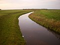 Broad Fleet - geograph.org.uk - 1563171.jpg 640 × 480; 47 KB
-
 Broad Fleet - geograph.org.uk - 3544721.jpg 640 × 480; 69 KB
-
 Broad Fleet - geograph.org.uk - 4263180.jpg 640 × 480; 33 KB
-
 Broad Fleet from Broadfleet Bridge - geograph.org.uk - 4165712.jpg 1 500 × 999; 142 KB
-
 Broad Fleet looking Downstream - geograph.org.uk - 2584326.jpg 4 320 × 3 240; 2,33 MB
-
 Broadfleet Bridge - geograph.org.uk - 1563176.jpg 640 × 480; 63 KB
-
 Broadfleet Bridge - geograph.org.uk - 1758031.jpg 640 × 427; 96 KB
-
 Broadfleet or Pilling Water Bridge - geograph.org.uk - 1050167.jpg 640 × 426; 145 KB
-
 Bungalow at Trashy Hill - geograph.org.uk - 5959932.jpg 4 441 × 2 498; 6,37 MB
-
 Bungalow on Lancaster Road - geograph.org.uk - 2306010.jpg 1 024 × 764; 125 KB
-
 Car park, Lane Ends Amenity Area - geograph.org.uk - 1235957.jpg 640 × 480; 81 KB
-
 Carr Bridge - geograph.org.uk - 1190765.jpg 640 × 426; 120 KB
-
 Carr Bridge - geograph.org.uk - 5962048.jpg 4 592 × 2 879; 7,96 MB
-
 Carr Lane - geograph.org.uk - 5938021.jpg 4 393 × 2 923; 7,14 MB
-

-

-
 Channel on Pilling Marsh - geograph.org.uk - 4159920.jpg 1 500 × 989; 155 KB
-
 Channel on Pilling Sands - geograph.org.uk - 1235966.jpg 640 × 480; 54 KB
-
 Cheesy Advert - geograph.org.uk - 1050291.jpg 400 × 600; 155 KB
-
 Chickens, Lane Ends Amenity Area - geograph.org.uk - 2583929.jpg 640 × 480; 107 KB
-
 Clow's Bridge (2) - geograph.org.uk - 5920613.jpg 3 456 × 2 355; 7,95 MB
-
 Clow's Bridge - geograph.org.uk - 5920284.jpg 4 003 × 2 276; 6,97 MB
-
 Coastal farmland - geograph.org.uk - 4263186.jpg 640 × 448; 30 KB
-
 Coastal grazing, Pilling Marsh - geograph.org.uk - 4262854.jpg 640 × 480; 66 KB
-
 Cross at Lane Ends Amenity Area near Pilling - geograph.org.uk - 6326345.jpg 5 184 × 2 920; 5,22 MB
-
 Damside Mill in Pilling - geograph.org.uk - 2836519.jpg 1 500 × 989; 118 KB
-

-

-
 Drain and track - geograph.org.uk - 4262575.jpg 640 × 480; 121 KB
-
 Drain off Lancaster Road - geograph.org.uk - 4262532.jpg 640 × 480; 70 KB
-
 Driveway at Springfield Farm - geograph.org.uk - 995458.jpg 640 × 425; 85 KB
-
 Duck pond - geograph.org.uk - 5961220.jpg 4 592 × 3 056; 6,21 MB
-
 Duck Pond at Pilling Hall Farm - geograph.org.uk - 100039.jpg 640 × 426; 135 KB
-
 Duck Pond opposite Pilling Hall - geograph.org.uk - 2582460.jpg 4 320 × 3 240; 3,9 MB
-

-
 Dyke Lambs Lane Pilling - geograph.org.uk - 995467.jpg 425 × 640; 107 KB
-

-
 Elletson Arms - geograph.org.uk - 5147143.jpg 5 183 × 2 920; 1,88 MB
-
 Elletson Arms, Stake Pool - geograph.org.uk - 3293432.jpg 640 × 480; 50 KB
-
 Elletson Arms, Stakepool - geograph.org.uk - 1166247.jpg 640 × 426; 86 KB
-
 Entering Pilling - geograph.org.uk - 4262525.jpg 640 × 403; 44 KB
-
 Entrance to Copthorne Fisheries - geograph.org.uk - 1170867.jpg 640 × 479; 112 KB
-
 Entrance to Copthorne Fisheries - geograph.org.uk - 1321194.jpg 640 × 426; 189 KB
-

-
 Entrance to Springfield House, Pilling - geograph.org.uk - 995454.jpg 640 × 425; 109 KB
-
 Fanny Bridge on Fluke Hall Lane - geograph.org.uk - 4165715.jpg 1 500 × 999; 170 KB
-
 Farm building off Horse Park Lane - geograph.org.uk - 4263202.jpg 640 × 480; 54 KB
-
 Farm buildings off Garstang Road - geograph.org.uk - 4263207.jpg 640 × 392; 35 KB
-
 Farm buildings off Lancaster Road - geograph.org.uk - 4262527.jpg 640 × 480; 65 KB
-
 Farm Road off Wheel Lane - geograph.org.uk - 1166214.jpg 640 × 426; 113 KB
-

-
 Farm track - geograph.org.uk - 5959900.jpg 4 191 × 2 794; 7,93 MB
-
 Farm track at Bankfield - geograph.org.uk - 1237293.jpg 576 × 383; 83 KB
-
 Farm track near Trashy Hill - geograph.org.uk - 1321190.jpg 640 × 426; 238 KB
-
 Farm track opposite Trashy Hill - geograph.org.uk - 1321192.jpg 640 × 426; 268 KB
-
 Farmland near Pilling Marsh - geograph.org.uk - 1756985.jpg 640 × 423; 83 KB
-
 Farmland towards Heys Meadow Wood - geograph.org.uk - 4262780.jpg 640 × 480; 75 KB
-
 Farmland west of Hools Lane - geograph.org.uk - 4262808.jpg 640 × 439; 70 KB
-
 Farmland west of Lancaster Road - geograph.org.uk - 4262569.jpg 640 × 480; 78 KB
-
 Farmland, Eagland Hill - geograph.org.uk - 3480170.jpg 640 × 425; 132 KB
-
 Farmland, Head Dyke Farm - geograph.org.uk - 4262802.jpg 640 × 480; 71 KB
-
 Farmyard at Jarvis Carr - geograph.org.uk - 1375441.jpg 640 × 425; 254 KB
-
 Feeding Station, Pilling Moss - geograph.org.uk - 1387960.jpg 640 × 480; 105 KB
-
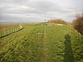
 Fenceposts on Pilling Marsh - geograph.org.uk - 4159885.jpg 1 500 × 994; 212 KB
-

-
 Fleetwood and the River Wyre - geograph.org.uk - 4937550.jpg 3 264 × 2 448; 3,12 MB
-
 Fluke Hall - geograph.org.uk - 1484140.jpg 640 × 354; 108 KB
-
 Fluke Hall Lane - geograph.org.uk - 2585111.jpg 4 320 × 3 240; 4,54 MB
-
 Fluke Hall Lane - geograph.org.uk - 4263155.jpg 640 × 480; 61 KB
-
 Fluke Hall Lane - geograph.org.uk - 5920919.jpg 4 270 × 2 842; 6,03 MB
-
 Fluke Hall Lane near Pilling - geograph.org.uk - 4165719.jpg 1 500 × 999; 181 KB
-
 Fluke Hall Lane near Pilling - geograph.org.uk - 4165722.jpg 1 500 × 999; 200 KB
-
 Fluke Hall Lane to the sea - geograph.org.uk - 4165728.jpg 1 500 × 999; 269 KB
-
 Footbridge Across the Broadfleet - geograph.org.uk - 1166249.jpg 640 × 426; 119 KB
-
 Footbridge over Dyke - geograph.org.uk - 1161573.jpg 640 × 426; 135 KB
-
 Footbridge over Pilling Water - geograph.org.uk - 2468029.jpg 640 × 480; 117 KB
-
 Footbridge, Old Ridge - geograph.org.uk - 2855884.jpg 640 × 480; 148 KB
-

-
 Footpath near Lane Ends Amenity Area - geograph.org.uk - 1563184.jpg 480 × 640; 78 KB
-
 Footpath to Cumming Carr - geograph.org.uk - 1375439.jpg 640 × 425; 276 KB
-
 Footpath to Eagland Hill - geograph.org.uk - 1375452.jpg 640 × 425; 330 KB
-
 Footpath to Island Farm - geograph.org.uk - 1237378.jpg 576 × 383; 71 KB
-
 Footpath to Stakepool - geograph.org.uk - 1298449.jpg 640 × 480; 183 KB
-
 Footpath, Moss Side - geograph.org.uk - 5811141.jpg 640 × 480; 79 KB
-
 Garstang Road - geograph.org.uk - 4263210.jpg 640 × 480; 78 KB
-
 Garstang Road at Brookfield - geograph.org.uk - 6089084.jpg 1 024 × 768; 118 KB
-
 Garstang Road by Glen Lea Nurseries - geograph.org.uk - 4158669.jpg 1 500 × 994; 162 KB
-

-
 Garstang Road entering Jarvis Carr - geograph.org.uk - 4158658.jpg 1 500 × 999; 140 KB
-
 Garstang Road in Stake Pool - geograph.org.uk - 4158673.jpg 1 500 × 999; 152 KB
-
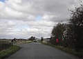
 Garstang Road leaving Pilling - geograph.org.uk - 6089080.jpg 1 024 × 769; 120 KB
-
 Garstang Road passes Calald's Farm - geograph.org.uk - 4158653.jpg 1 500 × 986; 102 KB
-
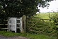
 Gates on the footpath - geograph.org.uk - 4159871.jpg 1 500 × 999; 217 KB
-
 Gates on the sea wall - geograph.org.uk - 4159878.jpg 1 500 × 999; 231 KB
-
 Grassland, Bone Hill Farm - geograph.org.uk - 2467864.jpg 480 × 640; 156 KB
-
 Grassland, Calcald's Farm - geograph.org.uk - 2467861.jpg 640 × 480; 143 KB
-
 Grazing beside drain - geograph.org.uk - 4263205.jpg 640 × 480; 59 KB
-
 Grazing east of Green Dick's Lane - geograph.org.uk - 3974405.jpg 640 × 480; 83 KB
-
 Grazing near Lane Ends Farm - geograph.org.uk - 4263196.jpg 640 × 480; 46 KB
-
 Grazing north of Lancaster Road - geograph.org.uk - 4262769.jpg 640 × 420; 48 KB
-
 Grazing off Garstang Road - geograph.org.uk - 4263209.jpg 640 × 480; 47 KB
-
 Grazing off Wheel Lane - geograph.org.uk - 4262813.jpg 640 × 480; 60 KB
-
 Green Dick's Lane - geograph.org.uk - 3974404.jpg 640 × 480; 150 KB
-
 Green Dick's Lane - geograph.org.uk - 3974406.jpg 640 × 480; 88 KB
-
 Green Dicks Lane - geograph.org.uk - 5936395.jpg 4 347 × 2 893; 7,93 MB
-
 Green energy, Pilling Moss - geograph.org.uk - 3480166.jpg 640 × 617; 176 KB
-

-
 Haw Pool - geograph.org.uk - 4263159.jpg 640 × 480; 57 KB
-
 Head Dyke Lane (A588) - geograph.org.uk - 4262787.jpg 640 × 480; 48 KB
-
 Head Dyke Lane (A588) - geograph.org.uk - 4262798.jpg 640 × 480; 61 KB
-

-
 Head Dyke Lane looking east - geograph.org.uk - 3293426.jpg 640 × 481; 32 KB
-
 Head Dyke Lane to Preesall - geograph.org.uk - 4165817.jpg 1 500 × 999; 216 KB
-
 Head Dyke Lane to Preesall - geograph.org.uk - 4165819.jpg 1 500 × 983; 150 KB
-
 Horse Park Lane (2) - geograph.org.uk - 5961862.jpg 4 592 × 2 876; 7,84 MB
-
 Horse Park Lane - geograph.org.uk - 5961288.jpg 3 712 × 2 453; 7,89 MB
-

-
 House - geograph.org.uk - 5147436.jpg 5 184 × 3 274; 1,63 MB
-
 House on Garstang Road - geograph.org.uk - 2247182.jpg 800 × 567; 106 KB
-
 House on Skitham Lane - geograph.org.uk - 2242795.jpg 1 024 × 745; 100 KB
-
 House on Union Lane - geograph.org.uk - 4262519.jpg 640 × 373; 58 KB
-
 Houses in Fishers Row - geograph.org.uk - 4052770.jpg 640 × 480; 57 KB
-
 Hut at Eagland Hill - geograph.org.uk - 1171093.jpg 640 × 480; 144 KB
-

-
 Incoming Tide Pilling sands - geograph.org.uk - 3555434.jpg 640 × 425; 290 KB
-
 Incoming Tide Pilling Sands - geograph.org.uk - 3555721.jpg 640 × 425; 269 KB
-
 Is It A Bird^ - geograph.org.uk - 1204877.jpg 400 × 600; 80 KB
-

-

-
 Kentucky Farm - geograph.org.uk - 2467983.jpg 640 × 480; 114 KB
-
 Lamb's Lane - geograph.org.uk - 4262805.jpg 640 × 447; 55 KB
-
 Lambs Lane - geograph.org.uk - 5936855.jpg 4 363 × 2 665; 6,82 MB
-
 Lambs Lane to Head Dyke Lane - geograph.org.uk - 4165804.jpg 1 500 × 999; 149 KB
-
 Lambs Lane to Head Dyke Lane - geograph.org.uk - 4165809.jpg 1 500 × 981; 107 KB
-

-
 Lancaster Road (A588) - geograph.org.uk - 4263198.jpg 640 × 480; 55 KB
-
 Lancaster Road - geograph.org.uk - 2243227.jpg 1 600 × 1 205; 218 KB
-
 Lancaster Road - geograph.org.uk - 4262531.jpg 640 × 423; 56 KB
-
 Lancaster Road - geograph.org.uk - 4262534.jpg 640 × 418; 49 KB
-
 Lancaster Road - geograph.org.uk - 4262565.jpg 640 × 480; 47 KB
-
 Lancaster Road - geograph.org.uk - 4262768.jpg 640 × 480; 59 KB
-
 Lancaster Road - geograph.org.uk - 5147361.jpg 5 184 × 2 587; 1,87 MB
-
 Lancaster Road at junction with Union Lane - geograph.org.uk - 2305973.jpg 1 024 × 726; 100 KB
-
 Lancaster Road in Stake Pool - geograph.org.uk - 4158679.jpg 1 500 × 977; 85 KB
-
 Lancaster Road passes Lane Ends Farm - geograph.org.uk - 4158686.jpg 1 500 × 999; 176 KB
-
 Lancaster Road runs through Fisher's Row - geograph.org.uk - 4158682.jpg 1 500 × 999; 119 KB
-
 Lane End Amenity Area - geograph.org.uk - 5921039.jpg 640 × 426; 126 KB
-
 Lane Ends Amenity Area - geograph.org.uk - 3364797.jpg 3 072 × 2 304; 3,63 MB
-
 Lane Ends Amenity Area - geograph.org.uk - 791224.jpg 640 × 480; 120 KB
-
 Lane to Moss Side - geograph.org.uk - 1375442.jpg 640 × 425; 242 KB
-
 Lane to New Ridge Farm - geograph.org.uk - 1484147.jpg 640 × 480; 145 KB
-
 Lane to Trashy Hill - geograph.org.uk - 1170927.jpg 640 × 479; 124 KB
-


_-_geograph.org.uk_-_4262791.jpg)


_-_geograph.org.uk_-_5920334.jpg)


_-_geograph.org.uk_-_5961162.jpg)


_-_geograph.org.uk_-_5920613.jpg)


_off_Lancaster_Road_-_geograph.org.uk_-_4262568.jpg)


_-_geograph.org.uk_-_4262787.jpg)
_-_geograph.org.uk_-_4262798.jpg)


_-_geograph.org.uk_-_5961862.jpg)


_-_geograph.org.uk_-_4263198.jpg)


