Category:Plan-de-Baix
Zur Navigation springen
Zur Suche springen
französische Gemeinde   | |||||
| Medium hochladen | |||||
| Ist ein(e) | |||||
|---|---|---|---|---|---|
| Ort |
| ||||
| Einwohnerzahl |
| ||||
| Fläche |
| ||||
 | |||||
Unterkategorien
Es werden 10 von insgesamt 10 Unterkategorien in dieser Kategorie angezeigt:
In Klammern die Anzahl der enthaltenen Kategorien (K), Seiten (S), Dateien (D)
C
- Chute de la Druise (3 D)
- Col de Bacchus (4 D)
E
M
- Mairie de Plan-de-Baix (4 D)
- Maps of Plan-de-Baix (3 D)
R
- Rocher du Vellan (8 D)
T
- Temple de Plan-de-Baix (5 D)
W
- War memorial of Plan-de-Baix (2 D)
Medien in der Kategorie „Plan-de-Baix“
Folgende 31 Dateien sind in dieser Kategorie, von 31 insgesamt.
-
 Le Tour du monde-02-p394.jpg 820 × 618; 201 KB
-
 Pano route plan de baix.jpg 5.780 × 2.199; 9,74 MB
-
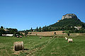 Plan de Baix.jpg 2.700 × 1.800; 3,94 MB
-
 Plan-de-Baix - Arrêt de bus Quartier La Combe (mai 2022).jpg 3.024 × 4.032; 14,49 MB
-
 Plan-de-Baix - Bascule à La Combe (mai 2022).jpg 4.032 × 3.024; 4,97 MB
-
 Plan-de-Baix - Borne de nivellement 728m.jpeg 4.128 × 2.322; 4,24 MB
-
 Plan-de-Baix - Borne de nivellement.jpg 2.160 × 3.840; 4,28 MB
-
 Plan-de-Baix - Boîte aux lettres La Combe (mai 2022).jpg 3.024 × 4.032; 3,34 MB
-
 Plan-de-Baix - Chemin de la Pâquerette (mai 2022).jpg 4.032 × 3.024; 30,29 MB
-
 Plan-de-Baix - Chemin du Grand Champ (mai 2022).jpg 4.032 × 3.024; 5,42 MB
-
 Plan-de-Baix - Fontaine chemin de la Pâquerette (mai 2022).jpg 4.032 × 3.024; 5,78 MB
-
 Plan-de-Baix - Fontaine à pompe 1 (mai 2022).jpg 3.024 × 4.032; 4,18 MB
-
 Plan-de-Baix - Fontaine à pompe 2 (mai 2022).jpg 3.024 × 4.032; 21,01 MB
-
 Plan-de-Baix - GR9 au centre du village.jpg 3.840 × 2.160; 4,78 MB
-
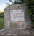 Plan-de-Baix - Mémorial résistance 1944 (mai 2022).jpg 3.008 × 3.201; 3,35 MB
-
 Plan-de-Baix - Mémorial résistance 1944, plaque (mai 2022).jpg 4.032 × 3.024; 13,72 MB
-
 Plan-de-Baix - Panneau indiquant le col de Bacchus.jpeg 2.322 × 4.128; 5,02 MB
-
 Plan-de-Baix - Panneau route non déneigée (mai 2022).jpg 3.024 × 4.032; 6,38 MB
-
 Plan-de-Baix - Place de la Mairie - Plaque.jpeg 4.128 × 2.322; 2,27 MB
-
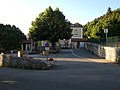 Plan-de-Baix - Place de la Mairie.jpeg 3.456 × 2.592; 5,3 MB
-
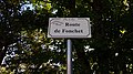 Plan-de-Baix - Route de Fonchet - Plaque.jpeg 4.128 × 2.322; 3,38 MB
-
 Plan-de-Baix - Route du Vialaret - Pierre scellée dans le mur.jpeg 2.322 × 4.128; 5,14 MB
-
 Plan-de-Baix - Route du Vialaret - Plaque et boîte-aux-lettres.jpeg 2.322 × 4.128; 3,28 MB
-
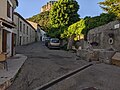
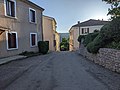 Plan-de-Baix - Route du Vialaret direction ouest (mai 2022).jpg 4.032 × 3.024; 5,7 MB
-
 Plan-de-Baix - Rue de Perrin-Chabas - Plaque.jpeg 4.128 × 2.322; 3,28 MB
-
 Plan-de-Baix - Rue de Perrin-Chabat (mai 2022).jpg 4.032 × 3.024; 4,12 MB
-
 Plan-de-Baix - Terrain de pétanque.jpeg 4.128 × 2.322; 3,93 MB
-
 Plan-de-Baix - Église Notre-Dame - Croix - Détail.jpeg 3.456 × 2.592; 5,13 MB
-
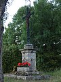 Plan-de-Baix - Église Notre-Dame - Croix.jpeg 2.592 × 3.456; 5,13 MB
-
 Population - Municipality code 26240.svg 475 × 355; 12 KB
-
 Vue de Plan-de-Baix depuis le rocher du Vellan, Drôme, 2021.jpg 3.449 × 2.111; 2,02 MB


.jpg)
.jpg)


.jpg)
.jpg)
.jpg)
.jpg)
.jpg)
.jpg)

.jpg)
.jpg)

.jpg)


.jpg)

.jpg)


