Category:Platte River
Mine navigeerimisribale
Mine otsikasti
river in Nebraska, United States   | |||||
| Laadi fail üles | |||||
| Üksikjuht nähtusest | |||||
|---|---|---|---|---|---|
| Asukoht | Nebraska, Ameerika Ühendriigid | ||||
| Pikkus |
| ||||
| Lähe |
| ||||
| Suue | |||||
| Valgla |
| ||||
| Valgla riik | |||||
| Lisajõgi |
| ||||
 | |||||
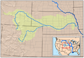
English: Media related to the Platte River, a river in the Great Plains region of the west—central in Nebraska, United States.
- Formed in western Nebraska, at the confluence of the North Platte River and South Platte River originating in Colorado and Wyoming.
- A significant tributary of the Missouri River, which in turn is a tributary of the Mississippi River.
- For the seperate and smaller 'Platte River' of Iowa and Missouri, see: Category: Little Platte River.
Alamkategooriad
Järgmised 16 alamkategooriat on selles kategoorias (kokku 16).
A
B
C
- CR 8 at Platte River (18 P)
F
G
L
M
- Meadow, Nebraska (1 P)
N
O
S
- SR 44 at the Platte River (3 P)
- SR 47 at the Platte River (4 P)
U
- U.S. 183 at Platte River (2 P)
Failid kategoorias "Platte River"
Järgmised 47 faili on selles kategoorias (kokku 47).
-
 Platterivermap.png 716 × 500; 485 KB
-
 Wpdms nasa topo platte river.jpg 300 × 250; 45 KB
-
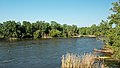
 11th Place - March Morning on the Platte River (7371879846).jpg 4256 × 2819; 9,22 MB
-

-
 Aerial view of the Platte River and I-80 at Gothenburg, Nebraska.jpg 3024 × 4032; 2,97 MB
-
 Channel Catfish (7463089188).jpg 4288 × 3216; 3,32 MB
-
 Colfax County.png 955 × 1421; 58 KB
-
 Dairy Farm in Platte River Valley - panoramio.jpg 4000 × 3000; 3,86 MB
-
 Great Blue Heron and immature Bald Eagle on the Platte River.jpg 1232 × 910; 280 KB
-
 Historic floods have inundated Nebraska (40463013783).jpg 700 × 742; 211 KB
-
 Meadow, NE.jpg 4878 × 3231; 8,11 MB
-
 Melia, NE.jpg 4928 × 3264; 5,59 MB
-

-

-
 MerrickCounty.png 1000 × 961; 82 KB
-
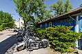
 My Platte River Ride (2798270682).jpg 500 × 375; 88 KB
-
 Nebraska - Platte River - NARA - 23942193.jpg 4385 × 3382; 2,74 MB
-
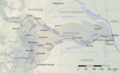 Platte basin map.png 1500 × 913; 2,27 MB
-
 Platte River (just south of Lexington, Nebraska, USA) (20038277931).jpg 3008 × 1710; 2,46 MB
-
 Platte River Banner.jpg 5736 × 822; 1,39 MB
-
 Platte River dusk panorama of arrival of sandhill cranes.jpg 13 126 × 2566; 7,19 MB
-
 Platte River GI.jpg 5184 × 3456; 4,42 MB
-
 Platte River in Central Nebraska.jpeg 7480 × 2570; 3,71 MB
-
 Platte River Kearny.jpg 3456 × 5184; 7,34 MB
-
 Platte River Slough (7489195988).jpg 800 × 600; 375 KB
-
 Platte River sunrise panorama of departure of sandhill cranes.jpg 5736 × 2000; 2,61 MB
-
 Platte River Valley 2016-07-12 265.jpg 3264 × 2176; 1,61 MB
-
 Platte River Valley 2016-07-12 273.jpg 3264 × 2176; 1,41 MB
-
 Platte River Valley 2016-07-12 276.jpg 3264 × 2176; 1,58 MB
-
 Platte River Valley P6060605.jpg 3072 × 2304; 1,16 MB
-
 Platte River.jpg 4000 × 2665; 2,13 MB
-
 Platte Valley.jpg 2032 × 1524; 677 KB
-
 Platterivermap.jpg 1382 × 919; 2,29 MB
-
 Platterivermap.svg 1394 × 924; 2,41 MB
-
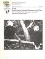 Platte River Resource Area and Jackson Canyon ACEC Bald Eagle habitat management plan - final (IA platteriverresou12unit).pdf 1229 × 1606, 441 lehekülge; 57,36 MB
-
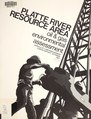 Programmatic environmental assessment for oil and gas leasing in the Platte River Resource Area (IA programmaticenvi11unit).pdf 1245 × 1635, 158 lehekülge; 19,5 MB
-

-
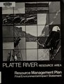 Resource management plan-environmental impact statement for the Platte River Resource Area, Casper, Wyoming - final (IA resourcemanageme04unit).pdf 1264 × 1645, 266 lehekülge; 49,29 MB
-
 Sandhill Migration on the Platte River (7371874564).jpg 4256 × 2819; 8,91 MB
-
 Section 404 and wetland alterations in the Platte River Basin of Colorado. - DPLA - 1049495f038842d99196b8f4b107edea.pdf 1275 × 1650, 26 lehekülge; 1,83 MB
-

-
 South Platte River after 2013 Colorado floods.png 1381 × 799; 1,42 MB
-
 Sunset on the Platte River (7463088324).jpg 6144 × 1584; 2,88 MB
-
 The Platte River At Ashland Alice Righter Edmiston.jpg 900 × 737; 402 KB
-
 Venice, NE.jpg 4928 × 3264; 7,05 MB
-

-


.jpg)


.jpg)


.jpg)


.jpg)


_(20038277931).jpg)


.jpg)


_(14780534731).jpg)
.jpg)


_(14781532734).jpg)
.jpg)
Kategooriad:
- Rivers of Nebraska
- Tributaries of the Missouri River
- Rivers of the Western United States
- California Trail
- Rivers of the United States by name
- Locations along Interstate 80 in Nebraska
- Locations along U.S. Route 6 in Nebraska
- Locations along U.S. Route 34 in Nebraska
- Locations along U.S. Route 75 in Nebraska
- Locations along U.S. Route 77 in Nebraska
- Locations along U.S. Route 81 in Nebraska
- Locations along U.S. Route 183 in Nebraska
- Locations along U.S. Route 283 in Nebraska
- Locations along Nebraska Highway 2
- Locations along Nebraska Highway 14
- Locations along Nebraska Highway 15
- Locations along Nebraska Highway 21
- Locations along Nebraska Highway 10
- Locations along Nebraska Highway 31
- Locations along Nebraska Highway 39
- Locations along Nebraska Highway 47
- Locations along Nebraska Highway 50
- Locations along Nebraska Highway 66
- Locations along Nebraska Highway 79
- Locations along Nebraska Highway 92
- Locations along Nebraska Link 56D
- Locations along Nebraska Spur 40D
- Locations along Nebraska Spur 56A