Category:Plaxtol
Vai alla navigazione
Vai alla ricerca
village and civil parish in Kent, England, UK  | |||||
| Carica un file multimediale | |||||
| Istanza di | |||||
|---|---|---|---|---|---|
| Luogo | Tonbridge and Malling, Kent, Sud Est dell'Inghilterra, Inghilterra | ||||
| Considerato essere uguale a | Plaxtol (pagina Wikimedia duplicata, parrocchia civile dell'Inghilterra) | ||||
 | |||||
Sottocategorie
Questa categoria contiene le 9 sottocategorie indicate di seguito, su un totale di 9.
B
C
- Claygate Cross (28 F)
F
O
- Old Soar Manor (13 F)
P
- Plaxtol Parish Church (16 F)
- Plaxtol War Memorial (1 F)
S
Y
- Yopps Green (6 F)
File nella categoria "Plaxtol"
Questa categoria contiene 200 file, indicati di seguito, su un totale di 517.
(pagina precedente) (pagina successiva)-
 A church fete in Kent - geograph.org.uk - 3508725.jpg 4 000 × 3 000; 4,25 MB
-
 Allen's House - geograph.org.uk - 1292899.jpg 640 × 480; 75 KB
-
 Allens Lane, Dunk's Green - geograph.org.uk - 5069381.jpg 3 264 × 2 448; 1,88 MB
-
 Alpacas, Tree Lane - geograph.org.uk - 3494917.jpg 640 × 430; 117 KB
-
 An orchard - geograph.org.uk - 2911946.jpg 640 × 430; 83 KB
-
 An orchard by The Hurst - geograph.org.uk - 2503138.jpg 640 × 430; 74 KB
-
 Apple crates - geograph.org.uk - 3487228.jpg 640 × 430; 70 KB
-
 Apple orchard - geograph.org.uk - 2911941.jpg 640 × 430; 93 KB
-
 Apple Orchard by Winfield Lane - geograph.org.uk - 2793850.jpg 640 × 425; 108 KB
-
 Approach to School Lane along Peckham Walk Avenue - geograph.org.uk - 3505730.jpg 4 000 × 3 000; 3,75 MB
-
 Archaeologia cantiana (1859) (14776991704).jpg 2 818 × 2 302; 1,18 MB
-
 Archaeologia cantiana (1900) (14784221445).jpg 3 728 × 2 453; 4,21 MB
-

-
 Barn of Grange Oast - geograph.org.uk - 1292979.jpg 640 × 480; 117 KB
-
 Barn, Fairlawne Home Farm, Plaxtol - geograph.org.uk - 1363994.jpg 640 × 430; 136 KB
-
 Bartons Farmhouse - geograph.org.uk - 3494888.jpg 640 × 371; 85 KB
-
 Basted - geograph.org.uk - 2208411.jpg 1 162 × 788; 616 KB
-
 Basted Mill Pond - geograph.org.uk - 2570481.jpg 640 × 430; 105 KB
-
 Bend, Crowhurst Lane - geograph.org.uk - 2911959.jpg 640 × 430; 84 KB
-
 Betenson Cottages, School Lane, Plaxtol - geograph.org.uk - 5038507.jpg 1 600 × 1 064; 480 KB
-
 Bewley Lane - geograph.org.uk - 2916325.jpg 640 × 430; 80 KB
-
 Bewley Lane - geograph.org.uk - 2916329.jpg 640 × 430; 102 KB
-
 Bewley Lane - geograph.org.uk - 3507266.jpg 4 000 × 3 000; 4,03 MB
-
 Bewley Lane - geograph.org.uk - 3829083.jpg 640 × 428; 129 KB
-
 Bewley Lane, near Plaxtol - geograph.org.uk - 5068018.jpg 3 264 × 2 448; 2,31 MB
-
 Bluebells in Hatcham's Wood - geograph.org.uk - 2939371.jpg 4 000 × 3 000; 4,31 MB
-
 Bluebells in Hatcham's Wood - geograph.org.uk - 2942492.jpg 4 000 × 3 000; 4,36 MB
-
 Bluebells, High Beeches - geograph.org.uk - 2397913.jpg 1 024 × 681; 331 KB
-
 Bluebells, High Beeches - geograph.org.uk - 2397930.jpg 681 × 1 024; 289 KB
-
 Bluebells, High Beeches - geograph.org.uk - 2397934.jpg 681 × 1 024; 366 KB
-
 Bluebells, High Beeches - geograph.org.uk - 2397940.jpg 1 024 × 681; 315 KB
-
 Bottom end of The Street, Plaxtol - geograph.org.uk - 2977674.jpg 640 × 480; 110 KB
-
 Bourne Cottage, Winfield Lane - geograph.org.uk - 1572149.jpg 640 × 430; 121 KB
-
 Bourne Lane, near Plaxtol - geograph.org.uk - 5067884.jpg 3 264 × 2 448; 2,2 MB
-
 Bourne Lane, Winfield Lane junction - geograph.org.uk - 1572076.jpg 640 × 430; 126 KB
-
 Bourne Valley House - geograph.org.uk - 3487192.jpg 640 × 430; 91 KB
-
 Bourne Valley House, Crowhurst Lane - geograph.org.uk - 2911952.jpg 640 × 430; 99 KB
-

-
-
 Bridleway off Yopps Green - geograph.org.uk - 2578717.jpg 640 × 430; 108 KB
-
 Bridleway to Ightam Mote - geograph.org.uk - 1399532.jpg 640 × 480; 111 KB
-
 Broadfield Farm, Plaxtol Spout - geograph.org.uk - 5233113.jpg 2 304 × 1 728; 1,32 MB
-
 Brook Farm - geograph.org.uk - 2494783.jpg 640 × 430; 74 KB
-
 Brook Lane - geograph.org.uk - 2494762.jpg 640 × 430; 87 KB
-
 Brook Lane - geograph.org.uk - 2494767.jpg 640 × 430; 100 KB
-
 Brook Lane, Plaxtol Spoute - geograph.org.uk - 2494765.jpg 640 × 430; 111 KB
-
 Buddleia Cottage (geograph 6731691).jpg 1 024 × 684; 161 KB
-
 Butchers shop, Plaxtol - geograph.org.uk - 1762435.jpg 3 072 × 2 304; 2,69 MB
-
 Butchers Shop, Plaxtol - geograph.org.uk - 2578766.jpg 640 × 430; 69 KB
-
 Byway to Winfield Lane - geograph.org.uk - 2578544.jpg 640 × 430; 127 KB
-
 Byway to Winfield Lane - geograph.org.uk - 2578545.jpg 640 × 430; 109 KB
-
 Byway to Winfield Lane - geograph.org.uk - 2578548.jpg 640 × 430; 138 KB
-
 Byway to Winfield Lane - geograph.org.uk - 2578550.jpg 640 × 430; 139 KB
-
 Byway to Winfield Lane - geograph.org.uk - 2578557.jpg 640 × 430; 145 KB
-
 Church Cottage - geograph.org.uk - 3501476.jpg 640 × 430; 77 KB
-

-
 Church Hill, Plaxtol - geograph.org.uk - 1762430.jpg 3 072 × 2 304; 2,45 MB
-
 Church Hill, Plaxtol - geograph.org.uk - 5069146.jpg 3 264 × 2 448; 1,65 MB
-
 Church House - geograph.org.uk - 3501429.jpg 640 × 430; 55 KB
-
 Church Row (geograph 6731656).jpg 1 024 × 684; 224 KB
-
 Church Row (geograph 6731672).jpg 1 024 × 684; 144 KB
-
 Church Row - geograph.org.uk - 3501443.jpg 640 × 430; 77 KB
-
 Church Row - geograph.org.uk - 3501485.jpg 640 × 430; 103 KB
-
 Clakkers Hall - geograph.org.uk - 1200027.jpg 640 × 481; 77 KB
-
 Claygate Cross - geograph.org.uk - 2208423.jpg 1 148 × 794; 329 KB
-
 Cleared orchard - geograph.org.uk - 2793832.jpg 640 × 425; 73 KB
-
 Closed Footpath off School Lane, Plaxtol - geograph.org.uk - 1363878.jpg 640 × 430; 130 KB
-
 Club Cottage (geograph 6731654).jpg 1 024 × 684; 171 KB
-

-
 Conifers, Fairlawne Park - geograph.org.uk - 3501523.jpg 640 × 430; 47 KB
-
 Conifers, Fairlawne Park - geograph.org.uk - 3501542.jpg 640 × 430; 78 KB
-
 Converted Wesleyan Chapel - geograph.org.uk - 1292989.jpg 640 × 480; 133 KB
-
 Copper Beech tree, Yopps Green - geograph.org.uk - 2578730.jpg 640 × 430; 109 KB
-
 Coppiced tree by Winfield lane - geograph.org.uk - 1572208.jpg 640 × 430; 227 KB
-
 Coppiced trees, Hurst Wood - geograph.org.uk - 2503145.jpg 640 × 430; 154 KB
-
 Coppiced trees, Hurst Wood - geograph.org.uk - 2503151.jpg 640 × 430; 160 KB
-
 Cottage, Claygate Cross - geograph.org.uk - 2208425.jpg 1 171 × 782; 350 KB
-

-
 Cottage, Yopps Green - geograph.org.uk - 2578713.jpg 640 × 430; 92 KB
-
 Cottages by Plaxtol Church - geograph.org.uk - 5229832.jpg 2 304 × 1 728; 841 KB
-
 Cottages, Roughway Lane - geograph.org.uk - 1358478.jpg 640 × 430; 140 KB
-
 Country Lane leading into Basted - geograph.org.uk - 2208406.jpg 1 161 × 789; 600 KB
-
 Crops, Plaxtol Spoute - geograph.org.uk - 2499963.jpg 640 × 430; 106 KB
-
 Crowhurst Lane - geograph.org.uk - 2911956.jpg 640 × 430; 101 KB
-
 Crowhurst Lane - geograph.org.uk - 2911960.jpg 640 × 430; 100 KB
-
 Crowhurst Lane - geograph.org.uk - 3487198.jpg 640 × 430; 99 KB
-
 Crowhurst Lane - geograph.org.uk - 3487205.jpg 640 × 430; 83 KB
-
 Crowhurst Lane - geograph.org.uk - 3487209.jpg 640 × 430; 87 KB
-
 Crowhurst Lane - geograph.org.uk - 3487211.jpg 640 × 430; 97 KB
-
 Crowhurst Lane - geograph.org.uk - 3487217.jpg 640 × 430; 94 KB
-
 Crowhurst Lane - geograph.org.uk - 3507285.jpg 4 000 × 3 000; 4,27 MB
-
 Crowhurst Lane, near Borough Green - geograph.org.uk - 5067854.jpg 3 264 × 2 448; 2,15 MB
-
 Crowhurst Lane, near Plaxtol - geograph.org.uk - 5068015.jpg 3 264 × 2 448; 2,4 MB
-
 Daffodils, Fairlawne Park - geograph.org.uk - 3501512.jpg 640 × 430; 131 KB
-
 Dunk's Green Village Sign - geograph.org.uk - 5069353.jpg 2 448 × 2 448; 1,94 MB
-
 Eggs for sale, Crowhurst Lane - geograph.org.uk - 3487193.jpg 640 × 430; 99 KB
-
 Electrical Pylon - geograph.org.uk - 1572125.jpg 529 × 640; 102 KB
-
 Elm Tree Cottage - geograph.org.uk - 3494891.jpg 640 × 430; 82 KB
-
 Elm Tree Cottage and Whitebeam Cottage - geograph.org.uk - 1292968.jpg 640 × 480; 100 KB
-
 Enclosed trees, Fairlawne Park - geograph.org.uk - 3501534.jpg 640 × 430; 65 KB
-
 Enclosed trees, Fairlawne Park - geograph.org.uk - 3501562.jpg 640 × 430; 66 KB
-
 Ex orchard and orchard - geograph.org.uk - 2916334.jpg 640 × 430; 86 KB
-

-
 Fairlawne from a footpath on the estate - geograph.org.uk - 5596740.jpg 4 000 × 3 000; 4,9 MB
-
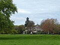
 Fairlawne House - geograph.org.uk - 2042418.jpg 640 × 430; 128 KB
-
 Fairlawne House - geograph.org.uk - 2042421.jpg 640 × 430; 123 KB
-
 Fairlawne House - geograph.org.uk - 3501555.jpg 640 × 430; 94 KB
-
 Fairlawne House - geograph.org.uk - 3501559.jpg 640 × 430; 75 KB
-
 Fairlawne House - geograph.org.uk - 3501569.jpg 640 × 430; 70 KB
-
 Fairlawne House - geograph.org.uk - 3501580.jpg 640 × 430; 71 KB
-
 Fairlawne House - geograph.org.uk - 3501598.jpg 640 × 430; 76 KB
-
 Fairlawne Park - geograph.org.uk - 3501508.jpg 640 × 430; 66 KB
-
 Fairlawne Park - geograph.org.uk - 3501519.jpg 640 × 430; 142 KB
-
 Fairlawne Park - geograph.org.uk - 3501531.jpg 640 × 430; 78 KB
-
 Fairlawne Park - geograph.org.uk - 3501549.jpg 640 × 430; 79 KB
-
 Fairlawne Park Ha-ha - geograph.org.uk - 4285273.jpg 640 × 480; 117 KB
-
 Fairlawne Park, July evening light - geograph.org.uk - 5038528.jpg 1 600 × 1 064; 474 KB
-
 Farm building, Fairlawne Home Farm - geograph.org.uk - 1364006.jpg 640 × 430; 114 KB
-
 Farm produce for sale - geograph.org.uk - 2911948.jpg 640 × 430; 83 KB
-
 Farmhouse, Fairlawne Home Farm - geograph.org.uk - 1364012.jpg 640 × 430; 158 KB
-
 Farmland by Yopps Green - geograph.org.uk - 3494876.jpg 640 × 430; 79 KB
-
 Field near Yopps Green - geograph.org.uk - 4336359.jpg 640 × 480; 39 KB
-
 Fields by Old Soar Road, Plaxtol - geograph.org.uk - 5233114.jpg 2 304 × 1 728; 970 KB
-
 Fingerpost, Plaxtol - geograph.org.uk - 5069156.jpg 2 448 × 3 264; 2,34 MB
-
 Footbridge across the River Bourne - geograph.org.uk - 2494820.jpg 640 × 430; 140 KB
-
 Footbridge on the path to Yopps Green - geograph.org.uk - 2578650.jpg 640 × 430; 154 KB
-
 Footpath by woodland and orchard - geograph.org.uk - 3494664.jpg 640 × 430; 150 KB
-
 Footpath junction on Weald Way - geograph.org.uk - 2793158.jpg 640 × 425; 114 KB
-
 Footpath junction, Hurst Wood - geograph.org.uk - 2503152.jpg 640 × 430; 154 KB
-
 Footpath near Brookside Farm - geograph.org.uk - 2578661.jpg 640 × 430; 78 KB
-
 Footpath next to Long Mill Lane - geograph.org.uk - 4832695.jpg 4 608 × 3 456; 3,39 MB
-
 Footpath north from Brook Lane - geograph.org.uk - 2494819.jpg 640 × 430; 106 KB
-
 Footpath off Bewley Lane - geograph.org.uk - 2916346.jpg 640 × 430; 108 KB
-
 Footpath off Brook Lane - geograph.org.uk - 2494775.jpg 640 × 430; 117 KB
-
 Footpath off Crowhurst Lane - geograph.org.uk - 2911979.jpg 640 × 430; 101 KB
-
 Footpath off Crowhurst Lane - geograph.org.uk - 3487215.jpg 640 × 430; 104 KB
-
 Footpath off Hamptons Rd - geograph.org.uk - 1358419.jpg 640 × 430; 163 KB
-
 Footpath off Hamptons Rd - geograph.org.uk - 1358441.jpg 640 × 430; 168 KB
-
 Footpath off Plaxtol Lane - geograph.org.uk - 3501507.jpg 640 × 430; 66 KB
-
 Footpath off Sheet Hill - geograph.org.uk - 2916300.jpg 640 × 430; 117 KB
-
 Footpath off Sheet Hill - geograph.org.uk - 3487242.jpg 640 × 430; 113 KB
-
 Footpath off The Hurst - geograph.org.uk - 2503139.jpg 640 × 430; 138 KB
-
 Footpath off Yopps Green - geograph.org.uk - 2578693.jpg 640 × 430; 114 KB
-
 Footpath off Yopps Green - geograph.org.uk - 3494881.jpg 640 × 430; 116 KB
-
 Footpath through Hurst Wood - geograph.org.uk - 2503159.jpg 640 × 430; 143 KB
-
 Footpath through the orchard - geograph.org.uk - 2916355.jpg 640 × 430; 93 KB
-
 Footpath to Bourne Lane - geograph.org.uk - 2578683.jpg 640 × 430; 92 KB
-
 Footpath to Crouch - geograph.org.uk - 2793826.jpg 640 × 425; 81 KB
-
 Footpath to Dunk's Green - geograph.org.uk - 2793025.jpg 640 × 425; 60 KB
-
 Footpath to Old Soar Manor - geograph.org.uk - 2499968.jpg 640 × 430; 120 KB
-
 Footpath to Old Soar Manor - geograph.org.uk - 2499969.jpg 640 × 430; 102 KB
-
 Footpath to Plaxtol - geograph.org.uk - 2499970.jpg 640 × 430; 111 KB
-
 Footpath to Plaxtol Lane - geograph.org.uk - 5596748.jpg 4 000 × 3 000; 4,85 MB
-
 Footpath to Yopps Green - geograph.org.uk - 2578666.jpg 640 × 430; 70 KB
-
 Footpath to Yopps Green - geograph.org.uk - 5596745.jpg 4 000 × 3 000; 5 MB
-
 Footpath, Brookside Farm - geograph.org.uk - 2578664.jpg 640 × 430; 116 KB
-
 Footpath, Hurst Wood - geograph.org.uk - 2503149.jpg 640 × 430; 152 KB
-
 Footpath, Hurst Wood - geograph.org.uk - 2503164.jpg 640 × 430; 150 KB
-
 Footpaths divide - geograph.org.uk - 2499971.jpg 640 × 430; 116 KB
-
 Forge Cottage - geograph.org.uk - 2578769.jpg 640 × 430; 105 KB
-

-
 Fruit boxes, Golding Hop Farm - geograph.org.uk - 2911990.jpg 640 × 430; 46 KB
-
 Gated path - geograph.org.uk - 2911947.jpg 640 × 430; 129 KB
-
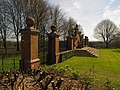
 Gatehouse, Plaxtol Lane - geograph.org.uk - 2792966.jpg 640 × 426; 66 KB
-
 Ginnel off Plaxtol Lane - geograph.org.uk - 1574693.jpg 640 × 430; 197 KB
-
 Golding Hop Farm - geograph.org.uk - 2911987.jpg 640 × 430; 67 KB
-
 Golding Hop Farm - geograph.org.uk - 2916309.jpg 640 × 430; 66 KB
-
 Gover Hill, near West Peckham - geograph.org.uk - 5127822.jpg 3 264 × 2 448; 2,06 MB
-
 Gover Pound - geograph.org.uk - 2977549.jpg 640 × 480; 127 KB
-
 Grange Hill at The Grange, Plaxtol - geograph.org.uk - 4667338.jpg 2 048 × 1 536; 739 KB
-
 Grange Hill, near Plaxtol - geograph.org.uk - 5068040.jpg 3 264 × 2 448; 2,53 MB
-
 Grange Hill, Yopps Green - geograph.org.uk - 1574155.jpg 640 × 430; 183 KB
-
 Grass triangle with copper beech tree, Plaxtol - geograph.org.uk - 4667300.jpg 2 048 × 1 536; 741 KB
-
 Grass triangle with village sign, Plaxtol - geograph.org.uk - 4667351.jpg 2 048 × 1 536; 743 KB
-
 Grassy fields near Yopps Green - geograph.org.uk - 2578686.jpg 640 × 430; 82 KB
-
 Half-timbered house in Yopps Green - geograph.org.uk - 5596743.jpg 4 000 × 3 000; 4,52 MB
-
 Harvest at Long Mill Lane Crouch - geograph.org.uk - 4650376.jpg 640 × 480; 93 KB
-
 Hatcham's Wood - geograph.org.uk - 2942484.jpg 4 000 × 3 000; 4,42 MB
-
 Hatcham's Wood - geograph.org.uk - 2942487.jpg 4 000 × 3 000; 4,4 MB
-
 Hedge near Yopps Green - geograph.org.uk - 2578691.jpg 640 × 430; 84 KB
-
 High Street Plaxtol - geograph.org.uk - 4568.jpg 570 × 456; 112 KB
-
 Horse riding, Bewley Lane - geograph.org.uk - 2916316.jpg 640 × 430; 123 KB
-
 Horses in Hurst Wood - geograph.org.uk - 4310620.jpg 640 × 480; 102 KB
-
 House by Sheet Hill - geograph.org.uk - 3494873.jpg 640 × 430; 87 KB
-
 House, Winfield Lane - geograph.org.uk - 1572134.jpg 578 × 640; 95 KB
-
 Hurst Wood - geograph.org.uk - 2503157.jpg 640 × 430; 139 KB
-
 Hurst Wood - geograph.org.uk - 4310608.jpg 640 × 480; 159 KB
-
 Hurst Wood - geograph.org.uk - 4310611.jpg 640 × 480; 136 KB
-
 Ightam Road at the junction of Plaxtol Lane - geograph.org.uk - 5229081.jpg 2 304 × 1 728; 823 KB
-
 In Mereworth Woods - geograph.org.uk - 2110777.jpg 960 × 1 280; 570 KB
-

-
 Junction of Yopps Green and Grange Hill - geograph.org.uk - 1574150.jpg 640 × 430; 161 KB
-
 Junction off Yopps Green and Grange Hill - geograph.org.uk - 3494911.jpg 640 × 430; 140 KB
-
 Junction on The Street, Plaxtol Spout - geograph.org.uk - 5232197.jpg 2 266 × 1 676; 1,24 MB
-
 Lake below Hamptons - geograph.org.uk - 2793046.jpg 640 × 425; 68 KB
-
 Lane junction, Plaxtol Spoute - geograph.org.uk - 2494746.jpg 640 × 430; 97 KB
-
 Lane leading off Crowhurst Lane - geograph.org.uk - 3507303.jpg 4 000 × 3 000; 4,11 MB
-
 Lane off Crowhurst Lane - geograph.org.uk - 3507309.jpg 4 000 × 3 000; 4,08 MB
-
 Large house, Bewley Lane - geograph.org.uk - 2916314.jpg 640 × 430; 81 KB
-
 Laying a new gas pipeline near Plaxtol - geograph.org.uk - 1363862.jpg 640 × 430; 120 KB


_(14776991704).jpg)
_(14784221445).jpg)


.jpg)


.jpg)
.jpg)


.jpg)


