Category:Pleasington
Vai alla navigazione
Vai alla ricerca
English: Pleasington is a village and civil parish in the Borough of Blackburn with Darwen, Lancashire, England. It had a population of 467 in the 2001 census. (→Pleasington)
Nederlands: Pleasington is een plaats en civil parish in het bestuurlijke gebied Blackburn with Darwen, in het Engelse graafschap Lancashire met 467 inwoners. (→Pleasington)
Polski: Pleasington – wieś w Anglii, w hrabstwie ceremonialnym Lancashire, w dystrykcie (unitary authority) Blackburn with Darwen. Leży 37 km na północny zachód od miasta Manchester i 297 km na północny zachód od Londynu. W 2001 miejscowość liczyła 467 mieszkańców. (→Pleasington)
village in Lancashire, United Kingdom  | |||||
| Carica un file multimediale | |||||
| Istanza di | |||||
|---|---|---|---|---|---|
| Luogo | Blackburn with Darwen, Lancashire, Nord Ovest dell'Inghilterra, Inghilterra | ||||
 | |||||
Sottocategorie
Questa categoria contiene le 2 sottocategorie indicate di seguito, su un totale di 2.
P
- Pleasington Priory (11 F)
- Pleasington railway station (2 F)
File nella categoria "Pleasington"
Questa categoria contiene 195 file, indicati di seguito, su un totale di 195.
-
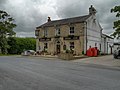
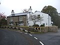
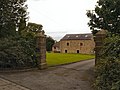
 "Butlers Arms" Pleasington - geograph.org.uk - 487036.jpg 640 × 480; 169 KB
-
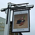
 "Clog and Billycock" Billinge, Blackburn - geograph.org.uk - 487044.jpg 640 × 480; 230 KB
-

-
 A woody stream valley - geograph.org.uk - 3454483.jpg 4 520 × 2 900; 7,82 MB
-
 Access Lane from Close Farm - geograph.org.uk - 6264197.jpg 5 184 × 3 456; 6,73 MB
-
 Alum Scar Bridge - geograph.org.uk - 586875.jpg 640 × 426; 515 KB
-
 Alum Scar Lane (1) - geograph.org.uk - 6264358.jpg 5 184 × 3 456; 6,25 MB
-
 Alum Scar Lane (2) - geograph.org.uk - 6264365.jpg 5 184 × 3 456; 5,9 MB
-
 Alum Scar Lane crossing Arley Brook - geograph.org.uk - 6264373.jpg 5 184 × 3 456; 4,88 MB
-

-
 Arches in Wild Bottom's Wood - geograph.org.uk - 5140429.jpg 640 × 480; 98 KB
-
 Barn ... with geese - geograph.org.uk - 2865221.jpg 2 592 × 1 944; 1,28 MB
-
 Barn on Woodcock Hill Road - geograph.org.uk - 1575840.jpg 640 × 480; 81 KB
-
 Billinge End Road - geograph.org.uk - 3099722.jpg 640 × 481; 569 KB
-
 Billinge End Road - geograph.org.uk - 5954045.jpg 640 × 480; 78 KB
-
 Billinge End Road - geograph.org.uk - 5954126.jpg 640 × 480; 76 KB
-
 Billinge End Road - geograph.org.uk - 6264347.jpg 5 184 × 3 456; 5,33 MB
-
 Black Hill Delf - geograph.org.uk - 4416944.jpg 640 × 481; 328 KB
-
 Black Hills Delf - geograph.org.uk - 5121980.jpg 640 × 480; 59 KB
-
 Bridge over Arley Brook - geograph.org.uk - 4048514.jpg 3 872 × 2 592; 6,24 MB
-
 Bridleway - geograph.org.uk - 3099741.jpg 640 × 481; 604 KB
-
 British Giant rabbit - geograph.org.uk - 163223.jpg 640 × 427; 122 KB
-
 Butler's Arms, Pleasington - geograph.org.uk - 3171175.jpg 1 280 × 809; 565 KB
-
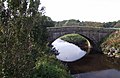
 Butler's Bridge - geograph.org.uk - 2852870.jpg 3 872 × 2 592; 5,69 MB
-
 Butler's Bridge - geograph.org.uk - 3171151.jpg 1 280 × 837; 844 KB
-
 Butlers Arms - geograph.org.uk - 3099657.jpg 640 × 480; 440 KB
-
 Butlers Arms, Pleasington - geograph.org.uk - 2852951.jpg 3 709 × 2 472; 1,15 MB
-
 Butlers Arms, Pleasington - geograph.org.uk - 3099653.jpg 640 × 481; 410 KB
-
 Climb up to Middle Shorrock Hey Farm - geograph.org.uk - 2861047.jpg 3 872 × 2 592; 4,6 MB
-
 Clog ^ Billycock public house - geograph.org.uk - 5954041.jpg 640 × 480; 56 KB
-

-
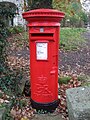
 Close up, Elizabeth II postbox on Long Lane, Pleasington - geograph.org.uk - 5958040.jpg 1 380 × 2 628; 821 KB
-

-
 Conduit near Pleasington - geograph.org.uk - 2852974.jpg 3 872 × 2 592; 3,64 MB
-
 Cows grazing - geograph.org.uk - 1528362.jpg 640 × 428; 82 KB
-
 Daffodils by the River Darwen - geograph.org.uk - 4422570.jpg 1 600 × 1 200; 536 KB
-
 Elizabeth II postbox on Billinge End Road, Blackburn - geograph.org.uk - 5957951.jpg 2 848 × 2 136; 1,43 MB
-
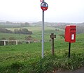 Elizabeth II postbox on Long Lane, Pleasington - geograph.org.uk - 5958037.jpg 2 258 × 1 978; 992 KB
-
 Elizabeth II postbox on Victoria Road, Pleasington - geograph.org.uk - 5958009.jpg 2 136 × 2 848; 1,37 MB
-
 Enoch Brow, Feniscowles - geograph.org.uk - 5954221.jpg 640 × 480; 86 KB
-
 Exposed rock in Yellow Hill Wood - geograph.org.uk - 4433891.jpg 1 600 × 1 200; 755 KB
-
 Fence and path below Middle Shorrock Hey Farm - geograph.org.uk - 2861067.jpg 3 872 × 2 592; 4,51 MB
-
 Field behind Clog and Billycock - geograph.org.uk - 378245.jpg 640 × 313; 230 KB
-

-
 Field entrance Enoch Brow - geograph.org.uk - 5954219.jpg 640 × 480; 104 KB
-
 Fields and woods - geograph.org.uk - 3473032.jpg 4 592 × 3 056; 6,7 MB
-
 Fields below Close Farm - geograph.org.uk - 4048526.jpg 3 872 × 2 592; 5,22 MB
-
 Fields by Lower Shorrock Hey Farm - geograph.org.uk - 471379.jpg 640 × 385; 266 KB
-
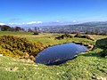
 Flooded Delf on Yellow Hill - geograph.org.uk - 4416958.jpg 640 × 483; 322 KB
-
 Flowering Mahonia - geograph.org.uk - 1575850.jpg 640 × 480; 125 KB
-
 Footbridge over the River Darwen, Witton Park - geograph.org.uk - 4124938.jpg 3 264 × 2 448; 3,92 MB
-
 Footpath between Pleasington and Witton Country Park - geograph.org.uk - 6263364.jpg 5 184 × 3 456; 5,86 MB
-
 Footpath Signpost, Witton Weavers Way - geograph.org.uk - 3099703.jpg 640 × 481; 418 KB
-
 Former quarry workings above Pleasington - geograph.org.uk - 2861149.jpg 3 872 × 2 592; 7,02 MB
-

-
 Gas^ Gas^ Quick, boys - geograph.org.uk - 906391.jpg 426 × 640; 323 KB
-
 Gate ^ bridge near Willow Ground Field - geograph.org.uk - 4433145.jpg 1 600 × 1 200; 841 KB
-
 Gatehouse for sale in Billinge End Road - geograph.org.uk - 3465602.jpg 4 306 × 2 866; 6,63 MB
-
 Gatehouse on Billinge End Road - geograph.org.uk - 6264351.jpg 5 184 × 3 456; 6,39 MB
-
 Gates on Path to Alum Scar Wood - geograph.org.uk - 3099736.jpg 640 × 481; 595 KB
-
 Grassland above the Darwen valley - geograph.org.uk - 4048547.jpg 3 872 × 2 592; 4,24 MB
-
 Grassy hillock on the Witton Weavers Way - geograph.org.uk - 2861161.jpg 3 872 × 2 592; 4,64 MB
-

-

-
 Grazing towards waste water conduit - geograph.org.uk - 5954133.jpg 640 × 480; 54 KB
-
 Higher Park Farm - geograph.org.uk - 2853183.jpg 3 872 × 2 592; 5,1 MB
-
 House near Higher Twist Farm - geograph.org.uk - 5954046.jpg 640 × 524; 110 KB
-
 House on Long Lane - geograph.org.uk - 5954135.jpg 640 × 480; 53 KB
-
 House on the Corner - geograph.org.uk - 3099729.jpg 640 × 480; 555 KB
-
-
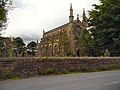
 Immanuel - The parish church of Feniscowles - geograph.org.uk - 3283120.jpg 4 230 × 3 046; 7,37 MB
-
 Immanuel Church, Feniscowles - geograph.org.uk - 5954171.jpg 640 × 480; 49 KB
-
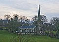
 Immanuel Parish Church - geograph.org.uk - 3099763.jpg 640 × 480; 466 KB
-
 Immanuel Parish Church - geograph.org.uk - 3551725.jpg 1 024 × 773; 509 KB
-
 Lane at Pleasington - geograph.org.uk - 3171158.jpg 1 280 × 852; 994 KB
-
 Lichen and moss on tree roots - geograph.org.uk - 163234.jpg 640 × 427; 126 KB
-
 Lodge House Wood - geograph.org.uk - 3099724.jpg 640 × 481; 552 KB
-
 Long Lane towards Pleasington - geograph.org.uk - 5954136.jpg 640 × 480; 57 KB
-
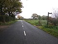
 Long Lane, Pleasington - geograph.org.uk - 487037.jpg 640 × 480; 205 KB
-
 Looking up the track towards Billinge - geograph.org.uk - 4433882.jpg 1 600 × 1 200; 383 KB
-
 Lower Fold Farm - geograph.org.uk - 2861266.jpg 3 872 × 2 592; 6,1 MB
-
 Lumb Bank - geograph.org.uk - 3099745.jpg 640 × 480; 484 KB
-
 Lumb Bank Wood - geograph.org.uk - 3099728.jpg 640 × 481; 470 KB
-
 Our house Pleasington - panoramio.jpg 2 048 × 1 536; 709 KB
-
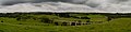 Panoramic View from Long Lane - geograph.org.uk - 3099670.jpg 4 125 × 1 024; 5,28 MB
-
 Path above Westholme School - geograph.org.uk - 2861095.jpg 3 872 × 2 592; 5,34 MB
-
 Path descending into the Darwen valley - geograph.org.uk - 4048556.jpg 3 872 × 2 592; 5,86 MB
-
 Path on Yellow Hill - geograph.org.uk - 4416401.jpg 640 × 480; 404 KB
-
 Path on Yellow Hill - geograph.org.uk - 4416993.jpg 640 × 483; 383 KB
-
 Path through former quarry near Pleasington - geograph.org.uk - 2861142.jpg 3 872 × 2 592; 6,85 MB
-
 Path to Alum Scar Wood - geograph.org.uk - 3099738.jpg 640 × 480; 622 KB
-
 Path to Higher Park Farm - geograph.org.uk - 1575817.jpg 640 × 480; 130 KB
-
 Path to Pleasington - geograph.org.uk - 2852898.jpg 3 872 × 2 592; 4,09 MB
-
 Path towards Billinge Wood - geograph.org.uk - 2861203.jpg 3 872 × 2 592; 5,08 MB
-
 Pipe Bridge near Pleasington - geograph.org.uk - 3099665.jpg 640 × 481; 489 KB
-
 Pleasington - panoramio - jim walton (1).jpg 600 × 377; 53 KB
-
 Pleasington - panoramio - jim walton (10).jpg 1 259 × 722; 240 KB
-
 Pleasington - panoramio - jim walton (2).jpg 2 048 × 1 536; 1,07 MB
-
 Pleasington - panoramio - jim walton (3).jpg 2 816 × 2 112; 2,74 MB
-
 Pleasington - panoramio - jim walton (4).jpg 2 816 × 2 112; 2,8 MB
-
 Pleasington - panoramio - jim walton (5).jpg 600 × 558; 96 KB
-
 Pleasington - panoramio - jim walton (6).jpg 720 × 588; 525 KB
-
 Pleasington - panoramio - jim walton.jpg 2 500 × 1 560; 2,28 MB
-
 Pleasington - panoramio.jpg 2 816 × 2 112; 2,61 MB
-
 Pleasington BB2, UK - panoramio.jpg 903 × 644; 197 KB
-
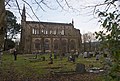
 Pleasington Cemetery - geograph.org.uk - 3283351.jpg 640 × 477; 75 KB
-
 Pleasington Cemetery from the Witton Weavers Way - geograph.org.uk - 2861176.jpg 3 872 × 2 592; 4,04 MB
-
 Pleasington Golf Course - geograph.org.uk - 5904910.jpg 1 024 × 594; 86 KB
-

-
 Pleasington Priory - geograph.org.uk - 3099640.jpg 640 × 480; 532 KB
-
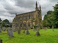 Pleasington Priory - geograph.org.uk - 3099648.jpg 640 × 479; 476 KB
-
 Pleasington Priory - geograph.org.uk - 3099750.jpg 640 × 481; 466 KB
-
 Pleasington Priory - geograph.org.uk - 3171166.jpg 1 280 × 852; 774 KB
-
 Pleasington Priory - geograph.org.uk - 3171191.jpg 1 280 × 852; 677 KB
-
 Pleasington Priory - geograph.org.uk - 3283042.jpg 3 784 × 2 554; 6,16 MB
-
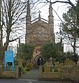 Pleasington Priory - geograph.org.uk - 3283068.jpg 2 911 × 3 077; 5,55 MB
-
 Pleasington Priory - geograph.org.uk - 4843082.jpg 1 341 × 1 600; 608 KB
-
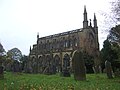 Pleasington Priory - geograph.org.uk - 5954149.jpg 2 848 × 2 136; 1,48 MB
-
 Pleasington Priory - geograph.org.uk - 6263356.jpg 5 184 × 3 456; 7,37 MB
-
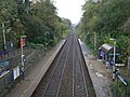 Pleasington Railway Station - geograph.org.uk - 5954162.jpg 640 × 480; 104 KB
-
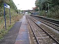 Pleasington railway station, Lancashire - geograph.org.uk - 3204526.jpg 800 × 600; 154 KB
-
 Pleasington Viaduct - geograph.org.uk - 4422731.jpg 1 600 × 1 200; 1,38 MB
-
 Preston to Colne Railway - geograph.org.uk - 487027.jpg 640 × 480; 157 KB
-
 Railway towards Blackburn - geograph.org.uk - 5954165.jpg 640 × 480; 62 KB
-
 River Darwen - geograph.org.uk - 3099768.jpg 640 × 481; 474 KB
-
 River Darwen from Butler's Bridge - geograph.org.uk - 6263348.jpg 5 184 × 3 456; 7,27 MB
-
 River Darwen, Feniscowles - geograph.org.uk - 5954216.jpg 640 × 480; 87 KB
-
 Road to Higher Twist Farm - geograph.org.uk - 5954047.jpg 640 × 480; 98 KB
-
 Rough grazing off Billinge End Road - geograph.org.uk - 5954049.jpg 640 × 480; 54 KB
-
 Sheep grazing towards Close Farm - geograph.org.uk - 5954053.jpg 640 × 480; 55 KB
-
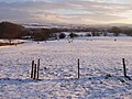 Sheep in field with snow at Pleasington, Lancashire.jpg 1 205 × 904; 331 KB
-
-

-

-
 Site of Roughs - geograph.org.uk - 4442991.jpg 1 597 × 1 198; 939 KB
-
 Small delf on Witton Weavers Way - geograph.org.uk - 163227.jpg 640 × 427; 86 KB
-
 Steps on the path in Crow Wood - geograph.org.uk - 4433870.jpg 1 600 × 1 200; 813 KB
-
 Stile on Path to Billinge End Road - geograph.org.uk - 4416994.jpg 640 × 481; 436 KB
-
 The Bridge at Pleasington Station - geograph.org.uk - 3099630.jpg 640 × 481; 556 KB
-
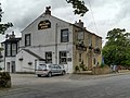
 The Butlers Arms, Pleasington - geograph.org.uk - 5954156.jpg 640 × 480; 57 KB
-
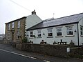
 The Clog and Billycock - geograph.org.uk - 163237.jpg 640 × 427; 75 KB
-
 The Clog and Billycock - geograph.org.uk - 2861105.jpg 3 872 × 2 592; 3,43 MB
-

-
 The Clog and Billycock, Pleasington - geograph.org.uk - 4416999.jpg 640 × 484; 295 KB
-
 The Clog ^ Billycock public house - geograph.org.uk - 5954040.jpg 640 × 480; 54 KB
-
 The corner of Billinge End Road - geograph.org.uk - 2865229.jpg 2 592 × 1 944; 1,68 MB
-
 The Gatehouse - geograph.org.uk - 487042.jpg 640 × 480; 206 KB
-
 The path on Yellow Hill - geograph.org.uk - 6430735.jpg 1 024 × 768; 200 KB
-
 The Railway - geograph.org.uk - 3099634.jpg 640 × 480; 510 KB
-
 The Railway Hotel, Pleasington - geograph.org.uk - 5954168.jpg 640 × 480; 88 KB
-
 The Railway, Pleasington - geograph.org.uk - 880762.jpg 640 × 480; 202 KB
-
 The River Darwen - geograph.org.uk - 3283139.jpg 4 592 × 3 056; 7,35 MB
-
 The River Darwen at Butler's Bridge - geograph.org.uk - 3283296.jpg 4 592 × 3 056; 5,94 MB
-
 The track from Higher Park Farm - geograph.org.uk - 2865210.jpg 2 592 × 1 944; 1,65 MB
-
 The Wainwright Memorial, Pleasington - geograph.org.uk - 4416991.jpg 640 × 480; 328 KB
-
 The West Doorway, Pleasington Priory - geograph.org.uk - 3099644.jpg 480 × 640; 578 KB
-
 The Wishing tree - panoramio (1).jpg 1 010 × 914; 970 KB
-
 The Witton Weavers Way - geograph.org.uk - 3283010.jpg 640 × 426; 94 KB
-
 The Witton Weavers Way - geograph.org.uk - 3454143.jpg 4 592 × 3 056; 6,21 MB
-
 Throstle Nest Brow - geograph.org.uk - 3282974.jpg 3 498 × 3 056; 5,7 MB
-
 Towards Hoghton Bottoms - geograph.org.uk - 42598.jpg 640 × 480; 65 KB
-
 Track to Higher Park Farm - geograph.org.uk - 1161836.jpg 640 × 480; 106 KB
-
 Track to Maiden House Farm - geograph.org.uk - 3099700.jpg 640 × 481; 608 KB
-
 Victoria Road, Pleasington - geograph.org.uk - 5954152.jpg 640 × 480; 120 KB
-
 View from Long Lane (1) - geograph.org.uk - 3099676.jpg 640 × 481; 452 KB
-
 View from Long Lane (2) - geograph.org.uk - 3099679.jpg 640 × 481; 465 KB
-
 View from Long Lane (4) - geograph.org.uk - 3099687.jpg 640 × 481; 462 KB
-
 View from Long Lane (5) - geograph.org.uk - 3099690.jpg 640 × 481; 447 KB
-
 View from Throstle Nest Brow at Pleasington - geograph.org.uk - 6430755.jpg 1 024 × 768; 172 KB
-
 View towards Blackburn from Yellow Hill - geograph.org.uk - 4416950.jpg 640 × 480; 318 KB
-
 Wainwright Memorial (detail) - geograph.org.uk - 4416989.jpg 640 × 480; 397 KB
-
 Wainwright Memorial Toposcope - geograph.org.uk - 4416987.jpg 640 × 483; 345 KB
-
 Water-filled delf west of Billinge Hill - geograph.org.uk - 2861189.jpg 3 872 × 2 592; 4,37 MB
-
 Weir on River Darwen, Lancashire - geograph.org.uk - 389351.jpg 640 × 480; 155 KB
-
 Witon Weavers Way - geograph.org.uk - 4048534.jpg 3 872 × 2 592; 5,06 MB
-
 Witton Weavers Way - geograph.org.uk - 488216.jpg 640 × 426; 296 KB
-
 Witton Weavers Way approaching Close Farm - geograph.org.uk - 6264190.jpg 5 184 × 3 395; 6,87 MB
-
 Witton Weavers Way at Pleasington - geograph.org.uk - 3171186.jpg 1 280 × 852; 858 KB
-
 Witton Weavers Way heading towards Billinge End Road - geograph.org.uk - 6264185.jpg 5 184 × 3 456; 7,22 MB
-
 Witton Weavers Way heading West from Gorton Wood - geograph.org.uk - 6264175.jpg 5 184 × 3 456; 5,94 MB
-
 Woodcock Hill Farm - geograph.org.uk - 3099707.jpg 640 × 480; 481 KB
-
 Woodcock Hill Road - geograph.org.uk - 3099709.jpg 640 × 481; 524 KB
-
 Yellow Hill - geograph.org.uk - 4416410.jpg 640 × 481; 372 KB
-
 Yellow Hill Delf - geograph.org.uk - 4433905.jpg 1 600 × 1 200; 637 KB
-
 Canal Scene - geograph.org.uk - 1442822.jpg 640 × 480; 89 KB
-
 Conduit - geograph.org.uk - 487039.jpg 640 × 480; 239 KB
-
 Evening mist - geograph.org.uk - 612681.jpg 640 × 426; 320 KB
-
 Field by the Leeds Liverpool canal - geograph.org.uk - 484171.jpg 640 × 426; 313 KB
-
 Gateway - geograph.org.uk - 487043.jpg 640 × 480; 181 KB
-
-
-
 Leeds Liverpool Canal - geograph.org.uk - 484163.jpg 640 × 505; 267 KB
-
 Looking towards Wild Bottoms Wood - geograph.org.uk - 586192.jpg 640 × 426; 357 KB
-
 On the path to Bolton Hall - geograph.org.uk - 586828.jpg 640 × 426; 345 KB
-
 Road junction - geograph.org.uk - 487040.jpg 640 × 480; 205 KB


_-_geograph.org.uk_-_6264358.jpg)
_-_geograph.org.uk_-_6264365.jpg)


_-_geograph.org.uk_-_5942683.jpg)


.jpg)
.jpg)
.jpg)
.jpg)
.jpg)
.jpg)
.jpg)


_-_geograph.org.uk_-_3099650.jpg)


.jpg)


_-_geograph.org.uk_-_3099676.jpg)
_-_geograph.org.uk_-_3099679.jpg)
_-_geograph.org.uk_-_3099687.jpg)
_-_geograph.org.uk_-_3099690.jpg)


_-_geograph.org.uk_-_4416989.jpg)


