Category:Port Clarence
Aller à la navigation
Aller à la recherche
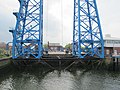
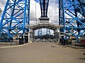
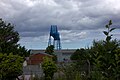
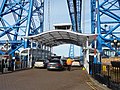
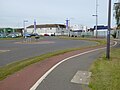
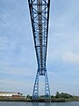
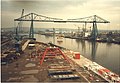
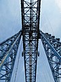
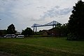
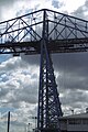
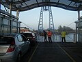
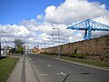
English: Port Clarence is a small village now within the borough of Stockton-on-Tees and ceremonial county of County Durham, England. It is situated on the north bank of the River Tees, and hosts the northern end of the Middlesbrough Transporter Bridge.
village britannique _-_geograph.org.uk_-_2670454.jpg) | |||||
| Téléverser des médias | |||||
| Nature de l’élément | |||||
|---|---|---|---|---|---|
| Lieu | Billingham, Stockton-on-Tees, Tees Valley, Angleterre du Nord-Est, Angleterre | ||||
 | |||||
Sous-catégories
Cette catégorie comprend seulement la sous-catégorie ci-dessous.
Média dans la catégorie « Port Clarence »
Cette catégorie comprend 170 fichiers, dont les 170 ci-dessous.
-
 A former road off Suffield Street, Middlesbrough - geograph.org.uk - 4420623.jpg 1 024 × 768 ; 179 kio
-
 A view of Middlesbrough Transporter Bridge (1911) - geograph.org.uk - 5432286.jpg 3 723 × 4 954 ; 5,93 Mio
-
 A.V.Dawson building on Riverside Park Road - geograph.org.uk - 4017799.jpg 1 600 × 1 116 ; 445 kio
-
 Atop the Transporter, facing Port Clarence - geograph.org.uk - 5980604.jpg 1 600 × 1 216 ; 415 kio
-
 Autumn sunset approaches - geograph.org.uk - 5980558.jpg 1 170 × 1 600 ; 319 kio
-
 Belasis Lane signal box, Billingham.jpg 4 096 × 2 304 ; 2,01 Mio
-

-
 Blast furnaces Middlesbrough.jpg 871 × 587 ; 92 kio
-
 Blue plaque affixed to Middlesbrough Dock clock tower - geograph.org.uk - 5359928.jpg 1 024 × 768 ; 185 kio
-
 Blue plaque on Vulcan Street wall, Middlesbrough (1) - geograph.org.uk - 5360393.jpg 1 024 × 768 ; 269 kio
-
 Blue plaque on Vulcan Street wall, Middlesbrough (2) - geograph.org.uk - 5360402.jpg 1 024 × 768 ; 274 kio
-
 Bowes Road off Riverside Park Road - geograph.org.uk - 4017813.jpg 1 600 × 1 064 ; 483 kio
-

-
 Brownfield site, east of Stockton Street, Middlesbrough - geograph.org.uk - 4420620.jpg 1 024 × 615 ; 125 kio
-
 Bungee jumping platform or bridge^ - geograph.org.uk - 2029546.jpg 2 272 × 1 414 ; 191 kio
-
 Bus turning area, Ferry Road, Middlesbrough - geograph.org.uk - 5360423.jpg 1 024 × 768 ; 130 kio
-
 Captain Cook - geograph.org.uk - 5081893.jpg 1 024 × 683 ; 293 kio
-
 Captain Cook - geograph.org.uk - 5081895.jpg 683 × 1 024 ; 248 kio
-
 Captain Cook - geograph.org.uk - 5081897.jpg 1 024 × 683 ; 268 kio
-
 Car park entrance, Middlesbrough - geograph.org.uk - 6083414.jpg 1 024 × 768 ; 122 kio
-
 Clarence Wharf Road - geograph.org.uk - 327174.jpg 640 × 426 ; 91 kio
-
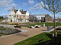
 Clock tower (former dock offices) - geograph.org.uk - 2670454.jpg 1 600 × 1 200 ; 260 kio
-
 Clock Tower, Middlesbrough Docks - geograph.org.uk - 5320038.jpg 480 × 640 ; 248 kio
-
 Commercial Street, Middlesbrough - geograph.org.uk - 4017726.jpg 1 600 × 1 064 ; 456 kio
-
 Crossing in progress - geograph.org.uk - 5081782.jpg 1 024 × 683 ; 249 kio
-

-
 Depot Road, Middlesbrough - geograph.org.uk - 4017730.jpg 1 600 × 986 ; 373 kio
-
 Depot Road, Middlesbrough - geograph.org.uk - 4017733.jpg 1 600 × 998 ; 404 kio
-
 Depot Road, Middlesbrough, just west of Snowdon Road - geograph.org.uk - 4420296.jpg 1 024 × 768 ; 114 kio
-
 Derelict pub, Middlesbrough - geograph.org.uk - 6083397.jpg 1 024 × 768 ; 130 kio
-
 Dock Clock Tower, Tees Transporter Trail, Middlesbrough - geograph.org.uk - 5807754.jpg 768 × 1 024 ; 153 kio
-
 Durham Street - geograph.org.uk - 5081932.jpg 1 024 × 683 ; 252 kio
-
 East end of Vulcan Street, Middlesbrough - geograph.org.uk - 5359939.jpg 1 024 × 768 ; 115 kio
-
 East Street, Middlesbrough - geograph.org.uk - 5360495.jpg 1 024 × 768 ; 105 kio
-
 EMR Non-Ferrous Depot, Middlesbrough - geograph.org.uk - 4420308.jpg 1 024 × 614 ; 100 kio
-
 Entrance to AV Dawson's reception, Middlesbrough - geograph.org.uk - 4420345.jpg 1 024 × 768 ; 115 kio
-
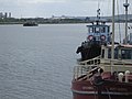
 Erimus Star beneath the Transporter Bridge - geograph.org.uk - 5081751.jpg 1 024 × 683 ; 271 kio
-
 Erimus Star, Middlesbrough Reach - geograph.org.uk - 5081747.jpg 683 × 1 024 ; 240 kio
-
 Farewell to Middlesbrough - geograph.org.uk - 3556464.jpg 640 × 480 ; 98 kio
-
 Ferry Landing - geograph.org.uk - 5081758.jpg 1 024 × 683 ; 215 kio
-
 Ferry Road ending at the Transporter Bridge - geograph.org.uk - 4419170.jpg 1 024 × 768 ; 157 kio
-
 Ferry Road, Middlesbrough - geograph.org.uk - 4419166.jpg 1 024 × 768 ; 125 kio
-
 Fire station, Ferry Road, Middlesbrough - geograph.org.uk - 5360446.jpg 1 024 × 768 ; 153 kio
-
 Gondola, Tees Transporter Bridge - geograph.org.uk - 5360433.jpg 1 024 × 768 ; 254 kio
-
 High above the gondola - geograph.org.uk - 5980830.jpg 1 600 × 1 159 ; 464 kio
-
 Home sweet home - geograph.org.uk - 2029543.jpg 1 600 × 1 345 ; 466 kio
-
 Industrial buildings in Middlesbrough - geograph.org.uk - 3154701.jpg 1 500 × 1 000 ; 113 kio
-
 Industrial buildings on North bank of the Tees - geograph.org.uk - 5840485.jpg 1 024 × 683 ; 101 kio
-
 Industrial buildings on north side of River Tees - geograph.org.uk - 2651840.jpg 1 500 × 938 ; 925 kio
-
 Industrial heritage, Middlesbrough - geograph.org.uk - 6083416.jpg 1 024 × 768 ; 129 kio
-
 Industrial Site on Vulcan Street - geograph.org.uk - 2149253.jpg 2 816 × 2 112 ; 1,31 Mio
-
 Lighting on the Transporter Bridge - geograph.org.uk - 3170398.jpg 1 000 × 1 500 ; 200 kio
-
 Loading steel tubes to ship, Port Clarence - geograph.org.uk - 3103857.jpg 3 648 × 2 736 ; 4,06 Mio
-
 Marine fire station - geograph.org.uk - 288239.jpg 640 × 427 ; 238 kio
-

-
 Middlesbrough Dock Clock Tower - geograph.org.uk - 5331952.jpg 711 × 1 024 ; 116 kio
-
 Middlesbrough Dock clock tower - geograph.org.uk - 5359923.jpg 1 024 × 768 ; 102 kio
-
 Middlesbrough dock clock tower - geograph.org.uk - 6083409.jpg 1 024 × 768 ; 94 kio
-
 Middlesbrough Reach - geograph.org.uk - 5081770.jpg 1 024 × 683 ; 269 kio
-
 Middlesbrough Reach, River Tees - geograph.org.uk - 4419225.jpg 1 024 × 615 ; 95 kio
-
 Middlesbrough Riverside - geograph.org.uk - 2935614.jpg 8 363 × 2 203 ; 2,96 Mio
-
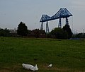
 Middlesbrough Transporter Bridge (1957) - geograph.org.uk - 2700908.jpg 1 644 × 1 080 ; 333 kio
-
 Middlesbrough Transporter Bridge - closed - geograph.org.uk - 5980825.jpg 1 197 × 1 600 ; 498 kio
-
 Middlesbrough Transporter Bridge - geograph.org.uk - 2670452.jpg 1 600 × 1 200 ; 385 kio
-
 Middlesbrough Transporter Bridge - geograph.org.uk - 3154699.jpg 1 000 × 1 500 ; 256 kio
-
 Middlesbrough Transporter Bridge - geograph.org.uk - 5432277.jpg 3 783 × 4 951 ; 4,51 Mio
-
 Middlesbrough transporter bridge from the station - geograph.org.uk - 5469213.jpg 5 202 × 3 465 ; 3,05 Mio
-
 Milepost on National Cycle Network Route 1 - geograph.org.uk - 2006938.jpg 480 × 640 ; 262 kio
-
 Millennium Milepost, Ferry Road-Vulcan Road - geograph.org.uk - 5081873.jpg 683 × 1 024 ; 296 kio
-
 New building on Depot Road, Middlesbrough - geograph.org.uk - 4017736.jpg 1 600 × 934 ; 426 kio
-
 New building, Durham Street - geograph.org.uk - 5081903.jpg 1 024 × 683 ; 313 kio
-
 North-bound traffic driving onto the Transporter Bridge - geograph.org.uk - 4419255.jpg 1 024 × 768 ; 187 kio
-
 Offices at the Transporter Bridge - geograph.org.uk - 3170401.jpg 1 500 × 1 000 ; 139 kio
-
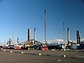
 Oil Rig Module Loadout - geograph.org.uk - 3265313.jpg 822 × 566 ; 318 kio
-
 Oil tank wagons at Port Clarence - geograph.org.uk - 1260758.jpg 640 × 427 ; 69 kio
-
 Open space off Vulcan Street, Middlesbrough - geograph.org.uk - 5360454.jpg 1 024 × 768 ; 124 kio
-
 Park beside Durham Street - geograph.org.uk - 5319950.jpg 640 × 480 ; 286 kio
-
 Park beside Durham Street - geograph.org.uk - 5319998.jpg 640 × 480 ; 290 kio
-

-
 Plaque on Riverside Park Road - geograph.org.uk - 4017746.jpg 1 600 × 1 191 ; 747 kio
-
 Port Clarence Fabrication Facility - geograph.org.uk - 3265295.jpg 852 × 572 ; 64 kio
-
 Port Clarence Fabrication Facility - geograph.org.uk - 3265299.jpg 828 × 572 ; 74 kio
-
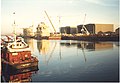
 Quayside on the River Tees - geograph.org.uk - 3035706.jpg 2 848 × 2 144 ; 1,52 Mio
-
 Quayside, south bank of the Tees - geograph.org.uk - 4420285.jpg 1 024 × 768 ; 132 kio
-
 Railway - geograph.org.uk - 326978.jpg 640 × 426 ; 75 kio
-
 Railway from Dawsons Wharf to Middlesbrough Goods Yard - geograph.org.uk - 4420353.jpg 1 024 × 768 ; 128 kio
-
 Railway onto Dawsons Wharf, south bank of the Tees - geograph.org.uk - 4420310.jpg 1 024 × 768 ; 152 kio
-
 Ready to cross the River Tees (1970) - geograph.org.uk - 2827536.jpg 506 × 702 ; 135 kio
-
 River Tees, west of Tees Transporter Bridge - geograph.org.uk - 5807718.jpg 1 024 × 768 ; 163 kio
-
 Riverside Park Road, Middlesbrough - geograph.org.uk - 4017742.jpg 1 600 × 1 060 ; 419 kio
-
 Riverside Park Road, Middlesbrough - geograph.org.uk - 4017816.jpg 1 600 × 1 064 ; 486 kio
-
 Riverside Park Road, Middlesbrough - geograph.org.uk - 4420315.jpg 1 024 × 768 ; 120 kio
-
 Roundabout by Dawsons Wharf - geograph.org.uk - 5026165.jpg 640 × 480 ; 232 kio
-
 Ruined building, Middlesbrough - geograph.org.uk - 4420373.jpg 1 024 × 614 ; 99 kio
-
 Ruined Fence, Clarence Wharf Road - geograph.org.uk - 326445.jpg 640 × 426 ; 75 kio
-
-
 Signpost, Ferry Road - Vulcan Street - geograph.org.uk - 5081810.jpg 1 024 × 683 ; 284 kio
-
 Slag Crusher, Port Clarence - geograph.org.uk - 405247.jpg 640 × 384 ; 47 kio
-
 South bank, Middlesbrough Reach, River Tees - geograph.org.uk - 4419234.jpg 1 024 × 615 ; 110 kio
-
 Station Hotel, Port Clarence - geograph.org.uk - 326447.jpg 640 × 384 ; 53 kio
-
 Storage tanks on A V Dawson's site, Middlesbrough - geograph.org.uk - 4420329.jpg 1 024 × 768 ; 113 kio
-
 Tees Transporter Bridge, Middlesbrough - geograph.org.uk - 5359954.jpg 1 024 × 768 ; 190 kio
-

-
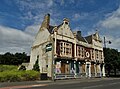
 The Captain Cook, Durham Street - geograph.org.uk - 2670447.jpg 1 600 × 1 200 ; 309 kio
-
 The Captain Cook, Durham Street, Middlesbrough - geograph.org.uk - 5360471.jpg 1 024 × 768 ; 123 kio
-
 The Clock Tower - geograph.org.uk - 5808895.jpg 400 × 640 ; 29 kio
-
 The Cradle - geograph.org.uk - 327171.jpg 640 × 384 ; 58 kio
-
 The Custom House - geograph.org.uk - 3599898.jpg 1 366 × 1 024 ; 456 kio
-
 The dredger Heortnesse passing the Transporter Bridge - geograph.org.uk - 4419263.jpg 1 024 × 768 ; 172 kio
-
 The gondola of the Transporter Bridge - geograph.org.uk - 4431995.jpg 1 600 × 1 085 ; 360 kio
-
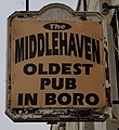
 The Middlehaven on Stockton Street, Middlesbrough - geograph.org.uk - 4017696.jpg 1 600 × 859 ; 483 kio
-
 The Middlehaven on Stockton Street, Middlesbrough - geograph.org.uk - 4017717.jpg 1 600 × 1 106 ; 524 kio
-
 The Middlehaven on Stockton Street, Middlesbrough - geograph.org.uk - 4017720.jpg 1 461 × 1 600 ; 545 kio
-
 The Middlesbrough Transporter Bridge - geograph.org.uk - 4017643.jpg 1 600 × 1 359 ; 574 kio
-
 The Middlesbrough Transporter Bridge - geograph.org.uk - 5320003.jpg 640 × 481 ; 256 kio
-

-

-

-
 The Riverside Stadium - geograph.org.uk - 2670456.jpg 1 600 × 1 200 ; 265 kio
-
 The sorry and disused "Captain Cook" pub - geograph.org.uk - 5432294.jpg 4 925 × 3 658 ; 3,27 Mio
-
 The south bank of the Tees, Middlesbrough - geograph.org.uk - 4419175.jpg 1 024 × 768 ; 127 kio
-
 The Tees at Middlesbrough - geograph.org.uk - 2129371.jpg 1 024 × 768 ; 148 kio
-
 The Transporter Bridge (2) - geograph.org.uk - 3556458.jpg 480 × 640 ; 52 kio
-
 The Transporter Bridge - geograph.org.uk - 3265272.jpg 828 × 570 ; 100 kio
-
 The Transporter Bridge - geograph.org.uk - 3556454.jpg 640 × 480 ; 126 kio
-

-
 The Transporter Bridge - southern tower - geograph.org.uk - 3556462.jpg 480 × 640 ; 103 kio
-
 The Transporter Bridge from Tower Green - geograph.org.uk - 4017691.jpg 1 600 × 1 064 ; 459 kio
-
 The Transporter Bridge, Middlesbrough - geograph.org.uk - 2149273.jpg 800 × 600 ; 200 kio
-
 The Tuxedo Royale - geograph.org.uk - 3559261.jpg 640 × 480 ; 70 kio
-
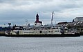
 The Tuxedo Royale at Port Clarence - geograph.org.uk - 3334365.jpg 800 × 600 ; 74 kio
-
 Through the girders - geograph.org.uk - 5980621.jpg 1 192 × 1 600 ; 358 kio
-
 Towering giant - geograph.org.uk - 5980842.jpg 1 600 × 1 113 ; 359 kio
-
 Transporter Bridge - geograph.org.uk - 209081.jpg 640 × 480 ; 92 kio
-
 Transporter Bridge - geograph.org.uk - 5081777.jpg 683 × 1 024 ; 274 kio
-
 Transporter Bridge - geograph.org.uk - 5081780.jpg 683 × 1 024 ; 274 kio
-
 Transporter Bridge Control Building - geograph.org.uk - 292868.jpg 480 × 640 ; 75 kio
-
 Transporter Bridge gondola - geograph.org.uk - 5081784.jpg 1 024 × 683 ; 229 kio
-
 Transporter Bridge ready to depart - geograph.org.uk - 4736618.jpg 640 × 480 ; 64 kio
-
 Transporter bridge viewing area, Middlesbrough - geograph.org.uk - 6083401.jpg 1 024 × 768 ; 139 kio
-
 Transporter Bridge Winding House - geograph.org.uk - 3170400.jpg 1 500 × 1 000 ; 146 kio
-
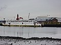 Tuxedo Royale - geograph.org.uk - 2641972.jpg 640 × 480 ; 106 kio
-
 Tuxedo Royale - geograph.org.uk - 5980581.jpg 1 600 × 1 210 ; 550 kio
-
 Tuxedo Royale on the River Tees - geograph.org.uk - 5684226.jpg 800 × 500 ; 73 kio
-

-

-
 Vulcan Street - geograph.org.uk - 3241980.jpg 1 024 × 768 ; 134 kio
-
 Vulcan Street - geograph.org.uk - 5320061.jpg 640 × 480 ; 255 kio
-
 Vulcan Street wall and transporter bridge, Middlesbrough - geograph.org.uk - 6083403.jpg 1 024 × 768 ; 121 kio
-
 Vulcan Street wall, Middlesbrough - geograph.org.uk - 5360068.jpg 1 024 × 768 ; 176 kio
-
 Vulcan Street, Middlesbrough (1) - geograph.org.uk - 5359941.jpg 1 024 × 768 ; 147 kio
-
 Vulcan Street, Middlesbrough (2) - geograph.org.uk - 5359945.jpg 1 024 × 768 ; 155 kio
-
 Vulcan Street, Middlesbrough - geograph.org.uk - 2670459.jpg 1 024 × 768 ; 165 kio
-
 Vulcan Street, Middlesbrough - geograph.org.uk - 5026167.jpg 640 × 480 ; 233 kio
-
 Vulcan Street, Middlesbrough - geograph.org.uk - 6083413.jpg 1 024 × 768 ; 118 kio
-
 Vulcan Street, Middlesbrough, looking west - geograph.org.uk - 4420290.jpg 1 024 × 768 ; 112 kio
-
 Watching the bungee jumpers - geograph.org.uk - 2026580.jpg 1 600 × 1 200 ; 424 kio
-
 West Street, Middlesbrough - geograph.org.uk - 4420380.jpg 1 024 × 768 ; 87 kio
-
 Wheels and rails, Transporter Bridge - geograph.org.uk - 5081795.jpg 1 024 × 683 ; 309 kio
-
 Wilton Group, Middlesbrough Reach - geograph.org.uk - 5081773.jpg 1 024 × 683 ; 232 kio
-
 Yard off Vulcan Street - geograph.org.uk - 2151237.jpg 2 816 × 2 112 ; 1,57 Mio
-
 Clarence Distillation Works - geograph.org.uk - 12108.jpg 640 × 480 ; 88 kio
-
 Derelict Signal Box, Port Clarence - geograph.org.uk - 331390.jpg 640 × 427 ; 75 kio
-
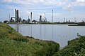
 Huntsman North Tees Refinery - geograph.org.uk - 130519.jpg 640 × 480 ; 48 kio
-
 Industrial Site, Old Middlesbrough - geograph.org.uk - 260669.jpg 640 × 384 ; 50 kio
-
 Inland Lagoon - geograph.org.uk - 137276.jpg 640 × 384 ; 39 kio
-
 New Middlesbrough College Site - geograph.org.uk - 355990.jpg 640 × 426 ; 54 kio
-
 North Tees Works - geograph.org.uk - 502684.jpg 640 × 427 ; 67 kio
-
 Oil Refinery - geograph.org.uk - 137274.jpg 640 × 480 ; 45 kio
-
 Victorian Cast Iron Gate Posts - geograph.org.uk - 76165.jpg 640 × 480 ; 60 kio


.jpg)


_-_geograph.org.uk_-_5360393.jpg)
_-_geograph.org.uk_-_5360402.jpg)


,_TS1_-_geograph.org.uk_-_3559272.jpg)


_-_geograph.org.uk_-_2827536.jpg)


,_TS1_-_geograph.org.uk_-_3555259.jpg)


,_TS1_-_geograph.org.uk_-_3555256.jpg)


_-_geograph.org.uk_-_5359941.jpg)
_-_geograph.org.uk_-_5359945.jpg)


_-_geograph.org.uk_-_5432286.jpg)
_-_geograph.org.uk_-_2700908.jpg)
_-_geograph.org.uk_-_3556458.jpg)