Category:Porth
Aller à la navigation
Aller à la recherche
établissement humain au Royaume-Uni  | |||||
| Téléverser des médias | |||||
| Prononciation (fichier son) | |||||
|---|---|---|---|---|---|
| Nature de l’élément |
| ||||
| Lieu | Rhondda Cynon Taf, pays de Galles | ||||
 | |||||
Български: 300px|мини|Изглед от Порт с моста "Реола"
Brezhoneg: Porth zo ur ger kernevek ha kembraek, a zo porzh e brezhoneg, hag a zo un anv-lec'h e Kernev-Veur ha Kembre dreist-holl, hag ivez war ar blanedenn Meurzh.
English: Porth is a town and a community in the county borough of Rhondda Cynon Taf, within the historic county boundaries of Glamorgan, Wales, lying in the Rhondda Valley and is regarded as the gateway to the Rhondda Fawr and Rhondda Fach valleys because both valleys meet at Porth. The Welsh word "porth" means "gate" when translated into English, however, Porth is a predominantly English-speaking community.
Sous-catégories
Cette catégorie comprend 6 sous-catégories, dont les 6 ci-dessous.
Média dans la catégorie « Porth »
Cette catégorie comprend 276 fichiers, dont les 200 ci-dessous.
(page précédente) (page suivante)-
 2010 Wales Rhondda Cynon Taf Community Porth map.svg 512 × 737 ; 416 kio
-
 2024 Wales Rhondda Cynon Taf Community Porth map.svg 512 × 737 ; 369 kio
-
 A view NW from Porth railway station footbridge - geograph.org.uk - 3138987.jpg 640 × 587 ; 120 kio
-
 A view SE from Porth railway station - geograph.org.uk - 2612189.jpg 640 × 480 ; 104 kio
-
 A4233, Porth - geograph.org.uk - 2612511.jpg 640 × 480 ; 63 kio
-
 Aberrhondda Road houses, Porth - geograph.org.uk - 3139200.jpg 640 × 500 ; 89 kio
-
 Aberrhondda Road urinal, Porth - geograph.org.uk - 3590508.jpg 800 × 600 ; 144 kio
-
 Across Porth Street railway bridge, Porth - geograph.org.uk - 5562185.jpg 800 × 510 ; 90 kio
-
 Across Station Road bridge, Trealaw - geograph.org.uk - 5553250.jpg 800 × 600 ; 126 kio
-
 AFC Porth, Dinas Road - geograph.org.uk - 414388.jpg 640 × 473 ; 67 kio
-

-
 Arriva Trains Wales 142059 at Porth.jpg 1 344 × 896 ; 244 kio
-
 Back lane in Porth - geograph.org.uk - 5562178.jpg 800 × 706 ; 152 kio
-
 Barclays Bank, 8 Station Street, Porth - geograph.org.uk - 5560777.jpg 735 × 800 ; 146 kio
-
 Barclays Bank, 8 Station Street, Porth - geograph.org.uk - 5560788.jpg 605 × 800 ; 140 kio
-
-
 Beatus Cartons, Porth - geograph.org.uk - 2440692.jpg 640 × 480 ; 76 kio
-
 Best Kebab, 65 Hannah Street, Porth - geograph.org.uk - 5567545.jpg 673 × 800 ; 108 kio
-
 Boundary of Llwyncelyn, Porth - geograph.org.uk - 2440751.jpg 640 × 614 ; 126 kio
-
 Bridge on the A4233, Porth - geograph.org.uk - 5032868.jpg 4 608 × 3 456 ; 3,7 Mio
-
 Bridge on the A4233, Porth - geograph.org.uk - 5032913.jpg 4 608 × 3 456 ; 3,81 Mio
-
 Bronwydd Avenue, Porth - geograph.org.uk - 4100356.jpg 800 × 681 ; 211 kio
-
 Burnt ground near Trehafod - geograph.org.uk - 4413921.jpg 4 000 × 3 000 ; 4,13 Mio
-
 Caemawr Road houses, Porth - geograph.org.uk - 4096615.jpg 800 × 795 ; 178 kio
-
 Caemawr Road, Porth - geograph.org.uk - 414371.jpg 640 × 452 ; 70 kio
-
 Capel Calfaria, Porth - geograph.org.uk - 5034124.jpg 3 456 × 3 763 ; 2,89 Mio
-
 Capel Seion, Porth - geograph.org.uk - 5035112.jpg 3 456 × 4 608 ; 3,48 Mio
-
 Car park at Porth railway station - geograph.org.uk - 5523034.jpg 1 024 × 768 ; 182 kio
-
 Cemetery Road bus stop and shelter, Porth - geograph.org.uk - 5565973.jpg 800 × 768 ; 168 kio
-
 Cemetery Road houses and vehicles, Porth - geograph.org.uk - 5565923.jpg 800 × 799 ; 159 kio
-
 Chapel, Pontypridd Rd, Porth - geograph.org.uk - 5035152.jpg 3 456 × 4 608 ; 3,25 Mio
-
 Chequered Flag, Porth - geograph.org.uk - 2456065.jpg 640 × 480 ; 72 kio
-
 Church for sale in Llwyncelyn - geograph.org.uk - 4413897.jpg 4 000 × 3 000 ; 6,37 Mio
-
 Comfy Corner, Porth - geograph.org.uk - 3138959.jpg 640 × 462 ; 79 kio
-
 Confluence of the Rhondda Fach and Rhondda Fawr - geograph.org.uk - 5032904.jpg 4 608 × 3 456 ; 3,84 Mio
-
 Confluence of the Rhondda Fach and Rhondda Fawr, Porth - geograph.org.uk - 5032911.jpg 3 000 × 2 102 ; 3,99 Mio
-
 Confluence of the Rhonddas, Porth - geograph.org.uk - 2612325.jpg 640 × 480 ; 128 kio
-
 Coral, Porth - geograph.org.uk - 3138940.jpg 640 × 480 ; 89 kio
-

-
 Costcutter, Porth - geograph.org.uk - 3590605.jpg 800 × 560 ; 108 kio
-
 Costcutter, Porth Street, Porth - geograph.org.uk - 5560773.jpg 800 × 717 ; 139 kio
-
 Cross Street, Porth - geograph.org.uk - 5562149.jpg 800 × 663 ; 145 kio
-
 Crossroads on Aber-rhondda Rd, Porth - geograph.org.uk - 5032919.jpg 4 608 × 3 456 ; 3,7 Mio
-
 Cymmer Bridge, Porth - geograph.org.uk - 1906831.jpg 640 × 480 ; 58 kio
-
 David Lyn young man.jpg 1 536 × 2 048 ; 392 kio
-
 Derelict former Empire Cinema, Porth - geograph.org.uk - 5565632.jpg 592 × 800 ; 96 kio
-
 Dereliction on Station Street, Porth - geograph.org.uk - 3138967.jpg 640 × 595 ; 108 kio
-
 Dilyn y B4278 - Following the B4278 - geograph.org.uk - 6111964.jpg 1 024 × 768 ; 165 kio
-
 Dinas Road - geograph.org.uk - 2613164.jpg 640 × 480 ; 68 kio
-
 Dinas Road, Dinas - geograph.org.uk - 414383.jpg 640 × 432 ; 55 kio
-
 Downstream along the Rhondda River, Dinas - geograph.org.uk - 5572286.jpg 800 × 798 ; 201 kio
-
 Dragon-10, Hannah Street, Porth - geograph.org.uk - 5567395.jpg 543 × 800 ; 97 kio
-
 Dylan's The Old Post Office, Porth - geograph.org.uk - 2473116.jpg 640 × 480 ; 92 kio
-
 Early morning mist - geograph.org.uk - 3227062.jpg 5 308 × 2 406 ; 1,04 Mio
-
 Eastern end of West Taff Street, Porth - geograph.org.uk - 3590801.jpg 800 × 600 ; 114 kio
-
 Edward Street, Porth - geograph.org.uk - 5562198.jpg 800 × 662 ; 127 kio
-

-

-
 Factory Shop, Hannah Street, Porth - geograph.org.uk - 5567596.jpg 750 × 800 ; 125 kio
-
 Fade's Legends Barber Shop, Hannah Street, Porth - geograph.org.uk - 5567419.jpg 653 × 800 ; 120 kio
-
 Fine Stone Gatepost - geograph.org.uk - 4435853.jpg 480 × 640 ; 118 kio
-
 Flats, Appletree Avenue, Dinas - geograph.org.uk - 414389.jpg 640 × 480 ; 75 kio
-
 Footpath from Morrisons Porth to the A4225 - geograph.org.uk - 2473037.jpg 640 × 480 ; 84 kio
-
 Footpath near Llwyncelyn - geograph.org.uk - 4413902.jpg 3 000 × 4 000 ; 5,84 Mio
-
 Former Greenfield Surgery, Porth - geograph.org.uk - 2612655.jpg 640 × 465 ; 58 kio
-
 Former Lloyds Bank branch on a Porth corner - geograph.org.uk - 5560781.jpg 800 × 600 ; 130 kio
-
 Former Porth Hotel to let, Porth - geograph.org.uk - 5560776.jpg 800 × 616 ; 134 kio
-
 Former Premier Cars premises, Porth - geograph.org.uk - 2440712.jpg 640 × 480 ; 78 kio
-
 Former reservoir near Llwyncelyn - geograph.org.uk - 4413910.jpg 4 000 × 3 000 ; 6,21 Mio
-
 Former Top Ten Bingo hall, Porth - geograph.org.uk - 2456699.jpg 640 × 480 ; 68 kio
-
 Former Tynewydd Hotel, Porth - geograph.org.uk - 3139123.jpg 640 × 442 ; 71 kio
-
 Former Woolworths in Porth - geograph.org.uk - 5565627.jpg 800 × 722 ; 131 kio
-
 Four blocks of flats, Dinas Rhondda - geograph.org.uk - 5566873.jpg 800 × 600 ; 154 kio
-
 From Trealaw to Porth - geograph.org.uk - 5565896.jpg 800 × 571 ; 118 kio
-
 Gemz Porth - geograph.org.uk - 3590553.jpg 800 × 557 ; 114 kio
-
 Golden Grill Fish Bar, Porth - geograph.org.uk - 3590441.jpg 800 × 571 ; 110 kio
-
 Golden Grill Fish Bar, Porth - geograph.org.uk - 5560771.jpg 761 × 800 ; 168 kio
-

-
 Hannah Street car park and public toilets, Porth - geograph.org.uk - 3590786.jpg 800 × 569 ; 133 kio
-

-
 Heol y Cymer - Cymmer Road - geograph.org.uk - 6111955.jpg 1 024 × 768 ; 171 kio
-
 Houses above Aberrhondda Road, Porth - geograph.org.uk - 3139260.jpg 640 × 506 ; 104 kio
-
-
 John St, Porth - geograph.org.uk - 5034095.jpg 4 608 × 3 456 ; 3,7 Mio
-
 John Street, Porth - geograph.org.uk - 1906824.jpg 640 × 480 ; 75 kio
-
 John Street, Porth - geograph.org.uk - 5562154.jpg 800 × 600 ; 100 kio
-
 Kirstys Kandy, Porth - geograph.org.uk - 5565594.jpg 800 × 600 ; 99 kio
-
 Knock-out Barbers, Porth - geograph.org.uk - 3139285.jpg 640 × 533 ; 90 kio
-
 La Maya Multicuisine Restaurant, Porth - geograph.org.uk - 3139153.jpg 618 × 640 ; 104 kio
-
 Lane near Porth - geograph.org.uk - 4413875.jpg 3 000 × 4 000 ; 6,62 Mio
-
 Leith House, Porth - geograph.org.uk - 2473081.jpg 640 × 480 ; 59 kio
-
 Les Square Deal in Porth - geograph.org.uk - 5565616.jpg 800 × 779 ; 109 kio
-
 Leslie Terrace, Llwyncelyn, Porth - geograph.org.uk - 2455860.jpg 640 × 448 ; 66 kio
-
 Lifestyle Express, Station Street, Porth - geograph.org.uk - 5560794.jpg 634 × 800 ; 127 kio
-
 Lloyds Bank, Porth - geograph.org.uk - 3926146.jpg 763 × 800 ; 181 kio
-
 Lloyds TSB Porth - geograph.org.uk - 2473105.jpg 640 × 483 ; 83 kio
-
 Llwyncelyn Hotel, Porth - geograph.org.uk - 2455963.jpg 640 × 480 ; 73 kio
-
 Llwyncelyn Infant School, Porth - geograph.org.uk - 2455923.jpg 640 × 415 ; 73 kio
-
 Long row of houses, Aberrhondda Road, Porth - geograph.org.uk - 3139312.jpg 640 × 512 ; 85 kio
-
 Long row of houses, West Taff Street, Porth - geograph.org.uk - 5565853.jpg 800 × 660 ; 134 kio
-
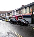
 Main Street, Porth - geograph.org.uk - 860405.jpg 640 × 480 ; 88 kio
-
 Meadbro, Porth - geograph.org.uk - 2440726.jpg 640 × 480 ; 71 kio
-
 Mural, Flats, Dinas 2 - geograph.org.uk - 2122255.jpg 480 × 640 ; 77 kio
-
 National Cycle Route 881, Porth - geograph.org.uk - 2612587.jpg 640 × 599 ; 95 kio
-

-
 North Rd, Porth - geograph.org.uk - 5034107.jpg 4 608 × 3 456 ; 3,66 Mio
-
 North side of Tabernacle Baptist Church, Porth - geograph.org.uk - 5629259.jpg 788 × 800 ; 147 kio
-
 North Street, Porth - geograph.org.uk - 5562134.jpg 800 × 621 ; 134 kio
-
 NW end of West Taff Street, Porth - geograph.org.uk - 3590865.jpg 800 × 663 ; 153 kio
-
 Oakdale Pharmacy and van, Porth Street, Porth - geograph.org.uk - 5560774.jpg 800 × 600 ; 124 kio
-

-
 On-street parking, Hannah Street, Porth - geograph.org.uk - 5565574.jpg 724 × 800 ; 129 kio
-
 On-street parking, John Street, Porth - geograph.org.uk - 5562165.jpg 800 × 737 ; 98 kio
-

-
 One-way side street in Porth - geograph.org.uk - 5565843.jpg 800 × 715 ; 108 kio
-
 One-way traffic, North Road, Porth - geograph.org.uk - 2612844.jpg 640 × 531 ; 86 kio
-
 Ordnance Survey Cut Mark - geograph.org.uk - 4435837.jpg 480 × 640 ; 122 kio
-
 Ordnance Survey Cut Mark - geograph.org.uk - 4435851.jpg 480 × 640 ; 115 kio
-
 Ordnance Survey Cut Mark - geograph.org.uk - 5417072.jpg 640 × 431 ; 112 kio
-
 Ordnance Survey Cut Mark - geograph.org.uk - 5417079.jpg 640 × 434 ; 134 kio
-
 Ordnance Survey Cut Mark - geograph.org.uk - 5417082.jpg 640 × 294 ; 68 kio
-
 Ordnance Survey Cut Mark - geograph.org.uk - 5417088.jpg 640 × 352 ; 65 kio
-
 Ordnance Survey Cut Mark - geograph.org.uk - 5417090.jpg 640 × 420 ; 67 kio
-
 Ordnance Survey Cut Mark - geograph.org.uk - 5417095.jpg 640 × 571 ; 64 kio
-
 Ordnance Survey Cut Mark - geograph.org.uk - 5417101.jpg 640 × 359 ; 100 kio
-
 Ordnance Survey Cut Mark - geograph.org.uk - 5417105.jpg 640 × 443 ; 59 kio
-
 Ordnance Survey Cut Mark - geograph.org.uk - 5439953.jpg 640 × 378 ; 109 kio
-
 Ordnance Survey Cut Mark - geograph.org.uk - 5439954.jpg 640 × 396 ; 94 kio
-
 Ordnance Survey Cut Mark - geograph.org.uk - 5439956.jpg 640 × 392 ; 92 kio
-
 Ordnance Survey Cut Mark - geograph.org.uk - 5439958.jpg 640 × 411 ; 39 kio
-
 Ordnance Survey Cut Mark - geograph.org.uk - 5439959.jpg 640 × 315 ; 47 kio
-
 Ordnance Survey Cut Mark - geograph.org.uk - 5439961.jpg 640 × 384 ; 80 kio
-
 Ordnance Survey Cut Mark - geograph.org.uk - 5439965.jpg 640 × 323 ; 86 kio
-
 Ordnance Survey Cut Mark - geograph.org.uk - 5439968.jpg 640 × 361 ; 98 kio
-
 Ordnance Survey Cut Mark - geograph.org.uk - 5439970.jpg 640 × 338 ; 62 kio
-
 Ordnance Survey Cut Mark - geograph.org.uk - 5439973.jpg 640 × 429 ; 108 kio
-
 Ordnance Survey Cut Mark - geograph.org.uk - 5789317.jpg 640 × 378 ; 82 kio
-
 Ordnance Survey Cut Mark - geograph.org.uk - 5789320.jpg 640 × 447 ; 103 kio
-
 Ordnance Survey Cut Mark - geograph.org.uk - 5789321.jpg 640 × 445 ; 77 kio
-
 Ordnance Survey Cut Mark - geograph.org.uk - 5789326.jpg 640 × 454 ; 104 kio
-
 Ordnance Survey Cut Mark - geograph.org.uk - 5789378.jpg 640 × 410 ; 85 kio
-
 Ordnance Survey Flush Bracket (S1307) - geograph.org.uk - 4435838.jpg 480 × 640 ; 107 kio
-
 Ordnance Survey Rivet - geograph.org.uk - 5439949.jpg 640 × 397 ; 118 kio
-
 Ordnance Survey Rivet - geograph.org.uk - 5439950.jpg 640 × 482 ; 92 kio
-
 Outdated auction board on a Porth corner - geograph.org.uk - 5629247.jpg 736 × 800 ; 151 kio
-
 Packers Road, Porth - geograph.org.uk - 3139271.jpg 640 × 477 ; 72 kio
-
 Path descending towards the Rhondda Valley - geograph.org.uk - 4413864.jpg 3 816 × 2 862 ; 2,69 Mio
-
 Path descending towards the Rhondda Valley - geograph.org.uk - 4413867.jpg 4 000 × 3 000 ; 3,23 Mio
-
 Pipeline over the River Rhondda, Porth - geograph.org.uk - 2456378.jpg 640 × 480 ; 89 kio
-
 Ponies on Troed-y-rhiw mountain - geograph.org.uk - 30802.jpg 640 × 480 ; 136 kio
-
 Pontypridd Road businesses, Porth - geograph.org.uk - 5560778.jpg 606 × 800 ; 100 kio
-
 Pontypridd Road, Porth - geograph.org.uk - 4494296.jpg 1 200 × 803 ; 1,26 Mio
-
 Porth (Junction) railway station, Rhondda Cynon Taf - geograph.org.uk - 4030004.jpg 1 024 × 768 ; 173 kio
-

-
 Porth Elim church - geograph.org.uk - 5035139.jpg 4 608 × 3 456 ; 3,52 Mio
-
 Porth Fire Station - geograph.org.uk - 2440629.jpg 640 × 480 ; 63 kio
-
 Porth Fire Station - geograph.org.uk - 467140.jpg 640 × 427 ; 218 kio
-
 Porth Infant School - geograph.org.uk - 5035118.jpg 4 608 × 3 456 ; 3,92 Mio
-
 Porth Infants School - geograph.org.uk - 2612619.jpg 640 × 428 ; 73 kio
-
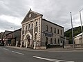
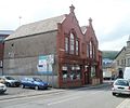 Porth Library - geograph.org.uk - 2456092.jpg 640 × 533 ; 67 kio
-
 Porth Park and Ride sign - geograph.org.uk - 5629323.jpg 729 × 800 ; 197 kio
-
 Porth Park ^ Ride car park - geograph.org.uk - 5629309.jpg 800 × 660 ; 126 kio
-
 Porth Park ^ Ride plaque, Porth railway station - geograph.org.uk - 5565869.jpg 800 × 786 ; 173 kio
-
 Porth Place, Porth - geograph.org.uk - 3590626.jpg 800 × 591 ; 114 kio
-
 Porth Police Station - geograph.org.uk - 2612289.jpg 640 × 480 ; 71 kio
-
 Porth Post Office and Lloyds Pharmacy - geograph.org.uk - 2612243.jpg 640 × 539 ; 79 kio
-
 Porth Post Office, Hannah Street, Porth - geograph.org.uk - 5567568.jpg 608 × 800 ; 107 kio
-
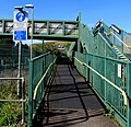
 Porth railway station footbridge - geograph.org.uk - 5629645.jpg 800 × 562 ; 144 kio
-
 Porth railway station plaque - geograph.org.uk - 5565878.jpg 686 × 800 ; 168 kio
-
 Porth railway station platform 2 - geograph.org.uk - 5629640.jpg 800 × 550 ; 161 kio
-
 Porth Takeaway, Porth - geograph.org.uk - 5565584.jpg 800 × 738 ; 112 kio
-
 Porth Telephone Exchange - geograph.org.uk - 3590436.jpg 800 × 600 ; 125 kio
-
 Porth Telephone Exchange - geograph.org.uk - 5560775.jpg 800 × 600 ; 140 kio
-
 Porth War Memorial - geograph.org.uk - 4096683.jpg 800 × 469 ; 100 kio
-
 Porth, Cymmer bridge.jpg 640 × 416 ; 67 kio
-
 Primrose Terrace, Llwyncelyn, Porth - geograph.org.uk - 2455892.jpg 640 × 480 ; 80 kio
-
 Proos Roofing Centres Ltd, Porth - geograph.org.uk - 2440737.jpg 640 × 480 ; 66 kio
-
 Puerto Madryn, Chubut.jpg 1 840 × 3 264 ; 2,17 Mio
-
 Railway between two bridges, Porth - geograph.org.uk - 3590573.jpg 800 × 634 ; 224 kio
-
 Railway bridge, central Porth - geograph.org.uk - 2455999.jpg 640 × 480 ; 58 kio
-

-
 Rainy morning, Hannah Street, Porth - geograph.org.uk - 5567430.jpg 800 × 694 ; 136 kio
-
 RCT People First, Porth - geograph.org.uk - 3926151.jpg 800 × 719 ; 148 kio
-
 Recycle shop in Porth - geograph.org.uk - 5567455.jpg 728 × 800 ; 146 kio
-

-
 Rheola Bridge, Porth - geograph.org.uk - 5629637.jpg 615 × 800 ; 144 kio
-

-
 Rhondda Fach Trail near Porth railway station - geograph.org.uk - 5629274.jpg 800 × 771 ; 214 kio
-
 Rhondda Fach viewed from Rheola Road, Porth - geograph.org.uk - 3139055.jpg 640 × 592 ; 118 kio
-
 Rhondda Household, Porth - geograph.org.uk - 2456357.jpg 640 × 561 ; 93 kio
-

-

-
 Rhondda Valley Rentals shop in Porth - geograph.org.uk - 5565573.jpg 800 × 600 ; 155 kio
-
 Richards Family Butchers, Porth - geograph.org.uk - 3590692.jpg 649 × 800 ; 153 kio
-

-
 Road bridge over railway, Porth - geograph.org.uk - 3590542.jpg 800 × 600 ; 129 kio
-
 Road to Llwyncelyn, Rhondda Valley - geograph.org.uk - 4413883.jpg 3 783 × 2 837 ; 4,11 Mio
-
 Row of houses, John Street, Porth - geograph.org.uk - 5562188.jpg 631 × 800 ; 124 kio
-
 School Street, Porth - geograph.org.uk - 2612624.jpg 640 × 480 ; 74 kio
-
 Shangerli Buffet, 3 Station Street, Porth - geograph.org.uk - 5560784.jpg 651 × 800 ; 140 kio


.jpg)


_-_geograph.org.uk_-_4435838.jpg)


_railway_station,_Rhondda_Cynon_Taf_-_geograph.org.uk_-_4030004.jpg)


