Category:Ports and harbours in the Republic of Ireland
Zur Navigation springen
Zur Suche springen
Staaten in Europa: Albanien · Aserbaidschan‡ · Belarus · Belgien · Bosnien und Herzegowina · Bulgarien · Dänemark · Deutschland · Estland · Finnland · Frankreich‡ · Georgien‡ · Griechenland · Irland · Island · Italien · Kasachstan‡ · Kroatien · Lettland · Litauen · Malta · Moldau · Monaco · Montenegro · Niederlande‡ · Nordmazedonien · Norwegen · Österreich · Polen · Portugal‡ · Rumänien · Russland‡ · Schweden · Schweiz · Serbien · Slowakei · Slowenien · Spanien‡ · Tschechien · Türkei‡ · Ukraine · Ungarn · Vereinigtes Königreich · Zypern‡
Spezifischer Status: Färöer · Bailiwick of Guernsey · Jersey · Isle of Man · Spitzbergen
‡: teilweise in Europa
Spezifischer Status: Färöer · Bailiwick of Guernsey · Jersey · Isle of Man · Spitzbergen
‡: teilweise in Europa
Wikimedia-Kategorie | |||||
| Medium hochladen | |||||
| Ist ein(e) | |||||
|---|---|---|---|---|---|
| Kategorie kombiniert die Themen | |||||
 | |||||
Unterkategorien
Es werden 41 von insgesamt 41 Unterkategorien in dieser Kategorie angezeigt:
In Klammern die Anzahl der enthaltenen Kategorien (K), Seiten (S), Dateien (D)
*
A
B
- Balbriggan Harbour (62 D)
- Bray Harbour (13 D)
C
- Carlingford Harbour (32 D)
- Coliemore Harbour (9 D)
- Cuan Chill Éinne (2 D)
- Céibh an Líonáin (4 D)
D
- Donegal Harbour (8 D)
- Dunmore East (84 D)
F
G
- Galway harbour (25 D)
- Greystones Harbour (7 D)
H
J
K
- Killybegs Harbour (82 D)
- Kinsale harbour (29 D)
L
- Liscannor Harbour (15 D)
P
R
S
- Skerries Harbour (10 D)
Y
Medien in der Kategorie „Ports and harbours in the Republic of Ireland“
Folgende 184 Dateien sind in dieser Kategorie, von 184 insgesamt.
-
-

-

-
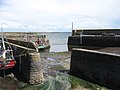
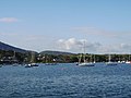
 A small harbour - geograph.org.uk - 239918.jpg 640 × 480; 94 KB
-
 About to dock, Greencastle - geograph.org.uk - 1124307.jpg 640 × 479; 50 KB
-
 Aerial approach to Lambay Island.jpg 1.024 × 586; 296 KB
-
 Annagassan harbour - geograph.org.uk - 286767.jpg 640 × 426; 135 KB
-
-
 Balbriggian Harbour - geograph.org.uk - 334918.jpg 640 × 197; 33 KB
-
 Balbriggian Harbour - geograph.org.uk - 336647.jpg 640 × 426; 117 KB
-
 Ballyhack harbour - geograph.org.uk - 202941.jpg 640 × 426; 153 KB
-
 Ballyhack Harbour, Co. Wexford - geograph.org.uk - 212166.jpg 640 × 480; 70 KB
-
 Ballysaggart Harbour 2010 09 22.jpg 3.504 × 2.336; 3,52 MB
-
 Ballyvaughan Harbour - geograph.org.uk - 1088732.jpg 640 × 427; 61 KB
-
 Bantry harbour - geograph.org.uk - 1213301.jpg 640 × 392; 56 KB
-
 Bantry Harbour 1979 - geograph.org.uk - 654327.jpg 640 × 432; 195 KB
-
 Bantry Harbour 2009 09 09.jpg 3.504 × 2.336; 3,87 MB
-
 Blasket Harbour.jpg 2.816 × 2.112; 2,01 MB
-
 Boats at Ballyhack - geograph.org.uk - 1543216.jpg 640 × 480; 59 KB
-
 Boats In Balbriggan Harbour At Low Tide - panoramio.jpg 6.000 × 4.000; 18,12 MB
-
 Brandon Harbour - geograph.org.uk - 1506051.jpg 640 × 427; 58 KB
-
 Breakwater - geograph.org.uk - 212207.jpg 640 × 480; 64 KB
-

-
 Caherciveen marina - geograph.org.uk - 1360313.jpg 640 × 457; 292 KB
-
 Carnlough harbour (2083709990).jpg 970 × 464; 431 KB
-
 Castletown Bearhaven Harbour - geograph.org.uk - 12881.jpg 640 × 480; 142 KB
-
 Castletownbere townscape and riverbank (7418613912).jpg 2.000 × 1.436; 1,44 MB
-
 Clear Island, north harbour - geograph.org.uk - 98530.jpg 640 × 401; 85 KB
-
 Cloch na Rón (Roundstone) - geograph.org.uk - 1438771.jpg 640 × 401; 56 KB
-
 Cloch na Rón - geograph.org.uk - 12397.jpg 640 × 427; 239 KB
-
 Clonakilty Harbour.jpg 6.000 × 4.000; 17,57 MB
-
 Colorful harbor (8045722118) (2).jpg 2.993 × 1.773; 5,89 MB
-
 Coming into harbour - geograph.org.uk - 1704174.jpg 1.024 × 768; 150 KB
-
 Cork Harbour - panoramio (1).jpg 3.072 × 2.304; 2,76 MB
-
 Cork Harbour - panoramio (3).jpg 3.072 × 2.304; 2,43 MB
-
 Cork Harbour - panoramio (4).jpg 3.072 × 2.304; 3 MB
-
 Cork Harbour - panoramio (5).jpg 3.072 × 2.304; 2,88 MB
-
 Cork Harbour - panoramio (7).jpg 3.072 × 2.304; 2,91 MB
-
 Cork Harbour - panoramio (8).jpg 2.304 × 3.072; 2,34 MB
-
 Cork Harbour from top of Blackrock Castle - panoramio (1).jpg 3.072 × 2.304; 2,77 MB
-
 Corrib Harbour, Galway-Gaillimh - geograph.org.uk - 68958.jpg 640 × 299; 73 KB
-
 Crosshaven from Curraghbinny - geograph.org.uk - 596566.jpg 640 × 397; 65 KB
-
 Crosshaven.jpg 3.308 × 1.890; 4,18 MB
-
 Cruise ship terminal - geograph.org.uk - 1384425.jpg 640 × 480; 66 KB
-
 Crushoa harbour.jpg 3.024 × 3.778; 1,43 MB
-
 Dingle Harbour, Kerry, Ireland.jpg 2.586 × 1.513; 841 KB
-
 Doolin Hafen County Clare in Irland @20160601.jpg 4.608 × 3.456; 7,49 MB
-
 Doonan Harbour Donegal - geograph.org.uk - 130540.jpg 545 × 310; 39 KB
-
 Downings Harbour - geograph.org.uk - 1956528.jpg 640 × 480; 195 KB
-
 Duncannon harbour - geograph.org.uk - 205322.jpg 640 × 426; 127 KB
-
 Duncannon Harbour, Co. Wexford - geograph.org.uk - 212189.jpg 640 × 473; 96 KB
-
 Duncannon Harbour, Co. Wexford - geograph.org.uk - 212190.jpg 640 × 480; 99 KB
-
 Dungarvan Harbour - geograph.org.uk - 485218.jpg 480 × 640; 62 KB
-
 Dungarvan Harbour - geograph.org.uk - 491499.jpg 640 × 480; 68 KB
-
 Dungarvan Harbour - geograph.org.uk - 835545.jpg 640 × 480; 48 KB
-
 Dunquin Harbour - 1960 - geograph.org.uk - 523373.jpg 640 × 427; 76 KB
-
 Dunquin Harbour - 1960 - geograph.org.uk - 544728.jpg 509 × 640; 59 KB
-

-

-
 Glengarriff Harbour - geograph.org.uk - 1414062.jpg 640 × 480; 148 KB
-

-
 Greenore Harbour - geograph.org.uk - 401448.jpg 640 × 417; 108 KB
-
 Greenore harbour, Carlingford Lough - geograph.org.uk - 272018.jpg 640 × 426; 147 KB
-
 Greystones Harbour new developments.jpg 3.264 × 2.448; 1,86 MB
-
 Harbour and castle at Dungarvan - geograph.org.uk - 484931.jpg 640 × 426; 100 KB
-
 Harbour at An Cobh - geograph.org.uk - 249716.jpg 640 × 480; 78 KB
-

-
 Harbour wall, Tarbert - geograph.org.uk - 293684.jpg 640 × 480; 62 KB
-
 Harbour, Ballygerry - geograph.org.uk - 231981.jpg 640 × 427; 59 KB
-
 Harbourside, Castletownbere - geograph.org.uk - 734802.jpg 640 × 480; 55 KB
-
 Haulbowline Island and Cobh Harbour - geograph.org.uk - 126824.jpg 640 × 480; 70 KB
-
 Hebble Sand at Dundalk Harbour - geograph.org.uk - 315649.jpg 640 × 426; 103 KB
-
 Helvick Head harbour - geograph.org.uk - 205313.jpg 640 × 426; 124 KB
-
 Howth Harbour Rusty Boat Irelands Eye.jpg 2.272 × 1.704; 855 KB
-
 Inishbofin Ferries 2018 09 03.jpg 3.178 × 1.621; 2,59 MB
-
 Inishmurray Clasaí Mór 2 2007 08 22.jpg 3.504 × 2.336; 1,16 MB
-
 Inishmurray Clasaí Mór 2007 08 22.jpg 3.504 × 2.336; 1,12 MB
-
 Inver Harbour 2012 09 16.jpg 3.372 × 2.055; 4,84 MB
-
 Ireland Victor Grigas 2011-2.jpg 5.184 × 2.802; 4,41 MB
-
 Kilmore Quay (fishery harbour) - geograph.org.uk - 202921.jpg 640 × 426; 137 KB
-
 KilmoreHarbour.JPG 2.016 × 1.512; 738 KB
-
 Kilronan - Inishmore Harbour - panoramio.jpg 2.048 × 1.150; 635 KB
-
 Kilronan Harbour, Inishmore, Aran Islands, Co. Galway. (The gossoons on the pier).jpg 2.500 × 1.898; 955 KB
-
 Kilronan Harbour. Boat and children - geograph.org.uk - 5587069.jpg 2.288 × 1.712; 748 KB
-
 Ireland Kinsale Cork County Yacht port.jpg 1.600 × 1.200; 723 KB
-
 Kinvarra Hafen County Galway Irland@20160601.jpg 4.608 × 3.456; 7,51 MB
-
 Kinvarra Harbour 01 (3585889633).jpg 2.560 × 1.920; 2,09 MB
-
 Lambay Harbour - geograph.org.uk - 469574.jpg 640 × 480; 51 KB
-
 Landing stage at Ballydonegan Strand - geograph.org.uk - 1401698.jpg 640 × 480; 198 KB
-
 Lecarrow Roscommon.jpg 640 × 480; 91 KB
-

-
 Lough Allen Spencer Harbour 2003 09 11.jpg 3.299 × 2.149; 7,11 MB
-
 Mouth of Cork Harbour - geograph.org.uk - 108929.jpg 640 × 479; 131 KB
-

-
 Old stone pier at Knocknagin - geograph.org.uk - 689299.jpg 640 × 480; 72 KB
-
 Out for a Stroll - geograph.org.uk - 82998.jpg 640 × 427; 67 KB
-
 Passage East Harbour 2018 09 12.jpg 3.442 × 2.295; 4,17 MB
-
 Pier at Bruckless Harbour - geograph.org.uk - 920805.jpg 640 × 480; 79 KB
-
 Port harbour area - geograph.org.uk - 1156098.jpg 639 × 426; 250 KB
-
 Port Oriel.jpg 3.456 × 2.304; 1,47 MB
-
 Portmagee (An Caladh) harbour - geograph.org.uk - 1350716.jpg 640 × 457; 322 KB
-
 Portmagee (An Caladh) harbour - geograph.org.uk - 1350813.jpg 640 × 457; 335 KB
-
 Portmagee (An Caladh) harbour - geograph.org.uk - 1366442.jpg 640 × 457; 286 KB
-
 Portmagee (An Caladh) Harbour - geograph.org.uk - 902602.jpg 640 × 485; 101 KB
-
 Portmagee Harbour - geograph.org.uk - 33191.jpg 640 × 420; 83 KB
-
 Portmagee on the Kerry Ring viewed from Valencia Island - geograph.org.uk - 1709411.jpg 1.780 × 1.175; 346 KB
-
 Quayside at Crookhaven - geograph.org.uk - 242711.jpg 640 × 353; 60 KB
-
 Quayside view of Dingle Harbour - geograph.org.uk - 16557.jpg 640 × 480; 329 KB
-
 RMS Ruhrort at Dundalk Harbour - geograph.org.uk - 315640.jpg 640 × 426; 86 KB
-
 Roundstone - geograph.org.uk - 305758.jpg 640 × 480; 83 KB
-
 Saleen Harbour, Mullet Peninsula - geograph.org.uk - 380446.jpg 640 × 398; 72 KB
-

-
 Sign at Lecarrow Harbour - geograph.org.uk - 167227.jpg 640 × 480; 146 KB
-
 Sign-1080800, Maynooth, Co. Kildare, Ireland.jpg 4.896 × 3.672; 2,12 MB
-
 Sign-1130343, Dingle Peninsula, Co. Kerry, Ireland.jpg 4.896 × 3.672; 8,81 MB
-
 Skellig experience - geograph.org.uk - 1349380.jpg 640 × 457; 328 KB
-
 Skellig experience jetty - geograph.org.uk - 1349381.jpg 640 × 457; 344 KB
-
 Skull Harbour - geograph.org.uk - 242876.jpg 640 × 480; 48 KB
-
 Skull Harbour - geograph.org.uk - 252062.jpg 638 × 467; 110 KB
-
 Slade harbour - geograph.org.uk - 206098.jpg 640 × 426; 151 KB
-
 Slade Harbour Fishing Boats 2018 09 09.jpg 3.504 × 2.336; 4,3 MB
-
 Slade Harbour Fishing Boats II 2018 09 09.jpg 2.336 × 3.504; 5,01 MB
-
 Slade Harbour Fishing Boats III 2018 09 09.jpg 3.503 × 1.924; 3,97 MB
-
 Slade Harbour “Fiona Yvonne” 2018 09 09.jpg 3.504 × 2.336; 4,91 MB
-
 Slade Harbour “Fiona Yvonne” II 2018 09 09.jpg 3.451 × 2.301; 4,02 MB
-
 Slade Harbour “Uisce Beatha” 2018 09 09.jpg 3.460 × 2.058; 3,9 MB
-
 St Helen's Harbour - geograph.org.uk - 246715.jpg 640 × 409; 70 KB
-
 The Harbor, Kingstown. County Dublin, Ireland-LCCN2002717402.jpg 3.696 × 2.759; 2,91 MB
-
 The Harbor, Kingstown. County Dublin, Ireland-LCCN2002717402.tif 3.696 × 2.759; 29,18 MB
-
 The Harbor, Kingstown. County Dublin, Ireland-LCCN2002717403.jpg 3.696 × 2.780; 2,63 MB
-
 The Harbor, Kingstown. County Dublin, Ireland-LCCN2002717403.tif 3.696 × 2.780; 29,4 MB
-
 The harbour of Knock, County Clare.JPG 2.048 × 1.536; 1,43 MB
-
 The Outer Harbour, Slade - geograph.org.uk - 4072969.jpg 2.592 × 1.944; 1,28 MB
-
-
 Three Ships, Dingle Harbour - geograph.org.uk - 16553.jpg 640 × 480; 371 KB
-
 Trawnahaha - geograph.org.uk - 16106.jpg 640 × 406; 224 KB
-
 Vessel in Port Oriel.jpg 3.456 × 2.304; 1,88 MB
-
 Warship off Cobh - geograph.org.uk - 596592.jpg 640 × 480; 74 KB
-
 Wicklow harbour - geograph.org.uk - 171367.jpg 640 × 426; 141 KB
-
 Wicklow Leitrim River 2016 09 16.jpg 3.468 × 2.249; 4,57 MB
-
 Annagassan Harbour - geograph.org.uk - 491277.jpg 640 × 480; 131 KB
-
 Ballycotton harbour - geograph.org.uk - 761138.jpg 640 × 480; 58 KB
-
 Baltimore Harbour - geograph.org.uk - 25099.jpg 640 × 334; 48 KB
-
 Baltimore harbour, South Pier - geograph.org.uk - 365413.jpg 640 × 480; 55 KB
-
 Brandon Harbour - geograph.org.uk - 259822.jpg 640 × 480; 93 KB
-
 Bulloch Harbour - geograph.org.uk - 84992.jpg 640 × 480; 83 KB
-
 Clifden across the harbour - geograph.org.uk - 200095.jpg 640 × 361; 79 KB
-
 Clifden Harbour - geograph.org.uk - 200103.jpg 640 × 479; 140 KB
-
 Clogherhead harbour - geograph.org.uk - 478134.jpg 640 × 427; 64 KB
-
 Colla Harbour, Co Cork - geograph.org.uk - 555218.jpg 640 × 480; 81 KB
-
 Coonanna Harbour - geograph.org.uk - 530231.jpg 640 × 480; 121 KB
-
 Cove Harbour and Leaghillaun Island - geograph.org.uk - 457647.jpg 640 × 437; 127 KB
-
 Crook Haven - geograph.org.uk - 257984.jpg 640 × 480; 68 KB
-

-
 Crookhaven Quay - geograph.org.uk - 305572.jpg 640 × 427; 62 KB
-
 Dingle Harbour, Near the N71 - geograph.org.uk - 16546.jpg 640 × 480; 427 KB
-
 Dun Choin Harbour - geograph.org.uk - 343278.jpg 640 × 425; 62 KB
-
 Dun Laoghaire harbour in daylight - geograph.org.uk - 228758.jpg 640 × 480; 98 KB
-
 Dun Laoghaire Port - geograph.org.uk - 162606.jpg 640 × 479; 64 KB
-
 East side of Bofin Harbour, Inishbofin - geograph.org.uk - 199489.jpg 640 × 458; 114 KB
-
 Glandore Harbour - geograph.org.uk - 714632.jpg 640 × 480; 95 KB
-

-
 Harbour at Brandon, Dingle Peninsula - geograph.org.uk - 249593.jpg 640 × 480; 53 KB
-
 Harbour at Clogher Head - geograph.org.uk - 467123.jpg 640 × 480; 61 KB
-
 Harbour at Mace, near Carna - geograph.org.uk - 377499.jpg 640 × 480; 88 KB
-
 Harbour near Coongar, Ring of Kerry - geograph.org.uk - 250371.jpg 640 × 477; 88 KB
-
 Harbour with boat - geograph.org.uk - 1430993.jpg 640 × 480; 57 KB
-
 Harbour with boats - geograph.org.uk - 1429909.jpg 640 × 480; 53 KB
-
 Lawrence's Cove, Bear Island - geograph.org.uk - 506047.jpg 640 × 341; 33 KB
-
 Loughshinny Harbour - geograph.org.uk - 625487.jpg 640 × 480; 54 KB
-
 Newport Co. Mayo - geograph.org.uk - 586086.jpg 480 × 640; 80 KB
-
 Quays, Crookhaven - geograph.org.uk - 257989.jpg 640 × 480; 77 KB
-
 Ring Harbour - geograph.org.uk - 405515.jpg 640 × 480; 100 KB
-
 Ros an Mhíl - geograph.org.uk - 13536.jpg 640 × 434; 195 KB
-
 Ships in the Harbour - geograph.org.uk - 669154.jpg 640 × 480; 73 KB
-
 Skerries Harbour - geograph.org.uk - 491440.jpg 640 × 480; 86 KB
-
 Skull Harbour - geograph.org.uk - 251359.jpg 640 × 480; 66 KB
-
 Skull Harbour - geograph.org.uk - 251362.jpg 640 × 480; 58 KB
-

-
 Teelin harbour, Co Donegal - geograph.org.uk - 243322.jpg 640 × 397; 84 KB
-
 View across Bofin Harbour - geograph.org.uk - 199509.jpg 640 × 428; 89 KB
-
 View of Wexford Harbour - geograph.org.uk - 308843.jpg 640 × 480; 49 KB
-
 Waterfront apartments and trawlers - geograph.org.uk - 336654.jpg 640 × 421; 138 KB
-
 West Passage, Cobh Harbour - geograph.org.uk - 126825.jpg 640 × 480; 50 KB
.jpg)
.jpg)
.jpg)


.jpg)

.jpg)
_-_geograph.org.uk_-_1438771.jpg)


_(2).jpg)

.jpg)
.jpg)
.jpg)
.jpg)
.jpg)
.jpg)
.jpg)


_-_geograph.org.uk_-_202921.jpg)


.jpg)


.jpg)


_harbour_-_geograph.org.uk_-_1350716.jpg)
_harbour_-_geograph.org.uk_-_1350813.jpg)
_harbour_-_geograph.org.uk_-_1366442.jpg)
_Harbour_-_geograph.org.uk_-_902602.jpg)


