Category:Potterhanworth
Vai alla navigazione
Vai alla ricerca
English: Potterhanworth is a village and civil parish in the North Kesteven district of Lincolnshire, England, it is situated south-east of Lincoln.
village and civil parish in North Kesteven, Lincolnshire, England  | |||||
| Carica un file multimediale | |||||
| Istanza di | |||||
|---|---|---|---|---|---|
| Luogo | North Kesteven, Lincolnshire, Midlands Orientali, Inghilterra | ||||
 | |||||
Sottocategorie
Questa categoria contiene le 10 sottocategorie indicate di seguito, su un totale di 10.
B
F
- Fields in Potterhanworth (8 F)
H
- Hedges in Potterhanworth (3 F)
P
- Potterhanworth War Memorial (1 F)
S
- Streets in Potterhanworth (6 F)
File nella categoria "Potterhanworth"
Questa categoria contiene 131 file, indicati di seguito, su un totale di 131.
-
 "Queuedinsky" mosaic, Potterhanworth (geograph 3179902).jpg 640 × 480; 76 KB
-
 "Slow Down, Me Duck" - geograph.org.uk - 521198.jpg 640 × 480; 126 KB
-

-

-
 B1178 heading west - geograph.org.uk - 3563776.jpg 640 × 480; 56 KB
-
 B1178 heading west - geograph.org.uk - 3563780.jpg 640 × 480; 65 KB
-
 B1188 Towards Branston - geograph.org.uk - 2428356.jpg 2 256 × 1 496; 978 KB
-
 B1202 towards Potterhanworth - geograph.org.uk - 3593284.jpg 640 × 480; 72 KB
-
 Bardney Bridge - geograph.org.uk - 2199517.jpg 640 × 480; 82 KB
-
 Bardney Bridge - geograph.org.uk - 3593358.jpg 640 × 480; 93 KB
-
 Bardney Bridge across River Witham - geograph.org.uk - 3520576.jpg 640 × 386; 38 KB
-
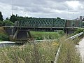
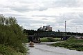 Bardney bridge with the sugar beet factory in the background - geograph.org.uk - 4488075.jpg 5 008 × 3 339; 3,08 MB
-
 Bardney Bridge, rivet bench mark - geograph.org.uk - 2199526.jpg 640 × 480; 105 KB
-

-

-
 Barff Farm - geograph.org.uk - 5137387.jpg 1 024 × 768; 272 KB
-

-
 Between Potterhanworth and Bardney - geograph.org.uk - 434023.jpg 480 × 640; 159 KB
-

-

-

-

-
 Branston Fen - geograph.org.uk - 6153335.jpg 1 024 × 718; 163 KB
-
 Branston Moor - geograph.org.uk - 380417.jpg 640 × 427; 50 KB
-

-
 Bridge over the River Witham at Bardney - geograph.org.uk - 5398818.jpg 1 280 × 1 280; 528 KB
-
 Bridleway alongside the Car Dyke - geograph.org.uk - 6153317.jpg 1 024 × 768; 194 KB
-

-

-
 Bridleway into the fen - geograph.org.uk - 5137846.jpg 1 024 × 768; 196 KB
-
 Bridleway near Woodside Farm - geograph.org.uk - 5137386.jpg 1 024 × 768; 303 KB
-
 Bridleway to Potterhanworth Booths - geograph.org.uk - 5138265.jpg 1 024 × 768; 229 KB
-
 Car Dyke - geograph.org.uk - 424929.jpg 640 × 427; 91 KB
-
 Car Dyke alongside Potterhanworth Wood - geograph.org.uk - 5577094.jpg 640 × 427; 110 KB
-
 Church of St Andrew, Potterhanworth - geograph.org.uk - 4549542.jpg 3 776 × 2 520; 4,1 MB
-
 Cottage in Potterhanworth.jpg 4 000 × 3 000; 1,32 MB
-
 Crop field on Potterhanworth Heath - geograph.org.uk - 5098371.jpg 2 482 × 1 482; 3,73 MB
-
 Crop field, Potterhanworth Heath - geograph.org.uk - 3563771.jpg 640 × 480; 68 KB
-
 Crops and flowers on Potterhanworth Heath - geograph.org.uk - 5098382.jpg 3 008 × 2 000; 7,38 MB
-
 Crops on Potterhanworth Heath - geograph.org.uk - 2428566.jpg 2 256 × 1 496; 864 KB
-
 Crossing of paths Potterhanworth Wood - geograph.org.uk - 3761263.jpg 1 024 × 768; 280 KB
-
 Cut bench mark Potterhanworth school - geograph.org.uk - 1888618.jpg 640 × 480; 106 KB
-

-
 Cut Mark, Potterhanworth, The Old Chapel - geograph.org.uk - 5870735.jpg 1 280 × 960; 501 KB
-

-
 Derelict Farm Buildings off Branston Causeway - geograph.org.uk - 2455894.jpg 1 280 × 960; 331 KB
-
 Derelict farm on Potterhanworth Fen - geograph.org.uk - 2832861.jpg 640 × 427; 73 KB
-
-
 Disused well on Potterhanworth Fen - geograph.org.uk - 5577025.jpg 640 × 427; 106 KB
-
 Farm building on Nocton Fen - geograph.org.uk - 3204309.jpg 640 × 480; 98 KB
-
 Farm track alongside Langham Drain - geograph.org.uk - 5137567.jpg 1 024 × 768; 154 KB
-
 Farm track off B1178, Potterhanworth Heath - geograph.org.uk - 3218698.jpg 3 088 × 2 056; 2,07 MB
-
 Farm track off the B1178 - geograph.org.uk - 3563774.jpg 640 × 480; 78 KB
-
 Farmland off B1188 near Potterhanworth - geograph.org.uk - 2428343.jpg 2 256 × 1 496; 926 KB
-
 Field of oilseed rape - geograph.org.uk - 5138437.jpg 1 024 × 768; 263 KB
-
 Fields on Potterhanworth Fen - geograph.org.uk - 2455988.jpg 1 280 × 960; 295 KB
-
 Footpath alongside Neville Wood - geograph.org.uk - 5137390.jpg 1 024 × 768; 296 KB
-
 Footpath alongside Potterhanworth Wood - geograph.org.uk - 5138423.jpg 1 024 × 768; 237 KB
-
 Footpath and Barff Farm - geograph.org.uk - 5138430.jpg 1 024 × 768; 226 KB
-
 Footpath and barn conversion, Barff Farm - geograph.org.uk - 5138425.jpg 1 024 × 768; 158 KB
-
 Footpath through Potterhanworth Wood - geograph.org.uk - 5138325.jpg 1 024 × 768; 297 KB
-
 Footpath to Nocton Fen Lane - geograph.org.uk - 5138434.jpg 1 024 × 768; 256 KB
-
 Footpath to Potterhanworth Wood - geograph.org.uk - 6153310.jpg 1 024 × 768; 229 KB
-
 Fox's Drain - geograph.org.uk - 2361858.jpg 640 × 480; 109 KB
-
 Fox's Drain - geograph.org.uk - 2362145.jpg 640 × 480; 130 KB
-
 Fox's Drain - geograph.org.uk - 2362154.jpg 640 × 480; 158 KB
-
 From B1178 towards Branston - geograph.org.uk - 5576954.jpg 640 × 427; 82 KB
-

-

-
 Heighington, aerial 2017 - geograph.org.uk - 5324474.jpg 640 × 427; 61 KB
-
 Langham Drain - geograph.org.uk - 2362216.jpg 640 × 480; 135 KB
-

-
 Main Street, Potterhanworth - geograph.org.uk - 3624787.jpg 640 × 426; 93 KB
-

-
 Metal screen, Potterhanworth - geograph.org.uk - 3179918.jpg 640 × 480; 91 KB
-

-
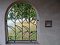
 Mosaic, Potterhanworth - geograph.org.uk - 3179909.jpg 640 × 480; 97 KB
-
 No access to footpath - geograph.org.uk - 5137618.jpg 1 024 × 768; 195 KB
-
 Nocton Fen , aerial 2017 - geograph.org.uk - 5323989.jpg 640 × 408; 43 KB
-
-
 Nocton road entering Potterhanwith (geograph 3520031).jpg 640 × 400; 84 KB
-
-
 Oilseed rape and Poplars Farm - geograph.org.uk - 6153327.jpg 1 024 × 768; 299 KB
-
 Oilseed rape and Potterhanworth Wood - geograph.org.uk - 5138444.jpg 1 024 × 768; 183 KB
-
-
 Path alongside Potterhanworth Wood - geograph.org.uk - 5576998.jpg 640 × 427; 110 KB
-
 Path through Potterhanworth Wood - geograph.org.uk - 5577005.jpg 640 × 427; 126 KB
-
 Plough Hill to Poplar Farm - geograph.org.uk - 2831998.jpg 640 × 427; 107 KB
-

-
 Pot o' Gold - located^ - geograph.org.uk - 477052.jpg 640 × 427; 34 KB
-

-
 Potterhanworth Fen - geograph.org.uk - 2361869.jpg 640 × 480; 121 KB
-
 Potterhanworth Fen - geograph.org.uk - 2361873.jpg 640 × 480; 81 KB
-
 Potterhanworth Fen - geograph.org.uk - 2362118.jpg 640 × 480; 135 KB
-
 Potterhanworth Fen - geograph.org.uk - 2362208.jpg 640 × 480; 135 KB
-
 Potterhanworth Fen - geograph.org.uk - 2362239.jpg 640 × 480; 98 KB
-
 Potterhanworth Fen - geograph.org.uk - 2831982.jpg 640 × 427; 87 KB
-
 Potterhanworth Fen - geograph.org.uk - 2832772.jpg 640 × 427; 57 KB
-
 Potterhanworth Fen - geograph.org.uk - 434005.jpg 640 × 475; 141 KB
-
 Potterhanworth Fen Road - geograph.org.uk - 2362375.jpg 640 × 480; 172 KB
-
 Potterhanworth village green triangle, North Kesteven, Lincolnshire.jpg 1 090 × 674; 543 KB
-
 Potterhanworth, Station Road - geograph.org.uk - 1883841.jpg 640 × 480; 91 KB
-
 Public Bridleway from Nocton Road - geograph.org.uk - 2523128.jpg 1 280 × 960; 398 KB
-
 Public bridleway off Nocton Road - geograph.org.uk - 3204058.jpg 640 × 480; 84 KB
-
 Public Footpath along Potterhanworth Wood - geograph.org.uk - 2524317.jpg 1 280 × 960; 311 KB
-
 Pylon near Potterhanworth Heath - geograph.org.uk - 2428565.jpg 2 256 × 1 496; 880 KB
-

-

-

-
-

-

-

-
 Road Junction on Moor Lane (B1202) - geograph.org.uk - 2524327.jpg 1 280 × 960; 370 KB
-
 Road through Potterhanworth Wood - geograph.org.uk - 5577002.jpg 640 × 427; 134 KB
-
 Road towards Bardney - geograph.org.uk - 3383837.jpg 2 256 × 1 504; 2,38 MB
-
 Rural scene near Potterhanworth - geograph.org.uk - 3144392.jpg 3 648 × 2 736; 2,52 MB
-
 Rylands Farm, From Barff Road (geograph 2524323).jpg 1 280 × 960; 308 KB
-
 Station Bridge - geograph.org.uk - 380475.jpg 640 × 427; 54 KB
-
 Track along horse Dyke Drain - geograph.org.uk - 3144256.jpg 1 962 × 1 124; 1,44 MB
-
 Track by Horse Dyke Drain - geograph.org.uk - 2832222.jpg 640 × 427; 53 KB
-
 Track on Potterhanworth Fen - geograph.org.uk - 6153321.jpg 1 024 × 768; 184 KB
-
 Trees with pond west of Nocton Road - geograph.org.uk - 5577099.jpg 640 × 427; 114 KB
-
 View towards Barff Farm - geograph.org.uk - 5138440.jpg 1 024 × 768; 252 KB
-
 Washingborough Fen, aerial 2014 - geograph.org.uk - 3887765.jpg 800 × 533; 94 KB
-

-
 Woodside Farm - geograph.org.uk - 5138322.jpg 1 024 × 768; 168 KB
-
 Potterhanworth Camp - geograph.org.uk - 380396.jpg 640 × 427; 41 KB
-
 Potterhanworth cattle - geograph.org.uk - 425051.jpg 640 × 427; 77 KB
-
 Potterhanworth Fen - geograph.org.uk - 424933.jpg 640 × 427; 57 KB
-

.jpg)


_lit_by_evening_sunlight_by_Nocton_Fen_Road_(2)_-_geograph.org.uk_-_5577183.jpg)
_lit_by_evening_sunlight_by_Nocton_Fen_Road_-_geograph.org.uk_-_5577181.jpg)


.jpg)


_-_geograph.org.uk_-_2524327.jpg)


.jpg)


