Category:Prescote
Aller à la navigation
Aller à la recherche
English: Prescote is a hamlet and civil parish about north of Banbury in Oxfordshire Its boundaries are the River Cherwell in the southeast, a tributary of the Cherwell called Highfurlong Brook in the west, and Oxfordshire's boundary with Northamptonshire in the northeast.
localité britannique du comté anglais d'Oxfordshire  | |||||
| Téléverser des médias | |||||
| Nature de l’élément | |||||
|---|---|---|---|---|---|
| Lieu | Cherwell, Oxfordshire, Angleterre du Sud-Est, Angleterre | ||||
 | |||||
Sous-catégories
Cette catégorie comprend seulement la sous-catégorie ci-dessous.
M
- Prescote Manor (2 F)
Média dans la catégorie « Prescote »
Cette catégorie comprend 9 fichiers, dont les 9 ci-dessous.
-
 Cropredy Marina - geograph.org.uk - 6142250.jpg 1 280 × 851 ; 259 kio
-
 Cropredy Marina along the Oxford Canal - geograph.org.uk - 4491894.jpg 1 024 × 668 ; 190 kio
-
 Fisherman's Cottage on Appletree Lane - geograph.org.uk - 4491858.jpg 1 024 × 763 ; 301 kio
-
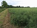 Path round the edge of the field - geograph.org.uk - 2699683.jpg 640 × 480 ; 91 kio
-
 Bridleway, Prescote - geograph.org.uk - 662737.jpg 640 × 480 ; 172 kio
-
 Bridleway, Prescote - geograph.org.uk - 662744.jpg 640 × 480 ; 165 kio
-
 Farmland, Prescote - geograph.org.uk - 662750.jpg 640 × 480 ; 125 kio
-
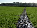
 Seven Shires Way - geograph.org.uk - 2699665.jpg 640 × 480 ; 91 kio
-
 Seven Shires Way - geograph.org.uk - 2699685.jpg 640 × 480 ; 104 kio


