Category:Prien am Chiemsee
Vai alla navigazione
Vai alla ricerca
comune tedesco    | |||||
| Carica un file multimediale | |||||
| Istanza di |
| ||||
|---|---|---|---|---|---|
| Parte di |
| ||||
| Luogo | circondario di Rosenheim, Alta Baviera, Baviera, Germania | ||||
| Popolazione |
| ||||
| Superficie |
| ||||
| Altezza sul mare |
| ||||
| sito web ufficiale | |||||
 | |||||
Sottocategorie
Questa categoria contiene le 16 sottocategorie indicate di seguito, su un totale di 16.
#
C
E
K
L
- Lakefront of Prien am Chiemsee (28 F)
P
S
- Signs in Prien am Chiemsee (7 F)
V
- Views of Prien am Chiemsee (1 F)
W
Pagine nella categoria "Prien am Chiemsee"
Questa categoria contiene un'unica pagina, indicata di seguito.
File nella categoria "Prien am Chiemsee"
Questa categoria contiene 29 file, indicati di seguito, su un totale di 29.
-
 'Barbara' on the Lake - geo.hlipp.de - 1891.jpg 640 × 436; 45 KB
-
 Alte Karte des Gebiets der Herrschaft Wildenwart.jpg 10 644 × 8 577; 17,7 MB
-
 Assovonoben.jpg 4 032 × 3 024; 2,32 MB
-
 Baureihe 101 050.jpg 3 872 × 2 592; 3,03 MB
-
 Biotop der Vergänglichkeit, 2014.jpg 4 272 × 2 848; 1,56 MB
-
 Chiemsee 2.jpg 3 648 × 2 736; 616 KB
-
 Chiemsee Yacht Club in Winter.png 1 396 × 785; 1,68 MB
-
 Closer and more distant Black-headed Gulls at Prien am Chiemsee .jpg 2 118 × 1 191; 471 KB
-
 DEU Prien am Chiemsee COA.svg 512 × 559; 24 KB
-
 Hiasl Maier-Erding Baumgruppe im Harrasser Moor 1919.jpg 2 362 × 1 756; 1,25 MB
-
 Historische Karte Prien.png 1 906 × 1 408; 3,92 MB
-
 Historische Karte St. Salvator.png 1 608 × 1 186; 2,47 MB
-
 Kreuztrachten der Pfarrei Mariä Himmelfahrt Prien.png 1 331 × 1 357; 1,31 MB
-
 LTG Prien – Gebäude I.jpg 2 592 × 4 608; 4,72 MB
-
 LTG Prien – Hofeinfahrt.jpg 4 608 × 2 592; 4,54 MB
-
 Michaela Kaniber, CSU at Prien (cropped).jpg 4 000 × 4 000; 5,65 MB
-
 Michaela Kaniber, CSU at Prien.jpg 6 000 × 4 000; 7,58 MB
-
 Nobody There (209686809).jpeg 1 600 × 1 067; 421 KB
-
 Paddle (209686791).jpeg 1 600 × 1 067; 267 KB
-
 Prien - Lage im Landkreis.png 252 × 310; 45 KB
-

-
 Prien am Chiemsee in RO.svg 836 × 836; 1,28 MB
-
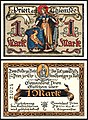 Prien Notgeld 1 Mark 1920.jpg 2 190 × 2 994; 5,36 MB
-
 Prien Purger 11342.jpg 1 600 × 2 120; 2,4 MB
-
 Priener Maibaum.jpg 3 188 × 4 782; 1,46 MB
-
 Shack On The Water (209686789).jpeg 1 600 × 1 067; 280 KB
-
 The Stone Sunrise (73280067).jpeg 2 000 × 1 011; 710 KB
-
 Wappen Prien.png 139 × 150; 19 KB
-
 Wasseramsel im Eichental.jpg 4 627 × 3 085; 16,3 MB


.jpg)

.jpeg)
.jpeg)

.jpg)


.jpeg)
.jpeg)

