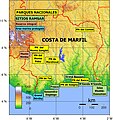
Category:Protected areas of Ivory Coast
Zur Navigation springen
Zur Suche springen
Staaten in Afrika: Ägypten‡ · Algerien · Angola · Äthiopien · Benin · Botswana · Burkina Faso · Burundi · Elfenbeinküste · Gabun · Gambia · Ghana · Guinea · Guinea-Bissau · Kamerun · Kap Verde · Kenia · Demokratische Republik Kongo · Republik Kongo · Liberia · Libyen · Madagaskar · Malawi · Mali · Marokko · Mauretanien · Mauritius · Mosambik · Namibia · Niger · Nigeria · Ruanda · Sambia · Senegal · Seychellen · Sierra Leone · Simbabwe · Südafrika · Tansania · Togo · Tschad · Tunesien · Uganda · Zentralafrikanische Republik
Weitere Gebiete: Kanarische Inseln · Madeira · Réunion
‡: teilweise in Afrika
Weitere Gebiete: Kanarische Inseln · Madeira · Réunion
‡: teilweise in Afrika
| Medium hochladen | |||||
| |||||
Unterkategorien
Es werden 5 von insgesamt 5 Unterkategorien in dieser Kategorie angezeigt:
In Klammern die Anzahl der enthaltenen Kategorien (K), Seiten (S), Dateien (D)
Medien in der Kategorie „Protected areas of Ivory Coast“
Folgende 68 Dateien sind in dieser Kategorie, von 68 insgesamt.
-
 6150 Ha de forêt classée de Mont Tonkoui.jpg 4.096 × 2.304; 1,54 MB
-
 A jumping Man in Man.jpg 768 × 1.024; 102 KB
-
 Ahouakro 1.jpg 960 × 640; 126 KB
-
 Ahouakro 3.jpg 1.024 × 576; 80 KB
-
 Ahouakro 4.jpg 1.024 × 576; 137 KB
-
 Baie des Sirènes.jpg 555 × 317; 31 KB
-
 Bingerville nature.jpg 3.456 × 4.608; 3,18 MB
-
 Boulay.png 1.440 × 2.046; 2,64 MB
-
 Calao à casque jaune, PN Ehotilé.jpg 2.560 × 1.440; 1,8 MB
-
 CASCADE MAN.jpg 3.000 × 2.000; 5,02 MB
-
 Cocotier.png 1.440 × 2.560; 3,96 MB
-
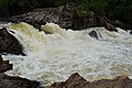
 DSC 0130 Chutes de la Nawa Soubré.jpg 6.000 × 4.000; 4,22 MB
-
 DSC 0131 Chutes de la Nawa Soubré.jpg 6.000 × 4.000; 4,66 MB
-
 DSC 0132 Chutes de la Nawa Soubré.jpg 6.000 × 4.000; 5,17 MB
-
 DSC 0137 Chutes de la Nawa Soubré.jpg 6.000 × 4.000; 4,68 MB
-
 DSC 0140 Chutes de la Nawa Soubré.jpg 6.000 × 4.000; 3,69 MB
-
 DSC 0142 Chutes de la Nawa Soubré.jpg 6.000 × 4.000; 2,79 MB
-
 DSC 0149 Chutes de la Nawa Soubré.jpg 6.000 × 4.000; 3,51 MB
-
 DSC 0159 (2) Chutes de la Nawa Soubré.jpg 5.953 × 3.186; 3,27 MB
-
 DSC 0180 Chutes de la Nawa Soubré.jpg 6.000 × 4.000; 3,62 MB
-
 DSC 0182 Chutes de la Nawa Soubré.jpg 6.000 × 4.000; 4,87 MB
-
 DSC 0270 Chutes de la Nawa Soubré.jpg 6.000 × 4.000; 2,61 MB
-
 Forêt de la ville de Seguela.jpg 3.000 × 4.000; 4,47 MB
-
 Forêt de Seguela.jpg 3.000 × 4.000; 4,65 MB
-
 Hamac au bord de l'eau.jpg 3.024 × 4.032; 6,93 MB
-
 Hamac géant.jpg 3.024 × 4.032; 7,45 MB
-
 IMG-20210420 En aval chutes Nawa Soubré.jpg 1.080 × 809; 88 KB
-
 Inbound6720851768307536358.jpg 670 × 694; 315 KB
-
 Ivory Coast Topography.jpg 1.009 × 1.071; 473 KB
-
 La fleur d'Hibiscus.jpg 3.024 × 4.032; 3,17 MB
-
 La fleur rouge.jpg 3.048 × 4.064; 5,6 MB
-
 La Montagne de Man.jpg 2.560 × 1.440; 246 KB
-
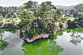
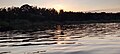 Le coucher du soleil au bord du lac Rwihinda.jpg 3.200 × 1.440; 1,32 MB
-
 Le fruit à pain.jpg 3.024 × 4.032; 2,69 MB
-
 Le Photinia.jpg 3.024 × 4.032; 9,65 MB
-
 Le soir au bord du lac Rwihinda communément appelé lac aux oiseaux.jpg 3.200 × 1.440; 1,32 MB
-
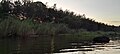 Le soir au bord du lac Rwihinda.jpg 3.200 × 1.440; 1,31 MB
-
 Les chutes de la nawa soubré.jpg 2.296 × 4.080; 2,59 MB
-
 Les oiseaux dans l'air en haut du lac Rwihinda.jpg 3.200 × 1.440; 695 KB
-
 Les tourbes dans le lac Rwihinda pendant le soir.jpg 3.200 × 1.440; 1,18 MB
-
 Lèvres pulpeuses clitoritique.jpg 3.024 × 4.032; 2,77 MB
-
 Man's natural waterfalls Two.jpg 768 × 1.024; 353 KB
-
 Man's natural waterfalls.jpg 768 × 1.024; 398 KB
-
 Mount Korhogo seen at sunset.jpg 5.760 × 3.840; 3,82 MB
-
 Nature verte à ciel bleu ouvert sur une lagune ebrié qui s’étend dans la ville de Dabou.jpg 4.032 × 3.024; 1,72 MB
-
 Odienné Pics 1.jpg 4.032 × 3.024; 1,49 MB
-
 Odienné Pics 2.jpg 4.032 × 3.024; 1,87 MB
-
 Odienné Pics.jpg 4.032 × 3.024; 1,48 MB
-
 Parinari curatellifoles à Ruvubu.jpg 1.090 × 1.882; 1,8 MB
-
 Piment vert "Samba".jpg 5.184 × 3.277; 10,5 MB
-
 Pont coloniale Dimbokro.jpg 4.160 × 1.872; 4,19 MB
-
 PONT DE LIANE.jpg 3.000 × 2.000; 6,32 MB
-
 Ravin prolongé du mont Tonkpi.jpg 1.440 × 2.560; 839 KB
-
 Reserve-naturelle-du.jpg 450 × 450; 101 KB
-
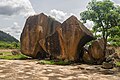 Rocher sacré Korhogo 02.jpg 6.000 × 4.000; 14,65 MB
-
 Rocher sacré Korhogo 03.jpg 4.000 × 6.000; 18,64 MB
-
 Rocher sacré Korhogo 04.jpg 4.000 × 6.000; 18,74 MB
-
 Sassandra port beach.jpg 4.032 × 3.024; 1,18 MB
-
 Soleil au zénith.jpg 768 × 1.024; 95 KB
-
 Sunrise in Grand Lahou.jpg 1.024 × 768; 147 KB
-
 The Dent de Man mountain.jpg 5.040 × 3.360; 4,7 MB
-
 The Tiassalé bridge.jpg 4.108 × 1.946; 5,32 MB
-
 Tiassale 100 years old tree.jpg 3.024 × 4.032; 4,55 MB
-
 Tiassale balade natural plantation.jpg 4.032 × 3.024; 3,24 MB
-
 Tiassale balade.jpg 4.032 × 3.024; 1,75 MB
-
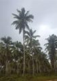
 Tiassale plantation.jpg 4.032 × 3.024; 2,18 MB
-
 Toujours plus haut.jpg 3.024 × 4.032; 6,66 MB
-
 Une brousse.jpg 3.120 × 4.160; 7,05 MB


_Chutes_de_la_Nawa_Soubr%C3%A9.jpg)


