Category:Prunet-et-Belpuig
Salti al navigilo
Salti al serĉilo
komunumo en la departemento Orientaj Pireneoj de Francio  Santuari de la Trinitat de Bellpuig  | |||||
| Alŝuti plurmedion | |||||
| Prononco-registraĵo | |||||
|---|---|---|---|---|---|
| Estas | |||||
| Loko | |||||
| Estro |
| ||||
| Loĝantaro |
| ||||
| Areo |
| ||||
 | |||||
Subkategorioj
Ĉi tiu kategorio havas la 5 jenajn subkategoriojn, el 5 entute.
Dosieroj en kategorio “Prunet-et-Belpuig”
La jenaj 24 dosieroj estas en ĉi tiu kategorio, el 24 entute.
-
 66153-Prunet-et-Belpuig-Routes-Hydro.png 3 507 × 2 480; 828 KB
-
 66153-Prunet-et-Belpuig-Sols.png 3 270 × 2 598; 1,55 MB
-
 Château de Belpuig.jpg 1 969 × 1 108; 635 KB
-
 Le Canigou 1.jpg 4 928 × 3 264; 4,53 MB
-
 Le Canigou 2.jpg 4 928 × 3 264; 4,64 MB
-
 Le Canigou 3.jpg 3 264 × 4 928; 4,31 MB
-
 Le Canigou 4.jpg 4 928 × 3 264; 6,96 MB
-
 Le Canigou 5.jpg 4 928 × 3 264; 5,76 MB
-
 Localització de Prunet i Bellpuig respecte del Rosselló.svg 487 × 522; 365 KB
-
 Map commune FR insee code 66153.png 756 × 605; 52 KB
-
 Mont Helena depuis Belpuig.jpg 3 264 × 2 448; 2,67 MB
-
 Panneau col du Fourtou.jpg 5 184 × 3 888; 5,44 MB
-
 Population - Municipality code 66153.svg 475 × 355; 13 KB
-
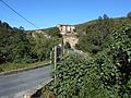
 Prunet i Bellpuig sanctuari 2013 07 14 05 M8.jpg 3 030 × 2 036; 2,98 MB
-
 Prunet i Bellpuig. Coll de Fortor 1.jpg 5 152 × 3 864; 4,42 MB
-
 Prunet i Bellpuig. Coll de Fortor 2.jpg 5 152 × 3 864; 4,43 MB
-
 Prunet i Bellpuig. Coll Xatard 1.jpg 5 152 × 3 864; 4,42 MB
-
 Prunet i Bellpuig. Coll Xatard 3.jpg 5 152 × 3 864; 4,32 MB
-
 Prunet i Bellpuig. El Serrat.jpg 5 152 × 3 864; 4,44 MB
-
 Prunet-et-Belpuig carte topographique.jpg 1 466 × 1 985; 812 KB
-
 Prunet-et-Belpuig sur carte P-O relief.jpg 1 956 × 1 090; 441 KB
-
 Retaule de Sant Esteve de Prunet.jpg 2 921 × 3 895; 3,5 MB
-
 Sant Esteve de Prunet.jpg 4 000 × 3 000; 3,8 MB
-
 Schiste noir Coll Xatard.jpg 1 788 × 1 163; 643 KB


