Category:Ptolemaic world maps
Направо към навигацията
Направо към търсенето
2nd century Greco-Roman map of the world  | |||||
| Качване на файл | |||||
| Екземпляр на | |||||
|---|---|---|---|---|---|
| Подклас на | |||||
| Наименуван на | |||||
| Местоположение |
| ||||
| Създател | |||||
| Дата на създаване |
| ||||
| |||||

* Ptolemy's first projection (top)
* Ptolemy's second projection (bottom)
Подкатегории
Показани са 6 от общо 6 подкатегории на тази категория.
1
E
P
- Ptolemy's first projection (0 К, 0 С, 72 Ф)
- Ptolemy's second projection (0 К, 0 С, 124 Ф)
W
- World map by Henricus Martellus (0 К, 0 С, 10 Ф)
Файлове в категория „Ptolemaic world maps“
Показани са 21 от общо 21 файла в тази категория.
-
Bodleian Libraries, Mappemonde(KenBurns).webm 4,0 сек, 1000 × 675; 860 КБ
-
 Bodleian Libraries, Mappemonde.jpg 1000 × 675; 142 КБ
-
 1490 Ptolemaic world map Tanais.jpg 1998 × 1830; 957 КБ
-

-
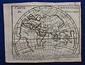 Carte Universelle de Ptolomee.jpg 1600 × 1226; 557 КБ
-
 1794 Anville Map of the Ancient World - Geographicus - AncientWorld-anville-1794.jpg 5000 × 3618; 4,69 МБ
-
-
 PSM V16 D259 Ptolemy map of the world.jpg 1916 × 1593; 375 КБ
-
 Orbis Terrarum ad Mentem Ptolemaei.jpg 896 × 637; 256 КБ
-

-
-
 Meyer‘s Zeitungsatlas 082 – Orbis Veteribus Notus.jpg 7131 × 6070; 18,76 МБ
-

-
 Orbis vetus juxta Strabonem - (tiré de Cellarius) - btv1b5963496h.jpg 3568 × 2568; 1,32 МБ
-

-

-
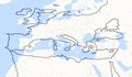 Ptolemy map of Mediterranean superimposed on modern map.png 1132 × 656; 225 КБ
-
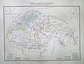
 Routes of ancient commerce (14803030753).jpg 2136 × 1328; 509 КБ
-
 The World as Known to the Ancients, 1872.jpg 3915 × 2713; 2,02 МБ
-
 The World showing the League of Nations, 1929.jpg 1600 × 1185; 912 КБ
-
 World according to Ptolemy RMG F1749.tiff 7422 × 4865; 103,31 МБ


.jpg)
.jpg)

_by_d%27Anville_(%C3%A9dition_anglaise)_-_auctore_d%27Anville_;_Engraved_for_Thomson%27s_classical_and_historical_atlas_-_btv1b53083563f.jpg)
_-_btv1b5963496h.jpg)

.jpg)

