Category:Puente Piedra District
Zur Navigation springen
Zur Suche springen
Distrikt in Lima, Peru    | |||||
| Medium hochladen | |||||
| Ist ein(e) | |||||
|---|---|---|---|---|---|
| Ort | Provinz Lima, Region Lima, Peru | ||||
| Einwohnerzahl |
| ||||
| Fläche |
| ||||
| offizielle Website | |||||
 | |||||
Unterkategorien
Es werden 3 von insgesamt 3 Unterkategorien in dieser Kategorie angezeigt:
In Klammern die Anzahl der enthaltenen Kategorien (K), Seiten (S), Dateien (D)
S
T
- Tambo Inga (46 D)
Medien in der Kategorie „Puente Piedra District“
Folgende 143 Dateien sind in dieser Kategorie, von 143 insgesamt.
-
 Acumulacion de desperdicios en techos.jpg 4.032 × 3.024; 2,42 MB
-
 Antena cerca de casas.jpg 3.024 × 4.032; 3,02 MB
-
 Apilamiento de ladrillos en techo.jpg 2.948 × 3.675; 1,55 MB
-
 Arbol con indicios de caerse.jpg 3.024 × 4.032; 4,16 MB
-
 Autoconstruccion.jpg 4.032 × 3.024; 1,79 MB
-
 Autoconstruccion02.jpg 3.024 × 4.032; 3,45 MB
-
 Avenida San Juan de Dios.jpg 4.000 × 3.000; 3,04 MB
-
 Basura en techos.jpg 1.280 × 858; 131 KB
-
 Bomberos Puente Piedra.jpg 4.032 × 3.024; 2,97 MB
-
 Casas en los cerros y mal cableado.jpg 4.032 × 3.024; 2,31 MB
-
 Casas mal posicionadas.jpg 2.448 × 3.264; 1,49 MB
-
 Centro de aislamiento temporal CAT “LA ENSENADA”.jpg 3.103 × 3.706; 1,71 MB
-
 Centro de Salud La Ensenada.jpg 3.081 × 3.856; 1,37 MB
-
 Centro de Salud Mental Comunitario RENATO CASTRO DE LA MATA.jpg 3.115 × 3.911; 1,58 MB
-
 Centro mental comunitario Puente Piedra.jpg 4.032 × 3.024; 3,26 MB
-
 Cerco perímetro en sitio arqueólogico Tambo Inga.jpg 2.448 × 3.264; 2,36 MB
-
 Colegio Perú Suiza.jpg 1.200 × 1.599; 236 KB
-
 COMISARIA LA ENSENADA.jpg 3.103 × 3.751; 1,29 MB
-
 Comisaría de Puente Piedra.jpg 4.032 × 3.024; 2,5 MB
-
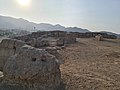
 Complejo Arqueológico Tambo Inga. Huaca en Puente Piedra.jpg 3.264 × 2.448; 1,6 MB
-
 Complejo Arqueológico. Tambo Inga.Puente Piedra.jpg 4.032 × 3.024; 2,41 MB
-
 Complejo Municipal Puente Piedra.jpg 4.032 × 3.024; 3,34 MB
-
 Construcciones empíricas, pircas y escaleras peligrosas.jpg 2.726 × 3.775; 1,39 MB
-
 Construcción de la entrada a Tambo Inga.jpg 3.264 × 2.448; 2,2 MB
-
 Costo de la obra.jpg 4.000 × 3.000; 3,05 MB
-
 Cuidado del Complejo arqueológico Tambo Inga.jpg 4.032 × 3.024; 2,08 MB
-
 Debilitamiento de muro.jpg 2.621 × 3.809; 2,38 MB
-
 Descuido e invasión al sitio arqueólogico Tambo Inga.jpg 3.264 × 2.448; 2,42 MB
-
 Deslizamiento de rocas cerca al puente Tambo Rio en Puente Piedra.jpg 2.448 × 3.264; 2,97 MB
-
 Despacho de la Parroquia "Padre Damian de Molokai".jpg 2.359 × 3.226; 1,18 MB
-
 Desprendimiento de piedras cerca de viviendas.jpg 3.067 × 3.452; 2,2 MB
-
 Distrito de Puente Piedra.svg 600 × 974; 32 KB
-
 Edificación de viviendas en el cerro.jpg 2.767 × 3.517; 687 KB
-
 Edificación de viviendas en lugares no aptos para vivir.jpg 2.954 × 3.627; 1.023 KB
-
 Enmarañado de cables.jpg 3.097 × 3.962; 2,28 MB
-
 Entra a la huaca.jpg 3.000 × 4.000; 3,94 MB
-
 Entrada al sitio arqueológico de Tambo Inga.jpg 2.448 × 3.264; 2,81 MB
-
 Escudo de Puente Piedra.png 266 × 370; 115 KB
-
 EXTERIORES HUACA TAMBO INGA.jpg 4.160 × 3.120; 2,09 MB
-
 Foto para corroborar que estuve en la huaca.jpg 4.000 × 3.000; 2,8 MB
-
 Fotografía de la comisaría de Puente Piedra.jpg 4.128 × 3.096; 4,45 MB
-
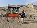
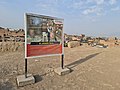 Gigantografia con info de la Huaca.jpg 4.000 × 3.000; 3,36 MB
-
 Gigantografía con información.jpg 4.000 × 3.000; 3,06 MB
-
 Gigantografía informativa.jpg 3.000 × 4.000; 3,54 MB
-
 Grandes bloques como especie de camino o pasaje.jpg 3.264 × 2.448; 2,29 MB
-
 HUACA , LIMA , PUENTE PIEDRA.jpg 3.120 × 4.160; 1,94 MB
-
 Huaca alrededor de la rivera del rio Chillón.jpg 4.160 × 3.120; 906 KB
-
 Huaca de Tambo Inga.jpg 2.322 × 3.096; 3,79 MB
-
 HUACA DE TANBO INGA.jpg 4.160 × 3.120; 2,12 MB
-
 HUACA MILENARIA DE LIMA, PERÚ.jpg 1.920 × 1.080; 709 KB
-
 Huaca parte baja.jpg 4.000 × 3.000; 2,99 MB
-
 Huaca parte superiorr.jpg 4.000 × 3.000; 2,67 MB
-
 HUACA PUENTE PIEDRA . TAMBO INGA.jpg 4.160 × 3.120; 2,34 MB
-
 Huaca superior.jpg 4.000 × 3.000; 2,63 MB
-
 Huaca Tambo inga Parte baja.jpg 4.000 × 3.000; 3,11 MB
-
 Huaca Tambo Inga. Centro de control durante el Tahuantinsuyo.jpg 4.032 × 3.024; 2,03 MB
-
 Huaca tambo Inga.jpg 4.000 × 3.000; 3,53 MB
-
 Huaca Tambo inga.jpg 4.000 × 3.000; 4,7 MB
-
 Huacaa.jpg 4.000 × 3.000; 3,18 MB
-
 I.E.I 350 La Ensenada, Puente Piedra.jpg 946 × 1.177; 169 KB
-
 Iglesia cristiana pentecostés del Perú Movimiento Misionero “La Ensenada”.jpg 3.028 × 3.701; 1,32 MB
-
 Instalaciones de gas sin terminar.jpg 3.024 × 4.032; 2,55 MB
-
 Institución Educativa "Módulo La Ensenada".jpg 951 × 1.200; 238 KB
-
 Institución Educativa N° 2081 Perú Suiza 2.jpg 1.200 × 1.599; 219 KB
-
 Institución Educativa N° 2081 Perú Suiza 3.jpg 1.200 × 1.599; 230 KB
-
 Institución Educativa N° 2081 Perú Suiza 4.jpg 1.200 × 1.599; 230 KB
-
 Institución Educativa N° 2081 Perú Suiza 5.jpg 1.280 × 575; 113 KB
-
 Institución Educativa N° 2081 Perú Suiza 6.jpg 576 × 1.280; 176 KB
-
 INSTITUCIÓN EDUCATIVA N° 2081 PERÚ SUIZA.jpg 2.834 × 3.785; 1,74 MB
-
 Institución Educativa N° 2081 Perú Suiza.jpg 1.200 × 1.599; 256 KB
-
 Interior de la Huaca Tambo Inga. Puente Piedra.jpg 3.024 × 4.032; 2,66 MB
-
 Interior de la Huaca Tambo Inga.jpg 4.032 × 3.024; 2,8 MB
-
 INTERIORES . HUACA TAMBO INGA.jpg 4.160 × 3.120; 3,48 MB
-
 Lenta construcción de cerco de tambo Inga.jpg 3.264 × 2.448; 2,32 MB
-
 Lica-puentepiedra.PNG 208 × 301; 9 KB
-
 Map of Lima highlighting Puente Piedra.PNG 185 × 296; 25 KB
-
 Mapa Distrito Comas Lima Peru Red de Essalud.png 1.024 × 1.219; 1,06 MB
-
 Mapa distrito San Martin de Porres Lima Peru.png 796 × 999; 688 KB
-
 Mapa san martin de porres distrito lima peru.png 1.132 × 1.559; 549 KB
-
 Maraña de cables invade el poste.jpg 2.795 × 3.659; 1,51 MB
-
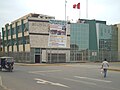
 Municipalidad de Puente Piedra.jpg 4.128 × 3.096; 4,62 MB
-
 Municipalidad-de-Puente-Piedra.jpg 4.032 × 3.024; 3,01 MB
-
 Mural de Tambo Inga, representado por los Cuchimilcos.jpg 3.264 × 2.448; 2,5 MB
-
 MURALES DE LA HUACA TOPA INGA.jpg 1.600 × 1.200; 126 KB
-
 MURALLAS DE ADOBE , HUACA INGA TAMBO.jpg 1.920 × 1.080; 729 KB
-
 Muro de la huaca.jpg 4.000 × 3.000; 3,12 MB
-
 Palacio-de-la-cultura-Puente-Piedra.jpg 4.032 × 3.024; 2,4 MB
-
 Parroquia "Padre Damian de Molokai".jpg 2.831 × 3.549; 1,36 MB
-
 Parroquia-Puente-Piedra.jpg 4.032 × 3.024; 1,74 MB
-
 Parte alta de Tambo Inga.jpg 2.448 × 3.264; 2,19 MB
-
 Parte plana de la huaca.jpg 4.000 × 3.000; 3,03 MB
-
 Pasaje de Tambo Inga.jpg 2.448 × 3.264; 2,28 MB
-
 Pircas Construidas sin asistencia técnica.jpg 2.936 × 3.847; 2,41 MB
-
 Pircas y casa construida sobre suelo rocoso.jpg 2.983 × 3.487; 1,63 MB
-
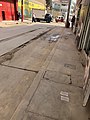
 Pista en mal estado 02.jpg 3.024 × 4.032; 4,18 MB
-
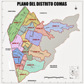 Plano del distrito Comas Lima Peru.png 1.593 × 1.600; 1,51 MB
-
 Plano Lima Metropolitana 1978 Guia de calles.png 452 × 851; 723 KB
-
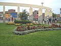
 Plaza Mayor de Puente Piedra.jpg 4.128 × 3.096; 4,67 MB
-
 Puente piedra lima peru.jpg 446 × 359; 55 KB
-
 Puente piedra0.jpg 210 × 204; 8 KB
-
 Puente piedra1.jpg 210 × 204; 7 KB
-
 Puente piedra2.jpg 210 × 204; 7 KB
-
 Puente Tambo Rio en Puente Piedra.jpg 2.448 × 3.264; 3,3 MB
-
 Puentepiedra 1918.jpg 234 × 149; 12 KB
-
 Puentepiedra.jpg 1.247 × 1.080; 1,22 MB
-
 Puentepiedra0.jpg 1.024 × 789; 588 KB
-
 Puentepiedra1.jpg 595 × 446; 62 KB
-
 Puentepiedra2.jpg 595 × 446; 75 KB
-
 Puentepiedra3.jpg 595 × 446; 101 KB
-
 Puentepiedra4.jpg 595 × 446; 65 KB
-
 Puentepiedra5.jpg 595 × 446; 78 KB
-
 Recorte territorial san martin de porres distrito lima peru.png 1.066 × 952; 555 KB
-
 RENIEC-Puente-Piedra.jpg 4.032 × 3.024; 2,43 MB
-
 Rio Chillón cerca al puente Tambo Rio en Puente Piedra.jpg 2.448 × 3.264; 2,3 MB
-
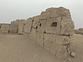
 Ruinas 1 de Tambo Inga.jpg 2.448 × 3.264; 3,17 MB
-
 Ruinas 2 de Tambo Inga.jpg 3.264 × 2.448; 2,62 MB
-
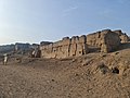
 Ruinas 3 de Tambo Inga.jpg 2.448 × 3.264; 3,12 MB
-
 Ruinas 4 de Tambo Inga.jpg 2.448 × 3.264; 3,32 MB
-
 Ruinas 5 de Tambo Inga.jpg 2.448 × 3.264; 2,58 MB
-
 Ruinas 6 de Tambo Inga.jpg 2.448 × 3.264; 1,98 MB
-
 Ruinas 7 de Tambo Inga.jpg 2.448 × 3.264; 2,89 MB
-
 Ruinas 8 de Tambo Inga.jpg 1.792 × 1.232; 736 KB
-
 Río Chillón alt urb La Ensenada Puente Piedra.jpg 444 × 333; 64 KB
-
 Sedapal-de-Puente-Piedra.jpg 4.032 × 3.024; 2,83 MB
-
 Señalética inestable.jpg 3.039 × 3.785; 1,81 MB
-
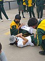
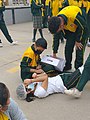
 Simulacro de sismo 2022-Puente Piedra.jpg 1.200 × 1.600; 164 KB
-
 Simulacro nacional multipeligro en Puente Piedra 01.jpg 4.608 × 3.456; 4,06 MB
-
 Simulacro nacional multipeligro en Puente Piedra 02.jpg 4.608 × 3.456; 3,57 MB
-
Simulacro nacional multipeligro en Puente Piedra.webm 41 s, 1.080 × 1.920; 15,62 MB
-
 Tambo Inga , Sitio arqueólogico.jpg 2.448 × 3.264; 2,31 MB
-
 TAMBO INGA . HUACA.jpg 4.160 × 3.120; 2,33 MB
-
 TAMBO INGA HUACA.jpg 4.160 × 3.120; 2,59 MB
-
 Tambo Inga, pintado de restos arqueológicos.jpg 3.264 × 2.448; 2,79 MB
-
 Tambo Inga. Centro de control incaico. Puente Piedra.jpg 4.032 × 3.024; 2,1 MB
-
 Tambo Inga. Huaca en Puente Piedra.jpg 3.264 × 2.448; 1,79 MB
-
 Tambo Inga.jpg 4.951 × 1.375; 3,04 MB
-
 Tierra y piedras caen a la acera peatonal.jpg 3.014 × 4.019; 2,07 MB
-
 Vacunatorio-de-Puente-Piedra.jpg 4.032 × 3.024; 2,37 MB
-
 Vista parcial (2) de Tambo Inga.jpg 3.264 × 2.448; 2,16 MB
-
 Vista parcial de Tambo Inga , sitio arqueólogico.jpg 3.264 × 2.448; 2,23 MB
-
 Vía sin señalizaciones.jpg 4.032 × 3.024; 3,49 MB
-
 Zona disputada del distrito San Martin de Porres y el distrito Independencia.png 1.080 × 1.080; 516 KB
-
 Zona disputada distrito San Martin de Porres distrito Comas.png 1.080 × 1.080; 448 KB


_de_Tambo_Inga.jpg)


