Category:Pulham Market
Aller à la navigation
Aller à la recherche
English: Pulham Market and its sister village Pulham St Mary are situated approximately 9 miles (14.5 kilometres) north of Diss in Norfolk, England. It covers an area of and had a population of 999 in 443 households as of the 2001 census.
localité britannique du comté anglais de Norfolk  | |||||
| Téléverser des médias | |||||
| Nature de l’élément | |||||
|---|---|---|---|---|---|
| Lieu | South Norfolk, Norfolk, Angleterre de l'Est, Angleterre | ||||
| Population |
| ||||
| Superficie |
| ||||
| Réputé identique à | Pulham Market (page en doublon, paroisse civile) | ||||
 | |||||
Sous-catégories
Cette catégorie comprend 9 sous-catégories, dont les 9 ci-dessous.
C
- The Crown Inn, Pulham Market (3 F)
D
- Depwade Union Workhouse (6 F)
E
- Environs of Pulham Market (1 F)
M
- Manor Farm, Pulham Market (5 F)
P
- Pulham Market village sign (9 F)
T
- The Falcon, Pulham Market (4 F)
Média dans la catégorie « Pulham Market »
Cette catégorie comprend 297 fichiers, dont les 200 ci-dessous.
(page précédente) (page suivante)-
 A ditch between two fields - geograph.org.uk - 2149469.jpg 640 × 480 ; 125 kio
-
 A seat by the path - geograph.org.uk - 1594156.jpg 640 × 480 ; 121 kio
-
 A window in the hedge beside Poppy's Lane - geograph.org.uk - 2149263.jpg 640 × 520 ; 135 kio
-
 A140 Ipswich Road, Colegate End - geograph.org.uk - 4261817.jpg 3 072 × 2 304 ; 1,85 Mio
-
 A140 Ipswich Road, Pulham Market - geograph.org.uk - 4262563.jpg 3 072 × 2 304 ; 1,74 Mio
-
 A140 Norwich ^ Ipswich Road, Pulham Market - geograph.org.uk - 5142172.jpg 3 072 × 2 304 ; 1,81 Mio
-
 A140 Norwich ^ Ipswich Road, Pulham Market - geograph.org.uk - 5142336.jpg 3 072 × 2 304 ; 1,88 Mio
-
 A140, Pulham Market - geograph.org.uk - 4267593.jpg 640 × 421 ; 54 kio
-
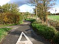
 Approaching Common Road on Wood Lane - geograph.org.uk - 2149212.jpg 640 × 480 ; 124 kio
-
 Approaching the A140 - geograph.org.uk - 5166636.jpg 640 × 480 ; 84 kio
-

-
 Approaching Tyrrel's Wood on Wood Lane - geograph.org.uk - 2149219.jpg 640 × 596 ; 212 kio
-
 Autumnal oaks in Poppy's Lane - geograph.org.uk - 2149283.jpg 561 × 640 ; 139 kio
-
 B1134 Station Road, Pulham Market - geograph.org.uk - 5141242.jpg 3 072 × 2 304 ; 3,14 Mio
-
 B1134 Station Road, Pulham Market - geograph.org.uk - 5141267.jpg 3 072 × 2 304 ; 1,89 Mio
-
 B1134 Station Road, Pulham Market - geograph.org.uk - 5141270.jpg 3 072 × 2 304 ; 1,86 Mio
-
 B1134 Station Road, Pulham Market - geograph.org.uk - 5142170.jpg 3 072 × 2 304 ; 1,73 Mio
-
 B1134 Station Road, Pulham Market - geograph.org.uk - 5142252.jpg 3 072 × 2 304 ; 1,92 Mio
-
 Bank Street past Briantiques - geograph.org.uk - 1594104.jpg 640 × 454 ; 95 kio
-
 Barns at Manor Farm, Pulham Market - geograph.org.uk - 2149496.jpg 640 × 480 ; 142 kio
-
 Boudicca Way footpath sign - geograph.org.uk - 4339681.jpg 640 × 480 ; 268 kio
-
 Bridge Farm Cottages - geograph.org.uk - 1592938.jpg 640 × 480 ; 131 kio
-
 Building, Duck Foot's Farm - geograph.org.uk - 4206074.jpg 640 × 480 ; 105 kio
-
 Bullock Hill east of Cole's Common - geograph.org.uk - 2149228.jpg 640 × 480 ; 134 kio
-
 Bullock Hill sign - geograph.org.uk - 4261743.jpg 2 983 × 2 241 ; 4,79 Mio
-
 Bullock Hill, North Green - geograph.org.uk - 2149563.jpg 480 × 640 ; 168 kio
-
 Bullock Hill, North Green - geograph.org.uk - 4261741.jpg 3 072 × 2 304 ; 1,98 Mio
-
 Bush Green sign - geograph.org.uk - 4261318.jpg 2 989 × 2 243 ; 2,86 Mio
-
 Bush Green, Bush Green - geograph.org.uk - 4261319.jpg 3 072 × 2 304 ; 2,03 Mio
-
 Bush Green, Bush Green - geograph.org.uk - 4261321.jpg 3 072 × 2 304 ; 1,97 Mio
-
 Bush Green, Hard standing used for baled straw - geograph.org.uk - 6430270.jpg 6 217 × 4 144 ; 6,74 Mio
-
 Bush Green, Vincent's Free Range Eggs - geograph.org.uk - 6430288.jpg 6 902 × 4 602 ; 6,05 Mio
-
 Bush Green, Vincent's Free Range Eggs - geograph.org.uk - 6430290.jpg 7 161 × 4 774 ; 6,32 Mio
-
 Cattle and hens sharing pasture, Colegate End - geograph.org.uk - 2149188.jpg 640 × 480 ; 122 kio
-
 Cemetery at Pulham Market - geograph.org.uk - 4432369.jpg 640 × 480 ; 137 kio
-
 Cherry Lane Garden Centre - geograph.org.uk - 4262550.jpg 3 049 × 2 290 ; 1,72 Mio
-
 Cherry Lane Garden Centre - geograph.org.uk - 4267606.jpg 640 × 390 ; 39 kio
-
 Cherry Lane Garden Centre Car Park - geograph.org.uk - 4262561.jpg 3 072 × 2 304 ; 2,25 Mio
-
 Cherry Lane Garden Centre sign - geograph.org.uk - 4262544.jpg 2 124 × 3 054 ; 2,12 Mio
-
 Church Hill Surgery, Pulham Market - geograph.org.uk - 4259509.jpg 2 990 × 2 244 ; 1,74 Mio
-
 Colegate End Ford - geograph.org.uk - 2934316.jpg 3 872 × 2 592 ; 2,35 Mio
-
 Colegate End Postbox - geograph.org.uk - 4260912.jpg 2 304 × 3 072 ; 1,95 Mio
-
 Colegate End Road - geograph.org.uk - 5166614.jpg 640 × 480 ; 75 kio
-
 Colegate End Road - geograph.org.uk - 5166622.jpg 640 × 480 ; 77 kio
-
 Colegate End Road Sign - geograph.org.uk - 4259425.jpg 3 029 × 2 276 ; 4,51 Mio
-
 Colegate End Road sign - geograph.org.uk - 4260915.jpg 3 072 × 2 304 ; 1,89 Mio
-
 Colegate End Road ^ Colegate End Postbox - geograph.org.uk - 4260907.jpg 3 072 × 2 304 ; 1,9 Mio
-
 Colegate End Road ^ Colegate End Postbox - geograph.org.uk - 4260910.jpg 3 072 × 2 304 ; 1,92 Mio
-
 Colegate End Road, Colegate End - geograph.org.uk - 4260893.jpg 2 948 × 2 214 ; 2,27 Mio
-
 Colegate End Road, Colegate End - geograph.org.uk - 4260896.jpg 3 072 × 2 304 ; 2,04 Mio
-
 Colegate End Road, Colegate End - geograph.org.uk - 4261226.jpg 3 011 × 2 262 ; 2 Mio
-
 Colegate End Road, Colegate End - geograph.org.uk - 4261250.jpg 3 072 × 2 304 ; 1,85 Mio
-
 Colegate End Road, Colegate End - geograph.org.uk - 4261307.jpg 2 788 × 2 094 ; 2,53 Mio
-
 Colegate End Road, Colegate End - geograph.org.uk - 4261803.jpg 3 072 × 2 304 ; 2,62 Mio
-
 Colegate End Road, Pulham Market - geograph.org.uk - 4259427.jpg 3 072 × 2 304 ; 2,65 Mio
-
 Colegate End Road, Pulham Market - geograph.org.uk - 4259477.jpg 3 072 × 2 304 ; 2,08 Mio
-
 Colegate End sign - geograph.org.uk - 4261808.jpg 3 072 × 2 304 ; 1,87 Mio
-
 Coles Common sign - geograph.org.uk - 4261312.jpg 3 072 × 2 304 ; 1,87 Mio
-
 Commemorative crosses on the fence - geograph.org.uk - 2149154.jpg 480 × 640 ; 198 kio
-
 Common Road - geograph.org.uk - 5166574.jpg 640 × 480 ; 68 kio
-
 Cottage on Station Road - geograph.org.uk - 1594071.jpg 640 × 480 ; 162 kio
-
 Cottages in Bank Street - geograph.org.uk - 1594086.jpg 640 × 455 ; 109 kio
-
 Cottages on Orchard Meadow - geograph.org.uk - 1594113.jpg 640 × 471 ; 124 kio
-
 Crop field near Grange Farm - geograph.org.uk - 5166619.jpg 640 × 480 ; 82 kio
-
 Crop field off Wood Lane - geograph.org.uk - 5166567.jpg 640 × 480 ; 78 kio
-
 Crop field, Colegate End - geograph.org.uk - 5166586.jpg 640 × 480 ; 88 kio
-
 Cultivated field west of Colegate End - geograph.org.uk - 2149173.jpg 640 × 480 ; 114 kio
-
 Derelict shed by Jimmy's cottage - geograph.org.uk - 2342843.jpg 640 × 452 ; 254 kio
-
 Direction Sign – Signpost - geograph.org.uk - 6532115.jpg 488 × 650 ; 188 kio
-
 Dismantled Railway Line, Pulham Market - geograph.org.uk - 363660.jpg 640 × 480 ; 119 kio
-
 Disused railway line - geograph.org.uk - 789838.jpg 640 × 426 ; 176 kio
-
 Drain beside Common Road - geograph.org.uk - 5166572.jpg 640 × 480 ; 102 kio
-
 Drain beside Wood Lane - geograph.org.uk - 5166562.jpg 640 × 480 ; 118 kio
-
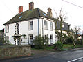
 Drayton House - geograph.org.uk - 1594062.jpg 640 × 455 ; 115 kio
-
 Duck's Foot Road - geograph.org.uk - 4339695.jpg 640 × 480 ; 125 kio
-
 Ducks Foot Road - geograph.org.uk - 4261314.jpg 3 072 × 2 304 ; 1,82 Mio
-
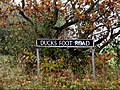 Ducks Foot Road sign - geograph.org.uk - 4261315.jpg 2 888 × 2 170 ; 3,89 Mio
-
 Ducks Foot Road, Bush Green - geograph.org.uk - 4261317.jpg 3 072 × 2 304 ; 2,52 Mio
-
 Ducks Foot Road, Bush Green - geograph.org.uk - 4261443.jpg 3 072 × 2 197 ; 2,04 Mio
-
 Entering Pulham Market - geograph.org.uk - 5166624.jpg 640 × 480 ; 92 kio
-
 Entering Pulham Market on Harleston Road - geograph.org.uk - 4260755.jpg 2 930 × 2 201 ; 2,68 Mio
-
 Entering Pulham Market on Tivetshall Road - geograph.org.uk - 4259470.jpg 2 872 × 2 158 ; 2,21 Mio
-
 Entrance from Cherry Lane Garden Centre - geograph.org.uk - 4262557.jpg 3 072 × 2 304 ; 1,56 Mio
-
 Entrance to Pulham Market Waste Transfer site - geograph.org.uk - 5141271.jpg 3 072 × 2 304 ; 1,86 Mio
-
 Field and mature hedgerow - geograph.org.uk - 5166571.jpg 640 × 480 ; 71 kio
-
 Field south of Harry's Lane, Colegate End - geograph.org.uk - 2149176.jpg 640 × 480 ; 152 kio
-
 Field towards Bale's Plantation - geograph.org.uk - 5166558.jpg 640 × 480 ; 79 kio
-
 Fields east of Poppy's Lane - geograph.org.uk - 2149269.jpg 640 × 469 ; 107 kio
-
 Footpath And Sign - geograph.org.uk - 4798340.jpg 1 024 × 768 ; 223 kio
-
 Footpath And Sign - geograph.org.uk - 5619452.jpg 768 × 1 024 ; 242 kio
-
 Footpath approaching the A140 (Norwich Road) - geograph.org.uk - 1596432.jpg 480 × 640 ; 195 kio
-
 Footpath off Hardwick Road to Foxholes Farm - geograph.org.uk - 4339700.jpg 640 × 480 ; 119 kio
-
 Footpath round the west edge of Tyrrel's Wood - geograph.org.uk - 2025648.jpg 768 × 1 024 ; 340 kio
-
 Footpath sign on Duck's Foot Road - geograph.org.uk - 4339693.jpg 640 × 480 ; 159 kio
-
 Footpath through Tyrrel's wood - geograph.org.uk - 2025647.jpg 1 024 × 768 ; 344 kio
-
 Footpath to Tivetshall St Margaret - geograph.org.uk - 1595953.jpg 480 × 640 ; 183 kio
-
 Ford at Colegate End - geograph.org.uk - 3841738.jpg 3 872 × 2 592 ; 4,76 Mio
-
 Former Pulham Market Station - geograph.org.uk - 5620452.jpg 5 184 × 2 920 ; 4,34 Mio
-
 Former railway station at Pulham Market - geograph.org.uk - 4432344.jpg 1 024 × 768 ; 381 kio
-
 Gates at Gothic House - geograph.org.uk - 1595505.jpg 640 × 511 ; 172 kio
-
 Gothic House - geograph.org.uk - 1595509.jpg 640 × 549 ; 144 kio
-
 Gray's Lane, Pulham Market - geograph.org.uk - 4259339.jpg 3 072 × 2 304 ; 2,14 Mio
-
 Grays Lane sign - geograph.org.uk - 4259342.jpg 2 914 × 2 189 ; 2,73 Mio
-
 Grazing, Cole's Common - geograph.org.uk - 5166577.jpg 640 × 480 ; 56 kio
-
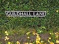 Guildhall Lane sign - geograph.org.uk - 4259506.jpg 3 072 × 2 304 ; 1,93 Mio
-
 Guildhall Lane, Pulham Market - geograph.org.uk - 4259502.jpg 3 072 × 2 304 ; 1,97 Mio
-
 Hardwick Road at the North Green Road junction - geograph.org.uk - 4339713.jpg 640 × 480 ; 124 kio
-
 Hardwick Road east of Cole's Common - geograph.org.uk - 2149226.jpg 640 × 480 ; 126 kio
-
 Hardwick Road near Willow Farm - geograph.org.uk - 4339705.jpg 640 × 480 ; 190 kio
-
 Hardwick Road sign - geograph.org.uk - 4261450.jpg 2 911 × 2 187 ; 3 Mio
-
 Hardwick Road, Bush Green - geograph.org.uk - 4261449.jpg 3 072 × 2 304 ; 2,79 Mio
-
 Hardwick, Goodies Food Hall - geograph.org.uk - 6430427.jpg 6 943 × 4 629 ; 4,83 Mio
-
 Hardwick, Tyrrel's Wood - geograph.org.uk - 6430390.jpg 5 175 × 3 451 ; 7,42 Mio
-
 Hardwick, Tyrrel's Wood car park - geograph.org.uk - 6430387.jpg 5 074 × 3 382 ; 5,67 Mio
-
 Hardwick, Tyrrel's Wood welcome sign - geograph.org.uk - 6430291.jpg 6 459 × 4 306 ; 7,04 Mio
-
 Hardwick, Tyrrel's Wood, Entrance to the car park from Wood Lane - geograph.org.uk - 6430399.jpg 6 699 × 4 466 ; 7,34 Mio
-
 Hardwick, Tyrrel's Wood, One of many clumps of primroses - geograph.org.uk - 6430292.jpg 5 697 × 3 797 ; 2,82 Mio
-
 Hardwick, Tyrrel's Wood, One of many clumps of primroses - geograph.org.uk - 6430394.jpg 5 815 × 3 877 ; 4,89 Mio
-
 Harleston Road past Drayton House - geograph.org.uk - 1594064.jpg 640 × 449 ; 125 kio
-
 Harry's Lane - geograph.org.uk - 5619447.jpg 1 024 × 768 ; 159 kio
-
 Harry's Lane from Colegate End Road - geograph.org.uk - 2149183.jpg 640 × 480 ; 82 kio
-
 Harry's Lane sign - geograph.org.uk - 4261233.jpg 3 029 × 2 276 ; 3,41 Mio
-
 Harry's Lane, Colegate End - geograph.org.uk - 2149171.jpg 640 × 480 ; 161 kio
-
 Harry's Lane, Colegate End - geograph.org.uk - 4261309.jpg 3 020 × 2 305 ; 2,07 Mio
-
 Heading south on Colegate End Road - geograph.org.uk - 5166615.jpg 640 × 480 ; 82 kio
-
 Hillcrest Court - geograph.org.uk - 4262537.jpg 3 072 × 2 304 ; 1,83 Mio
-
 House by Norwich Rd - geograph.org.uk - 4267604.jpg 640 × 430 ; 41 kio
-

-
 House in Bank Street - geograph.org.uk - 1594102.jpg 640 × 480 ; 112 kio
-
 Ipswich Road Postbox - geograph.org.uk - 4262512.jpg 3 072 × 2 304 ; 1,85 Mio
-
 Ipswich Road Postbox - geograph.org.uk - 4262515.jpg 3 072 × 2 304 ; 1,77 Mio
-
 Ipswich Road Postbox - geograph.org.uk - 4262517.jpg 2 304 × 3 072 ; 1,91 Mio
-
 Ipswich Road Postbox - geograph.org.uk - 4262521.jpg 3 072 × 2 304 ; 1,78 Mio
-
 Ipswich Road Postbox - geograph.org.uk - 4262539.jpg 3 072 × 2 304 ; 1,86 Mio
-
 Jimmy's cottage - geograph.org.uk - 2342852.jpg 640 × 480 ; 283 kio
-
 Jimmy's cottage - geograph.org.uk - 2342857.jpg 640 × 480 ; 268 kio
-
 Jimmy's cottage - peeling paint and wallpaper - geograph.org.uk - 2342954.jpg 640 × 492 ; 350 kio
-
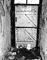 Jimmy's cottage - the back door - geograph.org.uk - 2342904.jpg 497 × 640 ; 263 kio
-
 Jimmy's cottage - the bathroom - geograph.org.uk - 2342959.jpg 480 × 640 ; 411 kio
-
 Jimmy's cottage - the coat rack - geograph.org.uk - 2342972.jpg 509 × 640 ; 427 kio
-
 Jimmy's cottage - the front door - geograph.org.uk - 2342933.jpg 480 × 640 ; 436 kio
-
 Jimmy's cottage - the kitchen - geograph.org.uk - 2342865.jpg 640 × 523 ; 455 kio
-
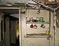 Jimmy's cottage - the kitchen - geograph.org.uk - 2342867.jpg 640 × 499 ; 366 kio
-
 Jimmy's cottage - the kitchen - geograph.org.uk - 2342877.jpg 498 × 640 ; 393 kio
-
 Jimmy's cottage - the kitchen - geograph.org.uk - 2342899.jpg 511 × 640 ; 193 kio
-
 Jimmy's cottage - the sitting room - geograph.org.uk - 2342912.jpg 640 × 475 ; 455 kio
-
 Jimmy's cottage - the sitting room - geograph.org.uk - 2342919.jpg 572 × 640 ; 548 kio
-
 Jimmy's cottage - the staircase - geograph.org.uk - 2342967.jpg 640 × 480 ; 413 kio
-
 Jimmy's cottage - writing on the wall - geograph.org.uk - 2342944.jpg 492 × 640 ; 344 kio
-
 Junction of Station Road with Bank Street - geograph.org.uk - 1594033.jpg 600 × 579 ; 99 kio
-
 Junction on Colegate End Road - geograph.org.uk - 5166611.jpg 640 × 480 ; 59 kio
-
 K6 telephone box in Colegate End - geograph.org.uk - 2149192.jpg 640 × 480 ; 110 kio
-
 Knotty Kott (detail) - geograph.org.uk - 1594098.jpg 503 × 640 ; 97 kio
-
 Knotty Kott - geograph.org.uk - 1594096.jpg 640 × 480 ; 93 kio
-
 Lane through Bush Green - geograph.org.uk - 2149503.jpg 640 × 480 ; 156 kio
-
 Layby on the A140 Ipswich Road - geograph.org.uk - 4234862.jpg 3 072 × 2 304 ; 1,95 Mio
-
 Minor Road - geograph.org.uk - 2170233.jpg 1 200 × 1 600 ; 456 kio
-
 Minor road junction on Common Road - geograph.org.uk - 5166579.jpg 640 × 480 ; 114 kio
-
 Minor road, Cole's Common - geograph.org.uk - 5166584.jpg 640 × 480 ; 109 kio
-
 Muddy field beside Poppy's Lane - geograph.org.uk - 2149274.jpg 640 × 480 ; 150 kio
-
 Near Hannah's Barn from Poppy Lane - geograph.org.uk - 4339688.jpg 640 × 480 ; 117 kio
-
 New Plantation - geograph.org.uk - 5166560.jpg 640 × 480 ; 70 kio
-
 North Green Road and Hardwick Road junction - geograph.org.uk - 4339711.jpg 640 × 480 ; 120 kio
-
 North Green Road, Hardwick - geograph.org.uk - 4339755.jpg 640 × 480 ; 125 kio
-
 North Green Road, North Green - geograph.org.uk - 4261738.jpg 3 072 × 2 304 ; 3,47 Mio
-
 North Green Road, North Green - geograph.org.uk - 4261789.jpg 3 072 × 2 304 ; 1,7 Mio
-
 North Green, Agricultural land - geograph.org.uk - 6040726.jpg 6 068 × 4 045 ; 5 Mio
-
 Northbound A140 - geograph.org.uk - 5877109.jpg 1 024 × 684 ; 287 kio
-
 Northbound A140 - geograph.org.uk - 5877117.jpg 1 024 × 684 ; 244 kio
-
 Norwich Rd - geograph.org.uk - 4267603.jpg 640 × 402 ; 63 kio
-
 Old Milestone - geograph.org.uk - 1256467.jpg 480 × 640 ; 109 kio
-

-
 Old Workhouse Chapel - geograph.org.uk - 4267609.jpg 640 × 357 ; 34 kio
-
 One Of Two Water Towers - geograph.org.uk - 320530.jpg 640 × 480 ; 62 kio
-
 Ordnance Survey Cut Mark - geograph.org.uk - 4206068.jpg 480 × 640 ; 107 kio
-
 Ordnance Survey Cut Mark - geograph.org.uk - 4208312.jpg 480 × 640 ; 131 kio
-
 Ordnance Survey Cut Mark - geograph.org.uk - 5764941.jpg 640 × 427 ; 80 kio
-
 Ordnance Survey Cut Mark - geograph.org.uk - 5764945.jpg 640 × 488 ; 78 kio
-
 Pasture south of St Mary Magdalene's church - geograph.org.uk - 1594077.jpg 640 × 480 ; 194 kio
-
 Pond in the hamlet of Bush Green - geograph.org.uk - 2149508.jpg 640 × 480 ; 182 kio
-
 Poppy's Lane, Pulham St. Mary - geograph.org.uk - 4339691.jpg 640 × 480 ; 116 kio
-
 Post Office The Green Postbox - geograph.org.uk - 4260828.jpg 3 072 × 2 304 ; 1,8 Mio
-
 Post Office The Green Postbox - geograph.org.uk - 4260829.jpg 2 304 × 3 072 ; 1,82 Mio
-
 Post Office The Green Postbox - geograph.org.uk - 4260831.jpg 2 304 × 3 072 ; 1,84 Mio
-
 Post Office The Green Postbox - geograph.org.uk - 4261247.jpg 3 072 × 2 304 ; 1,9 Mio
-
 Public footpath to Colegate End - geograph.org.uk - 2149236.jpg 640 × 480 ; 151 kio
-
 Pulham General Store and Post Office - geograph.org.uk - 1594035.jpg 640 × 443 ; 111 kio
-
 Old church A140 - geograph.org.uk - 134834.jpg 640 × 485 ; 76 kio
-
 Pulham Market - 1ax.jpg 3 680 × 2 104 ; 3,74 Mio
-
 Pulham Market - 4x.jpg 3 708 × 1 820 ; 1,73 Mio
-
 Pulham Market - Village Green - geograph.org.uk - 5620447.jpg 5 184 × 2 920 ; 3,58 Mio
-
 Pulham Market Post Office - geograph.org.uk - 4260794.jpg 3 072 × 2 304 ; 1,99 Mio
-
 Pulham Market Post Office - geograph.org.uk - 4260796.jpg 2 304 × 3 072 ; 1,79 Mio
-
 Pulham Market Surgery - geograph.org.uk - 6293356.jpg 6 394 × 4 262 ; 5,58 Mio
-
 Pulham Market Telephone Exchange - geograph.org.uk - 4259520.jpg 3 072 × 2 304 ; 3,76 Mio
-
 Pulham Market Telephone Exchange - geograph.org.uk - 4259521.jpg 2 304 × 3 072 ; 3,37 Mio
-
 Pulham Market Village Name sign - geograph.org.uk - 4260757.jpg 2 233 × 2 980 ; 2,97 Mio
-
 Pulham Market Village Name sign on Tivetshall Road - geograph.org.uk - 4259472.jpg 2 892 × 2 173 ; 2,3 Mio
-
 Pulham Market village sign - geograph.org.uk - 6676609.jpg 2 732 × 2 732 ; 996 kio
-
 Pulham Market village sign - geograph.org.uk - 6676612.jpg 4 608 × 3 072 ; 5,67 Mio


_-_geograph.org.uk_-_1596432.jpg)


_-_geograph.org.uk_-_1594098.jpg)


