Category:Pupplinger Au
Zur Navigation springen
Zur Suche springen
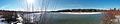
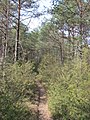
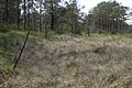
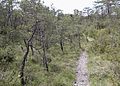
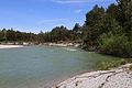
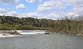
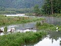
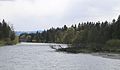
Deutsch: Gemeindefreies Gebiet Pupplinger Au im Landkreis Bad Tölz-Wolfratshausen, Oberbayern – Der Auwaldbereich ist Naturwaldreservat (09-085) und Teil des Naturschutzgebietes Isarauen zwischen Schäftlarn und Bad Tölz.
Gemeindefreies Gebiet im Landkreis Bad Tölz-Wolfratshausen in Bayern   | |||||
| Medium hochladen | |||||
| Ist ein(e) |
| ||||
|---|---|---|---|---|---|
| Benannt nach | |||||
| Liegt in Schutzgebiet | |||||
| Ort | Landkreis Bad Tölz-Wolfratshausen, Oberbayern, Bayern, Deutschland | ||||
| Liegt am oder im Gewässer | |||||
| Einwohnerzahl |
| ||||
| Fläche |
| ||||
 | |||||
Unterkategorien
Es werden 2 von insgesamt 2 Unterkategorien in dieser Kategorie angezeigt:
In Klammern die Anzahl der enthaltenen Kategorien (K), Seiten (S), Dateien (D)
M
Medien in der Kategorie „Pupplinger Au“
Folgende 151 Dateien sind in dieser Kategorie, von 151 insgesamt.
-
 Pupplinger Au in TÖL.svg 759 × 760; 590 KB
-
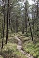
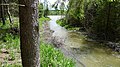
 20220611 Isar Pupplinger Au 01.jpg 6.016 × 4.016; 9,91 MB
-
 20220611 Isar Pupplinger Au 02.jpg 6.016 × 4.016; 9,57 MB
-
 20220611 Pupplinger Au 01.jpg 4.638 × 3.096; 4,17 MB
-
 20220611 Pupplinger Au 02.jpg 3.696 × 2.467; 3,13 MB
-
 20220611 Pupplinger Au 03.jpg 6.016 × 4.016; 14,76 MB
-
 An der Isar bei der Pupplinger Au, als 360 Panorama auf, bergnews.de - panoramio.jpg 11.626 × 2.335; 4,98 MB
-
 Auenkiefernwald.jpg 4.032 × 2.268; 4,69 MB
-
 Auwald in der Pupplinger Au - geo.hlipp.de - 12312.jpg 640 × 426; 379 KB
-
 Auwald in der Pupplinger Au 16.JPG 2.112 × 2.816; 3,01 MB
-
 Auwald Pupplinger Au-1.jpg 3.648 × 5.472; 6,96 MB
-
 Auwald Pupplinger Au-10.jpg 3.640 × 4.963; 6,22 MB
-
 Auwald Pupplinger Au-11.jpg 5.472 × 3.648; 5,06 MB
-
 Auwald Pupplinger Au-12.jpg 3.648 × 5.472; 6,11 MB
-
 Auwald Pupplinger Au-13.jpg 5.472 × 3.648; 6,69 MB
-
 Auwald Pupplinger Au-14.jpg 5.472 × 3.648; 6,8 MB
-
 Auwald Pupplinger Au-15.jpg 5.472 × 3.648; 7,26 MB
-
 Auwald Pupplinger Au-16.jpg 5.055 × 3.630; 6,25 MB
-
 Auwald Pupplinger Au-17.jpg 3.563 × 5.124; 3,73 MB
-
 Auwald Pupplinger Au-18.jpg 5.120 × 3.550; 4,83 MB
-
 Auwald Pupplinger Au-19.jpg 5.150 × 3.215; 4,84 MB
-
 Auwald Pupplinger Au-2.jpg 5.310 × 3.396; 5,87 MB
-
 Auwald Pupplinger Au-20.jpg 3.648 × 5.472; 6,17 MB
-
 Auwald Pupplinger Au-21.jpg 5.472 × 3.648; 6 MB
-
 Auwald Pupplinger Au-22.jpg 3.648 × 5.472; 4,81 MB
-
 Auwald Pupplinger Au-3.jpg 3.648 × 5.472; 7,22 MB
-
 Auwald Pupplinger Au-4.jpg 3.648 × 5.472; 7,59 MB
-
 Auwald Pupplinger Au-5.jpg 5.472 × 3.648; 5,81 MB
-
 Auwald Pupplinger Au-6.jpg 3.633 × 4.900; 4,66 MB
-
 Auwald Pupplinger Au-7.jpg 5.472 × 3.648; 6,4 MB
-
 Auwald Pupplinger Au-8.jpg 3.648 × 5.472; 6,63 MB
-
 Auwald Pupplinger Au-9.jpg 3.648 × 5.472; 6,97 MB
-
 Berg-Flockenblume (Centaurea montana).jpg 3.000 × 4.000; 2,35 MB
-
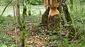
 Biberbiss in der Pupplinger Au 01.JPG 2.816 × 2.112; 2,51 MB
-
 Biberbissspuren Isar Pupplinger Au-1.jpg 3.648 × 5.472; 5,59 MB
-
 Biberbissspuren Isar Pupplinger Au-2.jpg 5.472 × 3.648; 5,39 MB
-
 Biberbissspuren Isar Pupplinger Au-3.jpg 5.472 × 3.648; 5,1 MB
-
 Blick über die Isar in der Pupplinger Au.JPG 2.816 × 2.112; 1,75 MB
-
 Daphne cneorum PupplingerAu Bavaria18052005b.jpg 474 × 589; 97 KB
-
 Daphne cneorum PupplingerAu Bavaria18052005c.jpg 426 × 632; 79 KB
-
 Die "Reißende" (Isar) bricht die Wege weg - panoramio.jpg 6.280 × 1.577; 1,72 MB
-
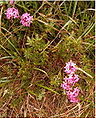
 Frauenschuh in der Pupplinger Au 2.jpg 3.160 × 2.084; 2,56 MB
-
 Frauenschuh in der Pupplinger Au.jpg 3.146 × 4.725; 1,23 MB
-
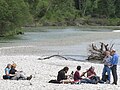
 Frühjahrswanderung 2017 - Pupplinger Au - 10.jpg 3.968 × 2.232; 2 MB
-
 Frühjahrswanderung 2017 - Pupplinger Au - 14.jpg 3.968 × 2.232; 2,5 MB
-
 Frühjahrswanderung 2017 - Pupplinger Au - 18.jpg 3.968 × 2.232; 3,11 MB
-
 Frühjahrswanderung 2017 - Pupplinger Au - 21.jpg 3.968 × 2.232; 3,3 MB
-
 Frühjahrswanderung 2017 - Pupplinger Au - 22.jpg 3.968 × 2.232; 3,37 MB
-
 Frühjahrswanderung 2017 - Pupplinger Au - 26.jpg 3.968 × 2.232; 3,93 MB
-
 Frühjahrswanderung 2017 - Pupplinger Au - 27.jpg 3.968 × 2.232; 3,5 MB
-
 Frühjahrswanderung 2017 - Pupplinger Au - 34.jpg 3.968 × 2.232; 3,16 MB
-
 Frühjahrswanderung 2017 - Pupplinger Au - 35.jpg 3.968 × 2.232; 2,93 MB
-
 Frühjahrswanderung 2017 - Pupplinger Au 03.jpg 3.968 × 2.232; 3,36 MB
-
 Frühjahrswanderung 2017 - Pupplinger Au 11.jpg 3.968 × 2.232; 2,2 MB
-
 Frühjahrswanderung 2017 - Pupplinger Au 13.jpg 3.968 × 2.232; 2,6 MB
-

-

-
 Hinweisschild Pupplinger Au-1.jpg 3.507 × 5.334; 2,13 MB
-
 In der Au - panoramio (1).jpg 1.920 × 2.560; 3,31 MB
-
 Isar bei München, Pupplinger Au 01.jpg 4.599 × 3.319; 5,24 MB
-
 Isar bei München, Pupplinger Au 02.jpg 3.298 × 2.383; 2,59 MB
-
 Isar bei Waldram (Foehrenwald) - panoramio.jpg 5.659 × 1.257; 1,47 MB
-
 Isar bei Wolfratshausen-2.jpg 1.332 × 1.776; 481 KB
-
 Isar in der Pupplinger Au.jpg 4.721 × 3.144; 2,48 MB
-
 Isar Nebenlauf Pupplinger Au-1.jpg 5.472 × 3.648; 6,36 MB
-
 Isar Nebenlauf Pupplinger Au-2.jpg 3.648 × 5.472; 5,43 MB
-
 Isar Nebenlauf Pupplinger Au-3.jpg 5.472 × 3.648; 5,28 MB
-
 Isar Nebenlauf Pupplinger Au-4.jpg 5.472 × 3.648; 5,64 MB
-
 Isar Nebenlauf Pupplinger Au-5.jpg 5.472 × 3.648; 6,07 MB
-
 Isar Nebenlauf Pupplinger Au-6.jpg 5.472 × 3.648; 7,23 MB
-
 Isar Nebenlauf Pupplinger Au-7.jpg 3.648 × 5.472; 5,59 MB
-
 Isar Nebenlauf Pupplinger Au-8.jpg 5.472 × 3.648; 5,12 MB
-
 Isar Nebenlauf Pupplinger Au-9.jpg 5.472 × 3.648; 4,93 MB
-
 Isar Pupplinger Au-1.jpg 5.330 × 3.475; 2,69 MB
-
 Isar Pupplinger Au-10.jpg 5.470 × 3.290; 2,95 MB
-
 Isar Pupplinger Au-11.jpg 5.472 × 3.648; 3,82 MB
-
 Isar Pupplinger Au-12.jpg 5.472 × 3.648; 4,63 MB
-
 Isar Pupplinger Au-13.jpg 5.472 × 3.648; 4,43 MB
-
 Isar Pupplinger Au-14.jpg 5.472 × 3.648; 4,67 MB
-
 Isar Pupplinger Au-15.jpg 5.450 × 2.920; 2,24 MB
-
 Isar Pupplinger Au-16.jpg 5.472 × 3.648; 4,77 MB
-
 Isar Pupplinger Au-17.jpg 5.305 × 3.485; 3,04 MB
-
 Isar Pupplinger Au-18.jpg 5.455 × 3.355; 3,95 MB
-
 Isar Pupplinger Au-19.jpg 5.472 × 3.648; 4,45 MB
-
 Isar Pupplinger Au-2.jpg 4.914 × 2.934; 2 MB
-
 Isar Pupplinger Au-20.jpg 5.472 × 3.648; 3,16 MB
-
 Isar Pupplinger Au-21.jpg 5.472 × 3.648; 4,48 MB
-
 Isar Pupplinger Au-22.jpg 5.472 × 3.648; 4,5 MB
-
 Isar Pupplinger Au-23.jpg 5.472 × 3.648; 3,76 MB
-
 Isar Pupplinger Au-24.jpg 5.080 × 3.595; 3,78 MB
-
 Isar Pupplinger Au-25.jpg 5.472 × 3.648; 4,51 MB
-
 Isar Pupplinger Au-26.jpg 5.472 × 3.648; 3,84 MB
-
 Isar Pupplinger Au-27.jpg 5.460 × 3.395; 4,01 MB
-
 Isar Pupplinger Au-28.jpg 5.472 × 3.648; 4,46 MB
-
 Isar Pupplinger Au-29.jpg 5.460 × 3.455; 4,72 MB
-
 Isar Pupplinger Au-3.jpg 5.467 × 3.325; 2,95 MB
-
 Isar Pupplinger Au-30.jpg 5.465 × 3.435; 3,78 MB
-
 Isar Pupplinger Au-31.jpg 5.465 × 3.625; 4,42 MB
-
 Isar Pupplinger Au-32.jpg 5.472 × 3.648; 4,28 MB
-
 Isar Pupplinger Au-33.jpg 5.465 × 3.495; 4,34 MB
-
 Isar Pupplinger Au-34.jpg 5.305 × 3.640; 4,57 MB
-
 Isar Pupplinger Au-35.jpg 5.472 × 3.648; 4,29 MB
-
 Isar Pupplinger Au-36.jpg 5.472 × 3.648; 4,22 MB
-
 Isar Pupplinger Au-37.jpg 5.472 × 3.648; 3,66 MB
-
 Isar Pupplinger Au-38.jpg 5.472 × 3.648; 4,36 MB
-
 Isar Pupplinger Au-4.jpg 5.472 × 3.648; 4,49 MB
-
 Isar Pupplinger Au-5.jpg 5.470 × 3.215; 2,69 MB
-
 Isar Pupplinger Au-6.jpg 5.470 × 3.465; 3,03 MB
-
 Isar Pupplinger Au-7.jpg 5.460 × 3.235; 2,84 MB
-
 Isar Pupplinger Au-8.jpg 5.472 × 3.648; 4,04 MB
-
 Isar Pupplinger Au-9.jpg 5.472 × 3.648; 4,13 MB
-
 Isar-Auwald bei Wolfratshausen.jpg 4.032 × 2.268; 4,38 MB
-
 Isar-Prallhang bei Wolfratshausen.jpg 4.032 × 1.908; 2,07 MB
-
 Isar-Pupplinger-Au.jpg 2.000 × 1.500; 1,76 MB
-

-
 Kunst an der Isar. - panoramio.jpg 5.044 × 1.730; 1,45 MB
-
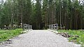
 Marienbruecke Pupplinger Au-1.jpg 5.345 × 3.100; 2,26 MB
-
 Murnau Werdenfelser Pupplinger Au Dunklere Rinder.jpg 4.608 × 3.456; 9,45 MB
-
 Murnau-Werdenfelser Rinder Pupplinger Au Detail.jpg 2.465 × 1.849; 2,89 MB
-
 Murnau-Werdenfelser Rinder Pupplinger Au.jpg 4.608 × 3.456; 11,63 MB
-
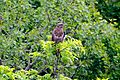 Mäusebussard (Buteo buteo).jpg 4.752 × 3.168; 3,64 MB
-
 Mündung des Loisach-Isar-Kanals in die Isar in der Pupplinger Au 01.JPG 2.816 × 2.112; 1,8 MB
-
 Mündung des Loisach-Isar-Kanals in die Isar in der Pupplinger Au 02.JPG 2.816 × 2.112; 2,51 MB
-
 Nördlich Marienbrücke Wolfratshausen - panoramio.jpg 1.678 × 1.650; 612 KB
-
 Prachtlibelle Pupplinger Au.jpg 1.600 × 1.200; 419 KB
-
 Prallhang in der Pupplinger Au.JPG 2.816 × 2.112; 2,58 MB
-
 Pupplinger Au 1.jpg 1.600 × 1.200; 519 KB
-
 Pupplinger Au 2.jpg 1.600 × 1.200; 504 KB
-
 Pupplinger Au 3.jpg 1.600 × 1.200; 506 KB
-
 Pupplinger Au 4.jpg 1.600 × 1.200; 499 KB
-
 Pupplinger Au Kiefern.jpg 4.608 × 3.456; 10,71 MB
-
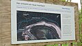
 Pupplinger Au Landschafts- und Naturschutzgebiet.jpg 3.648 × 3.648; 6,74 MB
-
 Pupplinger Au von der Weißen Wand.jpg 4.262 × 1.861; 8,52 MB
-
 Pupplinger Au-2.jpg 2.048 × 1.536; 2,01 MB
-
 Pupplinger Au-3.jpg 2.048 × 1.536; 1,43 MB
-
 Pupplinger Au-4.jpg 2.048 × 1.536; 1,58 MB
-
 Pupplinger Au.jpg 2.048 × 1.536; 1,57 MB
-
 Radweg durch die Pupplinger Au - geo.hlipp.de - 12311.jpg 640 × 426; 401 KB
-
 Schleusenhaus Wehrbaustraße 2 in Egling.jpg 4.032 × 1.908; 2,89 MB
-
 Sonderschild Naturschutzgebiet, Bayerisches Landesamt für Umwelt.png 1.804 × 2.380; 5,69 MB
-
 Tuempel Pupplinger Au-1.jpg 5.472 × 3.648; 5,19 MB
-
 Warten auf den Frühling.jpg 1.600 × 1.200; 881 KB
-
 Weiden auf Kiesflaeche Pupplinger Au-1.jpg 5.472 × 3.648; 7,18 MB
-
 Wiki MUC am Isarstrand.JPG 4.000 × 3.000; 2,52 MB
-
 Winter in der Flößerstadt (Panorama vom 16.12.10) - panoramio.jpg 5.016 × 706; 653 KB
-
 Wo sich Isar und Loisach vereinen ... - panoramio.jpg 9.808 × 2.376; 5,39 MB
-

-
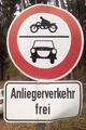 Zeichen 252 mit dem Zusatzschild „Anliegerverkehr frei“, StVO 1970.png 1.200 × 1.800; 2,74 MB
-
 Zeichen 252 mit Zusatzschild „Anliegerverkehr frei“, StVO 1970.png 1.710 × 2.499; 5,32 MB
-
 Zeichen 283 M mit Zusatzschild 744, StVO 1970.png 1.836 × 2.535; 6,4 MB
-
 Zeichen 314 mit den Zusatzschildern 704, 724d und 724l, StVO 1970.png 1.827 × 2.561; 6,74 MB


.jpg)


_2020..JPG)
_2020.JPG)

.jpg)


_in_Egling,_Bavaria-Q98742295.jpg)


.jpg)


_bricht_die_Wege_weg_-_panoramio.jpg)
_-_panoramio.jpg)
_-_panoramio.jpg)