Category:Pwani Region
Salti al navigilo
Salti al serĉilo
region of Tanzania  orbinder hovedstaden Dar-es-Salaam med de nordlige delene av landet  | |||||
| Alŝuti plurmedion | |||||
| Estas | |||||
|---|---|---|---|---|---|
| Loko | Tanzanio | ||||
| Ĉefurbo | |||||
| Loĝantaro |
| ||||
| Areo |
| ||||
| oficiala retejo | |||||
 | |||||
Subkategorioj
Ĉi tiu kategorio havas la 8 jenajn subkategoriojn, el 8 entute.
B
K
- Kichi Hills Forest Reserve (1 D)
L
- Lake Ruwe (1 D)
M
- Maps of Pwani Region (24 D)
P
- Pugu Hills Forest Reserve (10 D)
S
Dosieroj en kategorio “Pwani Region”
La jenaj 107 dosieroj estas en ĉi tiu kategorio, el 107 entute.
-
 13th Century Grave in Kaole Town, Dunda ward, Bagamoyo DC, Pwani.jpg 5 704 × 3 814; 8,48 MB
-
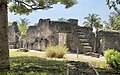 13th Century Mosque at Kaole Ruins, Bagamoyo, Pwani.jpg 3 800 × 2 381; 3,6 MB
-
 15th Century Graves at Kaole Ruins, Bagamoyo, Pwani.jpg 7 055 × 4 499; 16,7 MB
-
 15th Century Mosque at Kaole Ruins, Bagamoyo, Pwani.jpg 4 032 × 3 024; 5,83 MB
-
 15th Century Mosque deatil at Kaole Ruins, Bagamoyo, Pwani.jpg 2 782 × 3 710; 5,21 MB
-
 15th Century well at Kaole Ruins, Bagamoyo, Pwani.jpg 6 990 × 6 017; 13,88 MB
-
 500 year old baobab at Kaole Ruins, Bagamoyo, Pwani.jpg 3 024 × 4 032; 4,92 MB
-
 Absolution area at Kaole Ruins, Bagamoyo, Pwani.jpg 6 048 × 6 421; 20,87 MB
-
 Antiris toxicaria moraceae tree in Vikindu Forest Reserve, Mkuranga DC, Pwani.jpg 3 024 × 4 032; 4,79 MB
-
 Bagamoyo View.jpg 1 820 × 1 365; 1,08 MB
-
 Beautiful ruins at Kaole Ruins, Bagamoyo, Pwani.jpg 3 024 × 3 270; 3,76 MB
-
 Bridge in Vikindu Forest Reserve, Mkuranga DC, Pwani.jpg 3 024 × 2 484; 4,21 MB
-
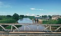 Bridge over Ruvu, Mlandizi Ward.jpg 4 030 × 2 423; 3,72 MB
-
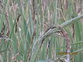
 Burhinus vermiculatus 37722088.jpg 1 801 × 1 794; 621 KB
-
 Chalinze District Capital, Bwilingu ward, Chalinze DC.jpg 1 630 × 1 187; 598 KB
-
 Chameleon in Vikindu Forest Reserve, Mkuranga DC, Pwani.jpg 2 273 × 2 141; 1,47 MB
-
 Child's grave at Kaole Ruins, Bagamoyo, Pwani.jpg 8 064 × 6 048; 18,98 MB
-
 Classic Bagamoyo Street in Bagamoyo, Pwani.jpg 2 650 × 3 533; 2,64 MB
-
 Cleared lands for irrigated rice development - panoramio (1).jpg 4 000 × 3 000; 4,82 MB
-
 Cleared lands for irrigated rice development - panoramio.jpg 4 000 × 3 000; 4,61 MB
-
 Close up of Historic Bagamoyo Sign.jpg 2 468 × 1 639; 1,15 MB
-
 Coral rag detail at Kaole Ruins, Bagamoyo, Pwani.jpg 6 636 × 4 977; 14,05 MB
-
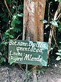
 Detail of Milletia pugunsis Pugu Hills, Kisarawe, Kisarawe DC, Pwani.jpg 2 510 × 2 978; 3,38 MB
-
 District Capital 2, Bwilingu ward, Chalinze DC.jpg 4 032 × 3 024; 3,25 MB
-
 District Capital, Bwilingu ward, Chalinze DC.jpg 3 024 × 1 970; 1,76 MB
-
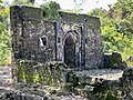
 Doorway at 13th Century Mosque at Kaole Ruins, Bagamoyo, Pwani.jpg 2 864 × 3 046; 4,28 MB
-
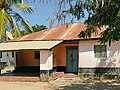
 Farmhouse in Msata Ward, Pwani.jpg 4 030 × 2 681; 3,05 MB
-
 Grave at Kaole Ruins, Bagamoyo, Pwani.jpg 3 024 × 3 448; 5,4 MB
-
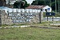
 Historic Bagamoyo Sign.jpg 3 024 × 2 319; 2,44 MB
-
 House window on Jibondo Island, Mafia District.jpg 1 001 × 1 241; 538 KB
-
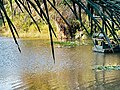
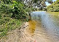
 Hut Near Lake Shore.jpg 2 736 × 4 864; 5,82 MB
-
 Hymenaea verrucosa Pugu Hills, Kisarawe, Kisarawe DC, Pwani.jpg 2 264 × 3 537; 4,04 MB
-
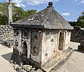
 Kaole Museum at Kaole Ruins, Bagamoyo, Pwani.jpg 3 759 × 2 454; 5,04 MB
-
 Kaole port sign at Kaole Ruins, Bagamoyo, Pwani.jpg 4 249 × 3 164; 7,72 MB
-
 Kitopeni ward, Bagamoyo DC.jpg 2 956 × 2 683; 3,59 MB
-
 KUVUNJA UNGO TRADITION IN PWANI TANZANIA.jpg 2 976 × 1 984; 1,76 MB
-
 Lake Miwaleni 3 Vikindu Forest Reserve, Mkuranga DC, Pwani.jpg 4 032 × 2 837; 7,27 MB
-
 Lake Miweleni 2 in Vikindu Forest Reserve, Mkuranga DC, Pwani.jpg 3 909 × 2 689; 5,84 MB
-
 Lake Miweleni in Vikindu Forest Reserve, Mkuranga DC, Pwani.jpg 2 624 × 1 968; 2,71 MB
-
 Lungs of Dar in Pugu Hills, Kisarawe, Kisarawe DC, Pwani.jpg 3 024 × 4 032; 4,96 MB
-
 Mandera Ward Landscape.jpg 4 030 × 1 583; 2,07 MB
-
 Masjid Taqwa, Kibaha ward, Kibaha TC, Pwani Region.jpg 2 449 × 3 310; 2,97 MB
-
 Mbwewe Ward Landscape, Chalinze District.jpg 4 032 × 3 024; 4,83 MB
-
 Milletia puguensis in Pugu Hills, Kisarawe, Kisarawe DC, Pwani.jpg 1 494 × 1 667; 1,45 MB
-
 Minaki dam in Pugu Hills, Kisarawe, Kisarawe DC, Pwani.jpg 4 032 × 3 024; 6,6 MB
-
 Minaki dam of Pugu Hills, Kisarawe, Kisarawe DC, Pwani.jpg 4 032 × 3 024; 6,7 MB
-
 Minaki dam view Pugu Hills, Kisarawe, Kisarawe DC, Pwani.jpg 4 032 × 3 024; 5,53 MB
-
 Ming pottery at Kaole Ruins, Bagamoyo, Pwani.jpg 4 032 × 3 024; 2,13 MB
-
 Mkongo tree in Pugu Hills,Kisarawe, Kisarawe DC, Pwani.jpg 2 259 × 2 500; 2,75 MB
-
 Mkongo tree seed, Pugu Hills, Kisarawe, Kisarawe DC, Pwani.jpg 2 937 × 3 421; 2,57 MB
-
 Mlandizi Ward Landscape.jpg 4 032 × 3 024; 4,67 MB
-
 Mosque in Kaole, in Bagamoyo, Pwani.jpg 3 573 × 4 763; 6,03 MB
-
 Mpugupugu tree in Pugu Hills, Kisarawe, Kisarawe DC, Pwani.jpg 2 665 × 2 828; 4,34 MB
-
 Msata Ward Landscape, Chalinze.jpg 3 017 × 1 710; 2,49 MB
-
 Msolo peak in Pugu Hills, Kisarawe, Kisarawe DC, Pwani.jpg 3 024 × 2 418; 3,79 MB
-
 Msolo peak sign at peak, Pugu Hills, Kisarawe, Kisarawe DC, Pwani.jpg 3 024 × 2 267; 3,43 MB
-
 Near Bagamoyo Port.jpg 5 540 × 4 160; 5,46 MB
-
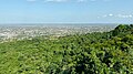
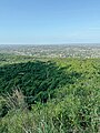 North Dar from Pugu Hills, Kisarawe, Kisarawe DC, Pwani.jpg 3 024 × 4 032; 6,47 MB
-
 Old 13th Century well at Kaole Ruins, Bagamoyo, Pwani.jpg 8 064 × 6 048; 19,56 MB
-

-
 Opilia amentacea in Pugu Hills, Kisarawe, Kisarawe DC, Pwani.jpg 3 024 × 4 032; 5,3 MB
-
 Outskirts of Dunda, Bagamoyo DC.jpg 5 616 × 3 216; 5,06 MB
-
 Papilio rex.JPG 887 × 498; 55 KB
-
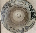 Pottery 2 at Kaole Ruins, Bagamoyo, Pwani.jpg 2 670 × 2 502; 1,05 MB
-
 Pottery 3 at Kaole Ruins, Bagamoyo, Pwani.jpg 3 024 × 2 848; 1,78 MB
-
 Pottery 4 at Kaole Ruins, Bagamoyo, Pwani.jpg 2 984 × 3 043; 1,77 MB
-
 Pottery at Kaole Ruins, Bagamoyo, Pwani.jpg 2 986 × 3 321; 2,93 MB
-
 Pugu hills panorama Pugu Hills, Kisarawe, Kisarawe DC, Pwani.jpg 3 024 × 2 267; 3,45 MB
-
 Pugu Hills, Kisarawe, Kisarawe DC, Pwani.jpg 4 032 × 3 024; 6,02 MB
-
 Rice cultivation near the Rufiji river - panoramio.jpg 4 000 × 3 000; 4,71 MB
-
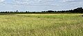 Rice fields in Dunda ward, Bagamoyo DC.jpg 4 390 × 1 934; 3,77 MB
-
 Rice fields in Mlandizi Ward.jpg 3 014 × 1 861; 1,68 MB
-
 Rice harvest.jpg 4 608 × 3 456; 3,99 MB
-
 River Mkangazi Bridge in Vikindu Forest Reserve, Mkuranga DC, Pwani.jpg 2 962 × 2 916; 5,5 MB
-
 Road in Pugu Hills, Kisarawe, Kisarawe DC, Pwani.jpg 3 024 × 1 700; 2,72 MB
-
 Ruvu River in Pwani.jpg 1 947 × 1 460; 812 KB
-
 Scene at Lake Miwaleni Vikindu Forest Reserve, Mkuranga DC, Pwani.jpg 2 812 × 2 109; 3,21 MB
-
 School in Vigwaza Ward, Chalinze District.jpg 2 951 × 1 903; 1,72 MB
-
 Sharifa's tomb at Kaole Ruins, Bagamoyo, Pwani.jpg 7 070 × 6 048; 17,51 MB
-
 Sharifa's Tomb sign at Kaole Ruins, Bagamoyo, Pwani.jpg 7 934 × 5 587; 12,73 MB
-
 Sign at Kaole Ruins, Bagamoyo, Pwani.jpg 2 881 × 1 965; 1,83 MB
-
 Sign at Minaki dam of Pugu Hills, Kisarawe, Kisarawe DC, Pwani.jpg 2 740 × 3 346; 4,8 MB
-
 South Dar from Pugu Hills, Kisarawe, Kisarawe DC, Pwani.jpg 4 031 × 2 267; 5,12 MB
-
 Southern Dar from v.jpg 4 032 × 3 024; 7,21 MB
-
 Store at Zinga ward, Bagamoyo DC.jpg 3 776 × 2 693; 4,52 MB
-
 Stream in Vikindu Forest Reserve, Mkuranga DC, Pwani.jpg 3 024 × 3 024; 5,59 MB
-
 Street in Mlandizi Town.jpg 4 032 × 3 024; 4,57 MB
-
 Swahili architecture in Bagamoyo, Pwani.jpg 2 168 × 2 890; 1,69 MB
-
 Swahili details at Kaole Ruins, Bagamoyo, Pwani.jpg 5 442 × 5 323; 10,68 MB
-
 Swahili door 2 in Bagamoyo, Pwani.jpg 1 841 × 2 453; 1,21 MB
-
 Swahili door 3 in Bagamoyo, Pwani.jpg 6 048 × 8 064; 19,64 MB
-
 Swahili door 5 in Bagamoyo, Pwani.jpg 8 063 × 6 046; 13,43 MB
-
 Swahili door in Bagamoyo, Pwani.jpg 3 024 × 4 031; 3,45 MB
-
 Swahili house in Kaole 2 in Bagamoyo, Pwani.jpg 2 544 × 1 907; 1,09 MB
-
 Swahili house in Kaole, Bagamoyo, Pwani.jpg 5 562 × 4 170; 6,75 MB
-
 Swahili house, Bagamoyo.jpg 2 825 × 3 535; 2,03 MB
-
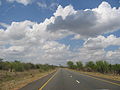 T2 road Tanzania Dar-Tanga.jpg 2 272 × 1 704; 758 KB
-
 Tanzanian Grasshopper, Kisarawe, Kisarawe DC, Pwani.jpg 3 024 × 4 032; 7,43 MB
-
 Tent at Minaki dam of Pugu Hills, Kisarawe, Kisarawe DC, Pwani.jpg 4 032 × 3 024; 6,22 MB
-
 The great Tomb Pillar of Khalid at Kaole Ruins, Bagamoyo, Pwani.jpg 6 048 × 8 064; 12,55 MB
-
 Trees in Vikindu Forest Reserve, Mkuranga DC, Pwani.jpg 3 024 × 3 024; 4,46 MB
-
 Vigwaza Landscape.jpg 3 818 × 2 533; 3,56 MB
-
 Vikindu Coconuts.jpg 3 697 × 2 773; 4,78 MB
-
 Water lilies in Lake Miwaleni Vikindu Forest Reserve, Mkuranga DC, Pwani.jpg 3 296 × 2 022; 3,88 MB
-
 Water of Minaki dam,Pugu Hills, Kisarawe, Kisarawe DC, Pwani.jpg 3 902 × 2 815; 6,26 MB
-
 Western Dar from Pugu Hills, Kisarawe, Kisarawe DC, Pwani.jpg 4 032 × 3 024; 7,35 MB
-
 Whats left at Kaole Ruins, Bagamoyo, Pwani.jpg 3 971 × 2 538; 5,56 MB


.jpg)