Category:Pwllheli
Aller à la navigation
Aller à la recherche
Cymraeg: Tref hynafol yw Pwllheli ar arfordir deheuol Llŷn yng Ngwynedd, Cymru, sy'n dyddio'n ôl i'r canol oesoedd. Bu'r porthladd yn bwysig i'r dref ar hyd y canrifoedd. Roedd yno ddiwydiant adeiladu llongau llewyrchus yn y bedwaredd ganrif a'r bymtheg. Tyfodd i fod yn dref marchnad i Lŷn gyfan, fel y tystia'r safle a adwaenir fel 'Y Maes' lle y cynhelid y ffeiriau, a 'Stryd Moch'.
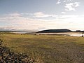
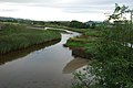
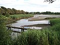
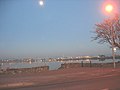
English: Pwllheli is a community and the main market town of the Llŷn Peninsula in Gwynedd, north-western Wales. It has a large Welsh-speaking population (81% in 2001). Pwllheli is the place where Plaid Cymru was founded. It is the birthplace of Albert Evans-Jones - Cynan - the Welsh poet.
Euskara: Pwllheli Llŷn penintsulako herririk nagusiena da, Gwynedd eskualdean, Gales-ko ipar mendebaldean. Gales Hiztunen populaketa oso handi baten jabe da. Pwllheli herria da Plaid Cymru alderdi politikoa sortu zen lekua. Albert Evans-Jones - Cynan - galestar olerkilari edo poetaren jaiolekua da.
Ирон: Пулхели у сахар Уэльсы цæгаты.
Svenska: Pwllheli (uttalas enligt IPA [pʊɬhɛlɪ]) är den huvudsakliga orten på Llŷnhalvön i nordvästra Wales. Befolkningen är huvudsakligen kymrisktalande, och det walesiska nationalistpartiet Plaid Cymru grundades här. Pwllheli har 3 861 invånare enligt 2001 års folkräkning och ligger i grevskapet Gwynedd.
localité britannique  | |||||
| Téléverser des médias | |||||
| Nature de l’élément | |||||
|---|---|---|---|---|---|
| Lieu | Gwynedd, pays de Galles | ||||
| Population |
| ||||
| Superficie |
| ||||
| Réputé identique à | Pwllheli | ||||
 | |||||
Sous-catégories
Cette catégorie comprend 16 sous-catégories, dont les 16 ci-dessous.
*
C
G
- Gimlet quarry (1 F)
H
- Houses in Pwllheli (15 F)
J
- Albert Evans-Jones (9 F)
M
N
- Neuadd Dwyfor (2 F)
P
- Plaques in Pwllheli (11 F)
- Pwllheli cemetery (24 F)
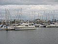
- Pwllheli harbour (29 F)
- Pwllheli Lifeboat Station (5 F)
S
T
W
- Pwllheli War Memorial (9 F)
Média dans la catégorie « Pwllheli »
Cette catégorie comprend 667 fichiers, dont les 200 ci-dessous.
(page précédente) (page suivante)-
 "Boy James" riding high at full tide - geograph.org.uk - 2005984.jpg 1 024 × 767 ; 170 kio
-
 "The most exciting modern house in Pwllheli" - geograph.org.uk - 345286.jpg 640 × 512 ; 79 kio
-
 17 Black Arrow Summer School students at camp at Pwllheli, North Wales.jpg 1 670 × 983 ; 567 kio
-

-
 A green at Pwllheli Golf Club - geograph.org.uk - 2086685.jpg 1 024 × 768 ; 271 kio
-
 A handy mode of transport seen on the quay at Pwllheli - geograph.org.uk - 1940264.jpg 1 024 × 780 ; 287 kio
-
 A new boat yard in Pwllheli (18898192129).jpg 600 × 452 ; 121 kio
-
 A new boat yard in Pwllheli (7000049027).jpg 600 × 460 ; 130 kio
-

-
 A patriotic amusement arcade - geograph.org.uk - 609091.jpg 640 × 521 ; 88 kio
-
 A Pwllheli jigger - geograph.org.uk - 604644.jpg 640 × 480 ; 74 kio
-
 A rear view of Pwllheli's Railway Station - geograph.org.uk - 1841784.jpg 1 024 × 590 ; 126 kio
-
 A sylvan Lon Denio near the old stone quarries - geograph.org.uk - 1921134.jpg 1 024 × 768 ; 340 kio
-
 A trimaran in the Inner Harbour at Pwllheli - geograph.org.uk - 2117391.jpg 1 024 × 768 ; 153 kio
-
 A view from Pwllheli from the railway NLW3362123.jpg 597 × 458 ; 52 kio
-
 A view of Pwllheli and the bay from Cam y Gwrda NLW3362120.jpg 596 × 454 ; 41 kio
-
 A view of Pwllheli from Pencraig Fawr (c 1885) NLW3362122.jpg 589 × 453 ; 47 kio
-
 A view of Pwllheli from the railway NLW3362121.jpg 594 × 450 ; 52 kio
-
 A497 below Allt Fawr leaving Pwllheli - geograph.org.uk - 3198640.jpg 640 × 508 ; 52 kio
-
 A499 at Lon Nant-Stigallt junction - geograph.org.uk - 3201169.jpg 640 × 447 ; 55 kio
-
 Aberech Road into Pwllheli - geograph.org.uk - 5244216.jpg 1 500 × 999 ; 220 kio
-
 Abererch Sands - geograph.org.uk - 27124.jpg 640 × 480 ; 57 kio
-
 Above the tidal gates on Ffordd-y-Cob-Embankment Road - geograph.org.uk - 4733974.jpg 4 608 × 3 456 ; 4,03 Mio
-

-

-

-
 ACF Clwyd a Gwynedd - geograph.org.uk - 4151420.jpg 4 000 × 3 000 ; 2,68 Mio
-
 Across the harbour entrance at Pwllheli - geograph.org.uk - 4211758.jpg 640 × 480 ; 71 kio
-

-

-
 Admiralty Chart No 1505 St.Tudwall's and Pwllheli Roads, Published 1891.jpg 13 699 × 10 879 ; 55,24 Mio
-
 Afon Dwyryd at Pont y Ddwyryd - geograph.org.uk - 1919692.jpg 1 024 × 768 ; 327 kio
-
 Afon Erch immediately above the new flood gates - geograph.org.uk - 1939738.jpg 1 024 × 768 ; 252 kio
-
 Afon Erch Pwllheli - geograph.org.uk - 542934.jpg 640 × 428 ; 128 kio
-
 Afon Penrhos above the footbridge - geograph.org.uk - 1919273.jpg 1 024 × 768 ; 298 kio
-
 Afon Penrhos below the footbridge - geograph.org.uk - 1923905.jpg 1 024 × 768 ; 257 kio
-
 Afon Rhyd Hir - geograph.org.uk - 3270604.jpg 4 000 × 3 000 ; 2,7 Mio
-
 Afon Rhyd-hir - geograph.org.uk - 5754366.jpg 640 × 480 ; 90 kio
-
 Afon Rhyd-hir - geograph.org.uk - 664192.jpg 640 × 480 ; 75 kio
-
 Afon Rhyd-hir behind the floodgate at low water - geograph.org.uk - 2006156.jpg 1 024 × 768 ; 236 kio
-
 Afon Rhyd-hir below Pont y Garreg-fechan - geograph.org.uk - 2096829.jpg 1 024 × 768 ; 93 kio
-
 Afon Rhyd-hir below Pont y Garreg-fychan - geograph.org.uk - 2086663.jpg 1 024 × 768 ; 198 kio
-
-
 Afon Rhyd-hir below the footpath bridge - geograph.org.uk - 2086665.jpg 1 024 × 768 ; 262 kio
-
 Afon Rhyd-hir from Y Cob- The Embankment - geograph.org.uk - 2204359.jpg 1 024 × 752 ; 159 kio
-
 Afon Rhydhir - geograph.org.uk - 543044.jpg 640 × 428 ; 124 kio
-

-
 Afon Rhydhir from the bus station - geograph.org.uk - 609191.jpg 640 × 480 ; 56 kio
-
 Ailgylchu Llechi - Recycling Slates - geograph.org.uk - 646883.jpg 640 × 428 ; 65 kio
-
 Ala Road in Pwllheli - geograph.org.uk - 5246106.jpg 1 500 × 986 ; 160 kio
-
 Alarch a'i deulu - Swan and its family - geograph.org.uk - 530486.jpg 640 × 428 ; 157 kio
-
 Allt Salem, Pwllheli, and a bench mark - geograph.org.uk - 4735983.jpg 4 608 × 3 456 ; 5,44 Mio
-
 Along South Beach - geograph.org.uk - 6081791.jpg 1 024 × 683 ; 417 kio
-
-
 Apartments on Caernarfon Road - geograph.org.uk - 1842198.jpg 1 024 × 649 ; 108 kio
-
 Apartments on Caernarfon Road, Pwllheli - geograph.org.uk - 1929706.jpg 1 024 × 498 ; 128 kio
-
 Approaching Pont Ddwyryd - geograph.org.uk - 1921475.jpg 1 024 × 767 ; 239 kio
-
 Arriva Train at Pwllheli, Gwynedd - geograph.org.uk - 3366729.jpg 4 000 × 2 666 ; 6,16 Mio
-
 Arrival at Pwllheli, Gwynedd - geograph.org.uk - 3366727.jpg 4 000 × 2 666 ; 6,76 Mio
-
 ASDA superstore Pwllheli - geograph.org.uk - 6280863.jpg 640 × 340 ; 61 kio
-
 ASDA, Pwllheli - geograph.org.uk - 3945254.jpg 640 × 480 ; 56 kio
-
 Awel y Môr - geograph.org.uk - 4844949.jpg 3 872 × 2 592 ; 2,34 Mio
-
 Awel y Môr - geograph.org.uk - 4844952.jpg 3 872 × 2 592 ; 2,34 Mio
-
 Awel-y-môr - geograph.org.uk - 3409146.jpg 4 000 × 3 000 ; 2,77 Mio
-
 Awel-y-môr - geograph.org.uk - 3409158.jpg 4 000 × 3 000 ; 2,09 Mio
-
 Awel-y-môr - geograph.org.uk - 3409167.jpg 4 000 × 3 000 ; 1,97 Mio
-
 Awel-y-môr - geograph.org.uk - 3409172.jpg 4 000 × 3 000 ; 1,9 Mio
-
 Awel-y-môr - geograph.org.uk - 3409176.jpg 4 000 × 3 000 ; 1,96 Mio
-
 Awel-y-môr - geograph.org.uk - 3409179.jpg 4 000 × 3 000 ; 1,96 Mio
-
 Awel-y-môr - geograph.org.uk - 3409185.jpg 4 000 × 3 000 ; 1,87 Mio
-
 Bardsey Island. - panoramio (3).jpg 3 648 × 2 736 ; 3,56 Mio
-
 Bay to the east of Pwllheli harbour - geograph.org.uk - 4897620.jpg 640 × 480 ; 69 kio
-
 Beach at Pwllheli - geograph.org.uk - 6078468.jpg 1 024 × 683 ; 453 kio
-
 Bench mark in Allt Salem, Pwllheli - geograph.org.uk - 4735975.jpg 4 213 × 3 163 ; 4,79 Mio
-
 Bench mark in Pentre Poeth-North Street, Pwllheli - geograph.org.uk - 4735867.jpg 4 608 × 3 456 ; 6,78 Mio
-
 Bench mark on Brynhyfryd gatepost, Pwllheli - geograph.org.uk - 4735326.jpg 4 608 × 3 456 ; 6,8 Mio
-
 Bench mark on Pwllheli Police Station - geograph.org.uk - 4736023.jpg 3 935 × 2 958 ; 2,88 Mio
-
 Bench mark on the Tower Hotel, Pwllheli - geograph.org.uk - 4735272.jpg 4 608 × 3 456 ; 3,08 Mio
-
 Bench mark on Whitehall wine bar in Penlon Llyn-Lleyn Street - geograph.org.uk - 4735166.jpg 4 169 × 3 127 ; 3,29 Mio
-
 Black sheep, Pwllheli - geograph.org.uk - 6051984.jpg 4 288 × 3 216 ; 3,57 Mio
-
 Boats at their moorings at Pwllheli - geograph.org.uk - 2117385.jpg 1 024 × 768 ; 143 kio
-
 Boatyard ^ cranes - geograph.org.uk - 4429016.jpg 1 600 × 1 200 ; 459 kio
-
 Bodawen - geograph.org.uk - 644900.jpg 640 × 428 ; 33 kio
-
 Boy James houseboat - geograph.org.uk - 1842079.jpg 1 024 × 768 ; 203 kio
-
 Branching Out (218600269).jpeg 2 048 × 1 152 ; 267 kio
-
 Bridge with sluice gates over the river Erch - geograph.org.uk - 6051992.jpg 4 288 × 3 216 ; 3,78 Mio
-
 Bridges over Afon Erch - geograph.org.uk - 1028219.jpg 640 × 480 ; 197 kio
-
 Bro Llwyn Estate, Ala Road, Pwllheli - geograph.org.uk - 2086638.jpg 1 024 × 766 ; 148 kio
-
 Bungalows and houses on Yr Ala Estate, Pwllheli - geograph.org.uk - 1937524.jpg 1 024 × 768 ; 156 kio
-
 Bungalows at Marian y Mor, Pwllheli - geograph.org.uk - 1923530.jpg 1 024 × 768 ; 246 kio
-
 Bungalows at the western end of Pwllheli's promenade - geograph.org.uk - 1923021.jpg 1 024 × 653 ; 111 kio
-
 Bungalows in Lon Glen Elen - geograph.org.uk - 1835918.jpg 1 024 × 768 ; 186 kio
-
 Bungalows on Yr Ala Estate - geograph.org.uk - 2086650.jpg 1 024 × 768 ; 171 kio
-
 Bunker and green, Pwllheli golf course - geograph.org.uk - 5753691.jpg 640 × 480 ; 63 kio
-
-
 Business Park, Pwllheli - geograph.org.uk - 1029043.jpg 640 × 480 ; 136 kio
-
 Caeau'r Ysgol - School Fields - geograph.org.uk - 5754384.jpg 640 × 480 ; 100 kio
-
 Camellia - geograph.org.uk - 679056.jpg 640 × 428 ; 95 kio
-
 Camellia - geograph.org.uk - 679057.jpg 640 × 428 ; 47 kio
-
 Capel Penmount viewed across the harbour - geograph.org.uk - 2117407.jpg 1 024 × 677 ; 137 kio
-
 Car park and Fire-Ambulance station - geograph.org.uk - 6082138.jpg 1 024 × 683 ; 487 kio
-
 Car Park next to the new Sailing Academy (under construction) - geograph.org.uk - 4428987.jpg 1 600 × 1 200 ; 371 kio
-

-
 Cardiff Road - geograph.org.uk - 6082131.jpg 1 024 × 683 ; 451 kio
-
 Cardiff Road from the Promenade - geograph.org.uk - 1922929.jpg 1 024 × 700 ; 145 kio
-
 Cardiff Road, Pwllheli - geograph.org.uk - 622796.jpg 640 × 480 ; 51 kio
-
 Carl Kammerling - geograph.org.uk - 4685205.jpg 3 872 × 2 592 ; 2,51 Mio
-
 Carreg-yr-Imbill viewed across dune land - geograph.org.uk - 1922596.jpg 1 024 × 765 ; 175 kio
-
 Carthlong yn Hafan Pwllheli - Dredger in Pwllheli Marina - geograph.org.uk - 4151408.jpg 4 000 × 3 000 ; 2,55 Mio
-
 Celyn y môr (Eryngium maritimum) Sea Holly - geograph.org.uk - 496275.jpg 640 × 443 ; 114 kio
-

-
 Cerrig - geograph.org.uk - 4685208.jpg 3 872 × 2 592 ; 2,28 Mio
-
 Cerrig - geograph.org.uk - 4685211.jpg 3 872 × 2 592 ; 2,3 Mio
-
 Chung's - geograph.org.uk - 3248865.jpg 4 000 × 3 000 ; 2,38 Mio
-
 Cilan - geograph.org.uk - 2702346.jpg 4 000 × 3 000 ; 2,14 Mio
-
 Cilan - geograph.org.uk - 2702353.jpg 4 000 × 3 000 ; 3,05 Mio
-
 Cliffs near Porth Dinllaen. - panoramio (1).jpg 3 648 × 2 736 ; 3,98 Mio
-
 Cliffs near Porth Dinllaen. - panoramio.jpg 3 648 × 2 736 ; 2,8 Mio
-
 Cloc Neuadd y Dref Pwllheli Town Hall Clock - geograph.org.uk - 586439.jpg 640 × 428 ; 93 kio
-
-
 Clubhouse at Pwllheli Golf Course - geograph.org.uk - 5753632.jpg 640 × 480 ; 57 kio
-

-
 Clwb y Ceidwadwyr Pwllheli Conservative Club - geograph.org.uk - 646897.jpg 640 × 428 ; 61 kio
-
 Coast Path near Aberdaron. - panoramio.jpg 3 648 × 2 736 ; 3,88 Mio
-

-
 Costa Pwllheli - geograph.org.uk - 3040713.jpg 4 000 × 3 000 ; 3,02 Mio
-
 Council offices, Pwllheli - geograph.org.uk - 3805093.jpg 1 024 × 536 ; 89 kio
-
 Craen - Crane - geograph.org.uk - 2666312.jpg 1 600 × 1 200 ; 162 kio
-
 Crehyrod - Herons - geograph.org.uk - 511924.jpg 640 × 428 ; 227 kio
-
 Creyrfa - heronry Pwllheli - geograph.org.uk - 419606.jpg 640 × 428 ; 150 kio
-
 Creyrfa - Heronry Pwllheli - geograph.org.uk - 511922.jpg 640 × 428 ; 228 kio
-
 Crochan Berw on one of its off the boil days - geograph.org.uk - 1922647.jpg 1 024 × 768 ; 161 kio
-
 Crowds gather for St David's day march - geograph.org.uk - 3874975.jpg 640 × 480 ; 70 kio
-
 Crysau-T Cymraeg - Welsh T-shirts - geograph.org.uk - 2914215.jpg 4 000 × 3 000 ; 3 Mio
-
 Cuisine to Eat In Sgwâr y Farchnad - geograph.org.uk - 2702303.jpg 4 000 × 3 000 ; 2,48 Mio
-
 Cychod ar werth - Boats for sale - geograph.org.uk - 3211504.jpg 4 000 × 3 000 ; 2,54 Mio
-
 Cychod Hir Celtaidd - Celtic Longboats - geograph.org.uk - 812991.jpg 640 × 428 ; 151 kio
-

-
 Cylch yr Orsedd a Pharc sgrialu Pwllheli - geograph.org.uk - 404530.jpg 640 × 428 ; 124 kio
-
 Davies Pwllheli BP garage on Caernarfon Road - geograph.org.uk - 6281046.jpg 640 × 454 ; 76 kio
-
 Decorative brick detail on Neuadd Dwyfor - geograph.org.uk - 3088612.jpg 640 × 480 ; 101 kio
-
 Deintyddfa Pwllheli Dental Surgery - geograph.org.uk - 2688158.jpg 4 000 × 3 000 ; 2,82 Mio
-
 Depo Post Brenhinol- Royal Mail Depot, Yr Ala - geograph.org.uk - 1989456.jpg 1 024 × 736 ; 173 kio
-
 Derelict House, Gorphwysfa - geograph.org.uk - 5636110.jpg 1 200 × 1 600 ; 621 kio
-
 Detached houses on Yr Ala Estate - geograph.org.uk - 1937526.jpg 1 024 × 527 ; 135 kio
-
 Development site, Yr Ala - geograph.org.uk - 1989464.jpg 1 024 × 768 ; 215 kio
-

-
 Difyrion Pwllheli Amusements - geograph.org.uk - 2006185.jpg 1 024 × 768 ; 179 kio
-
 Difyrion Pwllheli Amusements - geograph.org.uk - 648299.jpg 640 × 428 ; 76 kio
-
 Difyrion Pwllheli Amusements - geograph.org.uk - 670248.jpg 640 × 428 ; 61 kio
-
 Difyrion Pwllheli Amusements - geograph.org.uk - 670251.jpg 640 × 428 ; 69 kio
-
 Difyrion Pwllheli Amusements - geograph.org.uk - 670253.jpg 640 × 428 ; 67 kio
-
 Difyrion Pwllheli Amusements - geograph.org.uk - 670255.jpg 640 × 428 ; 73 kio
-
 Difyrion Pwllheli Amusements - geograph.org.uk - 670259.jpg 640 × 428 ; 87 kio
-
 Difyrion Pwllheli Amusements - geograph.org.uk - 670264.jpg 640 × 428 ; 90 kio
-
 Difyrion Pwllheli Amusements - geograph.org.uk - 670278.jpg 640 × 428 ; 87 kio
-
 Difyrion Pwllheli Amusements - geograph.org.uk - 670282.jpg 640 × 428 ; 86 kio
-
 Difyrion Pwllheli Amusements - geograph.org.uk - 670284.jpg 640 × 428 ; 80 kio
-
 Difyrion Pwllheli Amusements - geograph.org.uk - 670290.jpg 640 × 428 ; 92 kio
-
 Difyrion Pwllheli Amusements - geograph.org.uk - 670294.jpg 640 × 428 ; 80 kio
-
 Difyrion Pwllheli Amusements - geograph.org.uk - 670299.jpg 640 × 428 ; 50 kio
-
 Difyrion Pwllheli Amusements - geograph.org.uk - 670306.jpg 640 × 428 ; 83 kio
-
 Dinghies on the beach - geograph.org.uk - 4429031.jpg 1 600 × 1 200 ; 252 kio
-
 Donkeys outside a warehouse, Pwllheli (copy of jtoo001) NLW3363760.jpg 633 × 393 ; 76 kio
-
 Donkeys outside the warehouse, Pwllheli NLW3363218.jpg 597 × 426 ; 59 kio
-
 Draig Goch - geograph.org.uk - 2748982.jpg 1 600 × 1 200 ; 133 kio
-
 Driving Test Centre, Pwllheli - geograph.org.uk - 5850159.jpg 1 944 × 2 592 ; 930 kio
-
 Drws Llanw Rhydhir Tidal Door Pwllheli - geograph.org.uk - 543020.jpg 640 × 428 ; 150 kio
-
 Drws Llanw Rhydhir Tidal Door Pwllheli - geograph.org.uk - 543028.jpg 640 × 428 ; 158 kio
-
 DV307 no.152 A Welsh secret, Hats in the way. Pwllheli Aug 8 1866.png 1 099 × 832 ; 2,62 Mio
-

-
 Early morning high tide at Pwllheli Harbour - geograph.org.uk - 2005978.jpg 1 024 × 768 ; 184 kio
-
 Eglwys Gatholig St Joseph - St Joseph's Catholic Church - geograph.org.uk - 4685168.jpg 3 872 × 2 592 ; 2,3 Mio
-
 Eira cyntaf y gaeaf - The first snow of winter - geograph.org.uk - 3211501.jpg 4 000 × 3 000 ; 2,33 Mio
-
 Elyrch - Swans - geograph.org.uk - 530491.jpg 640 × 428 ; 144 kio
-
 Elyrch - Swans - geograph.org.uk - 530494.jpg 640 × 428 ; 165 kio
-
 Embankment Road - geograph.org.uk - 6078467.jpg 1 024 × 683 ; 588 kio
-
 Embankment Road in Pwllheli - geograph.org.uk - 5244239.jpg 1 500 × 999 ; 150 kio
-
 English Presbyterian Church - geograph.org.uk - 2702051.jpg 4 000 × 3 000 ; 2,49 Mio
-
 Entrance to ASDA superstore Pwllheli - geograph.org.uk - 6280855.jpg 640 × 360 ; 73 kio
-
 Entrance to Pwllheli harbour - geograph.org.uk - 3452000.jpg 4 000 × 3 000 ; 2,53 Mio
-
 Erratic boulders uncovered by low tide - geograph.org.uk - 2218806.jpg 2 000 × 1 500 ; 505 kio
-
 Esso Service Station on Yr Ala - geograph.org.uk - 2086656.jpg 1 024 × 609 ; 93 kio
-
 Exposed mud banks at Pwllheli harbour - geograph.org.uk - 1940303.jpg 1 011 × 1 024 ; 273 kio
-
 Factory building near the Pwllheli Marina - geograph.org.uk - 1922579.jpg 1 024 × 768 ; 109 kio
-
 Feeding frenzy at the Lon Cob Bach Nature Reserve - geograph.org.uk - 664166.jpg 640 × 640 ; 144 kio
-
 Fences protecting dune grass on Glan-y-don beach - geograph.org.uk - 1031029.jpg 640 × 480 ; 140 kio
-
 Festri Penlan Vestry - geograph.org.uk - 372630.jpg 640 × 428 ; 126 kio
-
 Fferm Gwynfryn Farm - geograph.org.uk - 1919687.jpg 1 024 × 767 ; 218 kio
-
 Fflatiau - Flats - geograph.org.uk - 3072688.jpg 4 000 × 3 000 ; 3,12 Mio
-
 Ffordd Caerdydd - geograph.org.uk - 2748984.jpg 4 000 × 3 000 ; 3,23 Mio
-
 Ffordd Caerdydd Uchaf - Upper Cardiff Road - geograph.org.uk - 3072842.jpg 4 000 × 3 000 ; 3,13 Mio
-
 Ffordd y Maer, Pwllheli - geograph.org.uk - 1929641.jpg 1 024 × 768 ; 120 kio
-
 Fire Station, Pwllheli - geograph.org.uk - 5754364.jpg 640 × 480 ; 43 kio
-
 Flag beside South Beach - geograph.org.uk - 6082072.jpg 1 024 × 683 ; 438 kio
-
 Flats on Rhodfa Marian-y-Môr Pwllheli - geograph.org.uk - 2118034.jpg 1 024 × 768 ; 133 kio
-
 Footbridge over Afon Erch - geograph.org.uk - 1027871.jpg 640 × 480 ; 177 kio
-
 Footpath along the dunes at Rhodfa Marian y Mor - geograph.org.uk - 1923016.jpg 1 024 × 754 ; 192 kio
-
 Footpath alongside the boat storage yard - geograph.org.uk - 4429008.jpg 1 600 × 1 200 ; 484 kio
-
 Footpath beside Pwllheli Marina boat park - geograph.org.uk - 1029053.jpg 640 × 480 ; 228 kio


.jpg)
.jpg)


_NLW3362122.jpg)


.jpg)


.jpeg)


_-_geograph.org.uk_-_4428987.jpg)


_Sea_Holly_-_geograph.org.uk_-_496275.jpg)
.jpg)


.jpg)


_NLW3363760.jpg)


