Category:Pyecombe
Zur Navigation springen
Zur Suche springen

village in the United Kingdom  | |||||
| Medium hochladen | |||||
| Ist ein(e) | |||||
|---|---|---|---|---|---|
| Ort | Mid Sussex, West Sussex, Südostengland, England | ||||
| Fläche |
| ||||
| offizielle Website | |||||
 | |||||
Unterkategorien
Es werden 5 von insgesamt 5 Unterkategorien in dieser Kategorie angezeigt:
In Klammern die Anzahl der enthaltenen Kategorien (K), Seiten (S), Dateien (D)
P
- Pyecombe War Memorial Plaque (1 D)
W
- Wolstonbury Camp (45 D)
Medien in der Kategorie „Pyecombe“
Folgende 200 Dateien sind in dieser Kategorie, von 475 insgesamt.
(vorherige Seite) (nächste Seite)-
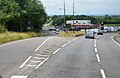
 A23 - geograph.org.uk - 3649801.jpg 640 × 430; 57 KB
-
 A23 2nd Southbound exit in Pyecombe - geograph.org.uk - 6227676.jpg 1.600 × 1.200; 282 KB
-
 A23 at Pyecombe - geograph.org.uk - 4746907.jpg 640 × 378; 40 KB
-
 A23 at Pyecombe, near Brighton - geograph.org.uk - 5252925.jpg 640 × 480; 81 KB
-
 A23 balancing pond near Pangdean Farm - geograph.org.uk - 5987422.jpg 1.024 × 768; 373 KB
-
 A23 near Pangdean - geograph.org.uk - 4746894.jpg 640 × 389; 47 KB
-
 A23 near Pyecombe - geograph.org.uk - 2855512.jpg 640 × 480; 62 KB
-
 A23 northbound near Pyecombe - geograph.org.uk - 2855509.jpg 640 × 499; 70 KB
-
 A23 though Pyecombe Junction - geograph.org.uk - 6227680.jpg 1.600 × 1.200; 553 KB
-
 A23 towards Crawley - geograph.org.uk - 2855504.jpg 640 × 480; 50 KB
-
 A23, northbound - geograph.org.uk - 3649782.jpg 640 × 430; 54 KB
-
 A23, northbound - geograph.org.uk - 3649788.jpg 640 × 430; 54 KB
-
 A273 - geograph.org.uk - 5642854.jpg 640 × 426; 82 KB
-
 A273 Clayton Hill, near Pyecombe - geograph.org.uk - 5252702.jpg 640 × 480; 102 KB
-
 A273 turning, A23 - geograph.org.uk - 3649785.jpg 640 × 396; 41 KB
-
 A273-A23 Junction - geograph.org.uk - 933177.jpg 479 × 640; 91 KB
-
 A281 leaves A23 - geograph.org.uk - 5962579.jpg 1.024 × 664; 198 KB
-
 A281 off A23 - geograph.org.uk - 3649794.jpg 640 × 430; 57 KB
-
 A281 off the A23 - geograph.org.uk - 4746930.jpg 640 × 426; 46 KB
-
 Across the valley to Jack and Jill - geograph.org.uk - 2433593.jpg 800 × 600; 92 KB
-
 Alongside Pyecombe Golf Course - geograph.org.uk - 4596197.jpg 1.142 × 857; 422 KB
-

-
 Ascending Wolstonbury Hill - geograph.org.uk - 4330267.jpg 427 × 640; 63 KB
-
 Bad combination - geograph.org.uk - 2262455.jpg 4.000 × 3.000; 3,04 MB
-
 Barn above Lower Standean Farm - geograph.org.uk - 2065078.jpg 640 × 428; 98 KB
-
 Barn, Pangdean Farm - geograph.org.uk - 5632212.jpg 640 × 426; 60 KB
-
 Beautiful meadow by the railway - geograph.org.uk - 5018927.jpg 800 × 600; 131 KB
-
 Bench with a view, near Clayton - geograph.org.uk - 6124621.jpg 1.024 × 768; 226 KB
-
 Bottom of Church Hill, Pyecombe - geograph.org.uk - 6162810.jpg 1.024 × 768; 592 KB
-
 Brick barn on the Downs - geograph.org.uk - 5310986.jpg 800 × 600; 127 KB
-
 Bridge Over the A23 - geograph.org.uk - 1629506.jpg 640 × 480; 84 KB
-
 Bridge, London Road - geograph.org.uk - 1629494.jpg 640 × 474; 78 KB
-
 Bridleway 7Py descending to Pyecombe - geograph.org.uk - 2264065.jpg 4.000 × 3.000; 2,95 MB
-
 Bridleway and footpath near Pyecombe - geograph.org.uk - 6124515.jpg 1.024 × 768; 257 KB
-
 Bridleway below East hill, Newtimber - geograph.org.uk - 388381.jpg 640 × 480; 91 KB
-
 Bridleway close to Pyecombe - geograph.org.uk - 5234441.jpg 4.608 × 3.456; 6,39 MB
-
 Bridleway Crossing - geograph.org.uk - 2956559.jpg 4.000 × 3.000; 2,48 MB
-
-
 Bridleway descending east down West Hill - geograph.org.uk - 1745155.jpg 1.600 × 1.200; 488 KB
-
 Bridleway down from Wolstonbury Hill - geograph.org.uk - 6163836.jpg 1.024 × 768; 363 KB
-
 Bridleway down to Pyecombe Street - geograph.org.uk - 6165967.jpg 1.024 × 768; 673 KB
-
 Bridleway down to Pyecombe Street - geograph.org.uk - 6165974.jpg 1.024 × 768; 675 KB
-
 Bridleway down to Pyecombe Street - geograph.org.uk - 6165985.jpg 1.024 × 768; 714 KB
-
 Bridleway east of New Barn Farm - geograph.org.uk - 4596205.jpg 1.142 × 857; 410 KB
-
 Bridleway gate, West Hill - geograph.org.uk - 2234201.jpg 640 × 480; 120 KB
-

-

-
 Bridleway in Wellcombe Bottom - geograph.org.uk - 2433734.jpg 600 × 800; 161 KB
-
 Bridleway junction in Ashen Plantation - geograph.org.uk - 2260283.jpg 4.000 × 3.000; 2,98 MB
-

-
 Bridleway near New Barn Farm - geograph.org.uk - 2432673.jpg 600 × 800; 100 KB
-
 Bridleway near Pyecombe - geograph.org.uk - 6124558.jpg 1.024 × 768; 196 KB
-
 Bridleway on the South Downs, near Pyecombe - geograph.org.uk - 6124547.jpg 1.024 × 768; 267 KB
-
 Bridleway on the South Downs, near Pyecombe - geograph.org.uk - 6124569.jpg 1.024 × 768; 164 KB
-
-
 Bridleway passing Rag Bottom - geograph.org.uk - 5708625.jpg 1.024 × 605; 97 KB
-
 Bridleway through Newer Copse - geograph.org.uk - 2262782.jpg 4.000 × 3.000; 3,04 MB
-
 Bridleway to Varncombe Hill - geograph.org.uk - 1628614.jpg 640 × 480; 109 KB
-
 Bridleway turns left towards gate - geograph.org.uk - 5018591.jpg 800 × 600; 123 KB
-
 Bridleway up Wolstonbury Hill - geograph.org.uk - 6163779.jpg 1.024 × 768; 355 KB
-
 Bridleway, Ashen Plantation - geograph.org.uk - 4047681.jpg 640 × 480; 124 KB
-
 Bridleway, Wolstonbury Hill - geograph.org.uk - 6163740.jpg 1.024 × 768; 355 KB
-
 Bridleways to Haresdean and Pangdean - geograph.org.uk - 388364.jpg 640 × 480; 69 KB
-
 Brighton Belle north out of Clayton Tunnel in 1972 - geograph.org.uk - 2262937.jpg 2.592 × 1.680; 421 KB
-
 Brighton line towards Brighton - geograph.org.uk - 5987374.jpg 768 × 1.024; 333 KB
-
 Brighton Road - geograph.org.uk - 2600045.jpg 640 × 480; 120 KB
-
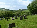
 Burial ground in Pyecombe - geograph.org.uk - 5137611.jpg 800 × 600; 152 KB
-
 Bus Stop at Pyecombe Garage - geograph.org.uk - 2436138.jpg 4.320 × 3.240; 3,98 MB
-
 Cattle on Wolstonbury Hill - geograph.org.uk - 6163754.jpg 1.024 × 768; 310 KB
-
 Church Bush Laine - geograph.org.uk - 1630904.jpg 640 × 480; 89 KB
-
 Church Cottages - geograph.org.uk - 933221.jpg 452 × 640; 72 KB
-
 Church Hill - geograph.org.uk - 932900.jpg 479 × 640; 94 KB
-
 Church Hill on the South Downs Way - geograph.org.uk - 5137608.jpg 800 × 600; 166 KB
-
 Church Hill, Pyecombe - geograph.org.uk - 5252911.jpg 640 × 480; 115 KB
-
 Church Hill, Pyecombe - geograph.org.uk - 5252917.jpg 640 × 480; 85 KB
-
 Church Lane - geograph.org.uk - 933121.jpg 479 × 640; 130 KB
-
 Clayton Hill - geograph.org.uk - 933195.jpg 479 × 640; 78 KB
-
 Clayton Holt - geograph.org.uk - 5709666.jpg 1.024 × 647; 85 KB
-
 Clayton recreation ground - geograph.org.uk - 2600050.jpg 640 × 480; 170 KB
-
 Clayton Tunnel - geograph.org.uk - 3437263.jpg 4.000 × 3.000; 3,96 MB
-
 Clayton Tunnel - geograph.org.uk - 3437266.jpg 4.000 × 3.000; 4,14 MB
-
 Clayton Tunnel, North Portal - geograph.org.uk - 6267466.jpg 4.160 × 3.120; 1,68 MB
-
 Clayton Windmills - geograph.org.uk - 3859020.jpg 3.072 × 2.048; 816 KB
-
 Clayton Windmills - geograph.org.uk - 4020122.jpg 573 × 382; 48 KB
-
 Cloudy Sky and Field on the South Downs - geograph.org.uk - 5708629.jpg 1.024 × 626; 83 KB
-
 Club house at Pyecombe Golf Club - geograph.org.uk - 2262820.jpg 4.000 × 3.000; 1,94 MB
-
 Clubhouse, Pyecombe Golf Course - geograph.org.uk - 1630917.jpg 640 × 480; 73 KB
-

-
 Copse on the horizon - geograph.org.uk - 1100888.jpg 640 × 480; 57 KB
-
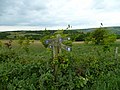
 Cross dyke southeast of Wolstonbury Camp 03.jpg 4.000 × 3.000; 3,15 MB
-
 Cross dyke southeast of Wolstonbury Camp 04.jpg 4.000 × 3.000; 2,62 MB
-
 Cross dyke southeast of Wolstonbury Camp 05.jpg 3.615 × 3.000; 8,04 MB
-

-

-
 Crossing of bridleways above Rockrose Farm - geograph.org.uk - 6163847.jpg 1.024 × 768; 609 KB
-
 Crosstracks north of Pyecombe church - geograph.org.uk - 2433580.jpg 800 × 600; 184 KB
-
 Cycle Path adjacent to A23-A281 Junction - geograph.org.uk - 2002616.jpg 640 × 480; 158 KB
-
 Cyclists on Haresdean Lane - geograph.org.uk - 4596194.jpg 1.142 × 857; 280 KB
-
 Danny House - geograph.org.uk - 4047667.jpg 640 × 444; 82 KB
-
 Dapps, New Way Lane - geograph.org.uk - 4047700.jpg 640 × 503; 58 KB
-
 Dew Pond, West Hill - geograph.org.uk - 1640606.jpg 640 × 480; 74 KB
-
 Disused chalk pit south of Little Danny - geograph.org.uk - 2260276.jpg 4.000 × 3.000; 2,86 MB
-
 Disused Garage - geograph.org.uk - 933160.jpg 640 × 479; 85 KB
-
 Ditch and bank, Wolstonbury Hill - geograph.org.uk - 6165608.jpg 1.024 × 768; 364 KB
-
 Ditch and bank, Wolstonbury Hill - geograph.org.uk - 6165613.jpg 1.024 × 768; 378 KB
-
 Ditchling Shaw Field - geograph.org.uk - 1455542.jpg 640 × 482; 111 KB
-
 Dolphin Cottage - geograph.org.uk - 933216.jpg 640 × 479; 112 KB
-
 Downland west of Pyecombe - geograph.org.uk - 3534978.jpg 1.600 × 1.030; 293 KB
-
 Drainage pool beside the A 23 - geograph.org.uk - 1745281.jpg 1.600 × 1.200; 579 KB
-

-
 East Hill - geograph.org.uk - 1628611.jpg 640 × 480; 94 KB
-
-

-
 Empty and Frozen - geograph.org.uk - 1629464.jpg 640 × 480; 91 KB
-
 Enclosure in Wellcombe Bottom - geograph.org.uk - 2433817.jpg 640 × 480; 65 KB
-
 Entrance to Three Greys Riding School, Pyecombe - geograph.org.uk - 2570689.jpg 1.600 × 802; 348 KB
-
 Exit road from the A23 at Pyecombe - geograph.org.uk - 5137617.jpg 800 × 600; 102 KB
-
 Farm track and bridleway approaching Lower Standean - geograph.org.uk - 2280301.jpg 4.000 × 3.000; 3,56 MB
-
 Field beyond the trees - geograph.org.uk - 5709360.jpg 1.024 × 656; 200 KB
-
 Field of poppies near Haresdean, West Sussex - geograph.org.uk - 5220160.jpg 3.264 × 2.448; 1,81 MB
-
 Field south of Clayton - geograph.org.uk - 2433824.jpg 800 × 600; 104 KB
-
 Field with depression by bridleway - geograph.org.uk - 5018832.jpg 800 × 600; 140 KB
-
 Fields to the south of the windmills - geograph.org.uk - 4596230.jpg 1.142 × 857; 324 KB
-
 Fifteenth Hole, Pyecombe Golf Club - geograph.org.uk - 1630962.jpg 640 × 480; 84 KB
-
 Filling station, A23 - geograph.org.uk - 5632211.jpg 640 × 426; 50 KB
-
 Flat Field (3) - geograph.org.uk - 4047703.jpg 640 × 480; 51 KB
-
 Flooded Stile - geograph.org.uk - 5708637.jpg 1.024 × 601; 157 KB
-
 Folly, Clayton Tunnel entrance - geograph.org.uk - 3707332.jpg 4.320 × 3.240; 3,49 MB
-
 Footbridge over the A23 - geograph.org.uk - 4746929.jpg 640 × 416; 47 KB
-
 Footbridge, A23 - geograph.org.uk - 3649792.jpg 640 × 430; 62 KB
-

-
 Footpath near Clayton - geograph.org.uk - 6124636.jpg 1.024 × 768; 211 KB
-
 Footpath North of Wolstonbury Hill - geograph.org.uk - 5223551.jpg 4.608 × 3.456; 6,19 MB
-
 Forge Close, Pyecombe - geograph.org.uk - 6124501.jpg 1.024 × 768; 136 KB
-
 Former Congregational Chapel, Pyecombe - geograph.org.uk - 6162833.jpg 1.024 × 768; 416 KB
-
 Former Route of A273 - geograph.org.uk - 933167.jpg 640 × 479; 73 KB
-
 Four horses - geograph.org.uk - 6163868.jpg 1.024 × 684; 450 KB
-
 Gate and track to Casterbridge Farm - geograph.org.uk - 5987347.jpg 1.024 × 768; 368 KB
-
 Gate on track in Wellcombe Bottom - geograph.org.uk - 2433750.jpg 800 × 600; 142 KB
-
 Gate to Pycombe Church - geograph.org.uk - 5628245.jpg 3.264 × 2.448; 4,05 MB
-
 Gates on bridleway, Wolstonbury Hill - geograph.org.uk - 6163766.jpg 1.024 × 768; 451 KB
-
-
 Gorse blooms in the snow - geograph.org.uk - 6052525.jpg 5.472 × 3.648; 2,91 MB
-
 GPS check, Wolstonbury Hill trig point - geograph.org.uk - 6163102.jpg 1.024 × 768; 420 KB
-
 Granary Laine - geograph.org.uk - 4026190.jpg 640 × 480; 64 KB
-
 Graveyard with a view, Pyecombe - geograph.org.uk - 6162814.jpg 1.024 × 768; 534 KB
-
 Graveyard, Pyecombe - geograph.org.uk - 6162819.jpg 1.024 × 768; 431 KB
-
 Grazing by the A23 - geograph.org.uk - 5632215.jpg 640 × 426; 55 KB
-
 Haresdean - geograph.org.uk - 5642855.jpg 640 × 352; 33 KB
-
 Haresdean - geograph.org.uk - 5962578.jpg 1.024 × 681; 115 KB
-
 Haresdean Farm - geograph.org.uk - 1629491.jpg 640 × 480; 82 KB
-
 Haresdean Lane - geograph.org.uk - 1640649.jpg 640 × 480; 66 KB
-
 High on West Hill - geograph.org.uk - 4596192.jpg 857 × 1.142; 381 KB
-
 Hills on a hill - geograph.org.uk - 2242820.jpg 640 × 480; 130 KB
-
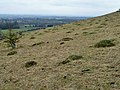
 Hillside view across to Wolstonbury Hill - geograph.org.uk - 2262791.jpg 4.000 × 3.000; 1,97 MB
-
 Hobbs Cottage - geograph.org.uk - 1629488.jpg 640 × 480; 101 KB
-
 Horse jumps at Haresdean Riding School - geograph.org.uk - 1745451.jpg 1.600 × 1.200; 503 KB
-
 Horses on the South Downs - geograph.org.uk - 5252935.jpg 640 × 480; 72 KB
-
 Horses, South Downs - geograph.org.uk - 2065056.jpg 640 × 428; 70 KB
-
 Jack and Jill - geograph.org.uk - 6250904.jpg 3.657 × 2.439; 7,79 MB
-
 Jack and Jill Upon The Hill - geograph.org.uk - 3858923.jpg 2.037 × 1.357; 590 KB
-
 Jack and Jill windmills, Clayton - geograph.org.uk - 6162932.jpg 1.024 × 768; 289 KB
-
 Jack Tower Mill - geograph.org.uk - 6052534.jpg 3.648 × 5.472; 3,16 MB
-
 Jack Windmill - geograph.org.uk - 6052538.jpg 5.472 × 3.648; 2,26 MB
-
 Jill of the Clayton Windmills - geograph.org.uk - 5709672.jpg 1.024 × 668; 156 KB
-
 Jill Windmill - geograph.org.uk - 5018632.jpg 800 × 600; 135 KB
-
 Jill Windmill - geograph.org.uk - 6250495.jpg 2.917 × 3.645; 7,57 MB
-
 Jill Windmill, Clayton - geograph.org.uk - 6217336.jpg 1.024 × 768; 193 KB
-

-
 Kia Motors - geograph.org.uk - 5642858.jpg 640 × 426; 61 KB
-
 Large Bracket Fungi in Newer Copse - geograph.org.uk - 2262787.jpg 4.000 × 3.000; 3,02 MB
-
 Little Danny north of Wolstonbury Hill - geograph.org.uk - 2261194.jpg 4.000 × 3.000; 2,27 MB
-
 London Road, Pyecombe - geograph.org.uk - 6162679.jpg 1.024 × 768; 497 KB
-

-

-

-

-

-
 Looking south on the A23 from Route 23 - geograph.org.uk - 5018674.jpg 800 × 600; 147 KB
-
 Meadow track in the valley - geograph.org.uk - 5018934.jpg 800 × 600; 159 KB
-
 Middle Brow - geograph.org.uk - 1573587.jpg 640 × 480; 57 KB
-
 Middle Laine - geograph.org.uk - 1637889.jpg 640 × 480; 64 KB
-
 Mill Lane - geograph.org.uk - 1509327.jpg 640 × 480; 82 KB
-
 Mill Lane - geograph.org.uk - 2597340.jpg 640 × 480; 168 KB
-
 Mill Lane - geograph.org.uk - 2600051.jpg 640 × 480; 240 KB
-
 Mill Lane - geograph.org.uk - 2600053.jpg 640 × 480; 122 KB
-
 Mill Lane - geograph.org.uk - 2606619.jpg 640 × 480; 145 KB
-
 Muddy Path - geograph.org.uk - 5709398.jpg 1.600 × 1.032; 412 KB
-
 Near the top of West Hill - geograph.org.uk - 4595930.jpg 979 × 1.306; 509 KB
-
 New Barn Farm - geograph.org.uk - 2065062.jpg 640 × 428; 83 KB
-
 New Barn Farm, near Clayton - geograph.org.uk - 5252686.jpg 640 × 480; 77 KB
-
 New BP Connect - geograph.org.uk - 1306203.jpg 640 × 480; 70 KB
-
 New BP filling station - geograph.org.uk - 2433832.jpg 640 × 452; 56 KB
-
 New Field - geograph.org.uk - 1640634.jpg 640 × 480; 71 KB
-
 New Way Lane - geograph.org.uk - 4047709.jpg 480 × 640; 89 KB
-
 Newtimber Hill - geograph.org.uk - 3703635.jpg 3.072 × 2.048; 936 KB
-
 Northern Slope of Middle Brow - geograph.org.uk - 933182.jpg 640 × 479; 76 KB
-
 Old Chalk Pit - geograph.org.uk - 4047620.jpg 640 × 480; 126 KB
-
 Old chalk pit, Wolstonbury Hill - geograph.org.uk - 6165711.jpg 1.024 × 768; 422 KB
-
 Old chalk pit, Wolstonbury Hill - geograph.org.uk - 6165717.jpg 1.024 × 768; 389 KB


_-_geograph.org.uk_-_4047703.jpg)


