Category:Queen Elizabeth Islands
Vai alla navigazione
Vai alla ricerca
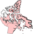
Northernmost group of islands of the Canadian Arctic Archipelago .jpg)  | |||||
| Carica un file multimediale | |||||
| Istanza di |
| ||||
|---|---|---|---|---|---|
| Prende il nome da | |||||
| Luogo | |||||
| Situato sul mare / lago / fiume | |||||
| Punto più alto | |||||
| Superficie |
| ||||
| Altezza sul mare |
| ||||
| Distinto da | |||||
 | |||||
Sottocategorie
Questa categoria contiene le 22 sottocategorie indicate di seguito, su un totale di 22.
A
- Amund Ringnes Island (4 F)
B
- Borden Island (2 F)
- Brock Island (4 F)
C
- Coburg Island (5 F)
- Cornwall Island (4 F)
D
E
- Eglinton Island (3 F)
- Ellef Ringnes Island (7 F)
G
- Graham Island (3 F)
L
- Lougheed Island (3 F)
M
- Mackenzie King Island (5 F)
- Meighen Island (6 F)
P
- Pim Island (6 F)
S
T
- Terre de Grinnell (1 F)
Pagine nella categoria "Queen Elizabeth Islands"
Questa categoria contiene un'unica pagina, indicata di seguito.
File nella categoria "Queen Elizabeth Islands"
Questa categoria contiene 24 file, indicati di seguito, su un totale di 24.
-

-
 Alexanderisland.png 320 × 329; 12 KB
-
 AN74 at NP28.jpg 1 200 × 814; 80 KB
-
 Byammartinisland.png 320 × 329; 13 KB
-
 Cameronisland.png 320 × 329; 13 KB
-
 Downtown Grise Fiord.jpg 1 600 × 1 200; 255 KB
-
 Emeraldisland.png 320 × 329; 12 KB
-
 Exmouth Island.png 816 × 431; 584 KB
-
 FMARS 2009 hab.jpg 3 648 × 2 736; 5,76 MB
-
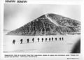
 Fort Conger, Grinnell Land, May 20, 1883.jpg 775 × 472; 168 KB
-
 Helenaisland.png 320 × 329; 13 KB
-
 Littlecornwallisisland.png 320 × 329; 12 KB
-
-
 NOAA - Alert, Nunavut, Canada.jpg 207 × 144; 22 KB
-
 Northkentisland.png 320 × 329; 13 KB
-
 Parry Islands in Canada.svg 512 × 433; 2 MB
-
 Queen elizabeth dorset thule.jpg 397 × 809; 37 KB
-
 Queen Elizabeth Islands 2009-08-27 (MODIS).jpg 5 600 × 4 400; 4,33 MB
-
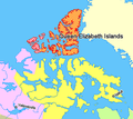
 Queen Elizabeth Islands in Canada.svg 512 × 433; 2 MB
-
 Queen Elizabeth islands map.gif 700 × 675; 44 KB
-
 Tassland.jpg 1 744 × 1 254; 136 KB
-
 Ilevanier.png 320 × 329; 12 KB
-
 Ward Hunt Island north.jpg 540 × 352; 125 KB
-
 WelcometotheNorthPole.jpg 888 × 597; 62 KB
.jpg)


_Islands,_northern_Canada.png)


