Category:Røros
ナビゲーションに移動
検索に移動
municipality in Trøndelag, Norway    | |||||
| メディアをアップロード | |||||
| 分類 | |||||
|---|---|---|---|---|---|
| 場所 |
| ||||
| 行政中心地 | |||||
| 公用語 | |||||
| 行政府の長 |
| ||||
| 成立日 |
| ||||
| 重要な出来事 |
| ||||
| 人口 |
| ||||
| 面積 | |||||
| 標高 |
| ||||
| 公式ウェブサイト | |||||
 | |||||
下位カテゴリ
このカテゴリに属する 21 個のサブカテゴリのうち、 21 個を表示しています。
*
- Paintings of Røros (19ファイル)
A
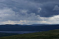
- Aursunden (7ファイル)
B
C
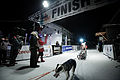
- Checkpoint Røros (1ファイル)
F
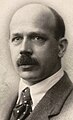
- Johan Falkberget (12ファイル)
- Fjell-Ljom (4ファイル)
G
H
- Hådalen kirkegård (1ファイル)
R
- Rambergsjøen (1ファイル)
S
- Kristina Skjevdal (1ファイル)
- Storhittersjøen (1ファイル)
T
カテゴリ「Røros」にあるメディア
このカテゴリに属する 299 個のファイルのうち、 200 個を表示しています。
(前のページ) (次のページ)-
 Aursunden.jpg 3,008 × 2,000;2.4メガバイト
-
 Bakgård ved Kjerkgata 24, Røros.jpg 4,032 × 3,024;3.07メガバイト
-
-
 Campanula rotundifolia (1015838589).jpg 2,592 × 3,428;3.2メガバイト
-
 Daniel Mortenson by Astri Aasen.jpg 218 × 289;44キロバイト
-
 Elisabeth Edland i mål på Røros (8442822953).jpg 5,616 × 3,744;2.95メガバイト
-
 Elisabeth Edland i mål på Røros (8442823709).jpg 5,436 × 3,624;3.73メガバイト
-
 Elisabeth Edland i mål på Røros (8443913982).jpg 5,154 × 3,436;2.82メガバイト
-
 Elisabeth Edland i mål på Røros (8443914262).jpg 3,744 × 5,616;2.94メガバイト
-
 Ellensveta, Røros.jpg 2,956 × 3,941;2.21メガバイト
-
 Ertzscheiderveta (ikke offisielt veinavn), Røros.jpg 3,024 × 4,032;3.62メガバイト
-
 Espen Bech (8443105349).jpg 5,616 × 3,744;2.39メガバイト
-
 Espen Bech (8443105741).jpg 3,744 × 5,616;2.3メガバイト
-
 Espen Bech (8443106111).jpg 3,744 × 5,616;2.63メガバイト
-
 Espen Bech (8444196246).jpg 3,744 × 5,616;2.6メガバイト
-
 Fargarveien, Røros.jpg 4,032 × 3,024;3.81メガバイト
-
 Femund 2013 (8433400052).jpg 7,360 × 4,912;5.92メガバイト
-
 Fjellbjørk, Kvitsanden Røros (897608330).jpg 3,585 × 2,592;7.23メガバイト
-
 Fotograf Morten Lauveng Røros Femundsløpet åpning (3 of 23).jpg 5,405 × 3,596;14.1メガバイト
-
 Fotograf Morten Lauveng Røros Femundsløpet åpning (5 of 24).jpg 5,353 × 3,562;6.18メガバイト
-
 Fra Rørosvidda (729024995).jpg 3,872 × 2,592;738キロバイト
-
 Jacob J. Friis.jpg 328 × 538;47キロバイト
-
 Fæmund II.jpg 2,897 × 1,828;2.59メガバイト
-

-

-
 Husflidbutikk ved Kjerkgata, Røros.jpg 4,032 × 3,024;3.93メガバイト
-
 Johan Falkberget ca 1950.jpg 1,335 × 1,920;1.44メガバイト
-
 Julikveld (749459415).jpg 3,342 × 2,508;5.16メガバイト
-
 Kulturlandskap (917150462).jpg 2,902 × 2,592;5.13メガバイト
-
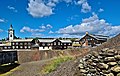
 Miner's accommodation in Roros, Norway.jpg 2,736 × 2,736;2.8メガバイト
-
 Morten Borgen (8443104765).jpg 5,616 × 3,744;2.52メガバイト
-
 Morten Borgen (8443105167).jpg 3,744 × 5,616;2.75メガバイト
-
 Nina Skramstad i mål på Røros (8445061624).jpg 3,000 × 2,000;3.87メガバイト
-
 NO Roros 0709 063 (17258310331).jpg 800 × 600;55キロバイト
-
 NO Roros 0709 064 (17232875166).jpg 800 × 600;56キロバイト
-
 NO Roros 0709 065 (17258856925).jpg 800 × 600;55キロバイト
-
 NO Roros 0709 066 (17258310081).jpg 800 × 600;60キロバイト
-
 NO Roros 0709 067 (17071042718).jpg 800 × 600;55キロバイト
-
 NO Roros 0709 068 (17258856625).jpg 800 × 600;65キロバイト
-
 NO Roros 0709 069 (16638639873).jpg 800 × 600;59キロバイト
-
 NO Roros 0709 070 (17258856325).jpg 800 × 600;82キロバイト
-
 NO Roros 0709 071 (17232874336).jpg 600 × 800;107キロバイト
-
 NO Roros 0709 072 (17257080282).jpg 800 × 600;108キロバイト
-
 NO Roros 0709 073 (17258444481).jpg 600 × 800;96キロバイト
-
 NO Roros 0709 074 (16638638993).jpg 800 × 600;79キロバイト
-
 NO Roros 0709 075 (16636390684).jpg 600 × 800;84キロバイト
-
 NO Roros 0709 076 (17071302630).jpg 800 × 600;86キロバイト
-
 NO Roros 0709 077 (16638638453).jpg 600 × 800;63キロバイト
-
 NO Roros 0709 078 (17258855015).jpg 800 × 600;65キロバイト
-
 NO Roros 0709 079 (17051442947).jpg 800 × 600;73キロバイト
-
 NO Roros 0709 080 (17258854805).jpg 800 × 600;86キロバイト
-
 NO Roros 0709 081 (16638637703).jpg 600 × 800;105キロバイト
-
 NO Roros 0709 082 (17051442327).jpg 800 × 600;107キロバイト
-
 NO Roros 0709 083 (17071301200).jpg 600 × 800;109キロバイト
-
 NO Roros 0709 084 (17258853825).jpg 800 × 600;93キロバイト
-
 NO Roros 0709 085 (17258853595).jpg 600 × 800;100キロバイト
-
 NO Roros 0709 086 (17258444211).jpg 800 × 600;75キロバイト
-
 NO Roros 0709 087 (17071090598).jpg 600 × 800;108キロバイト
-
 NO Roros 0709 088 (16638636113).jpg 600 × 800;76キロバイト
-
 NO Roros 0709 089 (17258806395).jpg 600 × 800;91キロバイト
-
 NO Roros 0709 090 (17071300010).jpg 600 × 800;90キロバイト
-
 NO Roros 0709 091 (17071089978).jpg 800 × 600;85キロバイト
-
 NO Roros 0709 092 (17258852545).jpg 800 × 600;106キロバイト
-
 NO Roros 0709 093 (17258305151).jpg 800 × 600;102キロバイト
-
 NO Roros 0709 094 (17257076422).jpg 600 × 800;99キロバイト
-
 NO Roros 0709 095 (17258304751).jpg 800 × 600;110キロバイト
-
 NO Roros 0709 097 (16638634223).jpg 600 × 800;71キロバイト
-
 NO Roros 0709 098 (17232869256).jpg 600 × 800;81キロバイト
-
 NO Roros 0709 099 (17232869086).jpg 600 × 800;83キロバイト
-
 NO Roros 0709 100 (17051439097).jpg 600 × 800;113キロバイト
-
 NO Roros 0709 101 (16638633413).jpg 600 × 800;100キロバイト
-
 NO Roros 0709 102 (17232868396).jpg 600 × 800;90キロバイト
-
 NO Roros 0709 103 (17258850515).jpg 800 × 600;101キロバイト
-
 NO Roros 0709 104 (17071297130).jpg 600 × 800;87キロバイト
-
 NO Roros 0709 105 (17258302891).jpg 800 × 600;89キロバイト
-
 NO Roros 0709 106 (17232867516).jpg 600 × 800;90キロバイト
-
 NO Roros 0709 107 (17051437717).jpg 800 × 600;83キロバイト
-
 NO Roros 0709 108 (16638631933).jpg 800 × 600;91キロバイト
-
 NO Roros 0709 109 (17257029882).jpg 800 × 600;91キロバイト
-
 NO Roros 0709 110 (17258849365).jpg 800 × 600;106キロバイト
-
 NO Roros 0709 111 (17232866746).jpg 800 × 600;60キロバイト
-
 NO Roros 0709 112 (16638631383).jpg 600 × 800;76キロバイト
-
 NO Roros 0709 113 (17072630269).jpg 800 × 600;96キロバイト
-
 NO Roros 0709 114 (17051436617).jpg 800 × 600;99キロバイト
-
 NO Roros 0709 117 (17258300911).jpg 800 × 600;104キロバイト
-
 NO Roros 0709 123 (17257071712).jpg 600 × 800;141キロバイト
-
 NO Roros 0709 124 (17258299661).jpg 600 × 800;71キロバイト
-
 NO Roros 0709 125 (17051434757).jpg 600 × 800;92キロバイト
-
 NO Roros 0709 126 (17071083648).jpg 800 × 600;104キロバイト
-
 NO Roros 0709 127 (17051434307).jpg 800 × 600;118キロバイト
-
 NO Roros 0709 128 (17257070492).jpg 800 × 600;113キロバイト
-
 NO Roros 0709 129 (17071083058).jpg 800 × 600;94キロバイト
-
 NO Roros 0709 130 (16636380154).jpg 800 × 600;101キロバイト
-
 NO Roros 0709 131 (17258298321).jpg 800 × 533;95キロバイト
-
 NO Roros 0709 132 (17051433227).jpg 800 × 533;112キロバイト
-
 NO Roros 0709 133 (17257069482).jpg 800 × 533;112キロバイト
-
 NO Roros 0709 134 (16636379124).jpg 800 × 533;50キロバイト
-
 NO Roros 0709 135 (16636340704).jpg 533 × 800;104キロバイト
-
 NO Roros 0709 136 (17258297511).jpg 533 × 800;118キロバイト
-
 NO Roros 0709 137 (17072625839).jpg 533 × 800;143キロバイト
-
 NO Roros 0709 138 (17232861636).jpg 533 × 800;63キロバイト
-
 NO Roros 0709 139 (17071290700).jpg 533 × 800;73キロバイト
-
 NO Roros 0709 140 (17232861446).jpg 533 × 800;80キロバイト
-
 NO Roros 0709 141 (17072625019).jpg 800 × 533;62キロバイト
-
 NO Roros 0709 142 (17071080658).jpg 533 × 800;126キロバイト
-
 NO Roros 0709 143 (17257067472).jpg 800 × 533;124キロバイト
-
 NO Roros 0709 144 (16636377304).jpg 800 × 533;124キロバイト
-
 NO Roros 0709 145 (17071079758).jpg 800 × 533;108キロバイト
-
 NO Roros 0709 146 (17232860086).jpg 800 × 533;109キロバイト
-
 NO Roros 0709 147 (17071288760).jpg 800 × 533;97キロバイト
-
 NO Roros 0709 148 (17072623689).jpg 800 × 533;105キロバイト
-
 NO Roros 0709 149 (17258294421).jpg 800 × 533;93キロバイト
-
 NO Roros 0709 150 (16636376144).jpg 800 × 533;110キロバイト
-
 NO Roros 0709 151 (16638624113).jpg 800 × 533;112キロバイト
-
 NO Roros 0709 152 (17232858846).jpg 533 × 800;74キロバイト
-
 NO Roros 0709 153 (17258293741).jpg 533 × 800;74キロバイト
-
 NO Roros 0709 154 (16638587323).jpg 533 × 800;89キロバイト
-
 NO Roros 0709 155 (17257065082).jpg 533 × 800;90キロバイト
-
 NO Roros 0709 156 (17258840925).jpg 800 × 533;92キロバイト
-
 NO Roros 0709 157 (17257064722).jpg 800 × 533;127キロバイト
-
 NO Roros 0709 158 (17072621729).jpg 800 × 533;91キロバイト
-
 NO Roros 0709 159 (17258840265).jpg 533 × 800;84キロバイト
-
 NO Roros 0709 160 (17232857596).jpg 533 × 800;88キロバイト
-
 NO Roros 0709 161 (17072621139).jpg 533 × 800;110キロバイト
-
 NO Roros 0709 162 (17051427237).jpg 533 × 800;105キロバイト
-
 NO Roros 0709 163 (17071285890).jpg 800 × 533;111キロバイト
-
 NO Roros 0709 164 (17257029272).jpg 533 × 800;49キロバイト
-
 NO Roros 0709 165 (17071285700).jpg 533 × 800;43キロバイト
-
 NO Roros 0709 166 (17072620389).jpg 800 × 533;64キロバイト
-
 NO Roros 0709 167 (17258839185).jpg 800 × 533;66キロバイト
-
 NO Roros 0709 168 (16636373354).jpg 800 × 533;66キロバイト
-
 NO Roros 0709 169 (17051426087).jpg 533 × 800;50キロバイト
-
 NO Roros 0709 170 (17071075448).jpg 800 × 533;77キロバイト
-
 NO Roros 0709 171 (16636372894).jpg 533 × 800;69キロバイト
-
 NO Roros 0709 172 (16636372744).jpg 533 × 800;53キロバイト
-
 NO Roros 0709 173 (17232855476).jpg 800 × 533;95キロバイト
-
 NO Roros 0709 174 (17071074698).jpg 800 × 533;83キロバイト
-
 NO Roros 0709 175 (17071074498).jpg 533 × 800;86キロバイト
-
 NO Roros 0709 176 (16636372004).jpg 533 × 800;99キロバイト
-
 NO Roros 0709 177 (17258289721).jpg 800 × 533;124キロバイト
-
 NO Roros 0709 178 (17258837205).jpg 800 × 533;121キロバイト
-
 NO Roros 0709 179 (16638619173).jpg 800 × 533;78キロバイト
-
 NO Roros 0709 180 (16638587003).jpg 800 × 533;83キロバイト
-
 NO Roros 0709 181 (17071073398).jpg 800 × 533;88キロバイト
-
 NO Roros 0709 182 (17071073218).jpg 800 × 533;91キロバイト
-
 NO Roros 0709 183 (17071073048).jpg 533 × 800;72キロバイト
-
 NO Roros 0709 184 (17257060142).jpg 800 × 533;101キロバイト
-
 NO Roros 0709 185 (17071072668).jpg 800 × 533;102キロバイト
-
 NO Roros 0709 186 (17258287931).jpg 800 × 600;80キロバイト
-
 NO Roros 0709 187 (16638617993).jpg 800 × 600;109キロバイト
-
 NO Roros 0709 188 (17258835445).jpg 800 × 600;86キロバイト
-
 NO Roros 0709 189 (16636369724).jpg 800 × 600;107キロバイト
-
 NO Roros 0709 190 (17232851876).jpg 800 × 600;103キロバイト
-
 NO Roros 0709 191 (17258834705).jpg 800 × 600;94キロバイト
-
 NO Roros 0709 192 (16638616913).jpg 800 × 533;92キロバイト
-
 NO Roros 0709 193 (17072615649).jpg 533 × 800;72キロバイト
-
 NO Roros 0709 194 (17051421337).jpg 800 × 533;74キロバイト
-
 NO Roros 0709 195 (17258286211).jpg 800 × 533;70キロバイト
-
 NO Roros 0709 196 (17071280320).jpg 800 × 533;67キロバイト
-
 NO Roros 0709 198 (17257057702).jpg 533 × 800;57キロバイト
-
 NO Roros 0709 199 (17051420687).jpg 800 × 533;64キロバイト
-
 NO Roros 0709 200 (17071279690).jpg 800 × 533;105キロバイト
-
 NO Roros 0709 201 (17232849906).jpg 800 × 533;107キロバイト
-
 NO Roros 0709 202 (17051420067).jpg 800 × 533;58キロバイト
-
 NO Roros 0709 203 (16638615243).jpg 800 × 533;113キロバイト
-
 NO Roros 0709 204 (17071251580).jpg 800 × 533;101キロバイト
-
 NO Roros 0709 205 (17072613849).jpg 800 × 533;123キロバイト
-
 NO Roros 0709 206 (17071278570).jpg 800 × 533;90キロバイト
-
 NO Roros 0709 207 (17232848716).jpg 800 × 533;93キロバイト
-
 NO Roros 0709 208 (17072613059).jpg 800 × 533;96キロバイト
-
 NO Roros 0709 209 (17257055872).jpg 800 × 533;56キロバイト
-
 NO Roros 0709 210 (17071068238).jpg 533 × 800;62キロバイト
-
 NO Roros 0709 211 (17071277860).jpg 533 × 800;75キロバイト
-
 NO Roros 0709 212 (17258283321).jpg 800 × 533;90キロバイト
-
 NO Roros 0709 213 (17258283231).jpg 800 × 533;81キロバイト
-
 NO Roros 0709 214 (17072612209).jpg 800 × 533;79キロバイト
-
 NO Roros 0709 215 (17072612049).jpg 533 × 800;85キロバイト
-
 NO Roros 0709 216 (16638586653).jpg 800 × 533;53キロバイト
-
 NO Roros 0709 217 (16638613143).jpg 800 × 533;60キロバイト
-
 NO Roros 0709 218 (17257054532).jpg 533 × 800;92キロバイト
-
 NO Roros 0709 219 (17258830295).jpg 533 × 800;88キロバイト
-
 NO Roros 0709 220 (17071066708).jpg 533 × 800;99キロバイト
-
 NO Roros 0709 221 (17071066548).jpg 533 × 800;121キロバイト
-
 NO Roros 0709 222 (16638612343).jpg 533 × 800;92キロバイト
-
 NO Roros 0709 223 (17051416847).jpg 533 × 800;50キロバイト
-
 NO Roros 0709 224 (16636363964).jpg 533 × 800;60キロバイト
-
 NO Roros 0709 225 (16638611873).jpg 533 × 800;61キロバイト
-
 NO Roros 0709 226 (16636363674).jpg 800 × 533;102キロバイト
-
 NO Roros 0709 227 (17258829115).jpg 800 × 533;96キロバイト
-
 NO Roros 0709 228 (17071275070).jpg 800 × 533;81キロバイト
-
 NO Roros 0709 229 (17071065148).jpg 533 × 800;62キロバイト
-
 NO Roros 0709 230 (17258828615).jpg 533 × 800;73キロバイト
-
 NO Roros 0709 231 (17258280461).jpg 800 × 533;45キロバイト
-
 NO Roros 0709 232 (17072609409).jpg 800 × 533;85キロバイト
-
 NO Roros 0709 233 (17071064528).jpg 800 × 533;72キロバイト
-
 NO Roros 0709 234 (17071064408).jpg 533 × 800;92キロバイト
-
 NO Roros 0709 235 (17257051702).jpg 800 × 533;110キロバイト
-
 NO Roros 0709 236 (17051415017).jpg 533 × 800;74キロバイト
-
 NO Roros 0709 237 (17232843786).jpg 800 × 533;80キロバイト
-
 NO Roros 0709 238 (17257028632).jpg 800 × 533;98キロバイト


.jpg)
.jpg)

.jpg)
.jpg)
.jpg)
.jpg)

,_R%C3%B8ros.jpg)
.jpg)
.jpg)
.jpg)
.jpg)

.jpg)
.jpg)
.jpg)
.jpg)
.jpg)


.jpg)
.jpg)

.jpg)
.jpg)
.jpg)
.jpg)
.jpg)
.jpg)
.jpg)
.jpg)
.jpg)
.jpg)
.jpg)
.jpg)
.jpg)
.jpg)
.jpg)
.jpg)
.jpg)
.jpg)
.jpg)
.jpg)
.jpg)
.jpg)
.jpg)
.jpg)
.jpg)
.jpg)
.jpg)
.jpg)
.jpg)
.jpg)
.jpg)
.jpg)
.jpg)
.jpg)
.jpg)
.jpg)
.jpg)
.jpg)
.jpg)
.jpg)
.jpg)
.jpg)
.jpg)
.jpg)
.jpg)
.jpg)
.jpg)
.jpg)
.jpg)
.jpg)
.jpg)
.jpg)
.jpg)
.jpg)
.jpg)
.jpg)
.jpg)
.jpg)
.jpg)
.jpg)
.jpg)
.jpg)
.jpg)
.jpg)
.jpg)
.jpg)
.jpg)
.jpg)
.jpg)
.jpg)
.jpg)
.jpg)
.jpg)
.jpg)
.jpg)
.jpg)
.jpg)
.jpg)
.jpg)
.jpg)
.jpg)
.jpg)
.jpg)
.jpg)
.jpg)
.jpg)
.jpg)
.jpg)
.jpg)
.jpg)
.jpg)
.jpg)
.jpg)
.jpg)
.jpg)
.jpg)
.jpg)
.jpg)
.jpg)
.jpg)
.jpg)
.jpg)
.jpg)
.jpg)
.jpg)
.jpg)
.jpg)
.jpg)
.jpg)
.jpg)
.jpg)
.jpg)
.jpg)
.jpg)
.jpg)
.jpg)
.jpg)
.jpg)
.jpg)
.jpg)
.jpg)
.jpg)
.jpg)
.jpg)
.jpg)
.jpg)
.jpg)
.jpg)
.jpg)
.jpg)
.jpg)
.jpg)
.jpg)
.jpg)
.jpg)
.jpg)
.jpg)
.jpg)
.jpg)
.jpg)
.jpg)
.jpg)
.jpg)
.jpg)
.jpg)
.jpg)
.jpg)
.jpg)
.jpg)
.jpg)
.jpg)
.jpg)
.jpg)
.jpg)
.jpg)
.jpg)
.jpg)
.jpg)
.jpg)
.jpg)
.jpg)
.jpg)
.jpg)
.jpg)
.jpg)
.jpg)
.jpg)
.jpg)
.jpg)
.jpg)