Category:Radwell, Hertfordshire
Aller à la navigation
Aller à la recherche
English: Not to be confused with Radwell.
village du Hertfordshire  Eglwys yr Holl Saint, Radwell | |||||
| Téléverser des médias | |||||
| Nature de l’élément | |||||
|---|---|---|---|---|---|
| Lieu | North Hertfordshire, Hertfordshire, Angleterre de l'Est, Angleterre | ||||
| Population |
| ||||
 | |||||
Sous-catégories
Cette catégorie comprend 2 sous-catégories, dont les 2 ci-dessous.
A
B
- Baldock Services (4 F)
Média dans la catégorie « Radwell, Hertfordshire »
Cette catégorie comprend 87 fichiers, dont les 87 ci-dessous.
-
 1 mile to the end of the A1(M) - geograph.org.uk - 4653828.jpg 640 × 385 ; 54 kio
-
 A1(M) bridge over Norton Mill Lane - geograph.org.uk - 5424223.jpg 640 × 480 ; 112 kio
-
 A1(M) northbound approaching junction 10 - geograph.org.uk - 2514777.jpg 640 × 480 ; 39 kio
-
 A1(M), north - geograph.org.uk - 4985683.jpg 640 × 329 ; 35 kio
-
 A507 North Road - geograph.org.uk - 5683317.jpg 640 × 428 ; 93 kio
-
 A507 North Road - geograph.org.uk - 5683326.jpg 640 × 428 ; 115 kio
-
 A507 towards Baldock - geograph.org.uk - 5424751.jpg 640 × 480 ; 125 kio
-
 A507 towards Clophill - geograph.org.uk - 5424748.jpg 640 × 480 ; 100 kio
-
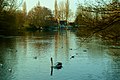 Across the lake at Radwell.jpg 3 392 × 2 262 ; 3,38 Mio
-
 All Saints' church, Radwell - geograph.org.uk - 4289336.jpg 4 320 × 3 240 ; 4,24 Mio
-
 All Saints, Radwell - Chancel - geograph.org.uk - 2474488.jpg 1 000 × 666 ; 138 kio
-
 All Saints, Radwell - East end - geograph.org.uk - 2474485.jpg 1 000 × 666 ; 130 kio
-
 All Saints, Radwell - Font - geograph.org.uk - 2474506.jpg 692 × 1 000 ; 97 kio
-
 All Saints, Radwell - geograph.org.uk - 2474475.jpg 1 000 × 658 ; 187 kio
-
 All Saints, Radwell - geograph.org.uk - 2474481.jpg 1 000 × 639 ; 164 kio
-
 All Saints, Radwell - Monument - geograph.org.uk - 2474495.jpg 590 × 1 000 ; 121 kio
-
 All Saints, Radwell - Royal Arms - geograph.org.uk - 2474518.jpg 1 000 × 642 ; 127 kio
-
 All Saints, Radwell - Sanctuary - geograph.org.uk - 2474489.jpg 1 000 × 684 ; 134 kio
-
 All Saints, Radwell - Stained glass window - geograph.org.uk - 2474499.jpg 510 × 1 000 ; 174 kio
-
 All Saints, Radwell - Stained glass window - geograph.org.uk - 2474502.jpg 621 × 1 000 ; 228 kio
-
 All Saints, Radwell - Wall monument - geograph.org.uk - 2474511.jpg 566 × 1 000 ; 90 kio
-
 All Saints, Radwell - Wall monument - geograph.org.uk - 2474513.jpg 699 × 1 000 ; 129 kio
-
 All Saints, Radwell - Wall monument - geograph.org.uk - 2474514.jpg 696 × 1 000 ; 140 kio
-
 All Saints, Radwell - Wall monument - geograph.org.uk - 2474515.jpg 657 × 1 000 ; 123 kio
-
 All Saints, Radwell - West end - geograph.org.uk - 2474496.jpg 1 000 × 682 ; 106 kio
-
 Baldock Services - geograph.org.uk - 2518385.jpg 800 × 600 ; 101 kio
-
 Baldock Services - geograph.org.uk - 3030789.jpg 3 872 × 2 592 ; 3,54 Mio
-
 Baldock Services - geograph.org.uk - 3179597.jpg 640 × 480 ; 71 kio
-
 Baldock Services on the A1 - geograph.org.uk - 3692456.jpg 800 × 532 ; 115 kio
-
 Baldock Services on the A1 - geograph.org.uk - 3692461.jpg 800 × 532 ; 119 kio
-
 Baldock Services on the A1 - geograph.org.uk - 3692467.jpg 800 × 532 ; 111 kio
-
 Baldock Services, junction 10 A1(M) - geograph.org.uk - 2264191.jpg 640 × 480 ; 105 kio
-
 Baldock Services, junction 10 A1(M) - geograph.org.uk - 2264195.jpg 640 × 480 ; 136 kio
-
 Baldock Services, junction 10 A1(M) - geograph.org.uk - 2264198.jpg 480 × 640 ; 66 kio
-
 Baldock Services, junction 10 A1(M) - geograph.org.uk - 4911791.jpg 640 × 480 ; 76 kio
-
 Bridle way near Baldock - geograph.org.uk - 5588770.jpg 819 × 1 024 ; 1,52 Mio
-
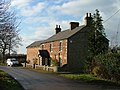
 Bury Farm, Radwell. - geograph.org.uk - 113805.jpg 640 × 153 ; 23 kio
-
 Cafe in Baldock Services - geograph.org.uk - 5555573.jpg 1 958 × 1 408 ; 800 kio
-
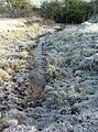
 Concrete barrier at end of footpath - geograph.org.uk - 4190798.jpg 2 000 × 1 500 ; 1,59 Mio
-
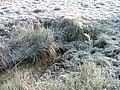
 Fields east of Stotfold - geograph.org.uk - 3332002.jpg 2 592 × 1 944 ; 1,36 Mio
-
 Footbridge at Radwell - geograph.org.uk - 113835.jpg 640 × 482 ; 192 kio
-

-
 GOC Radwell-Rivers and Meadows 001 Radwell Meadows (9814675974).jpg 4 288 × 3 216 ; 3,7 Mio
-
 GOC Radwell-Rivers and Meadows 008 Radwell campsite (9833661843).jpg 4 288 × 3 216 ; 3,8 Mio
-
 GOC Radwell-Rivers and Meadows 009 Barn (9833667233).jpg 4 288 × 3 216 ; 3,89 Mio
-
 GOC Radwell-Rivers and Meadows 010 Farm (9833560214).jpg 4 288 × 3 216 ; 3,7 Mio
-
 GOC Radwell-Rivers and Meadows 015 The Coach House, Radwell (9855624435).jpg 3 734 × 2 806 ; 2,99 Mio
-
 GOC Radwell-Rivers and Meadows 016 The Coach House, Radwell (9855614474).jpg 4 288 × 3 216 ; 4,32 Mio
-
 GOC Radwell-Rivers and Meadows 017 Field (9855669516).jpg 4 288 × 3 216 ; 3,6 Mio
-
 GOC Radwell-Rivers and Meadows 026 (9913300604).jpg 4 288 × 3 216 ; 3,81 Mio
-
 GOC Radwell-Rivers and Meadows 028 River Ivel (9913398323).jpg 4 288 × 3 216 ; 4,11 Mio
-
 GOC Radwell-Rivers and Meadows 038 Arlesey Bridge (9947675853).jpg 4 288 × 3 216 ; 3,83 Mio
-
 GOC Radwell-Rivers and Meadows 040 Arlesey Bridge (9947578534).jpg 4 288 × 3 216 ; 3,73 Mio
-
 GOC Radwell-Rivers and Meadows 043 River Hiz (9963728884).jpg 4 288 × 3 216 ; 4,31 Mio
-
 GOC Radwell-Rivers and Meadows 047 River Hiz (9980050773).jpg 4 288 × 3 216 ; 3,82 Mio
-
 GOC Radwell-Rivers and Meadows 068 Arlesey Common (10035408004).jpg 4 288 × 3 216 ; 3,48 Mio
-
 Grassy space at Baldock Services - geograph.org.uk - 3030795.jpg 3 872 × 2 592 ; 4,33 Mio
-
 Hotel,Baldock Services, junction 10 A1(M) - geograph.org.uk - 2264193.jpg 640 × 480 ; 107 kio
-
 Inside Baldock Services - geograph.org.uk - 5552743.jpg 2 048 × 1 536 ; 1,41 Mio
-
 Isolated tree in field - geograph.org.uk - 4650236.jpg 640 × 480 ; 128 kio
-
 Mill House. - geograph.org.uk - 113832.jpg 309 × 640 ; 40 kio
-
 Millpond in Radwell - geograph.org.uk - 80106.jpg 640 × 480 ; 112 kio
-
 Near the end of the A1(M) - geograph.org.uk - 4653830.jpg 640 × 409 ; 39 kio
-
 Newnham Road - geograph.org.uk - 3321770.jpg 640 × 480 ; 132 kio
-
 Newnham Road - geograph.org.uk - 3321771.jpg 640 × 480 ; 158 kio
-
 North from Newnham Road - geograph.org.uk - 5588692.jpg 1 024 × 768 ; 848 kio
-
 Norton Mill (2) - geograph.org.uk - 4289329.jpg 4 320 × 3 240 ; 4,47 Mio
-
 On Newnham Road - geograph.org.uk - 5582158.jpg 1 024 × 1 024 ; 1,67 Mio
-
 Over the hill to Newnham - geograph.org.uk - 5588694.jpg 1 024 × 768 ; 979 kio
-
 Part of Baldock Services - geograph.org.uk - 2573400.jpg 640 × 480 ; 85 kio
-
 Part of Radwell Lane - geograph.org.uk - 1280055.jpg 640 × 480 ; 98 kio
-
 Patisserie Valerie, Baldock Services - geograph.org.uk - 5552747.jpg 1 990 × 1 454 ; 805 kio
-
 Petrol filling station at Baldock Services - geograph.org.uk - 3030793.jpg 3 872 × 2 592 ; 4,59 Mio
-
 Petrol station at Baldock Services - geograph.org.uk - 5552740.jpg 1 982 × 1 446 ; 749 kio
-
 Poultry Farm - geograph.org.uk - 113836.jpg 640 × 482 ; 147 kio
-
 Pylon and farmland of Newnham Road - geograph.org.uk - 4289351.jpg 4 320 × 3 240 ; 4,5 Mio
-
 Pylons over the hill - geograph.org.uk - 5588697.jpg 819 × 1 024 ; 986 kio
-
 Radwell Lake, River Ivel, Radwell.jpg 4 288 × 3 216 ; 4,24 Mio
-

-
 Spring at Radwell feeding the Ivel - geograph.org.uk - 113839.jpg 640 × 482 ; 199 kio
-
 Spring feeding the Ivel. - geograph.org.uk - 113844.jpg 475 × 640 ; 167 kio
-
 Stotford Road - geograph.org.uk - 3324112.jpg 640 × 480 ; 145 kio
-
 Stotford Road - geograph.org.uk - 3324114.jpg 640 × 480 ; 158 kio
-
 Thatched cottage on the A507 - geograph.org.uk - 5424227.jpg 640 × 480 ; 102 kio
-
 The A1 road from the air - geograph.org.uk - 3367475.jpg 542 × 640 ; 100 kio
-
 The car park at Baldock Services - geograph.org.uk - 5555570.jpg 2 048 × 1 536 ; 1,4 Mio
-
 Wrayfields - geograph.org.uk - 95213.jpg 640 × 482 ; 114 kio
_-_geograph.org.uk_-_4653828.jpg)
_bridge_over_Norton_Mill_Lane_-_geograph.org.uk_-_5424223.jpg)
_northbound_approaching_junction_10_-_geograph.org.uk_-_2514777.jpg)
,_north_-_geograph.org.uk_-_4985683.jpg)


_-_geograph.org.uk_-_2264191.jpg)
_-_geograph.org.uk_-_2264195.jpg)
_-_geograph.org.uk_-_2264198.jpg)
_-_geograph.org.uk_-_4911791.jpg)


.jpg)
.jpg)
.jpg)
.jpg)
.jpg)
.jpg)
.jpg)
.jpg)
.jpg)
.jpg)
.jpg)
.jpg)
.jpg)
.jpg)

_-_geograph.org.uk_-_2264193.jpg)


_-_geograph.org.uk_-_4653830.jpg)


_-_geograph.org.uk_-_4289329.jpg)


_-_geograph.org.uk_-_2264190.jpg)


