Category:Rassau
Aller à la navigation
Aller à la recherche
village au Royaume-Uni   | |||||
| Téléverser des médias | |||||
| Prononciation (fichier son) | |||||
|---|---|---|---|---|---|
| Nature de l’élément | |||||
| Lieu | Blaenau Gwent, pays de Galles | ||||
| Population |
| ||||
| Superficie |
| ||||
 | |||||

Sous-catégories
Cette catégorie comprend 3 sous-catégories, dont les 3 ci-dessous.
R
- Rassau Industrial Estate (11 F)
- Rassau mast (2 F)
T
- Twyn Bryn-march (6 F)
Média dans la catégorie « Rassau »
Cette catégorie comprend 98 fichiers, dont les 98 ci-dessous.
-
 2024 Wales Blaenau Gwent Community Rassau map.svg 512 × 655 ; 238 kio
-
 A4046 bridge over Rassau Road, Rassau - geograph.org.uk - 3646747.jpg 800 × 672 ; 152 kio
-
 A465 bridge over Reservoir Road, Carmeltown - geograph.org.uk - 3992287.jpg 800 × 578 ; 109 kio
-
 A465 Construction - geograph.org.uk - 4513104.jpg 1 600 × 1 200 ; 269 kio
-
 A465 Construction Work - geograph.org.uk - 4513088.jpg 1 600 × 1 200 ; 293 kio
-
 Abandoned sheepfold (ii) - geograph.org.uk - 3133877.jpg 1 024 × 768 ; 201 kio
-
 Abandoned sheepfold - geograph.org.uk - 3133874.jpg 1 024 × 768 ; 210 kio
-
 Badminton Grove, Ebbw Vale - geograph.org.uk - 3647859.jpg 800 × 526 ; 92 kio
-
 Bridleway at Wells Farm - geograph.org.uk - 748177.jpg 480 × 640 ; 76 kio
-
 Bridleway past Wells Farm, Beaufort Wells - geograph.org.uk - 3160299.jpg 640 × 480 ; 146 kio
-
 Bryn-Serth Road bridge over A465 - geograph.org.uk - 2498705.jpg 800 × 600 ; 361 kio
-
 Carmel chapel - geograph.org.uk - 954052.jpg 640 × 480 ; 97 kio
-
 Carmel encased in scaffolding, Beaufort - geograph.org.uk - 3647773.jpg 800 × 623 ; 153 kio
-
 Carreg fedd Gymraeg.jpg 720 × 960 ; 194 kio
-
 Cendl Crescent, Rassau - geograph.org.uk - 3979752.jpg 800 × 461 ; 79 kio
-
 Children's playground in Rassau - geograph.org.uk - 3979422.jpg 800 × 502 ; 124 kio
-
 Club name sign, Rassau - geograph.org.uk - 3646810.jpg 640 × 614 ; 96 kio
-
 Clydach Avenue, Rassau - geograph.org.uk - 3979351.jpg 800 × 576 ; 120 kio
-

-
 Community Garden, Rassau - geograph.org.uk - 3979473.jpg 800 × 620 ; 149 kio
-
 Cycle route signpost, Beaufort - geograph.org.uk - 3647524.jpg 800 × 717 ; 174 kio
-
 Disused quarry track - geograph.org.uk - 491153.jpg 640 × 480 ; 156 kio
-
 Eastern boundary of Rassau - geograph.org.uk - 3646543.jpg 799 × 800 ; 235 kio
-
 Entrance to Rhos y Fedwen Primary School, Rassau - geograph.org.uk - 3979591.jpg 800 × 602 ; 143 kio
-

-
 Ferndale Close, Rassau - geograph.org.uk - 3979644.jpg 800 × 494 ; 123 kio
-
 Field system - Hirgan Fields - geograph.org.uk - 748190.jpg 640 × 480 ; 116 kio
-
 Former Moriah Apostolic Church, Rassau - geograph.org.uk - 3646712.jpg 800 × 548 ; 115 kio
-
 Former Rhyd-y-Blew Inn, Beaufort - geograph.org.uk - 3647879.jpg 800 × 534 ; 122 kio
-
 Former Tramroad near to Rassau (1) - geograph.org.uk - 3158340.jpg 640 × 480 ; 113 kio
-
 Former Tramroad near to Rassau (2) - geograph.org.uk - 3159209.jpg 640 × 480 ; 125 kio
-
 Gas pipeline below - geograph.org.uk - 3133849.jpg 1 024 × 768 ; 217 kio
-
 Glyndwr Road, Rassau - geograph.org.uk - 3979653.jpg 800 × 467 ; 92 kio
-
 Graig Ebbw, Rassau - geograph.org.uk - 3646815.jpg 800 × 600 ; 112 kio
-
 Grassy moorland above Rassau Industrial Estate - geograph.org.uk - 3133842.jpg 1 024 × 768 ; 249 kio
-
 Heading north - geograph.org.uk - 3131962.jpg 1 024 × 768 ; 240 kio
-
 Heads of the Valleys Road at Rassau - geograph.org.uk - 2952373.jpg 640 × 480 ; 43 kio
-
 Home for lapwings at Rassau - geograph.org.uk - 3263526.jpg 1 024 × 685 ; 186 kio
-
 Honeyfield Road houses, Rassau - geograph.org.uk - 3979609.jpg 800 × 484 ; 116 kio
-
 Honeyfield Road passes the Rassau boundary sign - geograph.org.uk - 3992062.jpg 800 × 618 ; 134 kio
-
 Honeyfield Road postbox, Rassau - geograph.org.uk - 3992329.jpg 800 × 800 ; 155 kio
-
 King George V postbox, Rassau - geograph.org.uk - 3979877.jpg 407 × 800 ; 106 kio
-
 Lampposts on a roundabout near Rassau - geograph.org.uk - 3992070.jpg 800 × 564 ; 111 kio
-
 Land of the free (sheep) - geograph.org.uk - 3131954.jpg 1 024 × 768 ; 110 kio
-
 Make way for the march of progress - geograph.org.uk - 3133809.jpg 768 × 1 024 ; 158 kio
-
 Mobile phone mast and former railway - geograph.org.uk - 498467.jpg 640 × 480 ; 77 kio
-
 Mountain Road house construction, Rassau - geograph.org.uk - 3646650.jpg 800 × 584 ; 126 kio
-
 Multi-use sports court, Rassau - geograph.org.uk - 3646970.jpg 800 × 621 ; 138 kio
-
 Nant Melyn houses, Rassau - geograph.org.uk - 3979630.jpg 800 × 601 ; 131 kio
-
 Nant Melyn, Rassau - geograph.org.uk - 3646872.jpg 703 × 800 ; 238 kio
-
 Nisa Local, Rassau Road, Rassau - geograph.org.uk - 3646641.jpg 800 × 570 ; 131 kio
-
 North along Reservoir Road, Garnlydan - geograph.org.uk - 3992315.jpg 800 × 800 ; 203 kio
-
 Northern end of Honeyfield Road, Rassau - geograph.org.uk - 3979682.jpg 800 × 518 ; 119 kio
-
 Ordnance Survey Cut Mark - geograph.org.uk - 5928928.jpg 1 024 × 859 ; 206 kio
-
 Ordnance Survey Cut Mark - geograph.org.uk - 5928961.jpg 1 024 × 774 ; 166 kio
-

-
 Path from Rassau Road to Waun Fawr, Rassau - geograph.org.uk - 3646887.jpg 800 × 600 ; 167 kio
-
-
 Path towards steps, Rassau - geograph.org.uk - 3979856.jpg 799 × 800 ; 313 kio
-
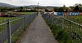
 Path, road and bridge, Rassau - geograph.org.uk - 3979802.jpg 800 × 752 ; 191 kio
-
 Pen y Bryn houses, Rassau - geograph.org.uk - 3979663.jpg 800 × 533 ; 120 kio
-

-
 Price's general stores and off licence, Beaufort - geograph.org.uk - 3647511.jpg 800 × 509 ; 114 kio
-
 Pylon from B4560 - geograph.org.uk - 482500.jpg 589 × 640 ; 94 kio
-
 Rassau - Cendl Crescent - geograph.org.uk - 162293.jpg 640 × 480 ; 59 kio
-
 Rassau - Old School - geograph.org.uk - 162289.jpg 640 × 480 ; 100 kio
-
 Rassau General Stores and Post Office - geograph.org.uk - 3979533.jpg 800 × 673 ; 145 kio
-
 Rassau Industrial Estate - geograph.org.uk - 3543922.jpg 2 288 × 1 712 ; 821 kio
-
 Rassau Industrial Estate at north-eastern end - geograph.org.uk - 6040873.jpg 1 024 × 768 ; 138 kio
-
 Rassau Industrial Estate road bend - geograph.org.uk - 6040871.jpg 1 024 × 768 ; 135 kio
-
 Rassau looking towards Ebbw Vale town - geograph.org.uk - 498176.jpg 640 × 480 ; 90 kio
-
 Rassau Old Age Pensioners Hall - geograph.org.uk - 3979373.jpg 800 × 426 ; 94 kio
-
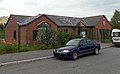
 Rassau Resource Centre - geograph.org.uk - 3979725.jpg 800 × 470 ; 81 kio
-
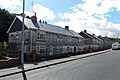 Rassau Road houses, Rassau - geograph.org.uk - 3646779.jpg 800 × 531 ; 116 kio
-
 Rassau Substation - geograph.org.uk - 283496.jpg 394 × 600 ; 37 kio
-
 Rassau Supper Bar - geograph.org.uk - 3646584.jpg 800 × 521 ; 114 kio
-
 Rassau Youth Centre - geograph.org.uk - 3979453.jpg 800 × 491 ; 100 kio
-
 Rhondda Close, Rassau - geograph.org.uk - 3979548.jpg 640 × 403 ; 61 kio
-
 Rhymney Close, Rassau - geograph.org.uk - 3992389.jpg 640 × 421 ; 57 kio
-
 Roundabout on Rassau during snow 2006 - geograph.org.uk - 1707297.jpg 1 280 × 960 ; 343 kio
-
 Rowan Way, Rassau - geograph.org.uk - 3992346.jpg 800 × 518 ; 88 kio
-
 Scaffolding on Avon Court flats in Rassau - geograph.org.uk - 3992420.jpg 800 × 678 ; 174 kio
-
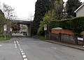 School Road passes under the A4046, Rassau - geograph.org.uk - 3979823.jpg 800 × 579 ; 129 kio
-
 School Road, Rassau - geograph.org.uk - 3646597.jpg 800 × 685 ; 142 kio
-
 Skate park in Rassau - geograph.org.uk - 3979528.jpg 800 × 460 ; 113 kio
-
 Southern slopes of Mynydd Llangynidr - geograph.org.uk - 3131931.jpg 1 024 × 768 ; 217 kio
-
 Summerfield Road, Rassau - geograph.org.uk - 3979461.jpg 800 × 506 ; 92 kio
-
 Summit of the Heads of the Valleys Road - geograph.org.uk - 381495.jpg 480 × 640 ; 88 kio
-
 Taff Close, Rassau - geograph.org.uk - 3992370.jpg 800 × 447 ; 75 kio
-
 The Castle Pub, Ebbw Vale - geograph.org.uk - 731264.jpg 640 × 480 ; 86 kio
-
 The Castle, Rassau - geograph.org.uk - 5334192.jpg 3 264 × 2 448 ; 2,19 Mio
-
 Towards Phillips Close, Rassau - geograph.org.uk - 3979677.jpg 800 × 476 ; 110 kio
-
 Tudor Close, Rassau - geograph.org.uk - 3979626.jpg 800 × 562 ; 132 kio
-
 Ty Bryn Non-political Workmen's Club, Rassau - geograph.org.uk - 3646806.jpg 800 × 586 ; 132 kio
-
 Western end of Summerfield Road, Rassau - geograph.org.uk - 3979635.jpg 800 × 504 ; 103 kio
-
 Wild moorland - geograph.org.uk - 3131948.jpg 1 024 × 768 ; 272 kio
-
 Wind Turbine, Rassau Industrial Estate - geograph.org.uk - 2872372.jpg 1 944 × 2 592 ; 1,13 Mio
-
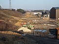 Work begins on the A465 dual carriageway - geograph.org.uk - 3358022.jpg 1 600 × 1 200 ; 409 kio


_-_geograph.org.uk_-_3133877.jpg)


_-_geograph.org.uk_-_3158340.jpg)
_-_geograph.org.uk_-_3159209.jpg)


_-_geograph.org.uk_-_3131954.jpg)


