Category:Rathmell
Aller à la navigation
Aller à la recherche
localité britannique du comté anglais de North Yorkshire | |||||
| Téléverser des médias | |||||
| Nature de l’élément | |||||
|---|---|---|---|---|---|
| Lieu | Craven, Yorkshire du Nord, Yorkshire-et-Humber, Angleterre | ||||
 | |||||
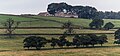
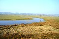
English: Rathmell is a village and civil parish in the Craven district of North Yorkshire, England. It is close to the River Ribble and about three miles south of Settle. Other towns and villages nearby include Wigglesworth, Tosside, Giggleswick and Long Preston.
Sous-catégories
Cette catégorie comprend 2 sous-catégories, dont les 2 ci-dessous.
H
R
- Rathmell War Memorial (2 F)
Média dans la catégorie « Rathmell »
Cette catégorie comprend 275 fichiers, dont les 200 ci-dessous.
(page précédente) (page suivante)-
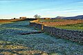
 A hawthorn near a footpath, Rathmell - geograph.org.uk - 5081458.jpg 2 000 × 1 500 ; 939 kio
-
 A sign for the Ribble Way - geograph.org.uk - 3574552.jpg 4 592 × 3 056 ; 6,56 Mio
-

-
 Ackworth, Rathmell - geograph.org.uk - 2556301.jpg 2 000 × 1 500 ; 921 kio
-
 Approaching Black Hill - geograph.org.uk - 4358982.jpg 800 × 600 ; 195 kio
-
 Approaching Bull Hurst - geograph.org.uk - 4358618.jpg 800 × 600 ; 129 kio
-
 Approaching Moor Close Crag - geograph.org.uk - 3494823.jpg 4 320 × 3 240 ; 6,07 Mio
-
 Back Lane at Hesley Lane, Rathmell - geograph.org.uk - 5081576.jpg 2 000 × 1 500 ; 1,18 Mio
-
 Barn and farmhouse at Lumb - geograph.org.uk - 4650942.jpg 1 024 × 631 ; 253 kio
-
 Barn on south side of Hesley Lane - geograph.org.uk - 6370491.jpg 1 024 × 683 ; 207 kio
-

-
 Benchmark on barn on south side of Hesley Lane - geograph.org.uk - 6370479.jpg 1 024 × 683 ; 332 kio
-
 Benchmark on footpath steps at Littlebank - geograph.org.uk - 4651040.jpg 683 × 1 024 ; 269 kio
-
 Benchmark on Great Close Lane bridge parapet - geograph.org.uk - 6373032.jpg 1 024 × 683 ; 358 kio
-
 Benchmark on Holy Trinity Church - geograph.org.uk - 6370239.jpg 1 024 × 683 ; 304 kio
-
 Benchmark on Lumb Barn - geograph.org.uk - 4650871.jpg 1 024 × 683 ; 187 kio
-
 Benchmark on rock on south side of Old Oliver Lane - geograph.org.uk - 6370587.jpg 1 024 × 683 ; 338 kio
-
 Benchmark on stone in wall at entrance to Ragged Hall - geograph.org.uk - 6370828.jpg 1 024 × 683 ; 359 kio
-
 Benchmark on stone in wall on NE side of Mill Lane - geograph.org.uk - 6370308.jpg 1 024 × 683 ; 292 kio
-
 Benchmark on the School House, Hesley Lane - geograph.org.uk - 6369943.jpg 646 × 1 024 ; 277 kio
-
 Benchmark on wall on the south side of Hesley Lane - geograph.org.uk - 6370412.jpg 1 024 × 683 ; 292 kio
-
 Bikers passing through Rathmell - geograph.org.uk - 3121928.jpg 1 879 × 1 408 ; 1,51 Mio
-
 Bond Beck - geograph.org.uk - 144398.jpg 640 × 480 ; 142 kio
-
 Boulders on Cocket Moss - geograph.org.uk - 3999519.jpg 640 × 480 ; 68 kio
-
 Bridge taking Old Oliver Lane over a beck - geograph.org.uk - 6370571.jpg 1 024 × 683 ; 258 kio
-
 Buried pipeline - geograph.org.uk - 522892.jpg 640 × 480 ; 126 kio
-
 Cancelled benchmark on building at Whelpstone Lodge - geograph.org.uk - 6372987.jpg 1 024 × 683 ; 347 kio
-
 Cocket Lane - geograph.org.uk - 3494832.jpg 4 320 × 3 240 ; 5,31 Mio
-
 Cocket Lane - geograph.org.uk - 3996336.jpg 640 × 480 ; 81 kio
-
 Cocket Lane, Rathmell - geograph.org.uk - 2556458.jpg 2 000 × 1 500 ; 1,12 Mio
-
 Cocket Moss - geograph.org.uk - 1393974.jpg 640 × 480 ; 106 kio
-
 Cocket Moss - geograph.org.uk - 3494816.jpg 4 320 × 3 240 ; 5,79 Mio
-
 Cocket Moss, Rathmell - geograph.org.uk - 3080538.jpg 2 000 × 1 500 ; 966 kio
-
 Country Road Rathmell - geograph.org.uk - 176779.jpg 640 × 480 ; 94 kio
-

-
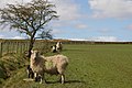
 Dalesbred ram and Pen-y-Ghent - geograph.org.uk - 4358973.jpg 640 × 480 ; 96 kio
-
 Derelict farmhouse, Black Hill - geograph.org.uk - 4358602.jpg 640 × 480 ; 134 kio
-
 Descending towards Upper Sheep Wash - geograph.org.uk - 4358632.jpg 640 × 480 ; 97 kio
-

-
 Elizabeth II postbox on Main Street, Rathmell - geograph.org.uk - 5141880.jpg 1 470 × 2 405 ; 682 kio
-
 Entrance and road to Street House Farm - geograph.org.uk - 158221.jpg 640 × 426 ; 134 kio
-
 Entrance to Ragged Hall from Old Oliver Road - geograph.org.uk - 6370839.jpg 1 024 × 683 ; 209 kio
-
 Far Cappleside - geograph.org.uk - 5091436.jpg 5 156 × 2 784 ; 1,8 Mio
-
 Far Cappleside Barn - geograph.org.uk - 5140149.jpg 640 × 480 ; 60 kio
-
 Farm building near Rathmell - geograph.org.uk - 4904556.jpg 640 × 480 ; 85 kio
-
 Farm Buildings near New Hall - geograph.org.uk - 4911454.jpg 640 × 428 ; 64 kio
-
 Farm driveway at Whelpstone Lodge, Rathmell - geograph.org.uk - 5496882.jpg 2 000 × 1 500 ; 879 kio
-

-
 Farm track towards Lumb passing Littlebank - geograph.org.uk - 4651089.jpg 1 024 × 683 ; 320 kio
-
 Farmhouse, Millgate House Farm - geograph.org.uk - 5140159.jpg 640 × 504 ; 62 kio
-
 Farmland at New Hall - geograph.org.uk - 4910364.jpg 640 × 428 ; 71 kio
-
 Field gateway off south side of Old Oliver Lane - geograph.org.uk - 6370731.jpg 1 024 × 683 ; 231 kio
-
 Field gateway onto Old Oliver Road near Ragged Hall - geograph.org.uk - 6371054.jpg 1 024 × 683 ; 231 kio
-
 Field Well, Far Cappleside - geograph.org.uk - 4904536.jpg 640 × 480 ; 75 kio
-
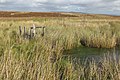
 Flooded field - geograph.org.uk - 5610244.jpg 640 × 427 ; 120 kio
-
 Footbridge on the path to Cocket Moss - geograph.org.uk - 3080569.jpg 2 000 × 1 500 ; 1,26 Mio
-
 Footbridge,Rathmell Beck - geograph.org.uk - 4904545.jpg 640 × 480 ; 114 kio
-
 Footpath above Higher Brayshaw - geograph.org.uk - 4357685.jpg 640 × 480 ; 97 kio
-
 Footpath above Rathmell Beck - geograph.org.uk - 4356238.jpg 640 × 480 ; 101 kio
-
 Footpath at the corner of a wall, Rathmell - geograph.org.uk - 5081468.jpg 2 000 × 1 500 ; 968 kio
-
 Footpath down to Rathmell Beck - geograph.org.uk - 4356224.jpg 640 × 480 ; 136 kio
-
 Footpath on Badger Hill - geograph.org.uk - 3493261.jpg 4 320 × 3 240 ; 5,73 Mio
-
 Footpath to Green Farm - geograph.org.uk - 5610238.jpg 640 × 427 ; 111 kio
-
 Footpath to Heath Farm - geograph.org.uk - 158204.jpg 640 × 426 ; 151 kio
-
 Ford at Rathmell Beck - geograph.org.uk - 1394504.jpg 640 × 480 ; 134 kio
-
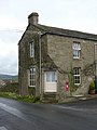 Former post office, Rathmell - geograph.org.uk - 2353576.jpg 480 × 640 ; 70 kio
-
 Foxholes Crag - geograph.org.uk - 3080727.jpg 2 000 × 1 500 ; 820 kio
-
 Foxholes Crag - geograph.org.uk - 3537345.jpg 1 600 × 1 200 ; 499 kio
-
 Gate across Old Oliver Lane approaching Whelpstone Lodge - geograph.org.uk - 6371343.jpg 1 024 × 683 ; 195 kio
-
 Gate on footpath from Holden Moor to Whelpstone Lodge, Rathmell - geograph.org.uk - 5496867.jpg 2 000 × 1 500 ; 1,08 Mio
-
 Gateway for track to Higher Barn from Old Oliver Lane - geograph.org.uk - 6368849.jpg 1 024 × 683 ; 194 kio
-
 Giggleswick Wigglesworth Tosside Wham Sign - geograph.org.uk - 707035.jpg 640 × 480 ; 37 kio
-
 Grassland near Long Gill - geograph.org.uk - 4507016.jpg 1 024 × 768 ; 605 kio
-
 Grazing north east of Rathmell - geograph.org.uk - 5140172.jpg 640 × 480 ; 54 kio
-
 Green Lane above Hanover Gill - geograph.org.uk - 3493559.jpg 4 320 × 3 240 ; 5,66 Mio
-
 Green Lane leading down to Upper and Lower Sheep Wash - geograph.org.uk - 3493596.jpg 4 320 × 3 240 ; 5,22 Mio
-
 Hanover Gill and Scoutber Crag - geograph.org.uk - 4358609.jpg 640 × 480 ; 111 kio
-
 Heading for Rathmell - geograph.org.uk - 4358775.jpg 800 × 600 ; 112 kio
-
 Heading north east from Rathmell - geograph.org.uk - 5140177.jpg 640 × 480 ; 64 kio
-
 Heading north towards Rathmell - geograph.org.uk - 5140148.jpg 640 × 480 ; 66 kio
-
 Hedge and tree-lined lane near to High Green Wood - geograph.org.uk - 6053856.jpg 4 000 × 3 000 ; 4,95 Mio
-

-
 Hesley Hall - geograph.org.uk - 5610217.jpg 640 × 427 ; 81 kio
-
 Hesley Lane bridge over Hesley Beck - geograph.org.uk - 6370385.jpg 1 024 × 683 ; 267 kio
-
 Hesley Lane west of Hesley Hall - geograph.org.uk - 6370432.jpg 1 024 × 683 ; 239 kio
-
 Hill up into the village, Rathmell - geograph.org.uk - 1450604.jpg 640 × 466 ; 101 kio
-
 Hollin Hall Barn - geograph.org.uk - 3121940.jpg 2 718 × 1 976 ; 1,81 Mio
-
 Hollin Hall Barn - geograph.org.uk - 5140178.jpg 640 × 480 ; 53 kio
-
 Hollin Hall Barn, Rathmell - geograph.org.uk - 1450618.jpg 640 × 480 ; 126 kio
-
 Hollow Gill - geograph.org.uk - 5091439.jpg 5 183 × 2 435 ; 1,73 Mio
-
 Hollow Gill Bridge, looking north, Wigglesworth - geograph.org.uk - 5081618.jpg 2 000 × 1 500 ; 1,05 Mio
-
 Hollow Gill Brow approaching Hollow Gill Bridge, Rathmell - geograph.org.uk - 5081627.jpg 2 000 × 1 500 ; 1,11 Mio
-
 Holly Dene - geograph.org.uk - 4904567.jpg 640 × 480 ; 48 kio
-
 Holy Trinity Church and part of its burial ground at Rathmell - geograph.org.uk - 6053848.jpg 4 000 × 3 000 ; 3,56 Mio
-
 Holy Trinity Church, Main Street - geograph.org.uk - 6370273.jpg 1 024 × 683 ; 258 kio
-
 House and barn at Whelpstone Lodge - geograph.org.uk - 6373005.jpg 1 024 × 683 ; 204 kio
-
 Houses on Main Street, Rathmell - geograph.org.uk - 5141881.jpg 2 848 × 2 136 ; 1,28 Mio
-
 Huggon House - geograph.org.uk - 2248554.jpg 4 320 × 3 240 ; 4,96 Mio
-
 Ingleborough - geograph.org.uk - 5610219.jpg 640 × 427 ; 66 kio
-
 Junction of Hesley Lane and Back Lane, Rathmell - geograph.org.uk - 5081583.jpg 2 000 × 1 431 ; 1,2 Mio
-
 Lane at Lower Sheep Wash Farm - geograph.org.uk - 6053861.jpg 4 000 × 3 000 ; 3,51 Mio
-
 Lane bend north of Rathmell - geograph.org.uk - 3338222.jpg 640 × 481 ; 41 kio
-
 Lane looking north near Hollin Hall Barn - geograph.org.uk - 3338708.jpg 640 × 480 ; 65 kio
-
 Lane near Huggon, Rathmell - geograph.org.uk - 1438854.jpg 640 × 480 ; 98 kio
-
 Lane near Huggon, Rathmell - geograph.org.uk - 1438860.jpg 640 × 471 ; 124 kio
-
 Last few metres to Resting Stone - geograph.org.uk - 3537361.jpg 1 600 × 1 200 ; 330 kio
-
 Littlebank - geograph.org.uk - 4908788.jpg 640 × 428 ; 92 kio
-
 Long Gill Brook below Middle Brayshaw - geograph.org.uk - 4357667.jpg 800 × 600 ; 119 kio
-
 Looking down the lane to Whelpstone Lodge, Rathmell - geograph.org.uk - 5496897.jpg 2 000 × 1 307 ; 796 kio
-
 Looking South East along Scoutber Crag - geograph.org.uk - 550989.jpg 640 × 480 ; 112 kio
-
 Looking south from Resting Stone - geograph.org.uk - 3537367.jpg 1 600 × 1 200 ; 405 kio
-
 Lumb Barn - geograph.org.uk - 4650925.jpg 683 × 1 024 ; 219 kio
-
 Lumb Bridge - geograph.org.uk - 4358752.jpg 640 × 480 ; 173 kio
-
 Main Street in Rathmell - geograph.org.uk - 6053852.jpg 3 812 × 2 859 ; 1,93 Mio
-
 Main Street, Rathmell - geograph.org.uk - 2353567.jpg 640 × 480 ; 133 kio
-
 Main Street, Rathmell - geograph.org.uk - 3338211.jpg 640 × 480 ; 75 kio
-
 Main Street, Rathmell - geograph.org.uk - 5140164.jpg 640 × 480 ; 64 kio
-
 Mill Lane near Rathmell - geograph.org.uk - 6053854.jpg 4 000 × 3 000 ; 3,65 Mio
-
 Millgate House Farm - geograph.org.uk - 5140157.jpg 640 × 480 ; 77 kio
-
 Minor road towards Giggleswick - geograph.org.uk - 5140181.jpg 640 × 480 ; 54 kio
-
 Minor road towards Giggleswick - geograph.org.uk - 5140186.jpg 640 × 480 ; 61 kio
-
 Muddy patch on Cocket Moss - geograph.org.uk - 3996303.jpg 640 × 480 ; 99 kio
-
 New Hall - geograph.org.uk - 4910353.jpg 640 × 428 ; 85 kio
-
 New Hall - geograph.org.uk - 5610242.jpg 640 × 427 ; 109 kio
-
 New houses being built, Rathmell - geograph.org.uk - 5140163.jpg 640 × 480 ; 80 kio
-
 Odd Stone Bridge between Upper and Lower Sheep Wash - geograph.org.uk - 3493696.jpg 4 320 × 3 240 ; 4,72 Mio
-
 Old milestone at Hesley Lane - Main Street junction - geograph.org.uk - 6370288.jpg 1 024 × 683 ; 297 kio
-
 Old Oliver Lane going towards Whelpstone Lodge - geograph.org.uk - 6371086.jpg 1 024 × 683 ; 182 kio
-
 On the footpath below Big Hill - geograph.org.uk - 3537340.jpg 1 600 × 1 200 ; 371 kio
-
 On the footpath from Holden Moor to Whelpstone Lodge, Rathmell - geograph.org.uk - 5496868.jpg 2 000 × 1 500 ; 1,05 Mio
-
 Ordnance Survey Cut Mark - geograph.org.uk - 6329495.jpg 1 024 × 699 ; 285 kio
-
 Ordnance Survey Cut Mark - geograph.org.uk - 6329496.jpg 1 024 × 758 ; 226 kio
-
 Ordnance Survey Cut Mark - geograph.org.uk - 6329497.jpg 1 024 × 840 ; 237 kio
-
 Ordnance Survey Pivot Cut Mark - geograph.org.uk - 6054138.jpg 3 812 × 2 859 ; 3,4 Mio
-
 Outside Rathmell - geograph.org.uk - 3121909.jpg 2 816 × 2 112 ; 3,92 Mio
-
 Path through bracken on Rathmell Common - geograph.org.uk - 1393993.jpg 640 × 480 ; 80 kio
-
 Perched boulder - geograph.org.uk - 3080560.jpg 2 000 × 1 500 ; 1,03 Mio
-
 Pond in pasture - geograph.org.uk - 3080600.jpg 2 000 × 1 500 ; 1,02 Mio
-
 Ragged Hall - geograph.org.uk - 1394498.jpg 640 × 480 ; 109 kio
-
 Rathmell - geograph.org.uk - 5091396.jpg 4 576 × 2 768 ; 2,01 Mio
-
 Rathmell - geograph.org.uk - 5091434.jpg 5 183 × 3 011 ; 2,02 Mio
-
 Rathmell Beck - geograph.org.uk - 5610230.jpg 640 × 427 ; 156 kio
-
 Rathmell Common - geograph.org.uk - 3080617.jpg 2 000 × 1 500 ; 931 kio
-
 Rathmell from Watery Lane - geograph.org.uk - 5610263.jpg 640 × 427 ; 103 kio
-
 Rathmell Reading Room - geograph.org.uk - 2353448.jpg 640 × 480 ; 111 kio
-
 Rathmell Reading Room - geograph.org.uk - 5140167.jpg 640 × 480 ; 73 kio
-
 Rathmell Reading Room, Rathmell village - geograph.org.uk - 45204.jpg 640 × 480 ; 124 kio
-
 Rathmell telephone box - geograph.org.uk - 5610267.jpg 640 × 427 ; 103 kio
-
 Rathmell Yorks WR Signpost 2016.06.03.jpg 1 500 × 1 057 ; 718 kio
-
 Reedy tarn near Resting Stone - geograph.org.uk - 2067210.jpg 640 × 426 ; 427 kio
-
 Relocated stone stile step with benchmark - geograph.org.uk - 6373207.jpg 683 × 1 024 ; 299 kio
-
 Resting Stone - geograph.org.uk - 2067206.jpg 640 × 426 ; 350 kio
-
 Resting Stone - geograph.org.uk - 770105.jpg 640 × 480 ; 74 kio
-
 Resting Stone - Northeast - Bowland - geograph.org.uk - 1869340.jpg 3 264 × 2 448 ; 1,96 Mio
-
 Retired farm machine at Whelpstone Lodge - geograph.org.uk - 1704524.jpg 1 909 × 1 273 ; 1,02 Mio
-
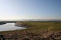
 Ribble Valley - geograph.org.uk - 5091393.jpg 5 184 × 3 456 ; 1,61 Mio
-
 Ribble Way - geograph.org.uk - 4904574.jpg 640 × 480 ; 50 kio
-
 Ribble Way at Holly Dene - geograph.org.uk - 2248549.jpg 4 320 × 3 240 ; 3,72 Mio
-
 Ribble Way near Hollin Hall - geograph.org.uk - 2248546.jpg 4 320 × 3 240 ; 3,42 Mio
-
 Ribble Way passing through Green Farm - geograph.org.uk - 2248551.jpg 4 320 × 3 240 ; 4,05 Mio
-
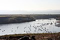
 River Ribble - geograph.org.uk - 176213.jpg 640 × 480 ; 235 kio
-
 River Ribble - geograph.org.uk - 176220.jpg 640 × 480 ; 238 kio
-
 River Ribble - geograph.org.uk - 696179.jpg 640 × 427 ; 59 kio
-
 River Ribble - geograph.org.uk - 696202.jpg 640 × 427 ; 54 kio
-
 River Ribble - geograph.org.uk - 706140.jpg 640 × 427 ; 67 kio
-
 River Ribble - geograph.org.uk - 706177.jpg 640 × 427 ; 81 kio
-
 River Ribble Meander looking North - geograph.org.uk - 2980952.jpg 4 320 × 3 240 ; 3,02 Mio
-
 River Ribble Meander looking South - geograph.org.uk - 2980964.jpg 4 320 × 3 240 ; 3,05 Mio
-
 Road (footpath) to Far Cappleside - geograph.org.uk - 5140153.jpg 640 × 480 ; 71 kio
-
 Road junction, Rathmell - geograph.org.uk - 5081513.jpg 2 000 × 1 388 ; 906 kio
-
 Rome Crag - geograph.org.uk - 1393965.jpg 640 × 480 ; 57 kio
-
 Rough ground southwest of Sandford Farm - geograph.org.uk - 3537328.jpg 1 600 × 1 200 ; 436 kio
-
 Rough pastureland by Black Leach - geograph.org.uk - 4358641.jpg 640 × 480 ; 104 kio
-
 Ruins below Big Hill from the East - geograph.org.uk - 3491345.jpg 4 320 × 3 240 ; 4,59 Mio
-
 Ruins below Big Hill from the West - geograph.org.uk - 3491337.jpg 4 320 × 3 240 ; 5,77 Mio
-
 School House, Hesley Lane - geograph.org.uk - 6370226.jpg 1 024 × 683 ; 176 kio
-
 Seat beside Mill Lane - geograph.org.uk - 6370327.jpg 1 024 × 683 ; 175 kio
-
 Seat^ Main Street, Rathmell - geograph.org.uk - 2353462.jpg 640 × 480 ; 185 kio
-
 Sheep grazing near Hollin Hall Barn - geograph.org.uk - 5140179.jpg 640 × 480 ; 81 kio
-
 Sheep grazing near New Hall - geograph.org.uk - 5140191.jpg 640 × 480 ; 69 kio
-
 Sheep near New Hall - geograph.org.uk - 6273885.jpg 1 024 × 683 ; 206 kio
-
 Sheep near old ruin - Foxholes Crag - NE Bowland - geograph.org.uk - 1869432.jpg 3 264 × 2 448 ; 1,82 Mio
-
 Stile on footpath from Boostagill to Old Oliver Lane, Rathmell - geograph.org.uk - 5081500.jpg 2 000 × 1 500 ; 1,03 Mio
-
 Stile on path across Rathmell Common - geograph.org.uk - 3080624.jpg 2 000 × 1 459 ; 1,06 Mio
-
 Stile on path to Cocket Moss - geograph.org.uk - 3080563.jpg 2 000 × 1 500 ; 1,19 Mio
-
 Stile on path to Cocket Moss and Cocket Lane, Rathmell - geograph.org.uk - 3080556.jpg 2 000 × 1 500 ; 1 001 kio
-
 Stile on the footpath from Boostagill to Old Oliver Lane - geograph.org.uk - 5081118.jpg 2 000 × 1 472 ; 924 kio
-
 Stile on the footpath from Boostagill to Old Oliver Lane, Rathmell - geograph.org.uk - 5081482.jpg 2 000 × 1 500 ; 1,18 Mio
-
 Stile onto Cocket Moss - geograph.org.uk - 3080582.jpg 2 000 × 1 500 ; 905 kio
-
 Stone Barn between Hesley Lane and Boostagill - geograph.org.uk - 2248557.jpg 4 320 × 3 240 ; 4,9 Mio
-
 Stone barn, Millgate House Farm - geograph.org.uk - 5140160.jpg 640 × 480 ; 83 kio
-
 Storm over the River Ribble - geograph.org.uk - 4727442.jpg 640 × 428 ; 33 kio
-
 Swainstead - geograph.org.uk - 5098866.jpg 5 184 × 2 405 ; 1,39 Mio
-
 Swainstead from Coney Garth, Rathmell - geograph.org.uk - 2556310.jpg 2 000 × 1 471 ; 879 kio
-
 Swainstead Raike - geograph.org.uk - 1394505.jpg 480 × 640 ; 79 kio
-
 Swainstead Raikes - geograph.org.uk - 3494810.jpg 4 320 × 3 240 ; 5,66 Mio
-
 The Crook - geograph.org.uk - 4667847.jpg 640 × 426 ; 74 kio
-
 The Crook - geograph.org.uk - 4667849.jpg 640 × 426 ; 67 kio
-
 The lane through Lower Sheepwash, Rathmell - geograph.org.uk - 1438846.jpg 640 × 479 ; 124 kio
-
 The Olde Post House, Main Street - geograph.org.uk - 6141262.jpg 1 024 × 683 ; 168 kio


_to_Far_Cappleside_-_geograph.org.uk_-_5140153.jpg)


