Category:Rawcliffe, East Riding of Yorkshire
Vai alla navigazione
Vai alla ricerca
English: Rawcliffe (or Rawcliffe in Snaith) is a village and civil parish in the East Riding of Yorkshire, England. It is situated approximately 4 miles (6.4 km) west of Goole. It lies on the banks of the River Aire just north of the M62 and on the A614 road.
village and civil parish in the East Riding of Yorkshire, England  | |||||
| Carica un file multimediale | |||||
| Istanza di | |||||
|---|---|---|---|---|---|
| Luogo | East Riding of Yorkshire, Yorkshire e Humber, Inghilterra | ||||
 | |||||
Sottocategorie
Questa categoria contiene le 5 sottocategorie indicate di seguito, su un totale di 5.
R
- Rawcliffe railway station (2 F)
S
- St James' Church, Rawcliffe (7 F)
File nella categoria "Rawcliffe, East Riding of Yorkshire"
Questa categoria contiene 200 file, indicati di seguito, su un totale di 324.
(pagina precedente) (pagina successiva)-
 "Material Girl" inflatable at Rawcliffe Bridge - geograph.org.uk - 6350024.jpg 3 701 × 4 953; 3,75 MB
-
 110 and 112 High Street, Rawcliffe - geograph.org.uk - 3020204.jpg 1 024 × 768; 128 KB
-
 A flat landscape over the River Aire - geograph.org.uk - 4997132.jpg 4 602 × 3 448; 4,74 MB
-
 A picture of Rawcliffe Bridge, Bridge Lane - geograph.org.uk - 2859286.jpg 1 024 × 768; 113 KB
-
 A sign of the railway - geograph.org.uk - 3020168.jpg 1 024 × 768; 224 KB
-
 A small part of the Croda Chemicals site - geograph.org.uk - 2859331.jpg 1 024 × 768; 141 KB
-
 A walk from Goole ^21 - geograph.org.uk - 1991805.jpg 800 × 600; 285 KB
-
 A walk from Goole ^22 - geograph.org.uk - 1991808.jpg 800 × 600; 243 KB
-
 A walk from Goole ^25 - geograph.org.uk - 1991825.jpg 800 × 600; 235 KB
-
 A walk from Goole ^26 - geograph.org.uk - 1991833.jpg 800 × 600; 251 KB
-
 A walk from Goole ^27 - geograph.org.uk - 1991862.jpg 800 × 600; 195 KB
-
 A walk from Goole ^28 - geograph.org.uk - 1991867.jpg 800 × 600; 238 KB
-
 A walk from Goole ^29 - geograph.org.uk - 1991878.jpg 800 × 600; 250 KB
-
 A walk from Goole ^30 - geograph.org.uk - 1991888.jpg 800 × 600; 315 KB
-
 A walk from Goole ^31 - geograph.org.uk - 1991894.jpg 800 × 600; 322 KB
-
 A walk from Goole ^32 - geograph.org.uk - 1991901.jpg 800 × 600; 217 KB
-
 A walk from Goole ^33 - geograph.org.uk - 1991907.jpg 800 × 600; 178 KB
-
 A walk from Goole ^34 - geograph.org.uk - 1991912.jpg 800 × 600; 212 KB
-
 A walk from Goole ^35 - geograph.org.uk - 1991916.jpg 800 × 600; 237 KB
-
 A walk from Goole ^36 - geograph.org.uk - 1991923.jpg 800 × 600; 200 KB
-
 A walk from Goole ^37 - geograph.org.uk - 1991927.jpg 800 × 600; 284 KB
-
 A walk from Goole ^38 - geograph.org.uk - 1991934.jpg 800 × 600; 218 KB
-
 A walk from Goole ^39 - geograph.org.uk - 1991940.jpg 800 × 600; 279 KB
-
 A walk from Goole ^40 - geograph.org.uk - 1991945.jpg 800 × 600; 250 KB
-
 A walk from Goole ^41 - geograph.org.uk - 1991949.jpg 800 × 600; 168 KB
-
 A walk from Goole ^42 - geograph.org.uk - 1991955.jpg 800 × 600; 233 KB
-
 A walk from Goole ^43 - geograph.org.uk - 1991963.jpg 800 × 600; 162 KB
-
 A walk from Goole ^44 - geograph.org.uk - 1991969.jpg 800 × 600; 235 KB
-
 A walk from Goole ^45 - geograph.org.uk - 1991975.jpg 800 × 600; 230 KB
-
 A walk from Goole ^46 - geograph.org.uk - 1991981.jpg 800 × 600; 268 KB
-
 A walk from Goole ^47 - geograph.org.uk - 1991987.jpg 800 × 600; 224 KB
-
 A walk from Goole ^48 - geograph.org.uk - 1991994.jpg 800 × 600; 269 KB
-
 A1041 at Turn Bridge - geograph.org.uk - 5921563.jpg 1 024 × 767; 99 KB
-
 A614 at Rawcliffe village boundary - geograph.org.uk - 5921572.jpg 1 024 × 774; 116 KB
-
 A614 heading to Rawcliffe - geograph.org.uk - 5256832.jpg 1 024 × 615; 110 KB
-
 A614 level crossing - geograph.org.uk - 5921569.jpg 1 024 × 771; 161 KB
-
 A614 Rawcliffe Road - geograph.org.uk - 5921573.jpg 1 024 × 805; 151 KB
-
 A614 towards Goole - geograph.org.uk - 2276015.jpg 1 600 × 1 200; 494 KB
-
 A614 towards Goole - geograph.org.uk - 2276076.jpg 1 600 × 1 200; 407 KB
-
 A645 towards Selby - geograph.org.uk - 2275044.jpg 1 600 × 1 200; 303 KB
-
 Access road by the Dutch River - geograph.org.uk - 1331696.jpg 640 × 480; 211 KB
-
 Access temporarily denied - geograph.org.uk - 664395.jpg 640 × 480; 309 KB
-
 Aire and Calder Navigation - geograph.org.uk - 4997459.jpg 4 460 × 3 250; 4,76 MB
-
 Aire ^ Calder Navigation, east of the M18 - geograph.org.uk - 3920536.jpg 1 024 × 614; 45 KB
-

-
 Aire ^ Calder Navigation, west of the M18 - geograph.org.uk - 3920547.jpg 1 024 × 614; 96 KB
-
 Along the A645 - geograph.org.uk - 6127323.jpg 1 024 × 683; 587 KB
-
 Alongside the A645 - geograph.org.uk - 3020708.jpg 1 024 × 768; 126 KB
-
 Alongside the Aire at Rawcliffe - geograph.org.uk - 3020208.jpg 1 024 × 768; 286 KB
-
 Arable land - geograph.org.uk - 1331688.jpg 640 × 480; 258 KB
-
 Bales of hay by Bridge Lane. Rawcliffe Bridge - geograph.org.uk - 6349795.jpg 4 898 × 3 574; 3,82 MB
-
 Bank House - geograph.org.uk - 2859339.jpg 1 024 × 768; 152 KB
-
 Barns west of Decoy Farm - geograph.org.uk - 3919883.jpg 1 024 × 768; 146 KB
-
 Bend around Gardener's Grounds - geograph.org.uk - 664295.jpg 640 × 480; 223 KB
-
 Bend in the River Ouse at Eskamhorn - geograph.org.uk - 6235303.jpg 1 600 × 1 200; 608 KB
-
 Beneath Rawcliffe Bridge - geograph.org.uk - 6349865.jpg 4 787 × 3 464; 2,12 MB
-
 Beware of the bend - geograph.org.uk - 2859374.jpg 1 024 × 768; 69 KB
-
 Big Patch or Tarmac - geograph.org.uk - 183833.jpg 640 × 480; 69 KB
-
 Black Horse pub, Bridge Lane, Rawcliffe Bridge - geograph.org.uk - 3919938.jpg 1 024 × 768; 109 KB
-
 Boats at Rawcliffe Bridge - geograph.org.uk - 6350012.jpg 3 771 × 5 121; 3,8 MB
-
 Bridge Construction - geograph.org.uk - 78322.jpg 640 × 434; 94 KB
-
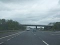
 Bridge Lane goes under the M62 - geograph.org.uk - 2707989.jpg 800 × 600; 210 KB
-
 Bridge Lane towards Rawcliffe - geograph.org.uk - 2422363.jpg 1 600 × 1 200; 469 KB
-
 Bridge Lane, Rawcliffe Bridge - geograph.org.uk - 2859274.jpg 1 024 × 768; 102 KB
-
 Bridge Lane, Rawcliffe Bridge - geograph.org.uk - 5146558.jpg 1 600 × 1 200; 682 KB
-
 Bridge over the River Aire - geograph.org.uk - 1287205.jpg 640 × 480; 28 KB
-
 Bridge over the River Aire - geograph.org.uk - 6127321.jpg 1 024 × 683; 435 KB
-
 Building at the end of Key Lane - geograph.org.uk - 5263416.jpg 1 024 × 768; 196 KB
-
 C'est la Vie, Hull - geograph.org.uk - 6349867.jpg 5 029 × 3 755; 3,09 MB
-
 Canalside, Croda Chemicals site - geograph.org.uk - 3919919.jpg 1 024 × 768; 91 KB
-
 Chapel Lane, Rawcliffe.jpg 640 × 477; 100 KB
-
 Chimney at the old tar works near East Cowick - geograph.org.uk - 5146552.jpg 1 600 × 1 200; 479 KB
-

-
 Commons Farm - geograph.org.uk - 2859368.jpg 1 024 × 768; 115 KB
-
 Cottages on Thorne Road, Rawcliffe Bridge - geograph.org.uk - 6349808.jpg 4 973 × 3 549; 4,56 MB
-
 Cottages, Cuckoo Park - geograph.org.uk - 2276073.jpg 1 600 × 1 200; 368 KB
-
 County boundary - geograph.org.uk - 664521.jpg 640 × 480; 236 KB
-
 Course of the old railway - geograph.org.uk - 3020227.jpg 1 024 × 768; 191 KB
-
 Creykes Arms, Rawcliffe - geograph.org.uk - 2276011.jpg 1 600 × 1 200; 356 KB
-
 Creykes Crossing - geograph.org.uk - 1458888.jpg 640 × 480; 81 KB
-
 Creykes railway crossing ahead - geograph.org.uk - 1163457.jpg 640 × 465; 49 KB
-
 Crop fields and farm track - geograph.org.uk - 3835999.jpg 640 × 418; 44 KB
-
 Decoy Farm across Dutch River - geograph.org.uk - 6343497.jpg 2 000 × 941; 1,29 MB
-
 Derelict property on Sugar Mill Pond Nature Reserve - geograph.org.uk - 4997050.jpg 4 522 × 3 338; 6,41 MB
-

-
 Dobella Farm on Dobeller Lane - geograph.org.uk - 4996797.jpg 4 450 × 3 234; 4,58 MB
-
 Dobella Lane Farm on Dobeller Lane - geograph.org.uk - 4996790.jpg 3 069 × 2 300; 2,38 MB
-
 Dobella Lane towards Dobella Farm - geograph.org.uk - 2422364.jpg 1 600 × 1 200; 373 KB
-
 Dobeller Lane Farm - geograph.org.uk - 456320.jpg 469 × 640; 127 KB
-
 Drain alongside Johnny Moor Long Lane - geograph.org.uk - 2859361.jpg 1 024 × 768; 107 KB
-
 Drain beside lane - geograph.org.uk - 1331702.jpg 480 × 640; 219 KB
-
 Drain on King's Moor - geograph.org.uk - 2708193.jpg 1 024 × 768; 131 KB
-
 Drainage ditch beside Ridding Lane - geograph.org.uk - 2276000.jpg 1 600 × 1 200; 617 KB
-
 Drained farmland, west of Oakhill nature reserve - geograph.org.uk - 6265714.jpg 1 600 × 900; 416 KB
-
 Dutch River - geograph.org.uk - 2422359.jpg 1 600 × 1 200; 354 KB
-
 Dutch River - geograph.org.uk - 426476.jpg 640 × 480; 90 KB
-
 Dutch River - geograph.org.uk - 5435922.jpg 640 × 426; 39 KB
-
 Dutch River at Rawcliffe Bridge - geograph.org.uk - 4930203.jpg 4 608 × 3 456; 4,11 MB
-
 Dutch River from Rawcliffe Bridge - geograph.org.uk - 3273144.jpg 1 500 × 996; 1,01 MB
-
 Dutch River, downstream of Rawcliffe Bridge - geograph.org.uk - 2859320.jpg 1 024 × 768; 115 KB
-
 Elms Farm - geograph.org.uk - 2422356.jpg 1 600 × 1 200; 272 KB
-

-
 Entering Rawcliffe - geograph.org.uk - 1255157.jpg 640 × 480; 48 KB
-
 Entrance to Croda works Rawcliffe Bridge - geograph.org.uk - 4996942.jpg 4 580 × 3 418; 4,68 MB
-
 Entrance to Elms Farm - geograph.org.uk - 4930188.jpg 4 177 × 3 129; 3,36 MB
-
 Exiting the M62 - geograph.org.uk - 5435920.jpg 640 × 453; 38 KB
-
 Farm buildings near Creyke's Crossing - geograph.org.uk - 2434049.jpg 1 600 × 1 200; 257 KB
-
 Farmland at the Soiling Farm - geograph.org.uk - 2850777.jpg 1 024 × 768; 166 KB
-
 Farmland near Hookmoor Farm - geograph.org.uk - 2434037.jpg 1 600 × 1 200; 210 KB
-
 Field Lane towards Rawcliffe - geograph.org.uk - 6235307.jpg 1 600 × 1 200; 603 KB
-
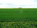
 Field of gold (currently green) - geograph.org.uk - 844311.jpg 640 × 480; 94 KB
-
 Field pond alongside River Aire flood bank - geograph.org.uk - 4997212.jpg 4 608 × 3 456; 4,98 MB
-
 Field pond and River Aire flood bank - geograph.org.uk - 4997220.jpg 4 510 × 3 320; 5,49 MB
-
 Fields alongside the Railway - geograph.org.uk - 1458904.jpg 640 × 480; 82 KB
-
 Flood defence on north side of Dutch River - geograph.org.uk - 3273317.jpg 1 500 × 996; 1,59 MB
-
 Flood Wall and Moor - geograph.org.uk - 183840.jpg 640 × 480; 93 KB
-
 Footpath back to Dobella Farm - geograph.org.uk - 4996806.jpg 4 588 × 3 430; 5,21 MB
-
 Footpath on top of the River Aire flood bank - geograph.org.uk - 4997110.jpg 4 608 × 3 454; 5,21 MB
-
 Footpath stile, south bank of Dutch River - geograph.org.uk - 2859311.jpg 1 024 × 768; 108 KB
-
 Footpath to Ridding Lane - geograph.org.uk - 4996781.jpg 4 608 × 3 456; 3,37 MB
-
 Former Free School, High Street, Rawcliffe - geograph.org.uk - 6225887.jpg 1 600 × 1 065; 713 KB
-
 Former Pub - geograph.org.uk - 193252.jpg 640 × 480; 74 KB
-
 Former Reading Rooms on High Street, Rawcliffe - geograph.org.uk - 6225888.jpg 1 195 × 1 600; 696 KB
-
 Former school at Rawcliffe - geograph.org.uk - 6235315.jpg 1 600 × 1 200; 502 KB
-
 Former Sunday School at Rawcliffe - geograph.org.uk - 6235313.jpg 1 600 × 1 200; 440 KB
-
 Grazing land, Rawcliffe - geograph.org.uk - 2276006.jpg 1 600 × 1 200; 456 KB
-
 Hidden by trees (1) - geograph.org.uk - 3020145.jpg 1 024 × 768; 136 KB
-
 Hidden by trees (2) - geograph.org.uk - 3020148.jpg 1 024 × 768; 219 KB
-
 High Street, Rawcliffe - geograph.org.uk - 3021093.jpg 1 024 × 768; 149 KB
-
 High Street, Rawcliffe - geograph.org.uk - 6225882.jpg 1 600 × 1 065; 652 KB
-
 Hookmoor Farm - geograph.org.uk - 2434031.jpg 1 600 × 1 200; 217 KB
-
 House-building, south side of Bridge Lane - geograph.org.uk - 3919965.jpg 1 024 × 768; 137 KB
-
 Houses at Newland - geograph.org.uk - 6214346.jpg 1 600 × 1 065; 619 KB
-
 Houses on Station Road, Rawcliffe - geograph.org.uk - 6349792.jpg 4 802 × 3 440; 3,25 MB
-
 Humber Keel Sobriety on the Aire and Calder Navigation - geograph.org.uk - 4997790.jpg 3 070 × 2 301; 2,3 MB
-

-
 Information Board at Sugar Mill Nature Reserve - geograph.org.uk - 4996951.jpg 4 574 × 3 412; 6,46 MB
-
 Jemmy Hirst at the Rose and Crown Riverside - geograph.org.uk - 4997101.jpg 4 602 × 3 448; 4,69 MB
-
 Johnny Moor Long Lane - geograph.org.uk - 2934707.jpg 1 024 × 768; 122 KB
-
 Jubilee Pump, The Green, Rawcliffe - geograph.org.uk - 6225631.jpg 1 065 × 1 600; 1,01 MB
-
 Junction With Bridge Lane - geograph.org.uk - 1219898.jpg 640 × 480; 92 KB
-
 Key Lane (2) - geograph.org.uk - 3020717.jpg 1 024 × 768; 137 KB
-
 Key Lane - geograph.org.uk - 3020711.jpg 1 024 × 768; 172 KB
-
 Key Lane - geograph.org.uk - 5263447.jpg 1 024 × 768; 197 KB
-
 Level crossing, A614 - geograph.org.uk - 2275985.jpg 1 600 × 1 200; 393 KB
-
 Lone tree and M62 - geograph.org.uk - 4003177.jpg 1 024 × 768; 96 KB
-
 Looking towards Greenland Farm - geograph.org.uk - 3920568.jpg 1 024 × 768; 139 KB
-
 Looking towards Plumtree Farm - geograph.org.uk - 3919990.jpg 1 024 × 614; 115 KB
-
 M18 bridge - geograph.org.uk - 138949.jpg 640 × 209; 44 KB
-
 M18 crossing the Aire ^ Calder Navigation - geograph.org.uk - 3920540.jpg 1 024 × 614; 102 KB
-
 M18 M62 interchange - geograph.org.uk - 1264063.jpg 640 × 480; 29 KB
-
 M18 M62 interchange - geograph.org.uk - 1264073.jpg 640 × 480; 30 KB
-
 M18 Motorway as it finally merges with the M62 - geograph.org.uk - 2095113.jpg 2 608 × 1 952; 843 KB
-
 M18 slip joins M62 westbound - geograph.org.uk - 3682486.jpg 640 × 480; 45 KB
-
 M18 slip to the M62 westbound - geograph.org.uk - 3682482.jpg 640 × 481; 42 KB
-
 M62 at Dobella Lane overbridge - geograph.org.uk - 5925226.jpg 1 024 × 728; 115 KB
-
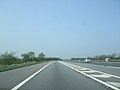
 M62 at Rawcliffe - geograph.org.uk - 342154.jpg 640 × 420; 85 KB
-
 M62 at West Pasture Farm - geograph.org.uk - 5925225.jpg 1 024 × 753; 108 KB
-
 M62 crosses Wakefield - Goole Line - geograph.org.uk - 1408943.jpg 482 × 640; 112 KB
-
 M62 eastbound - geograph.org.uk - 1287162.jpg 640 × 480; 30 KB
-
 M62 eastbound Dobella lane flyover - geograph.org.uk - 1287158.jpg 640 × 480; 31 KB
-
 M62 nearing M18 southbound slip overbridge - geograph.org.uk - 5925227.jpg 1 024 × 787; 114 KB
-
 M62 westbound - geograph.org.uk - 1996263.jpg 640 × 377; 34 KB
-
 M62 westbound from Dobeller Lane flyover - geograph.org.uk - 4996785.jpg 4 608 × 3 456; 5,05 MB
-
 M62, westbound - geograph.org.uk - 5435918.jpg 640 × 426; 42 KB
-
 Marina at Rawcliffe Bridge on Aire and Calder Canal - geograph.org.uk - 4996813.jpg 4 608 × 3 456; 4,19 MB
-
 Mill Lane off the A614 - geograph.org.uk - 6491027.jpg 5 456 × 3 632; 3,16 MB
-
 Mill Lane towards the A614 - geograph.org.uk - 6225894.jpg 1 600 × 1 065; 524 KB
-
 Mini-roundabout on the A614 - geograph.org.uk - 2275974.jpg 1 600 × 1 200; 290 KB
-
 Moor Road - geograph.org.uk - 2422358.jpg 1 600 × 1 200; 473 KB
-
 Moor Road and Top House - geograph.org.uk - 2932001.jpg 1 024 × 768; 129 KB
-
 Moor Road towards Bridge Farm, Rawcliffe Bridge - geograph.org.uk - 5146557.jpg 1 600 × 1 200; 509 KB
-
 Moor Road towards Rawcliffe - geograph.org.uk - 2422357.jpg 1 600 × 1 200; 497 KB
-
 Moor Road, Rawcliffe Bridge - geograph.org.uk - 2394830.jpg 800 × 600; 177 KB
-
 Moor Road, Rawcliffe Bridge - geograph.org.uk - 2707993.jpg 800 × 600; 238 KB
-

-
 Motorway crossing the canal west of Rawcliffe Bridge - geograph.org.uk - 5146554.jpg 1 600 × 1 200; 477 KB
-
 Mr Blue Sky - geograph.org.uk - 664333.jpg 640 × 480; 201 KB
-
 Mute Swan and Cygnets in the rain - geograph.org.uk - 4996836.jpg 3 070 × 2 304; 2,4 MB
-
 Mute Swan family at Rawcliffe Bridge marina - geograph.org.uk - 4996830.jpg 4 608 × 3 456; 3,29 MB
-
 Narrow boat moored on Aire and Calder Navigation - geograph.org.uk - 4997069.jpg 4 480 × 3 278; 4,74 MB
-

-
 Near Top House Farm - geograph.org.uk - 367502.jpg 640 × 458; 87 KB
-
 New Cottages. Moor Road, Rawcliffe Bridge - geograph.org.uk - 2931984.jpg 1 024 × 768; 158 KB
-
 Newland Bridge - geograph.org.uk - 581941.jpg 640 × 466; 80 KB
-
 Newland Bridge on the A645 - geograph.org.uk - 6214328.jpg 1 600 × 1 065; 678 KB
-
 Newland Bridge on the A645 - geograph.org.uk - 6214329.jpg 1 600 × 1 065; 637 KB
-
 No 10 moored at Sugar Mill Ponds Nature Reserve - geograph.org.uk - 4548900.jpg 1 024 × 768; 135 KB
-
 North side of Moor Road - geograph.org.uk - 2859346.jpg 1 024 × 768; 141 KB
-
 Oakhill Pond, from the west bank - geograph.org.uk - 6265724.jpg 1 600 × 1 067; 407 KB
-
 Oilseed rape and Drax power station - geograph.org.uk - 2931994.jpg 1 024 × 768; 177 KB
-
 Old peat workings, Rawcliffe Moors - geograph.org.uk - 788333.jpg 640 × 457; 106 KB
-

-
 On Rawcliffe Bridge - geograph.org.uk - 6349806.jpg 4 967 × 3 467; 4,1 MB
-
 Outbuilding at the Soiling Farm - geograph.org.uk - 2850800.jpg 1 024 × 768; 128 KB
-
 Paddock, north bank, Aire ^ Calder Navigation - geograph.org.uk - 3920577.jpg 1 024 × 768; 130 KB
-
 Partly flooded field in Rawcliffe Bridge - geograph.org.uk - 3273326.jpg 1 500 × 996; 1,59 MB
-

-
 Path across Rawcliffe Green - geograph.org.uk - 5819911.jpg 1 500 × 1 125; 2,09 MB
-
 Path along the west side of Oakhill Pond - geograph.org.uk - 6265718.jpg 1 600 × 1 067; 712 KB


_-_geograph.org.uk_-_844311.jpg)


_-_geograph.org.uk_-_3020145.jpg)
_-_geograph.org.uk_-_3020148.jpg)


_-_geograph.org.uk_-_3020717.jpg)


