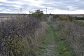
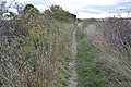
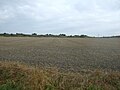
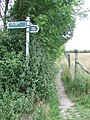
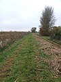
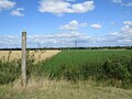
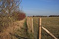
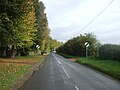
Category:Reach, Cambridgeshire
Zur Navigation springen
Zur Suche springen
العربية: ريتش (كامبريدجشير) هي civil parish تقع في المملكة المتحدة في إنجلترا. يقدر عدد سكانها بـ 358 نسمة .
English: Reach is a small village and civil parish on the edge of the fenland in East Cambridgeshire, England at the north end of Devil's Dyke, about west of Burwell.
Nederlands: Reach is een plaats en civil parish in het bestuurlijke gebied East Cambridgeshire, in het Engelse graafschap Cambridgeshire met 365 inwoners.
Polski: Reach – wieś w Anglii, w hrabstwie Cambridgeshire, w dystrykcie East Cambridgeshire. Leży 15 km na północny wschód od miasta Cambridge i 90 km na północ od Londynu. W 2001 miejscowość liczyła 365 mieszkańców.

Gemeinde in der englischen Grafschaft Cambridgeshire  | |||||
| Medium hochladen | |||||
| Ist ein(e) | |||||
|---|---|---|---|---|---|
| Ort | East Cambridgeshire, Cambridgeshire, East of England, England | ||||
| offizielle Website | |||||
 | |||||
Unterkategorien
Es werden 3 von insgesamt 3 Unterkategorien in dieser Kategorie angezeigt:
In Klammern die Anzahl der enthaltenen Kategorien (K), Seiten (S), Dateien (D)
Medien in der Kategorie „Reach, Cambridgeshire“
Folgende 200 Dateien sind in dieser Kategorie, von 231 insgesamt.
(vorherige Seite) (nächste Seite)-
 "Adventurer" in Spring - geograph.org.uk - 3459881.jpg 1.024 × 1.024; 397 KB
-
 21, Great Lane - geograph.org.uk - 6049726.jpg 1.024 × 681; 167 KB
-
 24, High St - geograph.org.uk - 6048036.jpg 1.024 × 681; 181 KB
-
 A long view from The Devil's Dyke - geograph.org.uk - 6239123.jpg 1.024 × 732; 882 KB
-
 A swan beside Reach Lode - geograph.org.uk - 6124168.jpg 819 × 1.024; 1,07 MB
-
 Across the fields to Burwell - geograph.org.uk - 6239109.jpg 1.024 × 768; 854 KB
-

-
 All the Fun of Reach Fair - geograph.org.uk - 3459965.jpg 1.024 × 768; 220 KB
-
 Along Devil's Dyke - geograph.org.uk - 5988601.jpg 3.264 × 2.448; 1,85 MB
-
 Another fine mess you've got me into^ - geograph.org.uk - 3460002.jpg 1.024 × 768; 220 KB
-
 Approach to Cycle Bridge over Reach Lode - geograph.org.uk - 4145386.jpg 1.600 × 1.067; 574 KB
-
 Approaching Reach from the south - geograph.org.uk - 1206508.jpg 640 × 480; 78 KB
-
 Barston Drove - geograph.org.uk - 6055399.jpg 1.024 × 681; 176 KB
-
 Barston Drove - geograph.org.uk - 6055400.jpg 1.024 × 681; 235 KB
-
 Barston Drove - geograph.org.uk - 6055404.jpg 1.024 × 681; 212 KB
-
 Barston Drove - geograph.org.uk - 6055407.jpg 1.024 × 681; 226 KB
-
 Barston Drove - geograph.org.uk - 6055410.jpg 1.024 × 681; 255 KB
-
 Barston Drove - geograph.org.uk - 6055411.jpg 1.024 × 681; 255 KB
-
 Barston Drove - geograph.org.uk - 6055418.jpg 1.024 × 681; 236 KB
-
 Barston Drove - geograph.org.uk - 6055423.jpg 1.024 × 681; 172 KB
-
 Barston Drove, nearing Reach - geograph.org.uk - 2753293.jpg 1.024 × 768; 1,28 MB
-
 Barston Drove, the edge of the fen - geograph.org.uk - 2753074.jpg 1.024 × 768; 1,16 MB
-
 Bench overlooking Burwell Fen - geograph.org.uk - 4504739.jpg 6.000 × 4.000; 5,65 MB
-
 Bend And Bridge - geograph.org.uk - 5520570.jpg 1.024 × 769; 161 KB
-
 Bird hide on Tubney Fen near Reach - geograph.org.uk - 3864510.jpg 2.848 × 2.136; 2,96 MB
-
 Bridge over Reach Lode on Tubney Fen - geograph.org.uk - 3865397.jpg 2.848 × 2.136; 3,01 MB
-
 Bull Cottage - detail - geograph.org.uk - 1206542.jpg 640 × 480; 97 KB
-
 Burwell Church tower framed by a pylon - geograph.org.uk - 4272890.jpg 1.024 × 732; 1,06 MB
-
 Burwell Road - geograph.org.uk - 4706429.jpg 640 × 480; 73 KB
-
 Burwell Road - geograph.org.uk - 4706430.jpg 640 × 480; 70 KB
-

-
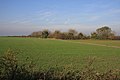
 Cambridgeshire farmland - geograph.org.uk - 6047455.jpg 1.024 × 681; 159 KB
-
 Cambridgeshire farmland - geograph.org.uk - 6047456.jpg 1.024 × 681; 184 KB
-
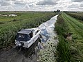
 Catch Water Drain becoming Reach Lode - geograph.org.uk - 2092351.jpg 1.600 × 1.200; 925 KB
-
 Catch Water Drain, Reach - geograph.org.uk - 2517549.jpg 640 × 480; 112 KB
-
 Chalk pit, Reach - geograph.org.uk - 2825932.jpg 1.600 × 1.067; 743 KB
-
 Chapel Lane - geograph.org.uk - 5197022.jpg 1.024 × 767; 224 KB
-
 Church in Reach - geograph.org.uk - 5955767.jpg 768 × 1.024; 169 KB
-
 Cmglee Reach Fair dog show.jpg 3.072 × 2.048; 1.024 KB
-
 Cmglee Reach Fair Maypole.jpg 4.096 × 2.048; 1.024 KB
-
 Cmglee Reach Fair penny throw.jpg 1.535 × 1.024; 256 KB
-
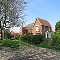
 Cottage in Reach - geograph.org.uk - 6048727.jpg 1.024 × 681; 135 KB
-
 Cottage on the corner - geograph.org.uk - 6048912.jpg 1.024 × 681; 166 KB
-
 Cottage on The Hythe - geograph.org.uk - 4145349.jpg 1.600 × 1.067; 384 KB
-
 Cottage, Great Lane - geograph.org.uk - 6049042.jpg 1.024 × 681; 179 KB
-
 Cottage, Great Lane - geograph.org.uk - 6055397.jpg 1.024 × 681; 130 KB
-
 Cottages, Reach - geograph.org.uk - 4706423.jpg 640 × 480; 68 KB
-
 Cow beside Hightown Drove - geograph.org.uk - 4145402.jpg 1.600 × 1.067; 636 KB
-
 Cows Beside Hightown Drove - geograph.org.uk - 4145399.jpg 1.600 × 1.067; 478 KB
-
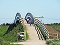
 Cycle Bridge - geograph.org.uk - 5197013.jpg 1.024 × 768; 256 KB
-
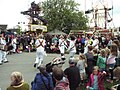
 Dancing the Maypole at Reach Fair - geograph.org.uk - 1286214.jpg 640 × 480; 118 KB
-
 Devil's Ditch and Dyke - geograph.org.uk - 1206521.jpg 640 × 480; 73 KB
-
 Devil's Dyke - geograph.org.uk - 363422.jpg 640 × 427; 66 KB
-
 Devil's Dyke - geograph.org.uk - 363429.jpg 640 × 427; 64 KB
-
 Devil's Dyke - geograph.org.uk - 6047454.jpg 1.024 × 681; 208 KB
-
 Devil's Dyke - geograph.org.uk - 6047459.jpg 1.024 × 681; 271 KB
-
 Devil's Dyke - geograph.org.uk - 6047461.jpg 1.024 × 681; 270 KB
-
 Devil's Dyke - geograph.org.uk - 6047462.jpg 1.024 × 681; 250 KB
-
 Devil's Dyke - geograph.org.uk - 6047465.jpg 1.024 × 681; 253 KB
-
 Devil's Dyke - geograph.org.uk - 6047466.jpg 1.024 × 681; 246 KB
-
 Ditch across Burwell Fen - geograph.org.uk - 2092325.jpg 1.600 × 1.200; 956 KB
-
 Ditch, Devil's Dyke - geograph.org.uk - 6047453.jpg 1.024 × 681; 216 KB
-
 Ditchfield, Reach - geograph.org.uk - 1206526.jpg 640 × 480; 58 KB
-
 Dykes End public house, Reach - geograph.org.uk - 5461013.jpg 3.456 × 2.592; 3,87 MB
-
 Earthworks, Reach - geograph.org.uk - 2825922.jpg 1.600 × 1.067; 533 KB
-
 Entering Reach - geograph.org.uk - 4706420.jpg 640 × 480; 66 KB
-
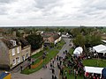
 Fair Green, Reach - geograph.org.uk - 6047481.jpg 1.024 × 681; 192 KB
-
 Farmland off National Cycle Route 51 - geograph.org.uk - 4706417.jpg 640 × 480; 67 KB
-
 Fen View from Reach Lode - geograph.org.uk - 2711498.jpg 2.048 × 810; 352 KB
-
 Field edge - geograph.org.uk - 6047460.jpg 1.024 × 681; 158 KB
-

-
 Field near Reach - geograph.org.uk - 4702035.jpg 640 × 480; 66 KB
-
 Fields sloping up from the edge of the fen - geograph.org.uk - 2753279.jpg 1.024 × 768; 1,33 MB
-
 Footpath along Reach Lode - geograph.org.uk - 2160494.jpg 1.600 × 1.200; 1,09 MB
-
 Footpath And Byway Sign - geograph.org.uk - 5520558.jpg 768 × 1.024; 357 KB
-
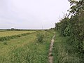
 Footpath from Reach - geograph.org.uk - 2825958.jpg 1.600 × 1.067; 1.009 KB
-
 Footpath Next To Reach Lode - geograph.org.uk - 5197018.jpg 768 × 1.024; 244 KB
-
 Footpath to Burwell - geograph.org.uk - 6238749.jpg 1.024 × 768; 992 KB
-
 Footpath to Reach - geograph.org.uk - 2092335.jpg 1.600 × 1.200; 1,21 MB
-
 Footpath to Reach - geograph.org.uk - 2092342.jpg 1.600 × 1.200; 832 KB
-
 Footpath to Reach - geograph.org.uk - 2825899.jpg 1.600 × 1.067; 852 KB
-
 Fullers Farmhouse - geograph.org.uk - 6048964.jpg 1.024 × 681; 228 KB
-
 Gate - geograph.org.uk - 3241502.jpg 1.024 × 768; 270 KB
-
 Grassland near Wicken Fen - geograph.org.uk - 2825969.jpg 1.600 × 1.067; 762 KB
-
 Green Lane - geograph.org.uk - 6055420.jpg 1.024 × 681; 209 KB
-
 Green Lane, Reach - geograph.org.uk - 2825905.jpg 1.600 × 1.067; 666 KB
-
 Hanging sign for The Dykes End - geograph.org.uk - 5461015.jpg 2.592 × 3.456; 2,31 MB
-
 Heading north east from Reach - geograph.org.uk - 4706427.jpg 640 × 480; 75 KB
-
 High Cloud Stud - geograph.org.uk - 1206589.jpg 640 × 480; 93 KB
-
 Hill Farmhouse - geograph.org.uk - 6047491.jpg 1.024 × 681; 159 KB
-
 Horse rider in Reach - geograph.org.uk - 3864042.jpg 2.848 × 2.136; 3,02 MB
-
 House, Fair Green - geograph.org.uk - 6047477.jpg 1.024 × 681; 187 KB
-
 Lane junction - geograph.org.uk - 6049752.jpg 1.024 × 681; 185 KB
-
 Little Fen Drove - geograph.org.uk - 4145353.jpg 1.600 × 1.200; 678 KB
-
 Looking across Fair Green, Reach - geograph.org.uk - 6047480.jpg 1.024 × 681; 120 KB
-

-

-
 Misty Day - geograph.org.uk - 3241505.jpg 1.024 × 768; 127 KB
-
 Moorings at Reach - geograph.org.uk - 2617445.jpg 640 × 427; 68 KB
-
 Moorings at Reach Lode - geograph.org.uk - 2618216.jpg 640 × 427; 84 KB
-
 Morris dancing at Reach Fair 2011 - geograph.org.uk - 2398760.jpg 1.024 × 768; 234 KB
-
 Morris Dancing at Reach Fair 2017 - geograph.org.uk - 5373108.jpg 1.000 × 750; 217 KB
-
 Myster House - geograph.org.uk - 6048862.jpg 1.024 × 681; 141 KB
-
 Nearing Burwell - geograph.org.uk - 4272920.jpg 1.024 × 731; 991 KB
-
 Nearing Reach - geograph.org.uk - 2753863.jpg 1.024 × 765; 951 KB
-
 New cyclepath to Wicken Fen - geograph.org.uk - 2825988.jpg 1.600 × 1.067; 701 KB
-
 New wetlands near Reach Bridge and Lode - geograph.org.uk - 3865410.jpg 2.848 × 2.136; 3,05 MB
-
 North-east Reach, Fair Day 2012 - geograph.org.uk - 2933495.jpg 1.024 × 768; 216 KB
-
 North-west Reach, Fair Day 2012 - geograph.org.uk - 2933325.jpg 1.024 × 768; 195 KB
-
 North-west Reach, Fair Day 2012 - geograph.org.uk - 2933339.jpg 1.024 × 768; 203 KB
-
 Old railway bridge near Reach - geograph.org.uk - 1206472.jpg 640 × 480; 83 KB
-
 On Devil's Dyke near Reach - geograph.org.uk - 3864026.jpg 2.848 × 2.136; 3,13 MB
-
 Once the Mildenhall Branch Line - geograph.org.uk - 2753041.jpg 800 × 576; 693 KB
-
 Out of Reach - geograph.org.uk - 4272930.jpg 1.024 × 1.024; 1,47 MB
-
 Path along the Devil's Dyke, north-west end - geograph.org.uk - 2999656.jpg 1.024 × 768; 181 KB
-
 Potato harvest, Burwell Fen - geograph.org.uk - 4702049.jpg 640 × 480; 74 KB
-
 Power Lines - geograph.org.uk - 5196679.jpg 768 × 1.024; 149 KB
-
 Prepared field by Straight Drove - geograph.org.uk - 4244494.jpg 1.600 × 1.200; 740 KB
-
 Pump at the Dykes End, Reach - geograph.org.uk - 5461019.jpg 2.592 × 3.456; 3,17 MB
-
 Pylon by Little Fen Drove - geograph.org.uk - 4145356.jpg 1.600 × 1.200; 507 KB
-
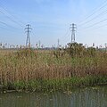
 Pylons across Burwell Fen - geograph.org.uk - 2092348.jpg 1.600 × 1.200; 648 KB
-
 Pylons near Reach - geograph.org.uk - 1461921.jpg 640 × 480; 68 KB
-
 Pylons on Burwell Fen - geograph.org.uk - 6124153.jpg 1.024 × 1.024; 1,26 MB
-
 Ramp up to Reach Bridge - geograph.org.uk - 3865389.jpg 2.848 × 2.136; 3,16 MB
-
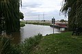
 Reach Bridge (2) - geograph.org.uk - 1192995.jpg 640 × 480; 91 KB
-
 Reach Bridge - geograph.org.uk - 1192993.jpg 640 × 480; 85 KB
-
 Reach Bridge to The Devil's Dyke - geograph.org.uk - 2753877.jpg 1.024 × 768; 971 KB
-
 Reach Cemetery - geograph.org.uk - 4272977.jpg 819 × 1.024; 1,43 MB
-
 Reach Cemetery - geograph.org.uk - 4706421.jpg 640 × 480; 91 KB
-
 Reach cemetery - geograph.org.uk - 5461589.jpg 3.456 × 2.592; 3,88 MB
-
 Reach Fair - Remix - geograph.org.uk - 1286276.jpg 640 × 480; 84 KB
-
 Reach Fair 2012 - geograph.org.uk - 2933410.jpg 1.024 × 768; 238 KB
-
 Reach Fair 800th Anniversary plaque - geograph.org.uk - 1206532.jpg 640 × 480; 100 KB
-
 Reach Fair Proclamation 2009 - geograph.org.uk - 1286176.jpg 640 × 480; 108 KB
-
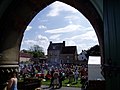 Reach Fair, Cambridgeshire - geograph.org.uk - 2780241.jpg 1.024 × 768; 144 KB
-
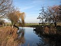
 Reach Lode - geograph.org.uk - 4145390.jpg 1.600 × 1.200; 600 KB
-
 Reach Lode - geograph.org.uk - 4145394.jpg 1.600 × 1.200; 562 KB
-
 Reach Lode - geograph.org.uk - 4504761.jpg 6.000 × 4.000; 4,06 MB
-
 Reach Lode - geograph.org.uk - 5419199.jpg 1.600 × 1.108; 403 KB
-
 Reach Lode and bridge - geograph.org.uk - 3865402.jpg 2.848 × 2.136; 3,04 MB
-
 Reach Lode and bridge on Tubney Fen - geograph.org.uk - 3865406.jpg 2.848 × 2.136; 3,05 MB
-
 Reach Lode Bridge - geograph.org.uk - 2106416.jpg 640 × 480; 67 KB
-
 Reach Lode bridge - geograph.org.uk - 2160470.jpg 1.600 × 1.200; 1,02 MB
-
 Reach Lode bridge - geograph.org.uk - 2160482.jpg 1.600 × 1.200; 1,06 MB
-
 Reach Lode Bridge - geograph.org.uk - 2632131.jpg 640 × 427; 78 KB
-
 Reach Lode in January - geograph.org.uk - 2753577.jpg 1.024 × 768; 1,06 MB
-
 Reach Port information board - geograph.org.uk - 2092350.jpg 1.600 × 1.200; 670 KB
-
 Reach Village - geograph.org.uk - 31663.jpg 640 × 480; 78 KB
-
 Reach Village Centre - geograph.org.uk - 1192998.jpg 640 × 480; 82 KB
-
 Reach Village Centre - geograph.org.uk - 6047852.jpg 1.024 × 681; 172 KB
-
 Reach Village Sign - geograph.org.uk - 5461021.jpg 2.592 × 3.456; 2,39 MB
-
 Reach Village sign - geograph.org.uk - 6047490.jpg 681 × 1.024; 175 KB
-
 Reach War Memorial - geograph.org.uk - 2692285.jpg 3.888 × 2.592; 6,09 MB
-
 Reach War Memorial - geograph.org.uk - 5461007.jpg 3.456 × 2.592; 3,91 MB
-
 Reach War Memorial - geograph.org.uk - 6047848.jpg 1.024 × 681; 162 KB
-
 Reach wood - geograph.org.uk - 823082.jpg 1.024 × 768; 326 KB
-
 Reach, a cottage on The Hythe - geograph.org.uk - 6124065.jpg 1.024 × 1.024; 1,37 MB
-
 Reach, a cruiser at The Hythe - geograph.org.uk - 6124349.jpg 819 × 1.024; 1,16 MB
-
 Reach, at the corner of Chapel Lane - geograph.org.uk - 6124045.jpg 1.024 × 768; 714 KB
-
 Reach, Barston Drove - geograph.org.uk - 2753461.jpg 1.024 × 768; 1,05 MB
-
 Reach, Bull Cottage - geograph.org.uk - 6124044.jpg 1.024 × 768; 852 KB
-
 Reach, Burwell Road near Churchfield Farm - geograph.org.uk - 4272928.jpg 1.024 × 731; 960 KB
-
 Reach, Delver Bridge - geograph.org.uk - 2753503.jpg 1.024 × 768; 1,09 MB
-
 Reach, Fair Green in August - geograph.org.uk - 6239140.jpg 1.024 × 683; 899 KB
-
 Reach, Fair Green in January - geograph.org.uk - 2753857.jpg 1.024 × 768; 1,3 MB
-
 Reach, Fair Green on a frosty morning - geograph.org.uk - 4272933.jpg 1.024 × 731; 1,01 MB
-
 Reach, learning to ride on Earthworks Way - geograph.org.uk - 4272925.jpg 1.024 × 768; 1,01 MB
-
 Reach, Myster House - geograph.org.uk - 2753595.jpg 1.024 × 740; 987 KB
-
 Reach, no through road - geograph.org.uk - 6124379.jpg 819 × 1.024; 1,07 MB
-
 Reach, out into The Fens - geograph.org.uk - 6124339.jpg 1.024 × 768; 1,06 MB
-
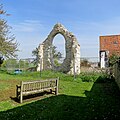 Reach, remains of the mediaeval church - geograph.org.uk - 6124051.jpg 1.024 × 1.024; 1,3 MB
-
 Reach, Spring Hall - geograph.org.uk - 2753482.jpg 1.024 × 707; 951 KB
-
 Reach, swings on Fair Green - geograph.org.uk - 6124049.jpg 1.024 × 731; 872 KB
-
 Reach, the corner of Chapel Lane - geograph.org.uk - 2753600.jpg 1.024 × 768; 879 KB
-
 Reach, the end of the lode - geograph.org.uk - 2753586.jpg 1.024 × 768; 1,16 MB
-
 Reach, top of the earthworks - geograph.org.uk - 2825911.jpg 1.600 × 1.067; 622 KB
-
 Reach, White Roses - geograph.org.uk - 6124364.jpg 1.024 × 1.024; 1,49 MB
-
 Reach, white walls and a blue sky - geograph.org.uk - 6124047.jpg 1.024 × 682; 796 KB
-
 Reach,Cambridgeshire Reach Fair 2009.jpg 1.024 × 512; 112 KB
-
 Reeds reflected in Reach Lode - geograph.org.uk - 6124163.jpg 1.024 × 768; 969 KB
-
 Road from Reach into the Fens - geograph.org.uk - 1461942.jpg 640 × 480; 97 KB
-

-
 Row of cottages - geograph.org.uk - 6047479.jpg 1.024 × 681; 146 KB
-
 Row of Cottages, Swaffham Rd - geograph.org.uk - 6047468.jpg 1.024 × 681; 144 KB
-
 Sheep grazing near Reach Lode - geograph.org.uk - 6124158.jpg 1.024 × 768; 940 KB
-
 Sign for the Dyke's End, Reach - geograph.org.uk - 4702042.jpg 488 × 640; 66 KB
-

-
 Snakehall Farm - geograph.org.uk - 6047452.jpg 1.024 × 681; 108 KB
-
 Spring Hall - geograph.org.uk - 6055445.jpg 1.024 × 681; 224 KB
-
 Spring Hall - geograph.org.uk - 6055449.jpg 1.024 × 681; 130 KB
-

-

-

-
 St Etheldreda ^ Holy Trinity, Reach - geograph.org.uk - 5288805.jpg 900 × 696; 521 KB
-
 St Etheldreda ^ Holy Trinity, Reach - geograph.org.uk - 5288808.jpg 900 × 750; 669 KB
-
 St Etheldreda ^ Holy Trinity, Reach - geograph.org.uk - 5288809.jpg 580 × 900; 498 KB
-
 St Etheldreda ^ Holy Trinity, Reach - geograph.org.uk - 5288811.jpg 900 × 821; 733 KB
-
 St Etheldreda ^ Holy Trinity, Reach - geograph.org.uk - 5288814.jpg 900 × 675; 616 KB
-

-


_-_geograph.org.uk_-_1192995.jpg)


.png)


