Category:Read, Lancashire
Vai alla navigazione
Vai alla ricerca
English: Read is a village in the Ribble Valley in Lancashire, England about west of Padiham on the A671 which was originally a turnpike road from Portfield, near Preston, to Padiham in the 1840s. (→Read, Lancashire)
Nederlands: Read is een plaats en civil parish in het bestuurlijke gebied Ribble Valley, in het Engelse graafschap Lancashire. (→Read)
Polski: Read – wieś w Anglii, w hrabstwie Lancashire, w dystrykcie Ribble Valley. Leży 39 km na północ od miasta Manchester i 297 km na północny zachód od Londynu. (→Read (Lancashire))

village and civil parish in Lancashire, England, UK  | |||||
| Carica un file multimediale | |||||
| Istanza di | |||||
|---|---|---|---|---|---|
| Luogo | Ribble Valley, Lancashire, Nord Ovest dell'Inghilterra, Inghilterra | ||||
 | |||||
Sottocategorie
Questa categoria contiene le 2 sottocategorie indicate di seguito, su un totale di 2.
M
- Martholme Viaduct (9 F)
File nella categoria "Read, Lancashire"
Questa categoria contiene 169 file, indicati di seguito, su un totale di 169.
-
 A gap in the trees - geograph.org.uk - 6090674.jpg 6 032 × 4 014; 5,89 MB
-
 A View down Sabden Valley - geograph.org.uk - 1832295.jpg 2 816 × 2 112; 1,81 MB
-
 A Welcoming Garage, Whalley Rd, Read - geograph.org.uk - 59172.jpg 640 × 427; 142 KB
-
 A671, Read Park - geograph.org.uk - 5039404.jpg 640 × 480; 111 KB
-
 Access Lane leading away from Dunkirk Farm - geograph.org.uk - 3955758.jpg 4 320 × 3 240; 3,99 MB
-
 Access road from Dunkirk Farm - geograph.org.uk - 3989952.jpg 3 872 × 2 592; 3,95 MB
-
 Access Road in Read Park - geograph.org.uk - 1835802.jpg 2 816 × 2 112; 1,87 MB
-
 An amazing lane - geograph.org.uk - 6123265.jpg 6 032 × 4 014; 6,46 MB
-
 Approaching Bridge Hey Wood Caravan Park - geograph.org.uk - 3051739.jpg 640 × 480; 520 KB
-
 Back Lane - geograph.org.uk - 6087804.jpg 6 032 × 4 014; 6,46 MB
-
 Back Lane in Autumn - geograph.org.uk - 5165693.jpg 3 264 × 2 448; 2,57 MB
-
 Back Lane in Well Wood - geograph.org.uk - 2154729.jpg 3 872 × 2 592; 7,22 MB
-
 Barn near Read Hall - geograph.org.uk - 2268723.jpg 3 872 × 2 592; 3,24 MB
-
 Barn to the west of Coppy Plantation - geograph.org.uk - 4529755.jpg 1 600 × 1 200; 546 KB
-
 Beech Wood - geograph.org.uk - 6088142.jpg 6 032 × 4 014; 6,86 MB
-
 Between the walls on the White Hill - geograph.org.uk - 6087904.jpg 6 032 × 4 014; 7,63 MB
-
 Beware of Trains - geograph.org.uk - 3051761.jpg 640 × 480; 656 KB
-
 Bridge Hey Wood - geograph.org.uk - 3989966.jpg 3 872 × 2 592; 5,63 MB
-
 Bridge Hey Wood Caravan Park - geograph.org.uk - 3051749.jpg 640 × 480; 508 KB
-
 Bridge Hey Wood Caravan Park - geograph.org.uk - 3051900.jpg 640 × 480; 448 KB
-
 Bus Graveyard at Dunkirk farm - geograph.org.uk - 3051897.jpg 640 × 480; 451 KB
-

-
 Business units in a small mill in Read - geograph.org.uk - 2060565.jpg 3 872 × 2 494; 3,25 MB
-
 Caravan storage area near New Plantation - geograph.org.uk - 3989956.jpg 3 872 × 2 592; 2,89 MB
-

-

-
 Constitutional Club - geograph.org.uk - 3051941.jpg 640 × 480; 409 KB
-
 Cottages, Whins Lane, Read, Lancashire - geograph.org.uk - 1977295.jpg 1 632 × 1 224; 974 KB
-
 Cottages, Whins Lane, Read, Lancashire - geograph.org.uk - 1977305.jpg 1 632 × 1 224; 495 KB
-
 Devil's Elbow - geograph.org.uk - 58935.jpg 640 × 427; 139 KB
-

-
 Distressed Bus at Dunkirk Farm - geograph.org.uk - 3955106.jpg 4 320 × 3 240; 3,19 MB
-
 Dunkirk Farm - geograph.org.uk - 3051896.jpg 640 × 480; 457 KB
-
 Entering Read - geograph.org.uk - 5039421.jpg 640 × 480; 73 KB
-
 Faint footpath on Read Heights - geograph.org.uk - 3822196.jpg 4 320 × 3 240; 6,43 MB
-
 Field above the Calder valley - geograph.org.uk - 3989922.jpg 3 872 × 2 592; 3,19 MB
-
 Field by Dunkirk Farm - geograph.org.uk - 3989932.jpg 3 872 × 2 592; 3,8 MB
-
 Field by Dunkirk Farm - geograph.org.uk - 3989946.jpg 3 872 × 2 592; 3,84 MB
-
 Footpath leading from Trapp Lane - geograph.org.uk - 1892213.jpg 3 648 × 2 736; 3,15 MB
-
 Footpath on the edge of Read - geograph.org.uk - 3989915.jpg 3 872 × 2 592; 3,96 MB
-
 Footpath towards High House Farm - geograph.org.uk - 4529744.jpg 1 600 × 1 200; 549 KB
-
 Footpaths approaching Gooseleach Wood - geograph.org.uk - 3955748.jpg 4 320 × 3 240; 4,76 MB
-
 From the churchyard at Read - geograph.org.uk - 4014514.jpg 1 024 × 768; 587 KB
-
 Gate piers, Read Hall.jpg 4 009 × 3 007; 3,11 MB
-
 George Lane, in Read - geograph.org.uk - 6088136.jpg 5 850 × 3 813; 4,67 MB
-
 George Lane, Read.jpg 3 005 × 4 007; 4,14 MB
-
 Gnarled tree on path through Shady Walks - geograph.org.uk - 2460078.jpg 1 198 × 1 600; 774 KB
-
 Gooseleach Wood - geograph.org.uk - 3989938.jpg 3 872 × 2 592; 5,55 MB
-
 Grazing near Parkhead - geograph.org.uk - 5038929.jpg 640 × 480; 80 KB
-
 Hameldon from Read.jpg 2 171 × 1 628; 937 KB
-
 Hammond Drive, Read - geograph.org.uk - 1832329.jpg 2 816 × 2 112; 2,25 MB
-
 High House Farm - geograph.org.uk - 2268753.jpg 3 872 × 2 592; 3,82 MB
-
 Horse warnings - geograph.org.uk - 6088170.jpg 6 032 × 4 014; 6,63 MB
-
 Houlker's Farmhouse, Read.jpg 4 009 × 3 008; 3,16 MB
-
 Houlkers Farm - geograph.org.uk - 1832305.jpg 2 816 × 2 112; 1,96 MB
-
 Ice House, Read Hall (north).jpg 4 009 × 3 005; 7,04 MB
-
 Ice House, Read Hall (south).jpg 4 009 × 3 006; 7,34 MB
-
 Isolated farm building south of Read - geograph.org.uk - 4529738.jpg 1 600 × 1 200; 677 KB
-
 Junction off Whins Lane at the top of Straits Lane - geograph.org.uk - 4868738.jpg 4 562 × 2 613; 6,54 MB
-
 Lancs Witches Walk at Read Hall.jpg 3 609 × 2 707; 4,65 MB
-
 Lancs Witches Walk at Sagar Heys, Read.jpg 3 494 × 2 621; 2,44 MB
-
 Lodge to Read Hall.jpg 1 600 × 1 198; 708 KB
-

-
 Lower Read Wood Farm - geograph.org.uk - 3820461.jpg 4 320 × 3 240; 2,5 MB
-
 Martholme Viaduct - geograph.org.uk - 6368131.jpg 2 222 × 1 668; 910 KB
-
 Martholme Viaduct on the defunct Great Harwood Loop - geograph.org.uk - 5138622.jpg 1 800 × 1 012; 1,74 MB
-
 Martholme Viaduct track bed - geograph.org.uk - 4587129.jpg 640 × 425; 251 KB
-
 Milestone, Whins Lane, Read, Lancashire - geograph.org.uk - 1977299.jpg 1 632 × 1 224; 869 KB
-
 Milestone, Whins Lane, Read, Lancashire - geograph.org.uk - 1977302.jpg 1 632 × 1 224; 944 KB
-

-
 Moss covered capping stones - geograph.org.uk - 6088225.jpg 6 032 × 4 014; 6,06 MB
-
 Muddy conditions at Read Park - geograph.org.uk - 6430716.jpg 1 024 × 768; 292 KB
-
 Mullioned windows on house off Old Roman Road - geograph.org.uk - 2698577.jpg 1 600 × 1 198; 658 KB
-
 My House - geograph.org.uk - 716097.jpg 640 × 480; 106 KB
-
 Notice Board, Whalley Road, Read, Lancashire - geograph.org.uk - 1977323.jpg 1 632 × 903; 357 KB
-
 Old Fireclay Pit - In Shady Walks - geograph.org.uk - 1122014.jpg 640 × 480; 138 KB
-
 Old Read Bridge on Old Roman Road - geograph.org.uk - 2698584.jpg 1 600 × 1 198; 767 KB
-
 Parkland, Read Park - geograph.org.uk - 5039408.jpg 640 × 480; 73 KB
-
 Parkland, Read Park - geograph.org.uk - 5039414.jpg 640 × 480; 65 KB
-
 Pasture and trees below Read - geograph.org.uk - 3989962.jpg 3 872 × 2 592; 3,42 MB
-
 Pasture beside Sabden Brook - geograph.org.uk - 1832286.jpg 2 816 × 2 112; 2,19 MB
-
 Pasture to the east of Gooseleach Wood - geograph.org.uk - 2307894.jpg 640 × 480; 129 KB
-
 Path in the Woods of Shady Walks - geograph.org.uk - 3822195.jpg 4 320 × 3 240; 4,77 MB
-
 Path through the woods on Read Heights - geograph.org.uk - 2698538.jpg 1 600 × 1 198; 953 KB
-
 Path Through Wheatcroft Wood - geograph.org.uk - 3051695.jpg 640 × 852; 1,08 MB
-
 Read CC - geograph.org.uk - 3051949.jpg 640 × 480; 407 KB
-
 Read Cricket Ground - geograph.org.uk - 3051947.jpg 640 × 480; 469 KB
-
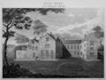 Read Hall (Engraving) c1750.png 866 × 651; 678 KB
-
 Read Hall - geograph.org.uk - 4529750.jpg 1 600 × 1 200; 504 KB
-
 Read Hall Cottages, Hammond Drive, Read.jpg 4 008 × 3 006; 6,12 MB
-
 Read Hall Farm - geograph.org.uk - 58962.jpg 640 × 427; 151 KB
-
 Read Hall lodge - geograph.org.uk - 1985529.jpg 2 592 × 1 944; 1,49 MB
-
 Read Hall Lodge - geograph.org.uk - 3051710.jpg 640 × 480; 696 KB
-
 Read Hall Lodge - geograph.org.uk - 6430719.jpg 1 024 × 768; 288 KB
-
 Read Hall Lodge and entrance - geograph.org.uk - 2303101.jpg 640 × 480; 183 KB
-
 Read Lancashire (geograph 3236253).jpg 3 648 × 2 736; 1,47 MB
-
 Read Library - geograph.org.uk - 3051939.jpg 640 × 480; 495 KB
-
 Read Old Bridge - geograph.org.uk - 1122019.jpg 640 × 480; 108 KB
-
 Read Old Bridge - geograph.org.uk - 4529761.jpg 1 600 × 1 200; 890 KB
-
 Read Old Bridge - geograph.org.uk - 4863240.jpg 4 592 × 3 056; 6,73 MB
-
 Read Park - geograph.org.uk - 1835812.jpg 2 816 × 2 112; 1,75 MB
-
 Read Park - geograph.org.uk - 3989967.jpg 3 872 × 2 592; 3,34 MB
-
 Read Park drive.jpg 3 005 × 4 007; 4,62 MB
-
 Read United Reformed Church - geograph.org.uk - 4529741.jpg 1 600 × 1 200; 354 KB
-
 Remains of a railway bridge south of Read - geograph.org.uk - 4528966.jpg 1 600 × 1 200; 689 KB
-
 River Calder near Martholme Viaduct - geograph.org.uk - 1158822.jpg 640 × 480; 54 KB
-

-

-
 Road junction at Read - geograph.org.uk - 2698519.jpg 1 600 × 1 198; 683 KB
-
 Road Junction in Read - geograph.org.uk - 6085506.jpg 6 552 × 5 000; 7,07 MB
-
 Road Sign - geograph.org.uk - 6085509.jpg 3 037 × 4 990; 4,36 MB
-
 Road to Read Nursery - geograph.org.uk - 812659.jpg 640 × 480; 199 KB
-
 Sabden Brook - geograph.org.uk - 1832282.jpg 2 816 × 2 112; 2,06 MB
-
 Sabden Brook upstream from Read Old Bridge - geograph.org.uk - 4863302.jpg 4 592 × 3 056; 7,8 MB
-
 Sabden Road at Read Old Bridge - geograph.org.uk - 6430709.jpg 1 024 × 768; 380 KB
-
 Sheep and Daffodils - geograph.org.uk - 6088228.jpg 6 032 × 4 014; 3,72 MB
-
 Sheep Pasture - geograph.org.uk - 3051906.jpg 640 × 480; 495 KB
-
 Sheltering sheep by Dunkirk Farm - geograph.org.uk - 3989947.jpg 3 872 × 2 592; 5,69 MB
-
 Sign Post, Whins Lane, Read, Lancashire - geograph.org.uk - 1977316.jpg 1 224 × 1 632; 487 KB
-
 Simon's Cross - geograph.org.uk - 1122007.jpg 640 × 480; 126 KB
-
 Smallholding - geograph.org.uk - 543698.jpg 640 × 384; 273 KB
-
 Stile at Dunkirk Farm - geograph.org.uk - 3051889.jpg 640 × 480; 468 KB
-
 Stone signpost at Houlker's Farm - geograph.org.uk - 2698531.jpg 1 600 × 1 198; 501 KB
-
 Stork Hotel, Read - geograph.org.uk - 849029.jpg 610 × 458; 161 KB
-
 Straits Lane, Read - geograph.org.uk - 4861953.jpg 4 088 × 2 191; 5,34 MB
-
 Straits Lane, Read, Lancashire - geograph.org.uk - 1977319.jpg 1 630 × 828; 345 KB
-
 Tatty fingerpost - geograph.org.uk - 6087815.jpg 5 156 × 3 503; 2,78 MB
-
 Telephone box on Fort Street, Read - geograph.org.uk - 5039422.jpg 640 × 480; 70 KB
-
 Texaco filling station, Read. - geograph.org.uk - 1769454.jpg 640 × 480; 74 KB
-
 The A671 at Read Park - geograph.org.uk - 3492214.jpg 4 255 × 2 631; 2,33 MB
-
 The approach to Sabden Brook footbridge - geograph.org.uk - 2460098.jpg 1 600 × 1 198; 598 KB
-
 The bridleway to Cock Wood - geograph.org.uk - 4862020.jpg 3 056 × 4 592; 7,88 MB
-
 The Congregational School, Read - geograph.org.uk - 2062007.jpg 3 872 × 2 499; 2,87 MB
-
 The farm at New Hall - geograph.org.uk - 2460085.jpg 1 600 × 1 198; 329 KB
-
 The gates at White Hill - geograph.org.uk - 6088140.jpg 6 032 × 4 014; 6,95 MB
-
 The Old Roman Road - geograph.org.uk - 4860689.jpg 4 592 × 3 056; 7,84 MB
-
 The path northeast through Read Park - geograph.org.uk - 4860580.jpg 3 002 × 3 861; 6,15 MB
-
 The path through Well Wood on White Hill - geograph.org.uk - 2460071.jpg 1 600 × 1 198; 538 KB
-
 The River Calder from Martholme Viaduct - geograph.org.uk - 5683429.jpg 5 184 × 3 888; 5,16 MB
-
 The road to Readwood - geograph.org.uk - 486440.jpg 640 × 480; 192 KB
-
 The road to Whittakers Farm - geograph.org.uk - 486438.jpg 640 × 480; 180 KB
-
 The view north across the fields - geograph.org.uk - 4864626.jpg 4 592 × 2 424; 7,77 MB
-
 The Village Bakery - Read - geograph.org.uk - 3491088.jpg 3 770 × 3 456; 2,28 MB
-
 The western end of Back Lane - geograph.org.uk - 2268742.jpg 3 872 × 2 592; 4,15 MB
-
 This takes a bit of mowing - geograph.org.uk - 4860459.jpg 4 592 × 3 056; 6,56 MB
-
 To Whalley 2 Miles - geograph.org.uk - 5039412.jpg 640 × 480; 100 KB
-
 Track approaching Read Old Bridge (geograph 3236278).jpg 3 648 × 2 736; 1,24 MB
-
 Track through Wheatcroft Wood - geograph.org.uk - 3051685.jpg 640 × 481; 566 KB
-
 Trap Lane - geograph.org.uk - 3822192.jpg 4 320 × 3 240; 7,33 MB
-
 View from Whins Lane, Read, Lancashire - geograph.org.uk - 1977314.jpg 1 482 × 973; 324 KB
-
 Whalley Road (A671) - geograph.org.uk - 3051717.jpg 640 × 481; 666 KB
-
 Whalley Road (A671) - geograph.org.uk - 5039405.jpg 640 × 480; 109 KB
-
 Whalley Road (A671) - geograph.org.uk - 5039410.jpg 640 × 480; 92 KB
-
 Whalley Road (A671) - geograph.org.uk - 5039416.jpg 640 × 480; 63 KB
-
 Whalley Road - geograph.org.uk - 3051723.jpg 640 × 480; 587 KB
-
 Whalley Road at Bridge Hey Wood - geograph.org.uk - 3051731.jpg 640 × 480; 571 KB
-
 Whims Lane, Read (geograph 3236264).jpg 3 648 × 2 736; 1,26 MB
-
 Whins Lane - geograph.org.uk - 2268734.jpg 3 872 × 2 592; 5,44 MB
-
 Whins Lane milestone, Read.jpg 1 932 × 2 576; 2,62 MB
-
 Whins Lane, Read, Lancashire - geograph.org.uk - 1977309.jpg 1 629 × 1 124; 448 KB
-
 Wind Turbine above Hodgeon Stone Plantation - geograph.org.uk - 3822198.jpg 4 320 × 3 240; 3,72 MB
-
 Wind turbine near New Hall - geograph.org.uk - 2460092.jpg 1 600 × 1 198; 209 KB
-
 Woodland Road near Read Hall (geograph 3236273).jpg 3 648 × 2 736; 1,62 MB
-
 Entrance to White Hill - geograph.org.uk - 486437.jpg 640 × 480; 210 KB
-
 Former outbuildings, Read Hall - geograph.org.uk - 58964.jpg 640 × 427; 143 KB
-
 Laural and Hardy gates - geograph.org.uk - 486442.jpg 640 × 480; 205 KB
-
 Looking towards Dunkirk Farm - geograph.org.uk - 542317.jpg 640 × 457; 270 KB
-
 Read Old Bridge - geograph.org.uk - 58940.jpg 640 × 427; 149 KB
-
 The road to Read - geograph.org.uk - 59142.jpg 640 × 427; 162 KB


,_Read_-_geograph.org.uk_-_5039423.jpg)


.jpg)
.jpg)


.jpg)


_c1750.png)


.jpg)


.jpg)


_-_geograph.org.uk_-_3051717.jpg)
_-_geograph.org.uk_-_5039405.jpg)
_-_geograph.org.uk_-_5039410.jpg)
_-_geograph.org.uk_-_5039416.jpg)


.jpg)


.jpg)


