Category:Redbourn
Aller à la navigation
Aller à la recherche
English: Redbourn (or occasionally Redbourne) is a village in Hertfordshire, United Kingdom, lying on Watling Street, 3 miles from Harpenden, 4 miles from St Albans and 5 miles from Hemel Hempstead. It has a population of around 6,000.
Nederlands: Redbourn is een plaats in het bestuurlijke gebied St Albans, in het Engelse graafschap Hertfordshire. De plaats telt 6.000 inwoners.
village britannique   | |||||
| Téléverser des médias | |||||
| Nature de l’élément | |||||
|---|---|---|---|---|---|
| Lieu | cité de St Albans, Hertfordshire, Angleterre de l'Est, Angleterre | ||||
| Superficie |
| ||||
| Réputé identique à | Redbourn (page en doublon, paroisse civile) | ||||
| site officiel | |||||
 | |||||
Sous-catégories
Cette catégorie comprend 14 sous-catégories, dont les 14 ci-dessous.
A
- Aubrey Park Hotel (1 F)
B
- The Bull Inn, Redbourn (3 F)
C
- Chequers Inn, Redbourn (8 F)
- Redbourn Cricket Club (4 F)
- Cumberland House, Redbourn (3 F)
F
- Redbourn Fire Station (5 F)
G
- The George, Redbourn (2 F)
N
P
- The Priory, Redbourn (2 F)
R
- Redbourn War Memorial (3 F)
S
Média dans la catégorie « Redbourn »
Cette catégorie comprend 462 fichiers, dont les 200 ci-dessous.
(page précédente) (page suivante)-
 'Our Car - April 1953' - geograph.org.uk - 2703830.jpg 1 225 × 824 ; 628 kio
-
 38-40 Fish Street, Redbourn - geograph.org.uk - 5461426.jpg 2 004 × 1 474 ; 854 kio
-
 A double dose of nostalgia - geograph.org.uk - 956904.jpg 640 × 480 ; 62 kio
-
 A new house in Luton Lane Redbourn - geograph.org.uk - 42175.jpg 640 × 480 ; 26 kio
-
 A surprise in Lamb Lane - geograph.org.uk - 956968.jpg 640 × 480 ; 75 kio
-
 A traveller's campsite at Redbourn - geograph.org.uk - 42172.jpg 640 × 480 ; 16 kio
-
 A5183 and B487 roundabout near Rebourn - geograph.org.uk - 5305905.jpg 5 202 × 3 465 ; 3,58 Mio
-
 A5183 Dunstable Road, Redbourn - geograph.org.uk - 4805960.jpg 3 072 × 2 304 ; 1,91 Mio
-
 A5183 towards Redbourne - geograph.org.uk - 6230266.jpg 640 × 480 ; 111 kio
-

-
 At Redbournbury - geograph.org.uk - 3983492.jpg 1 874 × 2 498 ; 2,65 Mio
-
 At Redbournbury Mill - geograph.org.uk - 3983891.jpg 2 368 × 1 692 ; 1,81 Mio
-
 Atelier, Redbourn - geograph.org.uk - 5305926.jpg 5 184 × 3 456 ; 6,22 Mio
-
 B487, Redbourn - geograph.org.uk - 6230280.jpg 800 × 600 ; 112 kio
-
 Bakers Farm Cottage at Bakers Farm - geograph.org.uk - 41270.jpg 640 × 480 ; 28 kio
-
 Bald Eagle at the Hertfordshire Showground 2013 - geograph.org.uk - 3481400.jpg 1 024 × 722 ; 514 kio
-
 Bald Eagle at the Hertfordshire Showground 2013 - geograph.org.uk - 3481401.jpg 1 024 × 778 ; 543 kio
-
 Barn Owl at the Hertfordshire Showground 2013 - geograph.org.uk - 3481404.jpg 1 024 × 828 ; 521 kio
-
 Beaumont Hall Farm - geograph.org.uk - 42144.jpg 640 × 480 ; 20 kio
-
 Beaumont Hall Farm buildings - geograph.org.uk - 5308502.jpg 640 × 426 ; 48 kio
-
 Beaumont Hall Farm businesses - geograph.org.uk - 5308510.jpg 4 338 × 2 835 ; 1,83 Mio
-
 Beaumont Hall Farm gate - geograph.org.uk - 5308514.jpg 5 202 × 3 465 ; 3,57 Mio
-
 Beaumont Hall Lane - geograph.org.uk - 5308494.jpg 5 202 × 3 465 ; 4,01 Mio
-
 Beaumont Hall Lane junction - geograph.org.uk - 5308521.jpg 5 202 × 3 465 ; 5,28 Mio
-
 Beesonend Lane looking East - geograph.org.uk - 5308625.jpg 5 202 × 3 465 ; 5,45 Mio
-
 Beesonend Lane looking South West - geograph.org.uk - 5308618.jpg 5 202 × 3 465 ; 2,89 Mio
-
 Beesonend Lane looking toward Redbournbury - geograph.org.uk - 5308602.jpg 5 202 × 3 465 ; 4,28 Mio
-
 Beesonend Lane near Redbournbury - geograph.org.uk - 5308599.jpg 5 202 × 3 465 ; 4,91 Mio
-
 Bend in Redding Lane - geograph.org.uk - 6230795.jpg 800 × 600 ; 153 kio
-
 Bend on Hogg End Lane - geograph.org.uk - 3638213.jpg 2 048 × 1 536 ; 1,29 Mio
-
 Bend on Hogg End Lane - geograph.org.uk - 3638546.jpg 2 048 × 1 536 ; 1,33 Mio
-
 Bridge for the M1 over Punchbowl Lane - geograph.org.uk - 41339.jpg 640 × 480 ; 27 kio
-
 Bull Inn, Redbourn - geograph.org.uk - 5305982.jpg 5 202 × 3 465 ; 2,08 Mio
-
 Buncefield, Total oil pipeline marker - geograph.org.uk - 1257596.jpg 640 × 480 ; 83 kio
-
 Bungalows at end of Gaddesden Lane - geograph.org.uk - 41267.jpg 640 × 480 ; 23 kio
-
 Bus stop on Dunstable Road, Redbourn - geograph.org.uk - 6230791.jpg 800 × 600 ; 141 kio
-
 Car Park, Hertfordshire Show Ground - geograph.org.uk - 3998499.jpg 1 024 × 768 ; 1,04 Mio
-
 Cereal crop near Punch Bowl House - geograph.org.uk - 6230240.jpg 800 × 600 ; 104 kio
-
 Cereal crop near Punch Bowl House - geograph.org.uk - 6230251.jpg 800 × 600 ; 113 kio
-
 Chef and Brewer Pub Redbourn - geograph.org.uk - 42355.jpg 640 × 480 ; 17 kio
-
 Cherry Tree Lane at the junction of Redbourn Road - geograph.org.uk - 3637954.jpg 2 048 × 1 536 ; 1,55 Mio
-
 Cherry Tree Lane, Cupid Green - geograph.org.uk - 3638449.jpg 2 048 × 1 536 ; 1,64 Mio
-
 Cherry Tree Lane, Cupid Green - geograph.org.uk - 3638457.jpg 2 048 × 1 536 ; 1,57 Mio
-

-

-

-

-
 Chesterton, Bettespol Meadows, Redbourn in 1947 - geograph.org.uk - 3106215.jpg 959 × 634 ; 147 kio
-
 Chesterton, Bettespol Meadows, Redbourn in 1947 - geograph.org.uk - 3107963.jpg 985 × 647 ; 154 kio
-
 Chesterton, Bettespol Meadows, Redbourn in 1947 - geograph.org.uk - 3107972.jpg 682 × 1 024 ; 143 kio
-
 Chickens at the Hertfordshire Show 2013 - geograph.org.uk - 3481374.jpg 683 × 1 024 ; 961 kio
-
 Chiltern Way - geograph.org.uk - 2170888.jpg 640 × 480 ; 80 kio
-
 ChristChurch, Redbourn - geograph.org.uk - 3199068.jpg 3 072 × 2 304 ; 1,79 Mio
-
 Church End houses - geograph.org.uk - 956788.jpg 640 × 480 ; 59 kio
-
 Club on the A5 between St Albans and Redbourn - geograph.org.uk - 3131525.jpg 2 560 × 1 920 ; 1,08 Mio
-
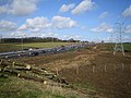
 Construction of M1 Motorway near Redbourn, 1958 - geograph.org.uk - 4592811.jpg 2 267 × 1 564 ; 1,62 Mio
-
 Copse on the hill past the wheat field - geograph.org.uk - 3549474.jpg 1 200 × 1 600 ; 556 kio
-
 Cottage at St Agnell's Farm - geograph.org.uk - 956774.jpg 640 × 480 ; 71 kio
-
 Cottages on High Street, Redbourn - geograph.org.uk - 6230389.jpg 800 × 600 ; 104 kio
-
 Cricketer's Pub, Redbourn - geograph.org.uk - 226772.jpg 640 × 485 ; 114 kio
-
 Crop field near Hogg End Farm - geograph.org.uk - 6230235.jpg 640 × 480 ; 75 kio
-
 Cumberland Gardens, Redbourn - geograph.org.uk - 5305975.jpg 5 202 × 3 465 ; 2,96 Mio
-
 Curving descent on the M1 - geograph.org.uk - 2892077.jpg 640 × 480 ; 42 kio
-
 Cut silage field off Redbourn Road (A5183) - geograph.org.uk - 6230230.jpg 800 × 600 ; 125 kio
-
 Dane End farm - geograph.org.uk - 176788.jpg 640 × 480 ; 69 kio
-
 Dane End farm - geograph.org.uk - 176796.jpg 640 × 480 ; 89 kio
-
 Dane End Farm - geograph.org.uk - 5308486.jpg 5 202 × 3 465 ; 2,88 Mio
-

-
 Doctor's Alley - geograph.org.uk - 956996.jpg 640 × 480 ; 100 kio
-
 Dunstable Road (A5183) - geograph.org.uk - 6230801.jpg 800 × 495 ; 132 kio
-
 Dunstable Road (A5183) - geograph.org.uk - 6230806.jpg 800 × 600 ; 147 kio
-
 Dunstable Road, Redbourn - geograph.org.uk - 4805951.jpg 2 836 × 2 051 ; 2,15 Mio
-
 Dunstable Road, Redbourn - geograph.org.uk - 5473329.jpg 1 275 × 1 802 ; 463 kio
-
 Elizabeth II postbox on High Street, Redbourn - geograph.org.uk - 6231022.jpg 480 × 640 ; 100 kio
-
 Elmcot, Harpenden Lane, Redbourn - geograph.org.uk - 3028036.jpg 3 493 × 2 364 ; 5,49 Mio
-
 Elmcot, Harpenden Lane, Redbourn - geograph.org.uk - 957801.jpg 640 × 427 ; 66 kio
-
 Embankment by the M1, Redbourn - geograph.org.uk - 5279827.jpg 2 304 × 1 728 ; 951 kio
-
 Entering Redbourn - geograph.org.uk - 6230789.jpg 800 × 600 ; 155 kio
-
 Entering Redbourn on Harpenden Lane - geograph.org.uk - 4805927.jpg 3 072 × 2 304 ; 1,8 Mio
-
-
 Entrance to Kettlewells Farm Hogg End Lane. - geograph.org.uk - 38171.jpg 640 × 480 ; 18 kio
-
 Entrance to underground bunker by Gaddesden Lane - geograph.org.uk - 5279828.jpg 2 304 × 1 728 ; 986 kio
-
 Entrance to Veolia water treatment plant, Redbournbury - geograph.org.uk - 2293497.jpg 1 600 × 1 200 ; 556 kio
-
 Equestrian Event at the Hertfordshire Showground 2013 - geograph.org.uk - 3481382.jpg 1 024 × 683 ; 536 kio
-
 Equestrian Event at the Hertfordshire Showground 2013 - geograph.org.uk - 3481383.jpg 1 024 × 683 ; 903 kio
-
 Equestrian Event at the Hertfordshire Showground 2013 - geograph.org.uk - 3481386.jpg 1 024 × 683 ; 684 kio
-
 Equestrian Event at the Hertfordshire Showground 2013 - geograph.org.uk - 3481389.jpg 1 024 × 683 ; 646 kio
-
 Equestrian Event at the Hertfordshire Showground 2013 - geograph.org.uk - 3481391.jpg 1 024 × 683 ; 491 kio
-
 Equestrian Event at the Hertfordshire Showground 2013 - geograph.org.uk - 3481393.jpg 1 024 × 683 ; 518 kio
-
 Equestrian Event at the Hertfordshire Showground 2013 - geograph.org.uk - 3481396.jpg 1 024 × 683 ; 598 kio
-
 Equestrian Event at the Hertfordshire Showground 2013 - geograph.org.uk - 3481397.jpg 1 024 × 683 ; 580 kio
-
 Ex-Elmcot, Harpenden Lane, Redbourn - geograph.org.uk - 957799.jpg 640 × 480 ; 83 kio
-
 Factory Farming at Little Revel end - geograph.org.uk - 41225.jpg 640 × 480 ; 23 kio
-
 Farm track and tree near New Jerome Farm - geograph.org.uk - 3549591.jpg 1 600 × 1 068 ; 392 kio
-
 Field by Beesonend Lane - geograph.org.uk - 5475832.jpg 2 048 × 1 536 ; 1,54 Mio
-
 Field by Beesonend Lane - geograph.org.uk - 5475834.jpg 2 048 × 1 536 ; 984 kio
-
 Field by Gaddesden Lane, Redbourn - geograph.org.uk - 5280857.jpg 2 298 × 1 720 ; 1 004 kio
-
 Field by Gaddesden Lane, Redbourn - geograph.org.uk - 5280858.jpg 2 304 × 1 728 ; 859 kio
-
 Field by the River Ver, Redbournbury - geograph.org.uk - 5468739.jpg 2 304 × 1 728 ; 829 kio
-
 Field by the River Ver, Redbournbury - geograph.org.uk - 5473703.jpg 2 304 × 1 728 ; 1,15 Mio
-
 Field by Watling Street, Redbournbury - geograph.org.uk - 2293486.jpg 1 600 × 1 200 ; 532 kio
-
 Field entrance on Dunstable Road, Redbourn - geograph.org.uk - 5473324.jpg 2 304 × 1 728 ; 873 kio
-
 Field entrance on Gaddesden Lane - geograph.org.uk - 5467006.jpg 2 048 × 1 536 ; 1,49 Mio
-
 Field in Redbournbury - geograph.org.uk - 5475825.jpg 2 048 × 1 536 ; 1,3 Mio
-
 Field next to the Redbournbury Watermill - geograph.org.uk - 2677682.jpg 3 968 × 2 976 ; 2,93 Mio
-
 Field path towards Dane End farm - geograph.org.uk - 5306643.jpg 5 202 × 3 465 ; 3,82 Mio
-
 Fields by Redbourn Road - geograph.org.uk - 2882673.jpg 1 600 × 1 200 ; 489 kio
-
 Fields by Redbourn Road - geograph.org.uk - 2882676.jpg 1 600 × 1 200 ; 505 kio
-
 Fields by Redbourn Road - geograph.org.uk - 2882681.jpg 1 600 × 1 200 ; 514 kio
-
 Fields by Redbourn Road - geograph.org.uk - 3638083.jpg 2 048 × 1 536 ; 1,39 Mio
-
 Fields by Watling Street, Redbournbury - geograph.org.uk - 2293489.jpg 1 600 × 1 200 ; 562 kio
-
 Fields from Beesonend Lane - geograph.org.uk - 5308611.jpg 5 202 × 3 465 ; 3,72 Mio
-
 Fish St and High St, Redbourn - geograph.org.uk - 5305927.jpg 4 026 × 2 726 ; 1,67 Mio
-
 Footbridge over River Ver - geograph.org.uk - 5308587.jpg 5 202 × 3 465 ; 5,19 Mio
-
 Footbridge over the M1 - geograph.org.uk - 4699339.jpg 640 × 399 ; 36 kio
-
 Footbridge over the M1 - geograph.org.uk - 4734438.jpg 640 × 426 ; 48 kio
-
 Footbridge over the Ver - geograph.org.uk - 3549497.jpg 1 600 × 1 068 ; 705 kio
-
 Footpath and field - geograph.org.uk - 176803.jpg 640 × 480 ; 89 kio
-
 Footpath entrance at Beaumont Hall Lane - geograph.org.uk - 5308490.jpg 5 202 × 3 465 ; 3,74 Mio
-
 Footpath over B487 - geograph.org.uk - 5306633.jpg 5 202 × 3 465 ; 4,37 Mio
-
 Footpath to Beeson End - geograph.org.uk - 3549540.jpg 1 200 × 1 600 ; 666 kio
-
 Footpath to Redbourn - geograph.org.uk - 3549615.jpg 1 600 × 1 067 ; 487 kio
-
 Footpath to the Hertfordshire Way - geograph.org.uk - 3549491.jpg 1 200 × 1 600 ; 821 kio
-
 Footpath to the river Ver - geograph.org.uk - 3549576.jpg 1 200 × 1 600 ; 601 kio
-
 Footpath towards Harpenden - geograph.org.uk - 3549476.jpg 1 600 × 1 068 ; 615 kio
-
 Ford at Redbournbury - geograph.org.uk - 3458602.jpg 3 872 × 2 592 ; 2,35 Mio
-
 Ford at Redbournbury Farm - geograph.org.uk - 5308556.jpg 5 202 × 3 465 ; 4,88 Mio
-
 Ford at Redbournbury Mill - geograph.org.uk - 5468741.jpg 2 304 × 1 728 ; 820 kio
-
 Ford at Redbournbury Mill and Farm - geograph.org.uk - 3458577.jpg 3 872 × 2 592 ; 2,38 Mio
-
 Ford at Watery Lane, Redbourn - 1953 - geograph.org.uk - 1450070.jpg 508 × 640 ; 54 kio
-
 Former club on A5 - geograph.org.uk - 4135181.jpg 4 214 × 3 094 ; 4,11 Mio
-
 Gaddesden Lane at the junction of Hemel Hempstead Road - geograph.org.uk - 5461420.jpg 2 048 × 1 536 ; 1,48 Mio
-
 Gaddesden Lane going under the M1 - geograph.org.uk - 5461419.jpg 1 994 × 1 462 ; 736 kio
-
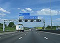
 Gantries over the M1 - geograph.org.uk - 4517472.jpg 3 287 × 1 954 ; 2,8 Mio
-
 Garden centre car park near Redbourn - geograph.org.uk - 6230793.jpg 800 × 600 ; 108 kio
-

-
 Goat at the Hertfordshire Show 2013 - geograph.org.uk - 3481369.jpg 1 024 × 683 ; 885 kio
-
 Goats at the Hertfordshire Show 2013 - geograph.org.uk - 3481372.jpg 1 024 × 683 ; 896 kio
-
 GOC Redbourn 054 Shafford Mill, St Michael (23516719184).jpg 4 288 × 3 216 ; 3,92 Mio
-
 Grassland off Dunstable Road - geograph.org.uk - 6230804.jpg 800 × 600 ; 81 kio
-
 Grazing near the River Ver - geograph.org.uk - 6230263.jpg 800 × 573 ; 101 kio
-
 Grey wagtail at Redbournbury - geograph.org.uk - 3983496.jpg 1 554 × 1 942 ; 1,47 Mio
-
 Harpenden golf course - geograph.org.uk - 1856144.jpg 640 × 480 ; 73 kio
-
 Harpenden Lane ^ Redbourn Village Name sign - geograph.org.uk - 4736375.jpg 2 889 × 2 165 ; 2,25 Mio
-
 Harpenden Lane, Redbourn - geograph.org.uk - 4736401.jpg 3 072 × 2 304 ; 1,71 Mio
-
 Harpenden Lane, Redbourn - geograph.org.uk - 4736407.jpg 3 072 × 2 304 ; 1,98 Mio
-
 Harpenden Lane, Redbourn - geograph.org.uk - 4805952.jpg 3 072 × 2 227 ; 2,72 Mio
-
 Hedgerow by Hogg End Lane - geograph.org.uk - 3638173.jpg 2 048 × 1 536 ; 1,51 Mio
-
 Hemel Hempstead, Punchbowl Lane - geograph.org.uk - 1248824.jpg 640 × 480 ; 79 kio
-
 Hertfordshire Showground 2013 - geograph.org.uk - 3481378.jpg 1 024 × 683 ; 641 kio
-
 Hertfordshire Way looking towards Redbournbury - geograph.org.uk - 5308529.jpg 5 202 × 3 465 ; 4,77 Mio
-
 Hertfordshire Way looking towards St Albans Road - geograph.org.uk - 5308536.jpg 5 202 × 3 465 ; 4,45 Mio
-
 Hertfordshire Way off Besonend Lane - geograph.org.uk - 3549505.jpg 1 600 × 1 068 ; 719 kio
-
 Hertfordshire Way path - geograph.org.uk - 5308527.jpg 5 202 × 3 465 ; 3,42 Mio
-
 Hertfordshire Way, Redbournbury - geograph.org.uk - 5475820.jpg 2 048 × 1 536 ; 1,48 Mio
-
 High St Cottages and Flowers - geograph.org.uk - 191606.jpg 640 × 426 ; 177 kio
-
 High Street Redbourn - geograph.org.uk - 2293466.jpg 1 600 × 1 200 ; 510 kio
-
 High Street Redbourn - geograph.org.uk - 2293469.jpg 1 600 × 1 200 ; 467 kio
-
 High Street Redbourn - geograph.org.uk - 2294100.jpg 1 600 × 1 200 ; 481 kio
-
 High Street Redbourn - geograph.org.uk - 2294101.jpg 1 600 × 1 200 ; 566 kio
-
 High Street, Redbourn in 1970 - geograph.org.uk - 1776992.jpg 745 × 453 ; 91 kio
-
 High Street, Redbourn in 1970 - geograph.org.uk - 2665962.jpg 772 × 1 163 ; 133 kio
-
 Hogg End Lane - geograph.org.uk - 3638549.jpg 2 048 × 1 536 ; 1,52 Mio
-
 Hogg End Lane - geograph.org.uk - 6230237.jpg 800 × 600 ; 108 kio
-
 Holts Meadow, Redbourn in 1970 - geograph.org.uk - 2665939.jpg 957 × 571 ; 151 kio
-
 House at Gate to Dane End Farm - geograph.org.uk - 42147.jpg 640 × 480 ; 19 kio
-
 House in Hogg End Lane - geograph.org.uk - 36943.jpg 640 × 480 ; 25 kio
-

-
 House on Dunstable Road, Redbourn - geograph.org.uk - 6230786.jpg 800 × 600 ; 187 kio
-
 House on Redbourn Common - geograph.org.uk - 5461425.jpg 2 048 × 1 536 ; 1,49 Mio
-
-
 Imposing houses at Hatching Green - geograph.org.uk - 3549469.jpg 1 600 × 1 069 ; 568 kio
-
 Isolated house on Gaddesden Lane - geograph.org.uk - 5461418.jpg 2 048 × 1 536 ; 1,51 Mio
-
 Junction of High Street and Fish Street, Redbourn - geograph.org.uk - 2293471.jpg 1 600 × 1 200 ; 271 kio
-
 Kink club looking very closed now - geograph.org.uk - 3549584.jpg 1 600 × 1 068 ; 369 kio
-
 Lane towards Little Revel End - geograph.org.uk - 4649039.jpg 640 × 480 ; 216 kio
-
 Little Revelend Farm - geograph.org.uk - 41229.jpg 640 × 480 ; 16 kio
-
 Luton Lane crossing the River Ver - geograph.org.uk - 5473702.jpg 2 304 × 1 728 ; 844 kio
-
 Luton Lane meets the Redbourn Bypass - geograph.org.uk - 5475945.jpg 2 014 × 1 490 ; 786 kio
-
 Luton Lane, Redbourn - geograph.org.uk - 5473605.jpg 2 304 × 1 728 ; 820 kio
-
 Lybury Lane going under the M1 motorway - geograph.org.uk - 3142634.jpg 2 048 × 1 536 ; 1,48 Mio
-
 Lybury Lane going under the M1 motorway - geograph.org.uk - 3142637.jpg 2 048 × 1 536 ; 1,48 Mio
-
 Lybury Lane passes under the M1 - geograph.org.uk - 3799231.jpg 4 320 × 3 240 ; 2,93 Mio
-
 Lybury Lane, Redbourn - geograph.org.uk - 956757.jpg 640 × 480 ; 79 kio
-
 Lybury Lane, Redbourn in 1970 - geograph.org.uk - 1778400.jpg 796 × 522 ; 81 kio
-
 M1 exit slip road northbound at Junction 9 - geograph.org.uk - 2438100.jpg 640 × 480 ; 60 kio
-
 M1 junction 9 - geograph.org.uk - 2391665.jpg 640 × 423 ; 45 kio
-
 M1 junction 9 - geograph.org.uk - 2391673.jpg 640 × 458 ; 51 kio
-
 M1 junction9 - geograph.org.uk - 2391651.jpg 640 × 458 ; 50 kio
-

-
 M1 motorway - Redding Lane bridge - geograph.org.uk - 2892634.jpg 640 × 480 ; 44 kio
-
 M1 motorway climbing near Redbourn - geograph.org.uk - 2892084.jpg 640 × 480 ; 52 kio
-
 M1 motorway in deepest Hertfordshire - geograph.org.uk - 2892074.jpg 640 × 480 ; 45 kio
-
 M1 motorway near Nicholls Farm - geograph.org.uk - 2892614.jpg 640 × 480 ; 55 kio
-
 M1 Motorway near Redbourn - geograph.org.uk - 142082.jpg 640 × 480 ; 93 kio
-
 M1 Motorway near Redbourn - geograph.org.uk - 142083.jpg 640 × 480 ; 81 kio
-
 M1 Motorway near Redbourn - geograph.org.uk - 142084.jpg 640 × 480 ; 89 kio
-
 M1 motorway north of junction 8 - geograph.org.uk - 2892070.jpg 640 × 480 ; 53 kio
-
 M1 motorway sign gantry - geograph.org.uk - 1856481.jpg 640 × 480 ; 64 kio
-
 M1 Motorway, Punchbowl Lane bridge - geograph.org.uk - 1248816.jpg 640 × 480 ; 80 kio


_-_geograph.org.uk_-_6230230.jpg)


_-_geograph.org.uk_-_6230801.jpg)
_-_geograph.org.uk_-_6230806.jpg)


.jpg)


