Category:Redruth
Zur Navigation springen
Zur Suche springen
Kleinstadt im Vereinigten Königreich  | |||||
| Medium hochladen | |||||
| Ist ein(e) | |||||
|---|---|---|---|---|---|
| Ort | Cornwall, Südwestengland, England | ||||
| Einwohnerzahl |
| ||||
 | |||||
Unterkategorien
Es werden 15 von insgesamt 15 Unterkategorien in dieser Kategorie angezeigt:
In Klammern die Anzahl der enthaltenen Kategorien (K), Seiten (S), Dateien (D)
A
B
C
- Countryside around Redruth (48 D)
E
F
- Forge, Cornwall (1 D)
M
- Minerals of Redruth (8 D)
- Minerals of Wheal Buller (2 D)
N
- North Country, Cornwall (1 D)
R
- Redruth Tunnel (5 D)
- Redruth War Memorial (6 D)
S
- Sparnon Gate (leer)
T
U
Medien in der Kategorie „Redruth“
Folgende 200 Dateien sind in dieser Kategorie, von 207 insgesamt.
(vorherige Seite) (nächste Seite)-

-

-
 @ Hellanbeagle. - panoramio.jpg 3.000 × 4.000; 3,12 MB
-
 A corner of Market Square, Redruth - geograph.org.uk - 6239449.jpg 5.472 × 3.648; 2,98 MB
-
 A row of terraced houses - geograph.org.uk - 6018567.jpg 1.024 × 681; 145 KB
-
 Access road for Parc Erissey - geograph.org.uk - 4874486.jpg 1.600 × 1.066; 269 KB
-
 Advert for BMX track, New Portreath Road - geograph.org.uk - 4874472.jpg 1.600 × 1.200; 229 KB
-
 Alley off West End - geograph.org.uk - 6259429.jpg 1.200 × 1.600; 564 KB
-
 Approach to Wheal Peevor - geograph.org.uk - 5859194.jpg 640 × 480; 119 KB
-
 B3297 towards Redruth - geograph.org.uk - 5462868.jpg 640 × 480; 59 KB
-
 Back lane off Falmouth Road, Redruth - geograph.org.uk - 5463011.jpg 640 × 480; 82 KB
-
 Blue fence - geograph.org.uk - 5110170.jpg 640 × 426; 66 KB
-
 Brunton's Arsenic Calcining Kiln - geograph.org.uk - 3755522.jpg 640 × 424; 281 KB
-
 Brunton's Arsenic Calcining Kiln - geograph.org.uk - 3755528.jpg 640 × 424; 276 KB
-
 Brunton's Arsenic Calcining Kiln - geograph.org.uk - 3755535.jpg 640 × 424; 277 KB
-
 Brunton's Arsenic Calcining Kiln - geograph.org.uk - 3755545.jpg 640 × 424; 299 KB
-
 Brunton's Arsenic Calcining Kiln - geograph.org.uk - 3755551.jpg 640 × 424; 276 KB
-
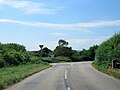
 Buckett's Hill (B3297) - geograph.org.uk - 5462872.jpg 640 × 480; 73 KB
-
 Buddles at Wheal Peevor mine - geograph.org.uk - 3190691.jpg 734 × 979; 326 KB
-
 By Order E.T. Verger (4929794011).jpg 1.438 × 2.207; 4,47 MB
-
 Cardrew Industrial Estate - geograph.org.uk - 5110204.jpg 640 × 426; 67 KB
-
 Chapel Street, Redruth - geograph.org.uk - 5463021.jpg 640 × 480; 61 KB
-
 Chapel, Redruth - geograph.org.uk - 6018575.jpg 1.024 × 681; 118 KB
-
 Clock Tower, Fore Street, Redruth - geograph.org.uk - 6224344.jpg 3.230 × 4.846; 4,45 MB
-

-
 Co-operative food store, Redruth - geograph.org.uk - 5463004.jpg 640 × 480; 78 KB
-
 Converted chapel, Buller Hill - geograph.org.uk - 5462869.jpg 640 × 480; 57 KB
-
 Copper Lane - geograph.org.uk - 5462870.jpg 640 × 480; 79 KB
-
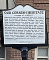
 Cornish Dancers wearing the Gook.jpg 1.519 × 927; 443 KB
-
 Cornish Studies Library - geograph.org.uk - 5403061.jpg 1.600 × 894; 403 KB
-
 Cornish Tin Miner statue, Redruth - geograph.org.uk - 4981212.jpg 800 × 630; 124 KB
-
 Cornwall Fae01.jpg 3.648 × 2.736; 3,84 MB
-
 Cornwall Fae02.jpg 2.736 × 3.648; 3,54 MB
-
 Cornwall Fae03.jpg 2.736 × 3.648; 3,66 MB
-
 Cornwall Gold - geograph.org.uk - 5000274.jpg 640 × 480; 49 KB
-
 Creamery, Wheal Rose - geograph.org.uk - 2807715.jpg 2.592 × 1.944; 1,05 MB
-
 Detail of a sculpture at Tolgus Tin - geograph.org.uk - 4878032.jpg 768 × 1.024; 122 KB
-
 Dominant tree on a Redruth corner - geograph.org.uk - 4988119.jpg 800 × 661; 157 KB
-

-

-
 Entrance to riding school - geograph.org.uk - 4883917.jpg 1.600 × 1.196; 250 KB
-
 Entrance to Trengweath Hospital, Redruth - geograph.org.uk - 4983215.jpg 800 × 600; 165 KB
-
 Fair Meadow car park, Redruth - geograph.org.uk - 4982850.jpg 800 × 520; 81 KB
-
 Falmouth Rd - geograph.org.uk - 6018571.jpg 1.024 × 681; 162 KB
-
 Falmouth Road, Redruth - geograph.org.uk - 5462875.jpg 640 × 480; 52 KB
-
 Footpath to Trefula - geograph.org.uk - 6278990.jpg 800 × 600; 132 KB
-
 Fore Street, Redruth - geograph.org.uk - 6239448.jpg 3.648 × 5.472; 4,3 MB
-
 Former Mining Exchange, Redruth - geograph.org.uk - 6167504.jpg 640 × 480; 81 KB
-
 Four Lanes Transmitter (Redruth).jpg 1.671 × 2.263; 1,07 MB
-
 Frances Moody Redruth.jpg 655 × 1.015; 312 KB
-
 Gate on the Mineral Tramway - geograph.org.uk - 2049792.jpg 640 × 480; 92 KB
-
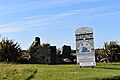
 Gilbert's Combe milestone - detail - geograph.org.uk - 3194165.jpg 734 × 979; 378 KB
-
 Gilbert's Combe milestone in its setting - geograph.org.uk - 3194159.jpg 979 × 734; 280 KB
-
 GWRSA club, Redruth - geograph.org.uk - 5007117.jpg 800 × 533; 123 KB
-
 Hind's Shaft - Wheal Uny - geograph.org.uk - 3895757.jpg 640 × 389; 87 KB
-
 Hind's Shaft - Wheal Uny - geograph.org.uk - 3895760.jpg 424 × 640; 77 KB
-
 Hind's Shaft - Wheal Uny - geograph.org.uk - 3895763.jpg 424 × 640; 77 KB
-
 Hind's Shaft - Wheal Uny - geograph.org.uk - 3895766.jpg 640 × 424; 66 KB
-
 Houses, Euny Close - geograph.org.uk - 6018569.jpg 1.024 × 681; 108 KB
-
 Inn for All Seasons - geograph.org.uk - 5797958.jpg 640 × 373; 266 KB
-
 James Moody plaque Redruth.jpg 2.048 × 1.536; 1,03 MB
-
 Junction With B3300 Near Cambrose - geograph.org.uk - 5835738.jpg 640 × 480; 61 KB
-
 Kresen Kernow archives centre - geograph.org.uk - 6283087.jpg 600 × 800; 99 KB
-
 Lane (footpath) off Buckett's Hill - geograph.org.uk - 5462871.jpg 640 × 480; 102 KB
-

-
 Market Strand, Redruth - geograph.org.uk - 4981197.jpg 800 × 600; 118 KB
-
 Milestone south of Gilbert's Coombe - geograph.org.uk - 4874482.jpg 1.600 × 1.278; 336 KB
-
 Miner's statue, Redruth - geograph.org.uk - 4996353.jpg 480 × 640; 72 KB
-
 Mineral Point, WI - 049.jpg 2.753 × 3.376; 3,53 MB
-
 Near Mount Ambrose - geograph.org.uk - 5110178.jpg 640 × 426; 53 KB
-
 Near Redruth - geograph.org.uk - 4156268.jpg 4.000 × 2.664; 6,39 MB
-

-

-

-

-

-

-

-

-

-
 One blue house - geograph.org.uk - 6258388.jpg 1.024 × 768; 173 KB
-
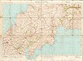 Ordnance Survey One-Inch Sheet 143 Truro & St Austell, Published 1918r.jpg 13.983 × 10.219; 13,81 MB
-
 Ordnance Survey One-Inch Sheet 143 Truro, Published 1918.jpg 13.991 × 10.267; 13,97 MB
-
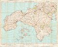 Ordnance Survey One-Inch Sheet 146 Land's End & Lizard, Published 1919.jpg 13.990 × 11.254; 13,96 MB
-
 Ornamental tree surround, Station Road, Redruth - geograph.org.uk - 1904280.jpg 1.200 × 1.600; 670 KB
-
 Pallett Track - geograph.org.uk - 6018592.jpg 1.024 × 681; 127 KB
-
 Paragon - geograph.org.uk - 6018595.jpg 1.024 × 681; 163 KB
-
 Pasty and Hanging Basket (28768503763).jpg 2.524 × 3.716; 7,03 MB
-
 Pednandrea stack, Redruth - geograph.org.uk - 6167455.jpg 480 × 640; 54 KB
-
 Pednandrea stack, Redruth - geograph.org.uk - 6167467.jpg 480 × 640; 59 KB
-
 Platform 2, Redruth Railway Station - geograph.org.uk - 5476104.jpg 640 × 453; 84 KB
-
 Poolside Cool in Redruth - geograph.org.uk - 4985338.jpg 800 × 583; 94 KB
-
 Portreath Stream - geograph.org.uk - 6283100.jpg 600 × 800; 151 KB
-
 Post Office, Redruth - geograph.org.uk - 5463045.jpg 640 × 480; 77 KB
-
 Railway towards Truro - geograph.org.uk - 5463028.jpg 640 × 480; 79 KB
-
 Railway viaduct, Redruth - geograph.org.uk - 5463016.jpg 640 × 480; 70 KB
-
 Raindrops on a Cobweb (4930388760).jpg 2.192 × 1.664; 2,74 MB
-
 Redruth , Small Road - geograph.org.uk - 4597200.jpg 4.288 × 2.848; 5,06 MB
-
 Redruth , Tolgus Hill Roundabout - geograph.org.uk - 4597204.jpg 4.005 × 2.660; 6,6 MB
-
 Redruth - World Capital of Cornish Mining - geograph.org.uk - 748039.jpg 480 × 640; 104 KB
-
 Redruth B3300 From Railway Bridge - geograph.org.uk - 4167288.jpg 640 × 433; 59 KB
-
 Redruth Railway Station - geograph.org.uk - 5463033.jpg 640 × 480; 82 KB
-
 Redruth Railway Station - geograph.org.uk - 5463034.jpg 640 × 480; 69 KB
-
 Redruth Railway Station - geograph.org.uk - 5476100.jpg 640 × 480; 92 KB
-
 Redruth railway station - geograph.org.uk - 5749156.jpg 1.024 × 768; 226 KB
-
 Redruth railway station - geograph.org.uk - 5749166.jpg 1.024 × 768; 162 KB
-
 Redruth Recreation Ground Bank.jpg 3.264 × 2.448; 1,72 MB
-
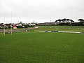
 Redruth Recreation Ground Grandstand.jpg 3.264 × 2.448; 2,08 MB
-
 Redruth Station - geograph.org.uk - 5798415.jpg 640 × 427; 348 KB
-
 Redruth Station - geograph.org.uk - 6018577.jpg 1.024 × 681; 146 KB
-
 Redruth Station - geograph.org.uk - 6018578.jpg 1.024 × 681; 130 KB
-
 Redruth Station - geograph.org.uk - 6018589.jpg 1.024 × 681; 161 KB
-
 Redruth Station - geograph.org.uk - 6018590.jpg 1.024 × 681; 238 KB
-
 Redruth Station - geograph.org.uk - 6167475.jpg 640 × 480; 94 KB
-
 Redruth Station - geograph.org.uk - 6167482.jpg 640 × 480; 68 KB
-
 Redruth station - geograph.org.uk - 6267460.jpg 640 × 480; 76 KB
-
 Redruth Welcome Sign.jpg 6.000 × 4.000; 12,06 MB
-
 Redruth West End Christmas advert - 1949.jpg 777 × 1.201; 160 KB
-
 Redruth, Tolgus or Sara's Foundry - geograph.org.uk - 107224.jpg 640 × 437; 143 KB
-
 Redruth@6-7-2019 (2).jpg 3.000 × 3.000; 2,63 MB
-
 Regal cinema - geograph.org.uk - 6258433.jpg 1.024 × 768; 123 KB
-

-
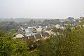
 Rooftops of Redruth - geograph.org.uk - 5110252.jpg 640 × 426; 65 KB
-
 Rooftops, Redruth - geograph.org.uk - 5144860.jpg 640 × 426; 51 KB
-
 Rooftops, Redruth - geograph.org.uk - 6018573.jpg 1.024 × 681; 161 KB
-
 Rooftops, South Park - geograph.org.uk - 5144846.jpg 640 × 426; 51 KB
-
 Rose Cottage public house, Redruth - geograph.org.uk - 6167517.jpg 640 × 480; 88 KB
-
 Rough ground near Mount Ambrose - geograph.org.uk - 5110184.jpg 640 × 426; 59 KB
-
 Sculpture at Tolgus Tin - geograph.org.uk - 4877197.jpg 800 × 600; 108 KB
-
 Seleggan Tin Smelting Works - geograph.org.uk - 6170424.jpg 640 × 480; 71 KB
-
 Self storage facility by A3047, edge of Scorrier - geograph.org.uk - 4884009.jpg 1.600 × 1.066; 284 KB
-
 Shops on Chapel Street, Redruth - geograph.org.uk - 5463018.jpg 640 × 480; 54 KB
-
 South Park - geograph.org.uk - 5144840.jpg 640 × 426; 60 KB
-
 South Park, Redruth - geograph.org.uk - 5536399.jpg 640 × 454; 87 KB
-
 St Stephens gates - geograph.org.uk - 1826259.jpg 640 × 480; 123 KB
-
 St.Aubyn Farm - geograph.org.uk - 6278992.jpg 800 × 600; 81 KB
-

-
 Stone cross off Fore Street, Redruth, Cornwall - September 2023.jpg 2.889 × 3.629; 2,81 MB
-
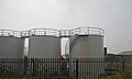 Storage tanks - geograph.org.uk - 5144961.jpg 640 × 386; 30 KB
-
 Tehidy Holiday Park. - geograph.org.uk - 1812026.jpg 640 × 480; 78 KB
-
 Terrace by the Main Line - geograph.org.uk - 5144906.jpg 640 × 426; 38 KB
-
 Terraced cottages on Buller Downs - geograph.org.uk - 4883908.jpg 1.600 × 1.065; 198 KB
-
 The edge of Redruth - geograph.org.uk - 5144835.jpg 640 × 426; 58 KB
-
 The Glass Slipper in Redruth - geograph.org.uk - 4987995.jpg 800 × 755; 138 KB
-
 The Inn For All Seasons, Redruth - geograph.org.uk - 6206563.jpg 1.024 × 768; 224 KB
-
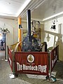
 The Murdoch Flyer - geograph.org.uk - 1198002.jpg 640 × 422; 104 KB
-
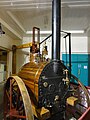
 The Murdoch Flyer - geograph.org.uk - 98782.jpg 469 × 640; 125 KB
-
 The Other Side of the Track - geograph.org.uk - 5798411.jpg 640 × 427; 413 KB
-
 The Parc Erissey milestone - detail - geograph.org.uk - 3190105.jpg 734 × 979; 389 KB
-
 The Parc Erissey milestone beside the B3300 - geograph.org.uk - 3190097.jpg 1.142 × 857; 298 KB
-
 The Treleigh Arms - geograph.org.uk - 5911169.jpg 1.024 × 674; 175 KB
-
 Tolgus Tin - Cornish stamps - geograph.org.uk - 2991408.jpg 640 × 427; 84 KB
-
 Tolgus Tin - Cornish Stamps - geograph.org.uk - 3139775.jpg 640 × 424; 276 KB
-
 Tolgus Tin - Cornish stamps - geograph.org.uk - 3799330.jpg 640 × 427; 85 KB
-
 Tolgus Tin - diesel engine - geograph.org.uk - 3799303.jpg 480 × 640; 137 KB
-
 Tolgus Tin - Dipper Wheel - geograph.org.uk - 3139755.jpg 640 × 424; 258 KB
-
 Tolgus Tin - dipper wheel - geograph.org.uk - 3139847.jpg 640 × 424; 270 KB
-
 Tolgus Tin - geograph.org.uk - 3139840.jpg 640 × 424; 257 KB
-
 Tolgus Tin - geograph.org.uk - 3139849.jpg 640 × 424; 258 KB
-
 Tolgus Tin - Holman - geograph.org.uk - 3139766.jpg 640 × 424; 247 KB
-
 Tolgus Tin - Horizontal Engine - geograph.org.uk - 3139741.jpg 640 × 424; 308 KB
-
 Tolgus Tin - outside exhibits - geograph.org.uk - 3799300.jpg 640 × 480; 92 KB
-
 Tolgus Tin - Overshot wheel - geograph.org.uk - 3139745.jpg 640 × 424; 267 KB
-
 Tolgus Tin - pitchback wheel - geograph.org.uk - 3139778.jpg 640 × 424; 250 KB
-
 Tolgus Tin - processing machinery - geograph.org.uk - 2991419.jpg 640 × 427; 78 KB
-
 Tolgus Tin - round frame - geograph.org.uk - 3139854.jpg 640 × 424; 259 KB
-
 Tolgus Tin - round frame - geograph.org.uk - 3799355.jpg 640 × 427; 78 KB
-
 Tolgus Tin - round frame label - geograph.org.uk - 3799339.jpg 640 × 427; 67 KB
-
 Tolgus Tin - shaker table - geograph.org.uk - 3139844.jpg 640 × 424; 267 KB
-
 Tolgus Tin - shaking tables - geograph.org.uk - 3139858.jpg 424 × 640; 262 KB
-
 Tolgus Tin - slurry tanks - geograph.org.uk - 3139760.jpg 640 × 424; 260 KB
-
 Tolgus Tin - steam engine - geograph.org.uk - 3095748.jpg 640 × 427; 81 KB
-
 Tolgus Tin - steam engine - geograph.org.uk - 3957815.jpg 640 × 427; 72 KB
-
 Tolgus Tin, near Redruth - geograph.org.uk - 2988698.jpg 640 × 480; 74 KB
-
 Tolgus Tin- dipper wheel - geograph.org.uk - 3799325.jpg 640 × 427; 88 KB
-
 Track near Wheal Boys - geograph.org.uk - 5144986.jpg 640 × 399; 33 KB
-
 Treasure Park - car park - geograph.org.uk - 3957788.jpg 640 × 427; 64 KB
-
 Trefusis Arms - geograph.org.uk - 5600119.jpg 1.024 × 768; 188 KB
-
 Treleigh Industrial Estate - geograph.org.uk - 5144964.jpg 640 × 426; 25 KB
-
 Treleigh Industrial Estate - geograph.org.uk - 5144969.jpg 640 × 426; 36 KB
-
 Treleigh Industrial estate - geograph.org.uk - 6018596.jpg 1.024 × 681; 125 KB
-
 Treleigh Industrial estate - geograph.org.uk - 6018597.jpg 1.024 × 681; 100 KB
-
 Trimming tin stone, East Pool Mine.jpg 960 × 613; 127 KB
-
 Twin pillarboxes, Station Road, Redruth - geograph.org.uk - 4981952.jpg 800 × 600; 148 KB
-

-

-
 Underneath the Viaduct - geograph.org.uk - 98760.jpg 640 × 587; 165 KB
-

-
 View to Carn Brea - geograph.org.uk - 5600116.jpg 1.024 × 768; 229 KB
-
 View to Carn Brea - geograph.org.uk - 6139019.jpg 1.024 × 768; 228 KB
-
 Waiting for a Train - geograph.org.uk - 5798410.jpg 640 × 427; 307 KB
-
 Warning Notice - geograph.org.uk - 6239452.jpg 3.480 × 2.263; 2 MB
-
 Welcome to Redruth signs - geograph.org.uk - 4883941.jpg 1.600 × 1.067; 241 KB
-

-
 Wheal Peevor - geograph.org.uk - 5819755.jpg 640 × 480; 97 KB
-
 Wheal Peevor - remains of boiler house - geograph.org.uk - 5859552.jpg 640 × 480; 106 KB
-
 Wheal Peevor - stamps engine house - geograph.org.uk - 5859208.jpg 640 × 480; 79 KB
-
 Wheal Peevor - the remains of the calciners - geograph.org.uk - 3190253.jpg 1.077 × 808; 360 KB
-

-
 Wheal Uny - geograph.org.uk - 3895769.jpg 640 × 424; 58 KB
.jpg)


_-_geograph.org.uk_-_5462872.jpg)

.jpg)


_off_Buckett%27s_Hill_-_geograph.org.uk_-_5462871.jpg)


.jpg)


.jpg)


.jpg)


.jpg)