Category:Reighton
Aller à la navigation
Aller à la recherche
localité britannique du comté anglais de North Yorkshire .JPG) | |||||
| Téléverser des médias | |||||
| Nature de l’élément | |||||
|---|---|---|---|---|---|
| Lieu |
| ||||
 | |||||
Sous-catégories
Cette catégorie comprend 2 sous-catégories, dont les 2 ci-dessous.
S
- St Peter's church, Reighton (14 F)
Média dans la catégorie « Reighton »
Cette catégorie comprend 606 fichiers, dont les 200 ci-dessous.
(page précédente) (page suivante)-

-
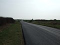
 A frosty New Rd - geograph.org.uk - 5383031.jpg 640 × 426 ; 53 kio
-
 A large field - geograph.org.uk - 5383041.jpg 640 × 426 ; 44 kio
-
 A minor junction near Eastfield Farm - geograph.org.uk - 2317579.jpg 800 × 600 ; 190 kio
-
 A Shepherd with sheep, at Dotterel roundabout - geograph.org.uk - 2498883.jpg 800 × 600 ; 203 kio
-
 A165 - geograph.org.uk - 5383039.jpg 640 × 426 ; 40 kio
-
 A165 and Southfields Farm - geograph.org.uk - 5403506.jpg 640 × 287 ; 25 kio
-
 A165 approaching Dotterel Roundabout - geograph.org.uk - 4492405.jpg 640 × 480 ; 49 kio
-
 A165 Bypass over the Field - geograph.org.uk - 2203241.jpg 4 000 × 3 000 ; 2,56 Mio
-
 A165 near Reighton - geograph.org.uk - 5326732.jpg 2 570 × 1 682 ; 1,56 Mio
-
 A165 near Southfield Farm - geograph.org.uk - 4492041.jpg 640 × 480 ; 77 kio
-
 A165 Railway Bridge - geograph.org.uk - 5327342.jpg 1 600 × 1 060 ; 272 kio
-
 A165 towards Scarborough - geograph.org.uk - 2869881.jpg 640 × 480 ; 46 kio
-
 A165 towards Scarborough - geograph.org.uk - 2869890.jpg 640 × 480 ; 44 kio
-
 A165 towards Scarborough - geograph.org.uk - 4492398.jpg 640 × 480 ; 48 kio
-
 A165 towards Scarborough - geograph.org.uk - 4492409.jpg 640 × 480 ; 49 kio
-
 A165 towards Scarborough - geograph.org.uk - 4492432.jpg 640 × 480 ; 60 kio
-
 A165-B1229 roundabout - geograph.org.uk - 4456705.jpg 640 × 428 ; 77 kio
-
 Access road, Reighton Sands Holiday Park - geograph.org.uk - 5872247.jpg 3 107 × 1 581 ; 1,39 Mio
-
 Access to Reighton Sands Holiday Park - geograph.org.uk - 3612692.jpg 768 × 1 024 ; 251 kio
-
 Access to the beach at Reighton Gap - geograph.org.uk - 5970795.jpg 640 × 480 ; 80 kio
-
 All quiet on Reighton Sands - geograph.org.uk - 5648950.jpg 2 000 × 1 500 ; 162 kio
-
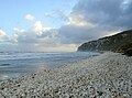
 Along the cliffs at Speaton - geograph.org.uk - 5790970.jpg 4 281 × 3 199 ; 4,35 Mio
-
 An arable landscape - geograph.org.uk - 1915524.jpg 640 × 430 ; 114 kio
-
 An old barn on Speeton Moor - geograph.org.uk - 2749866.jpg 800 × 600 ; 63 kio
-
 Arable land - geograph.org.uk - 5403517.jpg 640 × 426 ; 37 kio
-
 Arable land, Speeton Field - geograph.org.uk - 4492014.jpg 640 × 480 ; 78 kio
-
 B1229 approaching a bend - geograph.org.uk - 3819118.jpg 640 × 480 ; 68 kio
-
 B1229 approaching Dotterel Roundabout - geograph.org.uk - 5326726.jpg 2 576 × 1 670 ; 1,59 Mio
-
 B1229 approaching Speeton - geograph.org.uk - 5326717.jpg 1 600 × 1 045 ; 228 kio
-
 B1229 heading east - geograph.org.uk - 2870013.jpg 640 × 480 ; 59 kio
-
 B1229 heading east - geograph.org.uk - 3819114.jpg 640 × 480 ; 47 kio
-
 B1229 heading east - geograph.org.uk - 3819121.jpg 640 × 480 ; 65 kio
-
 B1229 heading east - geograph.org.uk - 3819126.jpg 640 × 480 ; 84 kio
-
 B1229 heading east over Speeton Moor - geograph.org.uk - 2870194.jpg 640 × 480 ; 51 kio
-
 B1229 heading east towards Buckton - geograph.org.uk - 2869996.jpg 640 × 480 ; 35 kio
-
 B1229 heading east towards Buckton - geograph.org.uk - 2870000.jpg 640 × 480 ; 63 kio
-
 B1229 heading east towards Buckton - geograph.org.uk - 2870001.jpg 640 × 480 ; 37 kio
-
 B1229 heading east towards Buckton - geograph.org.uk - 2870009.jpg 640 × 480 ; 43 kio
-
 B1229 heading east towards Buckton - geograph.org.uk - 2870179.jpg 640 × 480 ; 46 kio
-
 B1229 heading east towards Buckton - geograph.org.uk - 2870184.jpg 640 × 480 ; 39 kio
-
 B1229 heading east towards Buckton - geograph.org.uk - 2870189.jpg 640 × 480 ; 45 kio
-
 B1229 heading east towards Buckton - geograph.org.uk - 2870200.jpg 640 × 480 ; 43 kio
-
 B1229 heading east towards Buckton - geograph.org.uk - 2870206.jpg 640 × 480 ; 29 kio
-
 B1229 heading west - geograph.org.uk - 3991690.jpg 2 000 × 1 500 ; 1,28 Mio
-
 B1229 near Speeton Grange - geograph.org.uk - 4820175.jpg 640 × 480 ; 55 kio
-
 B1229 towards Reighton - geograph.org.uk - 4820170.jpg 640 × 480 ; 51 kio
-
 B1229 towards Reighton - geograph.org.uk - 4820180.jpg 640 × 480 ; 70 kio
-
 B1229 westbound - geograph.org.uk - 4734440.jpg 640 × 480 ; 31 kio
-
 Bad pointing - geograph.org.uk - 4507599.jpg 1 024 × 768 ; 266 kio
-
 Barleyfield on a windy day - geograph.org.uk - 3014621.jpg 1 024 × 768 ; 166 kio
-
 Beach fishing near Reighton Gap - geograph.org.uk - 4030247.jpg 2 235 × 1 320 ; 490 kio
-
 Beach, Reighton Gap - geograph.org.uk - 4107325.jpg 640 × 427 ; 48 kio
-
 Beach, Reighton Gap - geograph.org.uk - 4107326.jpg 640 × 427 ; 41 kio
-
 Beacon Hill - geograph.org.uk - 2203270.jpg 4 000 × 3 000 ; 2,58 Mio
-
 Between Gates - geograph.org.uk - 5403513.jpg 640 × 426 ; 32 kio
-
 Black Cliff - geograph.org.uk - 4127225.jpg 640 × 427 ; 48 kio
-
 Black cliff - geograph.org.uk - 4127228.jpg 640 × 427 ; 52 kio
-
 Black Cliff - geograph.org.uk - 4127312.jpg 640 × 427 ; 50 kio
-
 Black Cliff - Speeton Cliffs - geograph.org.uk - 4127315.jpg 640 × 427 ; 44 kio
-
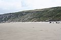
 Black cliffs and white sandy beach - geograph.org.uk - 3612707.jpg 1 600 × 1 200 ; 502 kio
-
 Boat Cliff - geograph.org.uk - 1220172.jpg 640 × 480 ; 84 kio
-
 Boat Cliff - geograph.org.uk - 3612678.jpg 1 024 × 768 ; 356 kio
-
 Boat Cliff, Reighton - geograph.org.uk - 815206.jpg 640 × 392 ; 64 kio
-
 Boiler from the wreck of the Diamond - geograph.org.uk - 4127368.jpg 427 × 640 ; 88 kio
-
 Boiler from the wreck of the Diamond - geograph.org.uk - 4127375.jpg 427 × 640 ; 72 kio
-
 Boiler from the wreck of the Diamond - geograph.org.uk - 4127378.jpg 640 × 427 ; 79 kio
-
 Boiler from the wreck of the Diamond - geograph.org.uk - 4127382.jpg 640 × 480 ; 69 kio
-
 Boilers, Wreck of The Laura - geograph.org.uk - 4127238.jpg 640 × 427 ; 32 kio
-
 Boilers, Wreck of The Laura - geograph.org.uk - 4127243.jpg 640 × 427 ; 46 kio
-
 Boilers, Wreck of The Laura - geograph.org.uk - 4127248.jpg 640 × 427 ; 34 kio
-
 Boilers, Wreck of The Laura - geograph.org.uk - 4127250.jpg 640 × 427 ; 37 kio
-
 Brick structure on Boat Cliff - geograph.org.uk - 3612673.jpg 1 024 × 728 ; 347 kio
-
 Bridge HBS-31 - geograph.org.uk - 203501.jpg 640 × 480 ; 84 kio
-
 Bridge near Eastfield Farm - geograph.org.uk - 3802344.jpg 1 200 × 798 ; 396 kio
-
 Bridge over St Helens Lane - geograph.org.uk - 3819058.jpg 640 × 480 ; 72 kio
-
 Bridlington Road - geograph.org.uk - 3819057.jpg 640 × 480 ; 70 kio
-
 Bridlington Road - geograph.org.uk - 4825890.jpg 640 × 480 ; 44 kio
-
 Bridlington Road towards Reighton - geograph.org.uk - 6399185.jpg 800 × 577 ; 89 kio
-
 Broken concrete - geograph.org.uk - 3612667.jpg 1 600 × 1 124 ; 635 kio
-
 Buckton Hall Farm - geograph.org.uk - 6399244.jpg 800 × 481 ; 47 kio
-
 Bungalow for sale on the Scarborough Road - geograph.org.uk - 2869879.jpg 640 × 480 ; 57 kio
-
 Bungalow on Watson's Lane, Reighton - geograph.org.uk - 4820253.jpg 640 × 480 ; 68 kio
-
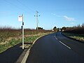
 Bus stop and shelter on Butts Hill, Reighton - geograph.org.uk - 4820286.jpg 640 × 480 ; 63 kio
-

-

-
 Bus stop on the old A165, Reighton - geograph.org.uk - 4820188.jpg 640 × 480 ; 52 kio
-
 Bus stop, Reighton - geograph.org.uk - 4820186.jpg 640 × 406 ; 34 kio
-
 Butts Hill - geograph.org.uk - 3551903.jpg 3 887 × 2 726 ; 2,61 Mio
-
 Caravan Site - Reighton Sands - geograph.org.uk - 404908.jpg 640 × 480 ; 79 kio
-
 Caravans - geograph.org.uk - 1220170.jpg 640 × 480 ; 68 kio
-
 Caravans, Reighton Sands Holiday Park - geograph.org.uk - 4820837.jpg 640 × 480 ; 66 kio
-

-
 Chalk boulders on the beach - geograph.org.uk - 3612736.jpg 1 600 × 1 198 ; 569 kio
-
 Chalk downland - geograph.org.uk - 5383027.jpg 640 × 426 ; 33 kio
-
 Chalk farm buildings at Church Farm Speeton - geograph.org.uk - 4507573.jpg 1 024 × 768 ; 164 kio
-
 Chalk pebbles - geograph.org.uk - 3612725.jpg 1 024 × 768 ; 274 kio
-
 Chalk stones against the cliff then the sand beach - geograph.org.uk - 5790955.jpg 4 247 × 3 150 ; 5,55 Mio
-
 Chalky farmland near The Willows - geograph.org.uk - 3818006.jpg 640 × 480 ; 68 kio
-
 Church Hill - geograph.org.uk - 4456751.jpg 640 × 428 ; 92 kio
-
 Church Hill Reighton - geograph.org.uk - 2203225.jpg 4 000 × 3 000 ; 2,51 Mio
-
 Church Hill, Reighton - geograph.org.uk - 1884982.jpg 640 × 480 ; 150 kio
-
 Church Hill, Reighton - geograph.org.uk - 1885772.jpg 640 × 480 ; 133 kio
-
 Church Hill, Reighton - geograph.org.uk - 1885799.jpg 640 × 480 ; 112 kio
-
 Church Hill, Reighton - geograph.org.uk - 3819078.jpg 640 × 480 ; 77 kio
-
 Church Hill, Reighton - geograph.org.uk - 3819088.jpg 640 × 480 ; 124 kio
-
 Church Hill, Reighton - geograph.org.uk - 4495118.jpg 640 × 428 ; 91 kio
-
 Church Hill, Reighton - geograph.org.uk - 4820244.jpg 640 × 480 ; 54 kio
-
 Church Hill, Reighton - geograph.org.uk - 4824159.jpg 640 × 452 ; 81 kio
-
 Church Hill, Reighton - geograph.org.uk - 4824160.jpg 1 564 × 1 138 ; 446 kio
-
 Cliffs and sea defences - geograph.org.uk - 3599110.jpg 1 024 × 768 ; 245 kio
-
 Cliffs near Reighton - geograph.org.uk - 3612699.jpg 1 024 × 768 ; 218 kio
-
 Clifftop footpath with Filey Bay beyond - geograph.org.uk - 5791028.jpg 4 237 × 3 146 ; 4,81 Mio
-
 Close up, Elizabeth II postbox on St Helens Lane, Reighton - geograph.org.uk - 4824172.jpg 1 116 × 2 348 ; 447 kio
-
 Close up, Elizabeth II postbox on Wide Lane, Speeton - geograph.org.uk - 4826123.jpg 1 318 × 2 690 ; 2,45 Mio
-

-
 Coastal Defences - geograph.org.uk - 1220163.jpg 640 × 480 ; 57 kio
-
 Coastal erosion above Reighton Sands - geograph.org.uk - 2614193.jpg 1 600 × 1 200 ; 356 kio
-
 Coastal erosion at Reighton Sands - geograph.org.uk - 4035753.jpg 640 × 480 ; 50 kio
-
 Coastal erosion, Boat Cliff - geograph.org.uk - 4030271.jpg 640 × 480 ; 72 kio
-
 Coastal farmland - geograph.org.uk - 4492862.jpg 640 × 480 ; 39 kio
-
 Coastal farmland off National Cycle Route 1 - geograph.org.uk - 4495097.jpg 640 × 443 ; 67 kio
-
 Cottages in Reighton - geograph.org.uk - 4820193.jpg 640 × 451 ; 57 kio
-
 County of North Yorkshire sign - geograph.org.uk - 4820096.jpg 640 × 480 ; 93 kio
-
 Crop field and hedgerow, Speeton Grange - geograph.org.uk - 4820177.jpg 640 × 480 ; 80 kio
-
 Crop field and Speeton Moor - geograph.org.uk - 3991691.jpg 2 000 × 1 500 ; 1,29 Mio
-
 Crop field beside New Road - geograph.org.uk - 4820130.jpg 640 × 480 ; 71 kio
-

-
 Crop field east of Reighton - geograph.org.uk - 4820272.jpg 640 × 480 ; 67 kio
-
 Crop field near Reighton - geograph.org.uk - 4825886.jpg 640 × 480 ; 51 kio
-
 Crop field near Speeton - geograph.org.uk - 4495126.jpg 640 × 480 ; 61 kio
-
 Crop field off Bridlington Road - geograph.org.uk - 4825889.jpg 640 × 480 ; 50 kio
-
 Crop field off Speeton Gate (B1229) - geograph.org.uk - 4820107.jpg 640 × 480 ; 111 kio
-
 Crop field off the A165 - geograph.org.uk - 4492394.jpg 640 × 442 ; 54 kio
-
 Crop field off Watson's Lane - geograph.org.uk - 4820265.jpg 640 × 480 ; 51 kio
-
 Crop field, Between Gates - geograph.org.uk - 2869940.jpg 640 × 465 ; 61 kio
-
 Crop field, Longlands - geograph.org.uk - 4820116.jpg 640 × 480 ; 68 kio
-
 Crop field, Moorhouse Farm - geograph.org.uk - 4821336.jpg 640 × 480 ; 66 kio
-
 Crop field, Reighton - geograph.org.uk - 4821345.jpg 640 × 326 ; 71 kio
-
 Descent from Reighton - geograph.org.uk - 4456755.jpg 640 × 428 ; 80 kio
-

-
 Don't try this footpath in flipflops - geograph.org.uk - 5791000.jpg 3 223 × 4 295 ; 6,22 Mio
-
 Downland farmland - geograph.org.uk - 5383035.jpg 640 × 426 ; 45 kio
-
 Dulcey Dock - geograph.org.uk - 3612745.jpg 1 600 × 1 150 ; 483 kio
-
 East Riding Boundary - geograph.org.uk - 1213442.jpg 640 × 480 ; 69 kio
-
 Eastfield Farm - geograph.org.uk - 1215358.jpg 640 × 480 ; 51 kio
-
 Eastfield Farm - geograph.org.uk - 4506761.jpg 1 024 × 768 ; 148 kio
-
 Eastfield Farm south of Reighton - geograph.org.uk - 2317583.jpg 800 × 600 ; 197 kio
-
 Elizabeth II postbox on Church Hill, Reighton - geograph.org.uk - 4824155.jpg 1 436 × 2 736 ; 961 kio
-
 Elizabeth II postbox on St Helens Lane, Reighton - geograph.org.uk - 4824171.jpg 721 × 818 ; 140 kio
-
 Elizabeth II postbox on Wide Lane, Speeton - geograph.org.uk - 4826121.jpg 640 × 526 ; 91 kio
-
 Elizabeth II postbox on Wide Lane, Speeton - geograph.org.uk - 4826125.jpg 3 648 × 2 736 ; 3,44 Mio
-
 Elizabeth II postbox, Reighton Sands Holiday Park - geograph.org.uk - 5872240.jpg 1 840 × 3 280 ; 2,33 Mio
-
 End of Watson's Lane - geograph.org.uk - 4820270.jpg 640 × 480 ; 76 kio
-
 Entering East Yorkshire - geograph.org.uk - 2749872.jpg 800 × 600 ; 70 kio
-
 Entering North Yorkshire - geograph.org.uk - 1215344.jpg 640 × 480 ; 97 kio
-
 Entering North Yorkshire - geograph.org.uk - 6398853.jpg 800 × 600 ; 119 kio
-
 Entering Reighton - geograph.org.uk - 4456747.jpg 640 × 428 ; 85 kio
-
 Entering Reighton - geograph.org.uk - 4820190.jpg 640 × 480 ; 84 kio
-
 Entering Reighton on National Cycle Route 1 - geograph.org.uk - 4495107.jpg 640 × 480 ; 60 kio
-
 Entering Speeton village - geograph.org.uk - 3991682.jpg 2 000 × 1 455 ; 896 kio
-
 Entering the East Riding on the B1229 - geograph.org.uk - 2870207.jpg 640 × 480 ; 41 kio
-
 Entrance to "The Bay" - geograph.org.uk - 1231115.jpg 640 × 375 ; 80 kio
-
 Entrance to Reighton Sands Holiday Park - geograph.org.uk - 3778520.jpg 1 600 × 1 067 ; 221 kio
-
 Entrance to Snugglepuss Cat Hotel - geograph.org.uk - 4492451.jpg 640 × 480 ; 55 kio
-
 Entrance to Woodbine Farm, Speeton - geograph.org.uk - 4820156.jpg 640 × 480 ; 49 kio
-
 Extensive wheat field - geograph.org.uk - 1915550.jpg 640 × 430 ; 97 kio
-
 Farm building and crop fields - geograph.org.uk - 3991698.jpg 2 000 × 1 500 ; 863 kio
-
 Farm building, Church Farm, Speeton - geograph.org.uk - 4820164.jpg 640 × 398 ; 61 kio
-
 Farm Buildings - geograph.org.uk - 1213469.jpg 640 × 480 ; 86 kio
-
 Farm buildings, Church Hill, Reighton - geograph.org.uk - 3819069.jpg 640 × 480 ; 70 kio
-
 Farm buildings, Moorhouse Farm - geograph.org.uk - 4820829.jpg 640 × 446 ; 79 kio
-
 Farm land to the east of North Burton Lane - geograph.org.uk - 3802359.jpg 1 200 × 798 ; 576 kio
-
 Farm land to the west of North Burton Lane - geograph.org.uk - 3802357.jpg 1 200 × 798 ; 500 kio
-
 Farm track in field - geograph.org.uk - 2870003.jpg 640 × 480 ; 69 kio
-
 Farm track off the A165 - geograph.org.uk - 4492026.jpg 640 × 480 ; 76 kio
-
 Farm track off the B1229 - geograph.org.uk - 4820173.jpg 640 × 480 ; 56 kio
-
 Farm track off Watson's Lane - geograph.org.uk - 4820263.jpg 640 × 480 ; 109 kio
-
 Farm track on to Speeton Moor - geograph.org.uk - 3991696.jpg 2 000 × 1 500 ; 1,05 Mio
-
 Farmland and hedge - geograph.org.uk - 5383037.jpg 640 × 426 ; 57 kio
-
 Farmland and hedgerow near Moorhouse Farm - geograph.org.uk - 4820857.jpg 640 × 480 ; 80 kio
-
 Farmland near Reighton - geograph.org.uk - 5970979.jpg 640 × 450 ; 87 kio
-
 Farmland near Speeton - geograph.org.uk - 3819124.jpg 640 × 480 ; 80 kio
-
 Farmland near Speeton - geograph.org.uk - 3819125.jpg 640 × 480 ; 82 kio
-
 Farmland off New Road - geograph.org.uk - 2869979.jpg 640 × 480 ; 37 kio
-
 Farmland off New Road - geograph.org.uk - 2869984.jpg 640 × 480 ; 76 kio
-
 Farmland off North Burton Lane - geograph.org.uk - 3818004.jpg 640 × 480 ; 87 kio
-
 Farmland off North Burton Lane - geograph.org.uk - 3818027.jpg 640 × 480 ; 44 kio
-
 Farmland off the B1229 - geograph.org.uk - 2870011.jpg 640 × 480 ; 65 kio
-
 Farmland towards Speeton Cliffs - geograph.org.uk - 2870008.jpg 640 × 480 ; 75 kio
-
 Farmland towards Speeton Cliffs - geograph.org.uk - 2870018.jpg 640 × 480 ; 57 kio
-
 Farmland towards Speeton Cliffs - geograph.org.uk - 2870183.jpg 640 × 480 ; 64 kio
-
 Farmland west of North Burton Lane - geograph.org.uk - 3819048.jpg 640 × 480 ; 60 kio
-
 Farmland, Between Gates - geograph.org.uk - 2869925.jpg 640 × 480 ; 72 kio
-
 Farmland, Between Gates - geograph.org.uk - 2869934.jpg 640 × 480 ; 86 kio
-
 Farmland, Between Gates - geograph.org.uk - 2869944.jpg 640 × 480 ; 46 kio
-
 Farmland, Speeton Field - geograph.org.uk - 2869887.jpg 640 × 480 ; 48 kio
-
 Farmland, Speeton Field - geograph.org.uk - 2869911.jpg 640 × 480 ; 71 kio
-
 Farmland, Speeton Moor - geograph.org.uk - 2870185.jpg 640 × 480 ; 57 kio
-
 Farmland, Speeton Moor - geograph.org.uk - 2870191.jpg 640 × 480 ; 55 kio


_-_geograph.org.uk_-_4820107.jpg)


