Category:Reston, Lincolnshire
Aller à la navigation
Aller à la recherche
English: Reston is a civil parish in the East Lindsey district of Lincolnshire, England. It is situated on the A157, south of the market town of Louth. (→Reston, Lincolnshire)

localité britannique du comté anglais de Lincolnshire  | |||||
| Téléverser des médias | |||||
| Nature de l’élément | |||||
|---|---|---|---|---|---|
| Lieu | East Lindsey, Lincolnshire, Midlands de l'Est, Angleterre | ||||
 | |||||
Sous-catégories
Cette catégorie comprend 3 sous-catégories, dont les 3 ci-dessous.
Média dans la catégorie « Reston, Lincolnshire »
Cette catégorie comprend 105 fichiers, dont les 105 ci-dessous.
-
 A bridleway leading towards Muckton Wood - geograph.org.uk - 2899117.jpg 800 × 600 ; 96 kio
-
 A bridleway off Sturdy Hill (road) - geograph.org.uk - 2899071.jpg 800 × 600 ; 140 kio
-
 A footpath leading to Castle Hill - geograph.org.uk - 2899093.jpg 800 × 600 ; 129 kio
-
 A house on Rats Pen Lane - geograph.org.uk - 2899103.jpg 800 × 600 ; 90 kio
-
 A pleasant corner in Rats Pen Lane - geograph.org.uk - 3562603.jpg 640 × 427 ; 93 kio
-
 A157 heading east - geograph.org.uk - 3523675.jpg 640 × 480 ; 62 kio
-
 A157 heading east - geograph.org.uk - 3524131.jpg 640 × 480 ; 66 kio
-
 A157 heading towards Mablethorpe - geograph.org.uk - 3523667.jpg 640 × 480 ; 78 kio
-
 A157 heading towards Mablethorpe - geograph.org.uk - 3523672.jpg 640 × 480 ; 51 kio
-

-

-

-
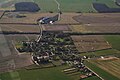 Authorpe, aerial 2016 - geograph.org.uk - 4878143.jpg 640 × 427 ; 64 kio
-

-
 Bridge over the Old Eau into Craker Lane - geograph.org.uk - 3539339.jpg 640 × 427 ; 86 kio
-
-
-

-
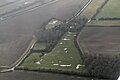
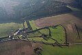
 Castle Carlton, aerial 2016 - geograph.org.uk - 5228827.jpg 640 × 416 ; 43 kio
-
 Castle Wood - geograph.org.uk - 4878552.jpg 1 024 × 683 ; 446 kio
-
 Close up of OS trig point on Scrub Lane - geograph.org.uk - 4669465.jpg 480 × 640 ; 117 kio
-
 Collecting bales near High Leas - geograph.org.uk - 4669450.jpg 640 × 480 ; 75 kio
-
 Cottage by Rookery Farm - geograph.org.uk - 3539369.jpg 640 × 427 ; 101 kio
-
 Cottage on Main Road, South Reston - geograph.org.uk - 6224655.jpg 1 280 × 960 ; 175 kio
-

-

-

-
 Cows near Gillwood's Grange - geograph.org.uk - 2515426.jpg 1 280 × 960 ; 501 kio
-
 Craker Lane - geograph.org.uk - 3898387.jpg 1 024 × 768 ; 231 kio
-

-
 Crops off New Lane, near South Reston - geograph.org.uk - 2515832.jpg 1 280 × 960 ; 789 kio
-
 Cut Mark, South Reston, Main Road - geograph.org.uk - 6224652.jpg 960 × 1 280 ; 240 kio
-
 Dog roses by the path to Castle Hill - geograph.org.uk - 3539359.jpg 640 × 427 ; 72 kio
-
 Dusk Descending - geograph.org.uk - 682910.jpg 640 × 480 ; 37 kio
-
-
 Farmland off the A157 - geograph.org.uk - 3523674.jpg 640 × 480 ; 81 kio
-
 Fire damaged house - geograph.org.uk - 3524167.jpg 640 × 480 ; 66 kio
-
 Footbridge on the Hall Farm Walk - geograph.org.uk - 3539615.jpg 640 × 427 ; 87 kio
-
 Footpath junction north of South Reston - geograph.org.uk - 3539653.jpg 640 × 427 ; 107 kio
-
 Footpath to Castle Hill and North Reston - geograph.org.uk - 3056156.jpg 1 024 × 768 ; 276 kio
-
 Game feeder - geograph.org.uk - 4878560.jpg 1 024 × 683 ; 413 kio
-
 Gate fastener on the Craker Lane bridleway - geograph.org.uk - 3539348.jpg 427 × 640 ; 62 kio
-

-
 Gayton le Marsh, aerial 2014 (1) - geograph.org.uk - 3871518.jpg 640 × 427 ; 60 kio
-
 Gayton Top - geograph.org.uk - 4179688.jpg 1 024 × 683 ; 141 kio
-
 Grazing off the A157 - geograph.org.uk - 3523677.jpg 640 × 480 ; 64 kio
-
-
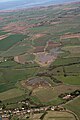
 Great Carlton to the sea, aerial 2015 - geograph.org.uk - 4303549.jpg 640 × 369 ; 39 kio
-

-
 Hall Farm Walk and an unnamed spinney - geograph.org.uk - 3539631.jpg 640 × 427 ; 85 kio
-

-
 Hall Farm, South Reston, Lincolnshire - geograph.org.uk - 5290408.jpg 427 × 640 ; 110 kio
-
 Heavy plant crossing near Strait House - geograph.org.uk - 2898966.jpg 800 × 600 ; 137 kio
-
 Hedge and tree-lined lane near to Castle Carlton - geograph.org.uk - 6080935.jpg 4 000 × 3 000 ; 4,47 Mio
-
 High Leas Farm on Willoughby Lane - geograph.org.uk - 2899110.jpg 800 × 600 ; 108 kio
-
 Horse gate onto Craker Lane - geograph.org.uk - 3539338.jpg 640 × 427 ; 99 kio
-
 House in Rats Pen Lane - geograph.org.uk - 3562602.jpg 640 × 427 ; 62 kio
-
 House in Rats Pen Lane - geograph.org.uk - 3562607.jpg 640 × 427 ; 72 kio
-
 House on Rats Pen Lane - geograph.org.uk - 4669448.jpg 640 × 454 ; 55 kio
-

-
 Looking along Scrub Lane - geograph.org.uk - 2899145.jpg 800 × 600 ; 89 kio
-
 Looking SW along Authorpe, aerial 2014 - geograph.org.uk - 3799578.jpg 427 × 640 ; 45 kio
-

-
 Main Road, A157, heading east - geograph.org.uk - 3524151.jpg 640 × 480 ; 78 kio
-
 Main Road, A157, heading east - geograph.org.uk - 3524164.jpg 640 × 480 ; 53 kio
-
-
-

-

-
 OS trig point on Scrub Lane - geograph.org.uk - 4669463.jpg 640 × 480 ; 79 kio
-
 Party at Hall Farm - geograph.org.uk - 3539328.jpg 640 × 427 ; 52 kio
-
 Prosperity Farm - geograph.org.uk - 4656440.jpg 640 × 480 ; 83 kio
-
 Prosperity Farm on Willoughby Lane - geograph.org.uk - 2899136.jpg 800 × 545 ; 105 kio
-
 Protected Roadside Verge on Willoughby Lane - geograph.org.uk - 3562605.jpg 640 × 427 ; 109 kio
-
 Rats Pen Lane - geograph.org.uk - 4669451.jpg 640 × 480 ; 75 kio
-
 Rats Pen Lane at Ivy House - geograph.org.uk - 6080920.jpg 4 000 × 3 000 ; 2,72 Mio
-
 Rats Pen Lane near to High Leas - geograph.org.uk - 6080910.jpg 4 000 × 3 000 ; 3,97 Mio
-

-

-

-
 Rookery Farm - geograph.org.uk - 3539368.jpg 640 × 427 ; 101 kio
-
 Sharp bend in the A157 - geograph.org.uk - 3523680.jpg 640 × 480 ; 86 kio
-
 Small enclosurers - geograph.org.uk - 833899.jpg 640 × 428 ; 115 kio
-

-

-

-
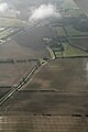
 South Reston towards Authorpe, aerial 2018 - geograph.org.uk - 5673364.jpg 800 × 533 ; 69 kio
-
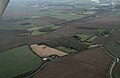
 South Reston, aerial 2018 - geograph.org.uk - 5706716.jpg 640 × 363 ; 46 kio
-
 Stubble field off Scub Lane - geograph.org.uk - 4669459.jpg 640 × 480 ; 46 kio
-
 The footpath from North Reston to Great Carlton - geograph.org.uk - 3063339.jpg 1 024 × 768 ; 155 kio
-
 The footpath to Hall Farm - geograph.org.uk - 3539578.jpg 640 × 427 ; 61 kio
-
-
 The Old Eau and The Beck - geograph.org.uk - 3539335.jpg 640 × 427 ; 54 kio
-
 The Old Eau from the bridge on Craker Lane - geograph.org.uk - 3539345.jpg 427 × 640 ; 97 kio
-
 The path around Castle Hill - geograph.org.uk - 3539362.jpg 640 × 427 ; 86 kio
-
 The path to Castle Hill - geograph.org.uk - 3539358.jpg 640 × 427 ; 50 kio
-

-
 Track to Castle Plat Plantation - geograph.org.uk - 2515507.jpg 1 280 × 960 ; 363 kio
-
 Traditional farm buildings at Hall Farm - geograph.org.uk - 3539555.jpg 640 × 427 ; 89 kio
-
 Trig Point BM S5958 on Scrub Lane - geograph.org.uk - 2899155.jpg 800 × 600 ; 125 kio
-
 Trig Point TP5857 - geograph.org.uk - 3223843.jpg 3 088 × 2 056 ; 2,19 Mio
-

-
 Willoughby Lane - geograph.org.uk - 4656434.jpg 640 × 480 ; 68 kio
-
-
 Willoughby Lane at Prosperity Farm - geograph.org.uk - 2899139.jpg 800 × 600 ; 107 kio

_-_geograph.org.uk_-_2899071.jpg)


_to_Little_Carlton_and_Manby,_aerial_2016_-_geograph.org.uk_-_4878306.jpg)


,_remains_of_tofts_and_crofts_(aerial_2018)_-_geograph.org.uk_-_5704067.jpg)
,_remains_of_tofts_and_crofts_(aerial_2018)_-_geograph.org.uk_-_5704161.jpg)
,_remains_of_tofts_and_crofts_(aerial_2018)_-_geograph.org.uk_-_5704176.jpg)


_-_geograph.org.uk_-_3871518.jpg)


_-_geograph.org.uk_-_5703909.jpg)


_-_geograph.org.uk_-_4823306.jpg)
_-_geograph.org.uk_-_4823314.jpg)


