Category:Rettenberg
Vai alla navigazione
Vai alla ricerca
comune tedesco    | |||||
| Carica un file multimediale | |||||
| Istanza di |
| ||||
|---|---|---|---|---|---|
| Parte di |
| ||||
| Luogo | circondario dell'Alta Algovia, distretto della Svevia, Baviera, Germania | ||||
| Capo del governo |
| ||||
| Popolazione |
| ||||
| Superficie |
| ||||
| Altezza sul mare |
| ||||
| Distinto da | |||||
| sito web ufficiale | |||||
 | |||||
Sottocategorie
Questa categoria contiene le 7 sottocategorie indicate di seguito, su un totale di 7.
- Sculptures in Rettenberg (8 F)
P
Pagine nella categoria "Rettenberg"
Questa categoria contiene un'unica pagina, indicata di seguito.
File nella categoria "Rettenberg"
Questa categoria contiene 36 file, indicati di seguito, su un totale di 36.
-

-
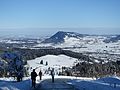 Blaichach-Gunzesried - Sicht auf Illertal und Rettenberg.JPG 4 864 × 3 648; 3,34 MB
-
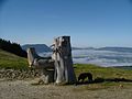
 Bruder Klaus - panoramio (1).jpg 2 816 × 2 120; 1,95 MB
-
 Burgberg - Häuser nördl - Felmer Moos, Rottachberg v SW 010123.jpg 4 608 × 3 456; 1,54 MB
-
 Diepolz über dem Nebel - panoramio.jpg 2 816 × 2 120; 1,31 MB
-
 Freidorf Humbach Photovoltaik im Bau - panoramio.jpg 2 816 × 2 120; 1,41 MB
-
 Grüntensteinbruch - panoramio (1).jpg 2 816 × 2 120; 1,78 MB
-
 Immenstadt unter dem Nebel - panoramio.jpg 2 816 × 2 120; 1,46 MB
-
 Liftstation - panoramio.jpg 2 816 × 2 120; 1,43 MB
-
 Mittag über dem Nebel - panoramio.jpg 2 816 × 2 120; 1,44 MB
-
 Nebel im Illertal - panoramio.jpg 2 816 × 2 120; 1,48 MB
-
 Parkplatz Kammeregg - panoramio.jpg 2 816 × 2 120; 1,45 MB
-
 DEU Rettenberg COA.svg 979 × 1 068; 11 KB
-
 Rettenberg - panoramio (1).jpg 2 816 × 2 120; 1,49 MB
-
 Rettenberg - panoramio (10).jpg 2 816 × 2 120; 1,86 MB
-
 Rettenberg 2018 05.jpg 3 456 × 4 608; 6,97 MB
-
 Rettenberg 2018 07.jpg 4 600 × 2 661; 1,21 MB
-
 Rettenberg 2018 08.jpg 4 601 × 2 142; 1,02 MB
-
 Rettenberg in OA.svg 590 × 892; 1,39 MB
-
 RETTENBERG KRANZEGG nieder.png 480 × 360; 5 KB
-
 RETTENBERG KRANZEGG nieder.svg 512 × 427; 21 KB
-
 Rotbuche am Nordhang - panoramio.jpg 2 816 × 2 120; 1,48 MB
-
 Rotbuche am Weg - panoramio.jpg 2 816 × 2 120; 1,5 MB
-
 Rotbuche Stamm - panoramio.jpg 2 816 × 2 120; 1,51 MB
-
 Rottachberg-GO-1.jpg 2 048 × 1 536; 947 KB
-
 Silbriger Fichtenstamm - panoramio.jpg 2 816 × 2 120; 1,49 MB
-
 Steinbruch - panoramio (12).jpg 2 816 × 2 120; 1,56 MB
-
 Steinbruch - panoramio (13).jpg 2 816 × 2 120; 1,61 MB
-
 Steinbruch - panoramio (14).jpg 2 816 × 2 120; 1,78 MB
-
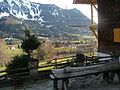 Terrasse - panoramio (2).jpg 2 816 × 2 120; 1,65 MB
-
 The Glow - panoramio.jpg 1 722 × 1 146; 621 KB
-
 Untermaiselstein Am Schilf Rottachberg - panoramio.jpg 2 816 × 2 120; 1,45 MB
-
 Vom Pavillon Blick auf Rettenberg - panoramio.jpg 2 793 × 2 123; 607 KB
-
 Vorderburg - panoramio (5).jpg 2 816 × 2 120; 1,46 MB
-
 Wappen von Rettenberg.png 154 × 164; 4 KB
-
 Weg zum Rottachberg - panoramio.jpg 2 816 × 2 120; 1,49 MB
_bei_Rettenberg,_03.07.2021.jpg)

.jpg)


.jpg)


.jpg)
.jpg)


.jpg)
.jpg)
.jpg)
.jpg)


.jpg)

