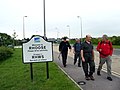
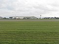
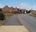
Category:Rhoose
Vai alla navigazione
Vai alla ricerca
village and community in Vale of Glamorgan, Wales   | |||||
| Carica un file multimediale | |||||
| Istanza di | |||||
|---|---|---|---|---|---|
| Luogo | Vale of Glamorgan, Galles | ||||
| Popolazione |
| ||||
| Superficie |
| ||||
 | |||||
Cymraeg: Pentref i'r de-orllewin o Gaerdydd yn ne Bro Morgannwg yw Y Rhws (Saesneg: Rhoose). Fe'i lleolir ar lan Môr Hafren ger Y Barri, 2 filltir i'r dwyrain.
English: Rhoose ' is a village located near the sea (the Bristol Channel) in the Vale of Glamorgan, Wales, near Barry.
Norsk bokmål: Rhoose er en landsby i Vale of Glamorgan, Wales. Cardiff internasjonale lufthavn ligger innenfor landsbyens grenser.
Sottocategorie
Questa categoria contiene le 4 sottocategorie indicate di seguito, su un totale di 4.
File nella categoria "Rhoose"
Questa categoria contiene 200 file, indicati di seguito, su un totale di 409.
(pagina precedente) (pagina successiva)-
 A clifftop view, Rhoose - geograph.org.uk - 3329945.jpg 640 × 482; 80 KB
-
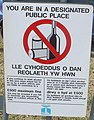 A designated public place, Rhoose - geograph.org.uk - 2455722.jpg 503 × 640; 84 KB
-

-
 A Rhoose airport building - geograph.org.uk - 3352387.jpg 640 × 399; 56 KB
-
-

-
 A4226 near Blackton Farm - geograph.org.uk - 5754050.jpg 640 × 481; 58 KB
-
 A4226 near Cardiff Airport - geograph.org.uk - 2006645.jpg 480 × 640; 62 KB
-
 A4226 Port Road at Barry boundary - geograph.org.uk - 5754109.jpg 640 × 479; 66 KB
-
 A4226 Rhoose.jpg 640 × 407; 43 KB
-

-
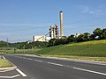 Aberthaw Cement Works - geograph.org.uk - 4980351.jpg 3 264 × 2 448; 1,5 MB
-
 Aberthaw Cement Works - geograph.org.uk - 5856860.jpg 1 600 × 1 200; 432 KB
-
 Aberthaw Lime Kiln Tramway - geograph.org.uk - 2746000.jpg 1 200 × 900; 1,37 MB
-
 Aberthaw Lime Kiln Tramway - geograph.org.uk - 2769205.jpg 600 × 800; 740 KB
-
 Aberthaw Lime Kilns - geograph.org.uk - 2225832.jpg 1 600 × 1 047; 429 KB
-

-
 Aberthaw Lime Kilns c2000 - geograph.org.uk - 2744239.jpg 2 187 × 754; 1 009 KB
-
 Aberthaw Lime Works - East Aberthaw - geograph.org.uk - 1944674.jpg 1 500 × 996; 1,21 MB
-
 Aberthaw Lime Works - geograph.org.uk - 1814994.jpg 640 × 480; 279 KB
-
 Aberthaw Lime Works - geograph.org.uk - 1815029.jpg 2 136 × 2 848; 2,67 MB
-
 Aberthaw Lime Works - geograph.org.uk - 5271048.jpg 3 264 × 2 448; 1,7 MB
-

-

-
 Aberthaw Lime Works and Lagoon - geograph.org.uk - 1814975.jpg 2 848 × 2 136; 3,16 MB
-
 Aberthaw Power Stations c1975 - geograph.org.uk - 2744250.jpg 1 000 × 680; 466 KB
-
 Aberthaw Quarry - geograph.org.uk - 2006704.jpg 640 × 480; 90 KB
-
 ABERTHAW Rhoose, Barry, The Vale of Glamorgan is that a tyre - panoramio.jpg 4 000 × 3 000; 4,65 MB
-
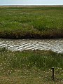
 Aberthaw salt-marsh at daybreak - geograph.org.uk - 1839929.jpg 2 000 × 1 328; 2,04 MB
-
 Aircraft Maintenance - geograph.org.uk - 4793352.jpg 2 533 × 1 646; 449 KB
-
 Airfield equipment at Cardiff - geograph.org.uk - 2101201.jpg 2 048 × 1 536; 1,15 MB
-
 Andrew's Pant - geograph.org.uk - 6258052.jpg 1 024 × 734; 98 KB
-
 Angler on Rhoose Beach.jpg 5 954 × 3 969; 11,44 MB
-
 Anyone for the Isle of Man^ - geograph.org.uk - 2103144.jpg 2 048 × 1 536; 1,25 MB
-

-
 Army Cadet Force hall, Rhoose - geograph.org.uk - 3426951.jpg 640 × 468; 78 KB
-
 B4265 at Penmark turn - geograph.org.uk - 5754037.jpg 640 × 480; 49 KB
-
 B4265 near Cardiff Airport - geograph.org.uk - 5754040.jpg 640 × 481; 60 KB
-
 B4265 near Fonmon - geograph.org.uk - 5754033.jpg 640 × 481; 69 KB
-
 Bales of Hay - geograph.org.uk - 5068984.jpg 3 264 × 2 448; 2,86 MB
-
 Barn Conversion - geograph.org.uk - 5068971.jpg 3 149 × 2 362; 1,71 MB
-
 Barry , Toby Carvery - geograph.org.uk - 6115672.jpg 6 000 × 4 000; 5,27 MB
-
 Beach and cliffs, Rhoose - geograph.org.uk - 3329943.jpg 640 × 480; 92 KB
-
-
 Beach at caravan park Rhoose - panoramio.jpg 2 592 × 1 944; 2,1 MB
-
 Bethel Evangelical Church, Rhoose - geograph.org.uk - 2454521.jpg 640 × 507; 68 KB
-
 Blackton Lane - geograph.org.uk - 1907101.jpg 640 × 569; 95 KB
-
 Blue Anchor - geograph.org.uk - 4799223.jpg 2 650 × 1 937; 1,11 MB
-
 Bpm04199.jpg 2 073 × 1 389; 612 KB
-
 Breaking seas at Breaksea Point - Aberthaw - geograph.org.uk - 2062753.jpg 3 051 × 2 010; 4,33 MB
-

-

-
 Bryn y Gloyn houses, Rhoose - geograph.org.uk - 3459968.jpg 800 × 624; 129 KB
-
 Burton Bridge - geograph.org.uk - 3845187.jpg 2 400 × 1 584; 3,75 MB
-
 Burton Bridges - geograph.org.uk - 3831177.jpg 2 400 × 1 593; 4,53 MB
-
 Canopy of Trees - geograph.org.uk - 4793333.jpg 2 448 × 3 264; 3,05 MB
-
 Caravan Park - geograph.org.uk - 4983717.jpg 3 264 × 2 448; 2,43 MB
-
 Cardiff Airport , Airport Scenery - geograph.org.uk - 6115681.jpg 3 648 × 2 736; 7,05 MB
-
 Cardiff Airport , Airport Scenery - geograph.org.uk - 6115684.jpg 6 000 × 4 000; 5,51 MB
-
 Cardiff Airport , Car Park - geograph.org.uk - 6115678.jpg 6 000 × 4 000; 7,1 MB
-
 Cardiff Airport , Gates - geograph.org.uk - 6115683.jpg 3 648 × 2 736; 7,08 MB
-
 Cardiff Airport , Grass - geograph.org.uk - 6115686.jpg 6 000 × 4 000; 6,46 MB
-
 Cardiff Airport , Grass - geograph.org.uk - 6115688.jpg 6 000 × 4 000; 6,22 MB
-
 Cardiff Airport , Grass - geograph.org.uk - 6115689.jpg 6 000 × 4 000; 5,96 MB
-
 Cardiff Airport , Grass - geograph.org.uk - 6115691.jpg 6 000 × 4 000; 5,14 MB
-
 Cardiff Airport , Grass - geograph.org.uk - 6115692.jpg 6 000 × 4 000; 7,07 MB
-
 Cardiff Airport , Grass - geograph.org.uk - 6115693.jpg 6 000 × 4 000; 6,71 MB
-
 Cardiff Airport , Parking Entrance - geograph.org.uk - 6115676.jpg 6 000 × 4 000; 6,25 MB
-
 Cardiff Airport , Road - geograph.org.uk - 6115677.jpg 6 000 × 4 000; 6,12 MB
-
 Cardiff Airport , Taxiway - geograph.org.uk - 6115687.jpg 6 000 × 4 000; 6,59 MB
-
 Cardiff Airport , Terminal Building - geograph.org.uk - 6115685.jpg 6 000 × 4 000; 5,78 MB
-
 Cardiff Airport , TUI Plane - geograph.org.uk - 6115682.jpg 3 648 × 2 736; 5,62 MB
-
 Cardiff Airport , Wind Sock ^ Grass - geograph.org.uk - 6115690.jpg 4 000 × 6 000; 5,91 MB
-
 Cardiff Airport - geograph.org.uk - 3862622.jpg 3 648 × 2 056; 2,61 MB
-
 Cardiff International Airport Terminal buildings - geograph.org.uk - 2101198.jpg 2 048 × 1 536; 624 KB
-
 Cardiff Wales Airport - geograph.org.uk - 6145118.jpg 5 184 × 3 456; 5,96 MB
-
 Cardiff Wales Airport perimeter road - geograph.org.uk - 1058797.jpg 640 × 480; 75 KB
-
 Cardiff, Wales, Airport - geograph.org.uk - 4793359.jpg 3 264 × 2 448; 863 KB
-
 Cars and houses, Station Road, Rhoose - geograph.org.uk - 6317956.jpg 1 024 × 679; 163 KB
-
 Castle Road houses, Rhoose - geograph.org.uk - 2454594.jpg 640 × 507; 68 KB
-
 Castle Road, Rhoose - geograph.org.uk - 6338314.jpg 1 024 × 839; 142 KB
-
 Cement Works - geograph.org.uk - 5048505.jpg 3 264 × 2 448; 2,36 MB
-
 Cement works entrance - geograph.org.uk - 2321929.jpg 640 × 480; 82 KB
-
 Ceri Avenue, Rhoose - geograph.org.uk - 3426921.jpg 640 × 526; 78 KB
-
 Ceri Road houses and a bench, Rhoose - geograph.org.uk - 3427103.jpg 800 × 568; 117 KB
-
 Channel to Channel (501) - geograph.org.uk - 4469996.jpg 800 × 600; 95 KB
-
 Charter train approaches Lafarge Cement Works - geograph.org.uk - 2765109.jpg 1 024 × 683; 146 KB
-
 Chris Davies office on a Rhoose corner - geograph.org.uk - 6318817.jpg 1 600 × 1 300; 337 KB
-
 Church Farmhouse aka Glebe Farm, Rhoose - geograph.org.uk - 2256655.jpg 4 000 × 3 000; 1,58 MB
-
 Church Road, Rhoose - geograph.org.uk - 6338322.jpg 1 600 × 1 429; 399 KB
-
 Churchyard cross, St Curig's, Rhoose - geograph.org.uk - 2256660.jpg 3 000 × 4 000; 3,16 MB
-
 Cilgant-y-Meillion houses, Rhoose - geograph.org.uk - 3460292.jpg 800 × 600; 96 KB
-
 Cliff and lake near Rhoose Point - geograph.org.uk - 3460261.jpg 800 × 600; 140 KB
-
 Cliff face, Rhoose - geograph.org.uk - 981196.jpg 640 × 480; 108 KB
-
 Cliff-top path near Rhoose Point - geograph.org.uk - 2781945.jpg 4 000 × 3 000; 3,13 MB
-

-
 Cliffs at Ffontygari Bay - geograph.org.uk - 2781940.jpg 4 000 × 3 000; 2,89 MB
-
 Cliffs near Rhoose Point - geograph.org.uk - 3485497.jpg 800 × 637; 150 KB
-
 Clifftop path, Rhoose - geograph.org.uk - 3329926.jpg 640 × 480; 121 KB
-
 Coal train near Aberthaw - geograph.org.uk - 5259416.jpg 3 184 × 2 388; 3,96 MB
-
 Coal train near Aberthaw - geograph.org.uk - 5259418.jpg 3 456 × 1 944; 3,06 MB
-
 Coastal lake near Rhoose Point - geograph.org.uk - 3485584.jpg 800 × 600; 149 KB
-
 Coastal Path near Leys Beach - geograph.org.uk - 2781912.jpg 4 000 × 3 000; 3,41 MB
-
 Coastal Wall - geograph.org.uk - 5270862.jpg 3 181 × 2 387; 1,86 MB
-
 Coffee Time in Rhoose - geograph.org.uk - 6318835.jpg 1 600 × 1 285; 308 KB
-
 Community Centre - geograph.org.uk - 5249765.jpg 3 264 × 2 448; 1,28 MB
-
 Contrasting architecture, Lower Porthkerry - geograph.org.uk - 2256625.jpg 4 000 × 3 000; 2,61 MB
-
 Control tower at Cardiff Airport - geograph.org.uk - 425094.jpg 640 × 427; 115 KB
-
 Converted Barn - geograph.org.uk - 5249740.jpg 3 264 × 2 448; 1,85 MB
-

-

-
 Cottage, Lower Porthkerry - geograph.org.uk - 2256627.jpg 4 000 × 3 000; 2,45 MB
-
 Country lane, Porthkerry - geograph.org.uk - 1906933.jpg 640 × 480; 105 KB
-
 Cowbridge ^ Aberthaw Railway Embankment - geograph.org.uk - 2753474.jpg 1 000 × 750; 734 KB
-
 Crib y Sianel, Rhoose, May 2023.jpg 6 000 × 4 000; 13,66 MB
-
 Crows Nesting - geograph.org.uk - 5301132.jpg 3 264 × 2 448; 4,29 MB
-

-
 Dark green cabinets, Rhoose Road, Rhoose - geograph.org.uk - 6338371.jpg 1 600 × 1 422; 459 KB
-
 Deano's Barber Shop, Fontygary Road, Rhoose - geograph.org.uk - 6317802.jpg 1 600 × 1 394; 354 KB
-

-
 Derelict Buildings - geograph.org.uk - 5249718.jpg 3 264 × 2 448; 3,64 MB
-
 Derelict Farm Building - geograph.org.uk - 5249708.jpg 3 264 × 2 448; 2,33 MB
-

-

-
 East Aberthaw beach - panoramio.jpg 2 048 × 1 536; 651 KB
-
 East Aberthaw beach well worth the walk - panoramio.jpg 2 048 × 1 536; 729 KB
-
 East Aberthaw Coastline - geograph.org.uk - 1815043.jpg 640 × 480; 220 KB
-
 East Aberthaw Coastline - geograph.org.uk - 1815061.jpg 640 × 480; 298 KB
-
 East Aberthaw Coastline. - geograph.org.uk - 1815012.jpg 640 × 480; 266 KB
-
 East Aberthaw to Rhoose road - geograph.org.uk - 2321930.jpg 640 × 480; 55 KB
-
 East Aberthaw wild life reserve - panoramio.jpg 2 592 × 1 936; 1,13 MB
-
 East along Torbay Terrace, Rhoose - geograph.org.uk - 6338405.jpg 1 600 × 1 174; 433 KB
-
 Eastern boundary of Rhoose - geograph.org.uk - 3427164.jpg 800 × 799; 130 KB
-

-

-
 Entrance ramp to platform 1, Rhoose - geograph.org.uk - 3426664.jpg 640 × 480; 93 KB
-
 Entrance to New Farm, Barry - geograph.org.uk - 1908424.jpg 640 × 480; 91 KB
-

-
 Farm Entrance - Blackton Farm - geograph.org.uk - 5255134.jpg 2 931 × 2 146; 1,66 MB
-
 Farmhouse, Model Farm, Port Road - geograph.org.uk - 1908368.jpg 640 × 480; 63 KB
-
 Fence Posts, Cowbridge ^ Aberthaw Railway - geograph.org.uk - 2753488.jpg 1 196 × 1 800; 2,71 MB
-
 Ffontygary Inn by Night - geograph.org.uk - 4641022.jpg 1 600 × 840; 273 KB
-
 Ffwl y Mwn - Fonmon - geograph.org.uk - 4388888.jpg 640 × 480; 150 KB
-
 Fields and woods south east of airport hotel - geograph.org.uk - 6144057.jpg 5 184 × 3 456; 4,87 MB
-
 Fields near Lower Porthkerry Farm - geograph.org.uk - 2006651.jpg 640 × 480; 70 KB
-
 Flight simulator, Cardiff Wales Airport - geograph.org.uk - 5761356.jpg 5 184 × 3 456; 7,29 MB
-
 Flybe Airliner, Cardiff Wales Airport - geograph.org.uk - 5761329.jpg 5 184 × 3 456; 5,38 MB
-
 Flying Club entrance, Rhoose airport - geograph.org.uk - 3352398.jpg 640 × 635; 105 KB
-
 Fonmon Duckpond - geograph.org.uk - 4793322.jpg 3 264 × 2 448; 2,7 MB
-
 Fonmon Park Road - geograph.org.uk - 4793370.jpg 3 264 × 2 448; 1,83 MB
-
 Fontygary Holiday Park - geograph.org.uk - 6258053.jpg 1 024 × 671; 98 KB
-
 Fontygary, near Rhoose, Vale of Glamorgan (20548573464).jpg 3 387 × 2 339; 5,27 MB
-

-
 Footbridge Over the River Kenson - geograph.org.uk - 3845195.jpg 2 400 × 1 591; 4,84 MB
-
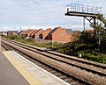
 From level crossing to platform 1, Rhoose - geograph.org.uk - 6338299.jpg 1 422 × 1 600; 402 KB
-
 From level crossing to platform 2, Rhoose - geograph.org.uk - 6338304.jpg 1 330 × 1 600; 495 KB
-
 Fuel tanks at Cardiff Airport - geograph.org.uk - 2101227.jpg 2 048 × 1 536; 596 KB
-
 Gadael Rhws - Leaving Rhoose - geograph.org.uk - 4384555.jpg 640 × 480; 65 KB
-
 General Aviation area, Cardiff Airport. - geograph.org.uk - 2103258.jpg 2 048 × 1 536; 609 KB
-
 Ger Ffwl-y-Mwn - Near Fonmon - geograph.org.uk - 5112809.jpg 640 × 513; 87 KB
-
 Ger Penmarc - Near Pen Mark - geograph.org.uk - 4388885.jpg 640 × 480; 101 KB
-
 Ger Pwynt y Rhas - Near Rhoose Point - geograph.org.uk - 4384600.jpg 640 × 480; 91 KB
-
 Glamorgan coast near Aberthaw - geograph.org.uk - 2781933.jpg 4 000 × 3 000; 2,41 MB
-
 Glebe (Church) Farm, Porthkerry - geograph.org.uk - 6145166.jpg 5 184 × 3 456; 7,29 MB
-
 Golden Star in Rhoose - geograph.org.uk - 6317796.jpg 1 592 × 1 600; 334 KB
-
 Grass strip on the west side of Station Road, Rhoose - geograph.org.uk - 6317952.jpg 1 504 × 1 600; 443 KB
-
 Great Western Railway Boundary Marker - geograph.org.uk - 2744979.jpg 800 × 735; 637 KB
-
 Havant Close, Rhoose - geograph.org.uk - 6317881.jpg 1 600 × 1 440; 535 KB
-

-
 Heol Pilipala, Rhoose - geograph.org.uk - 3485303.jpg 800 × 589; 115 KB
-
 Heol y Pentir, Rhoose - geograph.org.uk - 3352138.jpg 640 × 571; 81 KB
-
 Hole in the Trees - geograph.org.uk - 1366843.jpg 640 × 459; 111 KB
-
 Holiday Inn Express - geograph.org.uk - 2103155.jpg 2 048 × 1 536; 1,26 MB
-
 Holiday Inn Express Cardiff Airport - geograph.org.uk - 1907014.jpg 640 × 368; 63 KB
-
 House at end of Well Road East Aberthaw - panoramio.jpg 2 048 × 1 536; 585 KB
-

-
 Houses on the east side of Station Road, Rhoose - geograph.org.uk - 6338318.jpg 1 600 × 1 369; 441 KB
-
 Houses on the south side of Church Road, Rhoose - geograph.org.uk - 6338331.jpg 1 591 × 1 600; 415 KB
-
 Houses, houses everywhere, Rhoose - geograph.org.uk - 3460008.jpg 800 × 560; 135 KB
-
 Housing development in old quarry, Rhoose.jpg 6 000 × 4 000; 16,91 MB
-

-
 Jackson Close, Rhoose - geograph.org.uk - 2454667.jpg 640 × 419; 73 KB
-
 Jubilee Hall, Rhoose - geograph.org.uk - 2454660.jpg 640 × 480; 77 KB
-
 Jubilee Hall, Rhoose - geograph.org.uk - 5249755.jpg 3 264 × 2 448; 1,81 MB
-
 Junction at the northern end of Station Road, Rhoose - geograph.org.uk - 6338346.jpg 1 600 × 1 539; 498 KB
-
 Just arrived - geograph.org.uk - 2101195.jpg 2 048 × 1 536; 1,18 MB
-

-
 Keepers Cottage, Lower Porthkerry - geograph.org.uk - 1906998.jpg 640 × 510; 54 KB
-
 Kemeys Road, Rhoose - geograph.org.uk - 6318726.jpg 1 600 × 1 036; 366 KB
-
 Kenson River - geograph.org.uk - 4799472.jpg 3 648 × 5 472; 6,28 MB
-
 Kenson River - geograph.org.uk - 4799476.jpg 3 648 × 5 472; 6,96 MB
-
 Kenson River Bridge - geograph.org.uk - 4799466.jpg 3 648 × 5 472; 7,41 MB
-
 Lafarge Aberthaw cement works - geograph.org.uk - 2765928.jpg 1 024 × 683; 107 KB
-
 Lafarge cement works - geograph.org.uk - 2766394.jpg 683 × 1 024; 79 KB
-
 Lagoon - East Aberthaw - geograph.org.uk - 1944922.jpg 1 500 × 993; 1,69 MB
-
 Lake and cliff near Rhoose Point - geograph.org.uk - 3485410.jpg 800 × 520; 99 KB
-

-

-
 Leys Beach, near Aberthaw - geograph.org.uk - 2006764.jpg 640 × 480; 83 KB
-
 Lifebelt - East Aberthaw - geograph.org.uk - 1944939.jpg 996 × 1 500; 1,65 MB


_-_i.e._mouth_of_the_River_Thaw_-_geograph.org.uk_-_2006773.jpg)


_-_geograph.org.uk_-_4469996.jpg)


.jpg)


_Farm,_Porthkerry_-_geograph.org.uk_-_6145166.jpg)


