Category:Richmond Heights, Missouri
Vai alla navigazione
Vai alla ricerca
city of Missouri, United States of America .jpg)  | |||||
| Carica un file multimediale | |||||
| Istanza di | |||||
|---|---|---|---|---|---|
| Luogo | contea di St. Louis, Missouri, Stati Uniti d'America | ||||
| Popolazione |
| ||||
| Superficie |
| ||||
| Altezza sul mare |
| ||||
| sito web ufficiale | |||||
 | |||||
Sottocategorie
Questa categoria contiene un'unica sottocategoria, indicata di seguito.
B
File nella categoria "Richmond Heights, Missouri"
Questa categoria contiene 97 file, indicati di seguito, su un totale di 97.
-
 170 and 64.jpg 4 608 × 3 456; 2,41 MB
-

-

-

-

-

-

-

-

-
 40 and Hanley.jpg 5 472 × 3 648; 13,72 MB
-
 64 East at 170.jpg 4 167 × 2 778; 576 KB
-
 Arch Terrace.jpg 5 472 × 3 648; 17,01 MB
-
 Beautiful Sky in Richmond Heights.jpg 3 648 × 2 736; 3,6 MB
-
 Bellevue Avenue.jpg 3 264 × 4 080; 5,32 MB
-
 Bellvue.jpg 4 320 × 3 240; 4,84 MB
-
 Beulah Walk - Richmond Heights - 50881919216.jpg 3 431 × 5 146; 10,06 MB
-
 Beulah Walk - Richmond Heights.jpg 3 620 × 5 430; 13,77 MB
-
 Boland Place Bridge.jpg 5 472 × 3 648; 10,5 MB
-
 Boneta Walk - 50892811021.jpg 3 648 × 5 472; 14,64 MB
-
 Boneta Walk.jpg 3 648 × 5 472; 13,87 MB
-
 Brentwood Blvd. Bus Stop.jpg 4 320 × 3 240; 4,67 MB
-
 Bus Stop on Clayton.jpg 4 320 × 3 240; 4,87 MB
-
 CH2MHILL 2.jpg 4 608 × 3 456; 3,09 MB
-
 CH2MHILL 3.jpg 4 608 × 3 456; 3,19 MB
-
 CH2MHILL.jpg 4 608 × 3 456; 3,36 MB
-
 Clayton-Richmond Heights from 40-64.jpg 3 934 × 2 910; 2,81 MB
-
 Claytonia Creek - 50876801687.jpg 3 648 × 5 472; 16,7 MB
-
 Claytonia Creek.jpg 3 648 × 5 472; 16,37 MB
-
 Claytonia Terrace and Ethel Walk.jpg 5 472 × 3 648; 11,27 MB
-
 Claytonia Underpass.jpg 5 472 × 3 648; 15,6 MB
-
 Cleared.jpg 5 472 × 3 648; 3,15 MB
-
 Construction off I-64 and I-170.jpg 4 500 × 3 000; 514 KB
-
 Dale Avenue.jpg 5 472 × 3 648; 12,24 MB
-
 Demo (Richmond Heights, Missouri).jpg 3 190 × 4 785; 5,68 MB
-
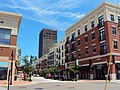
 Downtown Clayton Richmond Heights - 8895575425.jpg 4 000 × 3 000; 1,23 MB
-
 Downtown Clayton Richmond Heights.jpg 4 000 × 3 000; 1,54 MB
-
 Drainage (Richmond Heights, Missouri).jpg 5 472 × 3 648; 2,06 MB
-
 Edward Terrace.jpg 5 406 × 3 604; 13,56 MB
-
 Ethel Walk - 50871179416.jpg 3 495 × 5 243; 9,91 MB
-
 Ethel Walk - 50872335532.jpg 3 648 × 5 472; 13,58 MB
-
 Ethel Walk.jpg 3 521 × 5 281; 11,94 MB
-
 Fall Colors (Richmond Heights, Missouri).jpg 4 000 × 3 000; 4,73 MB
-
 Fall in Richmond Heights, MO.jpg 4 000 × 3 000; 4,82 MB
-
 Glasses (Richmond Heights, Missouri).jpg 5 472 × 3 648; 18,81 MB
-
 Hanley (Richmond Heights, Missouri).jpg 5 472 × 3 648; 1,55 MB
-
 Hawthorne and Dale.jpg 3 632 × 5 448; 14,27 MB
-
 Hiawatha and Boneta.jpg 5 472 × 3 648; 12,54 MB
-
 Hillsdale Drive from Laclede Station.jpg 5 472 × 3 648; 17,2 MB
-
 I-64 Traffic.jpg 4 000 × 3 000; 1,66 MB
-
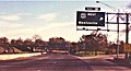 Interstate 170 South at Exit 1B, US 40 West, Wentzville exit (1990).jpg 2 048 × 1 103; 354 KB
-
 Interstate 64 & US 40 West at Exit 32B, Hanley Rd exit (2000).jpg 670 × 359; 73 KB
-
 Interstate 64 and 170.jpg 4 000 × 3 000; 1,69 MB
-

-
 Laclede Station Road.jpg 5 420 × 3 613; 11,28 MB
-
 Lake Forest - Richmond Heights.jpg 4 896 × 3 264; 8,29 MB
-
 Lake Forest Walk - Richmond Heights - 51124564866.jpg 4 896 × 3 264; 10,11 MB
-
 Lake Forest Walk - Richmond Heights.jpg 3 264 × 4 896; 10,63 MB
-
 Lincoln Looks like Civic.jpg 4 000 × 3 000; 2,04 MB
-
 Lindberg Hiawatha Walk - 50891461966.jpg 3 313 × 4 969; 11,58 MB
-
 Lindberg Hiawatha Walk.jpg 3 373 × 5 059; 12,48 MB
-
 Little Free Library (50892953561).jpg 3 509 × 5 263; 8,13 MB
-
 Maggiano's @ The Boulevard.jpg 2 736 × 3 648; 3,52 MB
-
 Magna Place.jpg 4 608 × 3 456; 2,94 MB
-
 Manhasset Village - 24313028319.jpg 4 896 × 1 870; 577 KB
-
 Manhasset Village - 25389072903.jpg 4 228 × 1 034; 286 KB
-
 Manhasset Village - 26075717964.jpg 4 820 × 3 214; 1,45 MB
-
 Manhasset Village - 26078342583.jpg 4 773 × 3 182; 1,07 MB
-
 Manhasset Village - 26616304611.jpg 2 900 × 4 350; 1,22 MB
-
 Manhasset Village - 28445557006.jpg 5 190 × 2 383; 718 KB
-
 Manhasset Village.jpg 4 323 × 2 882; 5,13 MB
-
 McCausland Exit from 40.jpg 4 320 × 3 240; 4,65 MB
-
 MOMap-doton-Richmond Heights.png 300 × 263; 13 KB
-
 Oakland Ave in Richmond Heights.jpg 4 320 × 3 240; 4,45 MB
-
 PF Chang's @ The Boulevard.jpg 2 736 × 3 648; 3,47 MB
-
 Richmond Heights - 50875114233.jpg 4 538 × 3 025; 8,7 MB
-
 Richmond Heights - 50893067367.jpg 5 393 × 3 595; 13,25 MB
-
 Richmond Heights Maplewood Civic Progress.jpg 5 231 × 3 487; 2,24 MB
-
 Richmond Heights Metrolink station, looking north.jpg 1 280 × 960; 270 KB
-
 Richmond Heights Walk.jpg 3 604 × 5 406; 11,42 MB
-
 Richmond Heights.jpg 5 472 × 3 648; 1,93 MB
-
 Rubble (Richmond Heights, Missouri).jpg 5 472 × 3 648; 2,16 MB
-
 Rubble - 13210615225.jpg 5 472 × 3 648; 2,39 MB
-
 Side Yard in November.jpg 4 000 × 3 000; 4,03 MB
-
 SnowyDayInStLouis.jpg 3 264 × 2 448; 2,47 MB
-
 Sold to Bommarito.jpg 5 472 × 3 648; 807 KB
-

-
 St. Mary's (Richmond Heights, Missouri).jpg 4 320 × 3 240; 4,57 MB
-
 Starrs.jpg 5 365 × 3 577; 12,42 MB
-
 Stonecreast at Clayton View - 26078338953.jpg 3 264 × 4 896; 1,07 MB
-
 Stonecreast at Clayton View.jpg 4 896 × 3 264; 1,29 MB
-
 Stonecrest Senior Living in Richmond Heights.jpg 4 654 × 3 103; 932 KB
-
 Surrey Hills Drive.jpg 5 472 × 3 648; 15,26 MB
-
 The Boulevard from the North.jpg 3 648 × 2 736; 3,61 MB
-
 The Boulevard from the South (4692672370).jpg 3 648 × 2 736; 3,54 MB
-
 Traffic on 40.jpg 3 862 × 2 808; 2,4 MB
-
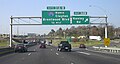
 US 40 East at Interstate 170 North, Brentwood Blvd exit (1990).jpg 1 937 × 1 069; 422 KB
-
 US Bank on Big Bend.jpg 5 472 × 3 648; 1,46 MB


_-_St._Louis_County_-_Richmond_Heights_-_ED_95-284_to_299_-_NARA_-_81114491.jpg)


.jpg)


.jpg)


.jpg)

.jpg)
.jpg)


.jpg)
.jpg)


.jpg)


.jpg)


.jpg)


.jpg)
