Category:Ridgewell
Aller à la navigation
Aller à la recherche
English: Ridgewell is a village and civil parish in the Braintree district of Essex, England, about six miles from Haverhill on the main road between Haverhill and Braintree.
Nederlands: Ridgewell is een plaats in het bestuurlijke gebied Braintree, in het Engelse graafschap Essex. De plaats telt 503 inwoners.

village britannique  | |||||
| Téléverser des médias | |||||
| Nature de l’élément | |||||
|---|---|---|---|---|---|
| Lieu | Braintree, Essex, Angleterre de l'Est, Angleterre | ||||
 | |||||
Sous-catégories
Cette catégorie comprend 4 sous-catégories, dont les 4 ci-dessous.
Média dans la catégorie « Ridgewell »
Cette catégorie comprend 84 fichiers, dont les 84 ci-dessous.
-
 'Road ahead closed' - geograph.org.uk - 5447448.jpg 640 × 480 ; 154 kio
-
 15th Century Bier - geograph.org.uk - 2866353.jpg 1 024 × 768 ; 123 kio
-
 All Useful Services - geograph.org.uk - 2866362.jpg 1 024 × 768 ; 230 kio
-
 American Flag - geograph.org.uk - 2866347.jpg 768 × 1 024 ; 92 kio
-
 Ashen Road, Ridgewell - geograph.org.uk - 5399607.jpg 640 × 480 ; 59 kio
-

-
 Bridge - geograph.org.uk - 2867178.jpg 1 024 × 768 ; 402 kio
-
 Byway at Ridgewell - geograph.org.uk - 2263310.jpg 427 × 640 ; 87 kio
-
 Byway to Ashen - geograph.org.uk - 1994242.jpg 640 × 427 ; 82 kio
-
 Chapel Road (A1017), Ridgewell - geograph.org.uk - 5399300.jpg 640 × 480 ; 61 kio
-
 Church school, Church Lane, Ridgewell - geograph.org.uk - 897711.jpg 640 × 480 ; 96 kio
-
 Common Spotted Orchid - geograph.org.uk - 4003808.jpg 424 × 640 ; 37 kio
-
 Congregational Church Ridgewell Essex - geograph.org.uk - 2186516.jpg 640 × 480 ; 101 kio
-

-
 Crop field and hedgerow - geograph.org.uk - 5399242.jpg 640 × 480 ; 71 kio
-
 Crop field towards Wash Farm - geograph.org.uk - 5399244.jpg 640 × 415 ; 61 kio
-
 Direction Sign And Junction - geograph.org.uk - 4763643.jpg 1 024 × 768 ; 250 kio
-
 Essex Hall, near Stambourne, Essex - geograph.org.uk - 226375.jpg 640 × 454 ; 74 kio
-
 Farm track, Wesley End - geograph.org.uk - 5341877.jpg 640 × 480 ; 108 kio
-
 Footbridge - geograph.org.uk - 2866382.jpg 768 × 1 024 ; 399 kio
-
 Footbridge And Gate - geograph.org.uk - 2866328.jpg 768 × 1 024 ; 361 kio
-
 Footpath - geograph.org.uk - 2866387.jpg 768 × 1 024 ; 225 kio
-
 Footpath - geograph.org.uk - 3275165.jpg 768 × 1 024 ; 383 kio
-
 Footpath - geograph.org.uk - 3275675.jpg 1 024 × 768 ; 264 kio
-
 Footpath Junction - geograph.org.uk - 3275666.jpg 1 024 × 768 ; 279 kio
-
 Footpath near Ridgewell - geograph.org.uk - 1994176.jpg 640 × 427 ; 85 kio
-
 Footpath to Baythorne Park - geograph.org.uk - 2263292.jpg 427 × 640 ; 96 kio
-
 Footpath to Ridgewell - geograph.org.uk - 1994234.jpg 427 × 640 ; 108 kio
-
 Footpath ^ Field Maple Hedge - geograph.org.uk - 4003763.jpg 424 × 640 ; 82 kio
-
 Frosty Footpaths - geograph.org.uk - 3275167.jpg 1 024 × 768 ; 383 kio
-
 Green Lane - geograph.org.uk - 5447452.jpg 640 × 480 ; 125 kio
-
 Houses on The Green, Ridgewell - geograph.org.uk - 897662.jpg 640 × 480 ; 78 kio
-
 Houses, Drury Lane, Ridgewell - geograph.org.uk - 896854.jpg 640 × 481 ; 76 kio
-
 Houses, Drury Lane, Ridgewell - geograph.org.uk - 896874.jpg 640 × 452 ; 81 kio
-
 Lane towards Tilbury Green - geograph.org.uk - 5447435.jpg 640 × 480 ; 142 kio
-
 Meeting Lane - geograph.org.uk - 5447457.jpg 640 × 480 ; 205 kio
-
 Muddy Track - geograph.org.uk - 2866325.jpg 768 × 1 024 ; 248 kio
-
 Oilseed rape crop near Ridgewell - geograph.org.uk - 5399290.jpg 640 × 480 ; 76 kio
-
 Old font bowl in rectory garden, Ridgewell - geograph.org.uk - 1994227.jpg 640 × 434 ; 103 kio
-
 Old houses, Chapel Road, Ridgewell - geograph.org.uk - 896620.jpg 640 × 480 ; 85 kio
-
 Old Pump - geograph.org.uk - 2866377.jpg 1 024 × 768 ; 307 kio
-
 Orchid ^ Pettyfield Lane - geograph.org.uk - 4003798.jpg 424 × 640 ; 88 kio
-
 Ordnance Survey Flush Bracket 11737 - geograph.org.uk - 4707542.jpg 4 000 × 3 000 ; 2,48 Mio
-
 Overhanging roof, Drury Lane, Ridgewell - geograph.org.uk - 896892.jpg 640 × 477 ; 67 kio
-
 Path Through Meadowend Grove - geograph.org.uk - 4003909.jpg 424 × 640 ; 114 kio
-
 Pettyfield Lane - geograph.org.uk - 4003772.jpg 459 × 640 ; 81 kio
-
 Plaque On Village Pump - geograph.org.uk - 2866369.jpg 768 × 1 024 ; 208 kio
-
 Pump, Ridgewell - geograph.org.uk - 4356297.jpg 4 320 × 3 240 ; 4,22 Mio
-
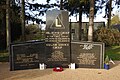
 R.A.F. Ridgewell Memorial - geograph.org.uk - 3501283.jpg 1 024 × 768 ; 301 kio
-
 R.A.F. Ridgewell Memorial - geograph.org.uk - 3501286.jpg 1 024 × 768 ; 284 kio
-
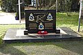
 RAF - USAAF Ridgewell Memorial - geograph.org.uk - 6335993.jpg 4 608 × 3 072 ; 5,79 Mio
-
 RAF - USAAF Ridgewell Memorial - geograph.org.uk - 6336643.jpg 4 608 × 3 072 ; 5,81 Mio
-
 RAF Ridgewell Memorial - geograph.org.uk - 6336004.jpg 4 608 × 3 072 ; 5,19 Mio
-
 Ram Pump in Ridgewell - geograph.org.uk - 69302.jpg 619 × 640 ; 74 kio
-
 Richmond House, Ridgewell - geograph.org.uk - 4356303.jpg 3 779 × 2 762 ; 3,9 Mio
-
 Richmond House, The Green, Ridgewell - geograph.org.uk - 897860.jpg 640 × 455 ; 51 kio
-
 Ridgewell Sign - geograph.org.uk - 6218837.jpg 800 × 600 ; 110 kio
-
 Ridgewell, village sign - geograph.org.uk - 4356319.jpg 4 320 × 3 240 ; 3,68 Mio
-
 Short cut across the green, Ridgewell - geograph.org.uk - 896835.jpg 640 × 470 ; 78 kio
-

-
 Sloping wheat field near Ridgewell - geograph.org.uk - 1993993.jpg 640 × 427 ; 67 kio
-
 St Lawrence Lodge, Church Lane, Ridgewell - geograph.org.uk - 897696.jpg 640 × 460 ; 72 kio
-
 Stambourne Road - geograph.org.uk - 5399248.jpg 640 × 480 ; 69 kio
-
 Thatched house on Chapel Road, Ridgewell - geograph.org.uk - 5399296.jpg 640 × 480 ; 76 kio
-
 The Coronation Village Hall, Ridgewell - geograph.org.uk - 896824.jpg 640 × 434 ; 44 kio
-
 The crossroads at Ridgewell in 1984 - geograph.org.uk - 2638267.jpg 917 × 623 ; 150 kio
-
 The King's Head, Chapel Road, Ridgewell - geograph.org.uk - 896576.jpg 640 × 439 ; 58 kio
-
 The Kings Head public House, Ridgewell - geograph.org.uk - 5399304.jpg 640 × 480 ; 70 kio
-
 The Kings Head public House, Ridgewell - geograph.org.uk - 5399305.jpg 640 × 480 ; 67 kio
-
 The village pump, The Green, Ridgewell - geograph.org.uk - 897611.jpg 480 × 640 ; 77 kio
-
 The village sign, The Green, Ridgewell - geograph.org.uk - 896905.jpg 640 × 476 ; 76 kio
-
 Three Chimneys Lane - geograph.org.uk - 5341880.jpg 640 × 480 ; 128 kio
-
 Three Decades On - geograph.org.uk - 246938.jpg 640 × 640 ; 187 kio
-
 Through The Trees - geograph.org.uk - 2867167.jpg 1 024 × 768 ; 384 kio
-
 Tree on The Green, Ridgewell - geograph.org.uk - 897634.jpg 640 × 466 ; 76 kio
-
 U.S.A.A.F. Ridgewell Memorial - geograph.org.uk - 3501277.jpg 1 024 × 768 ; 315 kio
-
 U.S.A.A.F. Ridgewell Memorial - geograph.org.uk - 3501279.jpg 1 024 × 768 ; 344 kio
-
 Village Pump - geograph.org.uk - 2866364.jpg 768 × 1 024 ; 244 kio
-
 Wooden Arachnids - geograph.org.uk - 4003904.jpg 640 × 424 ; 58 kio
-
 Great Meadowend Farm - geograph.org.uk - 269947.jpg 640 × 416 ; 50 kio
-
 Old house at Ridgewell, Essex - geograph.org.uk - 226487.jpg 640 × 480 ; 73 kio
-
 Ridgewell - geograph.org.uk - 1174.jpg 640 × 427 ; 119 kio
-
 Ridgewell's Village Pump - geograph.org.uk - 507366.jpg 640 × 480 ; 93 kio
-


_towards_Ridgewell_-_geograph.org.uk_-_5399293.jpg)


,_Ridgewell_-_geograph.org.uk_-_5399300.jpg)


