Category:Ringelspitz
Vai alla navigazione
Vai alla ricerca
| Posizione del soggetto | | Mappa di tutte le coordinate: OpenStreetMap |
|---|
montagna svizzera  | |||||
| Carica un file multimediale | |||||
| Istanza di | |||||
|---|---|---|---|---|---|
| Luogo | |||||
| Catena montuosa |
| ||||
| Prominenza topografica |
| ||||
| Isolamento topografico |
| ||||
| Altezza sul mare |
| ||||
| Montagna principale | |||||
 | |||||
Piz Barghis / Ringelspitz (3'247 m)
Sottocategorie
Questa categoria contiene le 2 sottocategorie indicate di seguito, su un totale di 2.
R
File nella categoria "Ringelspitz"
Questa categoria contiene 62 file, indicati di seguito, su un totale di 62.
-
 Bargistal Übersicht.jpg 1 800 × 1 116; 359 KB
-
 Brün-Valendas2.jpg 1 607 × 839; 589 KB
-
 Calanda und Ringel 01.jpg 2 560 × 1 693; 888 KB
-
 Calanda und Ringel 02.jpg 2 560 × 1 920; 2,32 MB
-
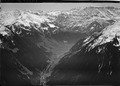
 Calfeisen und Ringel.jpg 2 592 × 1 456; 1,08 MB
-
 Calfeisental mit Gigerwald.jpg 2 560 × 1 920; 2,39 MB
-
 Churfisten vom Ringelspitz.jpg 4 608 × 2 592; 1,62 MB
-
 Crap Mats and Ringelspitz south.jpg 2 592 × 1 456; 1,24 MB
-
 Crap Mats and Ringelspitz.jpg 2 592 × 1 456; 914 KB
-
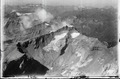
 ETH-BIB-Churfirsten, Blick nach Südsüdosten, Ringelspitz-LBS H1-012455.tif 6 201 × 4 306; 76,56 MB
-
 ETH-BIB-Flims, Blick nach Nordnordost, Ringelspitz-LBS H1-018179.tif 6 753 × 4 716; 91,32 MB
-
 ETH-BIB-Flums Kleinberg, Blick nach Süden, Ringelspitz-LBS H1-012785.tif 6 748 × 4 651; 89,94 MB
-
 ETH-BIB-Flums Kleinberg, Blick nach Südsüdosten, Ringelspitz-LBS H1-012787.tif 4 651 × 6 732; 89,66 MB
-

-

-
 ETH-BIB-Piz Lagrev, Blick Nordwesten Ringelspitz-LBS H1-018049.tif 6 839 × 4 795; 93,9 MB
-

-
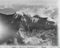
 ETH-BIB-Piz Sardona, Clariden, Ringelspitze v. O. aus 3500 m-Inlandflüge-LBS MH01-003028.tif 6 297 × 4 158; 75,06 MB
-

-
 ETH-BIB-Piz Sardona, Trinserhorn, Ringelspitz aus 3500 m-Inlandflüge-LBS MH01-003029.tif 6 384 × 4 449; 81,4 MB
-
 ETH-BIB-Piz Segnas, Ringelspitz-Inlandflüge-LBS MH05-59-04.tif 3 508 × 2 367; 23,81 MB
-
 ETH-BIB-Ringelspitz von Norden-Inlandflüge-LBS MH01-007703.tif 5 506 × 3 833; 60,47 MB
-
 ETH-BIB-Ringelspitz, Glaserhorn v. N. aus 3500 m-Inlandflüge-LBS MH01-003037.tif 5 505 × 4 452; 70,27 MB
-
 ETH-BIB-Ringelspitz, Glaserhorn v. N. W. aus 3400 m-Inlandflüge-LBS MH01-003025.tif 6 352 × 4 537; 82,6 MB
-
 ETH-BIB-Ringelspitz, Glaserhorn v. N. W. aus 3500 m-Inlandflüge-LBS MH01-003041.tif 6 244 × 4 535; 81,17 MB
-
 ETH-BIB-Ringelspitz, Glaserhorn, Piz da Sterls v. N. aus 2300 m-Inlandflüge-LBS MH01-003508.tif 6 426 × 4 402; 81,12 MB
-
 ETH-BIB-Ringelspitz, Piz Barghis, Tschep v. N. aus 3400 m-Inlandflüge-LBS MH01-003023.tif 6 218 × 4 435; 79,04 MB
-
 ETH-BIB-Ringelspitz, Piz Barghis, Tschep v. N. aus 3400 m-Inlandflüge-LBS MH01-003024.tif 6 053 × 4 010; 69,6 MB
-
 ETH-BIB-Ringelspitz, Sardona, Zwölfihorn-LBS H1-019139.tif 3 508 × 2 498; 25,14 MB
-

-
 ETH-BIB-Ringelspitz-Inlandflüge-LBS MH05-59-05.tif 3 508 × 2 370; 23,84 MB
-
-

-
 ETH-BIB-Sernftal, Segnes, Sardona, Ringelspitz-Inlandflüge-LBS MH01-000365.tif 6 066 × 4 491; 78,12 MB
-
 ETH-BIB-Spitzmeilen, Ringelspitz-LBS H1-019663.tif 6 704 × 4 691; 90,04 MB
-
 ETH-BIB-Spitzmeilen, Ringelspitz-LBS H1-019664.tif 6 732 × 4 713; 90,83 MB
-
 ETH-BIB-Tödi, Piz Sardona, Ringelspitz v. S. W. aus 3800 m-Inlandflüge-LBS MH01-003341.tif 6 551 × 4 439; 83,36 MB
-
 ETH-BIB-Weisstannental, Ringelspitz, Wolken v. N. aus 4800 m-Inlandflüge-LBS MH01-003824.tif 6 277 × 4 440; 79,88 MB
-
 Fixseil zum Ringelspitzgipfel.jpg 4 608 × 2 592; 2,47 MB
-
 Flimserstein ringelspitz.JPG 2 048 × 1 536; 698 KB
-
 Föhnwalze Ringelspitz.jpg 4 608 × 2 592; 2,32 MB
-
 Hauptüberschiebung Nahaufnahme.jpg 4 608 × 2 592; 2,73 MB
-
 Hauptüberschiebung Tschepband.jpg 4 608 × 2 592; 2,6 MB
-
 Hike Switzerland on Cassons to find different rocks.jpg 2 592 × 1 456; 1,29 MB
-
 Kunkelspass von Süden.jpg 1 000 × 562; 200 KB
-
 Ringelfirn mit Punkt 3154 m, spitzer Mürtschenstock darüber.jpg 4 608 × 2 592; 2,38 MB
-
 Ringelspitz (13129101433).jpg 5 184 × 3 456; 5,4 MB
-
 Ringelspitz (13129251044).jpg 5 184 × 3 456; 5,91 MB
-
 Ringelspitz (13129301984).jpg 5 184 × 3 456; 5,87 MB
-
 Ringelspitz - Gigerwaldsee.jpg 4 000 × 3 000; 7,21 MB
-
 Ringelspitz from Calanda.jpg 2 688 × 1 927; 794 KB
-
 Ringelspitz Kunkels Calanda.JPG 2 048 × 1 536; 702 KB
-
 Ringelspitz und Punkt 3015 vom Sattel 2922 m.jpg 4 608 × 2 592; 3,54 MB
-
 Ringelspitz von der Hütte.jpg 768 × 1 024; 234 KB
-
 Ringelspitz von Süden.jpg 2 816 × 2 112; 1,79 MB
-
 Ringelspitz.jpg 800 × 532; 68 KB
-
 Ringelspitzhüttte.jpg 1 024 × 768; 274 KB
-
 Switzerland - NARA - 68157231.jpg 5 347 × 6 843; 5,21 MB
-
 Vorderer Ringel.jpg 4 608 × 2 592; 2,69 MB
-
 Vättnerchopf links, Zanaihorn rechts unter Ringelspitz.jpg 4 608 × 2 592; 2 MB
-
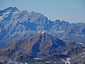 Weisshorn (Arosa) as seen from Älplihorn.jpg 5 184 × 3 888; 6,65 MB
-
 Zoom Ringelspitz.jpg 2 272 × 1 704; 1,02 MB


.jpg)
.jpg)
.jpg)


_as_seen_from_%C3%84lplihorn.jpg)
