Category:Ringforts in Ireland
Vai alla navigazione
Vai alla ricerca
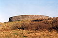
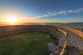
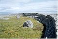
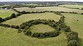
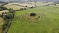
English: The ringforts of Ireland are fortified settlements that are generally deemed to be from the Iron Age, Early Christian or possibly the Early Medieval period. They are also known as ráth, caiseal, cathair and dún in the early Irish sources, and by caher in contemporary archaeological literature of Ireland.
circular fortified settlements that were mostly built during the Early Middle Ages in Northern Europe ,_Co_Roscommon,_Ireland.jpg) | |||||
| Carica un file multimediale | |||||
| Sottoclasse di | |||||
|---|---|---|---|---|---|
| Luogo |
| ||||
| Distinto da | |||||
| |||||
Sottocategorie
Questa categoria contiene le 10 sottocategorie indicate di seguito, su un totale di 10.
B
- Ballyallaban Ring Fort (18 F)
C
- Caherdooneerish Stone Fort (5 F)
- Cahergall stone fort (36 F)
D
- Dún Dúchathair (28 F)
G
- Glendalough Caher (1 F)
- Grianan of Aileach (1 P, 69 F)
L
- Loher Cashel (6 F)
N
- Ringforts in Northern Ireland (26 F)
R
- Rathcroghan (11 F)
S
- Staigue stone fort (32 F)
File nella categoria "Ringforts in Ireland"
Questa categoria contiene 35 file, indicati di seguito, su un totale di 35.
-
 Baltrasna Ringfort - geograph.org.uk - 1029215.jpg 640 × 480; 116 KB
-
 Belsar's Hill, earthwork and ditch (geograph 3394865).jpg 1 200 × 842; 1,44 MB
-
 Caher black head.jpg 3 040 × 2 024; 1,07 MB
-
 Cahercommaun close up.jpg 3 456 × 1 944; 3,13 MB
-
 Cahercommaun distant view.jpg 3 456 × 1 944; 2,98 MB
-
 Cahercommaun info sign.jpg 3 456 × 1 944; 2,79 MB
-
 Cahergal 2.jpg 1 752 × 1 134; 164 KB
-
 Cahergal.jpg 1 752 × 1 140; 296 KB
-
 Cashlaungar from the east.jpg 3 456 × 1 944; 3,22 MB
-
 Cashlaungar from the southwest.jpg 3 456 × 1 944; 3,07 MB
-
 Finiskil Ringfort, Mohill, Co. Leitrim.jpg 2 592 × 1 936; 1,58 MB
-
 Freestone Hill with Hawthorne tree.png 1 400 × 803; 1,84 MB
-
 Grainan of Aileach Ring Fort - Donegal - Ireland.jpg 7 150 × 4 771; 17,48 MB
-
 Inisheer - O'Briens.jpg 2 048 × 1 536; 329 KB
-
 InishmaanRingfort2.jpg 1 801 × 1 194; 221 KB
-

-
 Kilclone ringfort.jpg 4 056 × 2 280; 5,13 MB
-

-
 Loughane More Ring Fort - geograph.org.uk - 1382172.jpg 640 × 480; 96 KB
-
 Marshland near Dun an Oir - geograph.org.uk - 16996.jpg 640 × 480; 497 KB
-
 Medieval Ringfort.jpg 5 878 × 3 919; 15,57 MB
-
 Mullaun Ringfort, County Leitrim.jpg 2 592 × 1 936; 1,67 MB
-

-

-
 Rath at Shinnahergoa - geograph.org.uk - 168119.jpg 640 × 479; 80 KB
-
 Ring Fort - geograph.org.uk - 916496.jpg 640 × 426; 57 KB
-

-
 Ringfort at Pollnagowna - geograph.org.uk - 1542520.jpg 640 × 480; 57 KB
-
 Ringfort at Reynella, Co. Westmeath - geograph.org.uk - 1097939.jpg 640 × 480; 74 KB
-
 Ringfort distribution Ireland.png 2 355 × 2 805; 1,91 MB
-

-
 Ringfort, Garrysallagh, Co. Cavan - geograph.org.uk - 627500.jpg 640 × 480; 59 KB
-
 Rocks galore in the Bog of the Castle.jpg 2 000 × 1 386; 1,1 MB
-
 Rodanstown ringfort.jpg 4 056 × 2 280; 4,88 MB
-


.jpg)


