Category:Ripley, Derbyshire
Vai alla navigazione
Vai alla ricerca
Nederlands: Ripley is een plaats in het bestuurlijke gebied Amber Valley, in het Engelse graafschap Derbyshire. De plaats telt 21.097 inwoners.
Norsk bokmål: Ripley er en by i Amber Valley, England. Området ble på grunn av rike mineralforekomster industrialisert fra slutten av det 18. århundre.
Polski: Ripley - miasto w Wielkiej Brytanii. w Anglii w hrabstwie Derbyshire położone w dolinie Amber Walley. Miasto zamieszkuje ponad 24 tys. osób.
Română: Ripley este un oraş în comitatul Derbyshire, regiunea East Midlands, Anglia. Oraşul se află în districtul Amber Valley a cărui reşedinţă este.
Русский: У этого термина существуют и другие значения, см. Рипли.
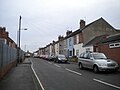
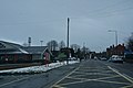
town and civil parish in Amber Valley district, Derbyshire, England  Одна из улиц города | |||||
| Carica un file multimediale | |||||
| Istanza di | |||||
|---|---|---|---|---|---|
| Luogo | Amber Valley, Derbyshire, Midlands Orientali, Inghilterra | ||||
| Considerato essere uguale a | Ripley (pagina Wikimedia duplicata, parrocchia civile dell'Inghilterra) | ||||
| sito web ufficiale | |||||
 | |||||
Sottocategorie
Questa categoria contiene le 17 sottocategorie indicate di seguito, su un totale di 17.
A
B
- Bullbridge (11 F)
D
H
L
M
- Marehay (19 F)
P
- Padley Hall, Amber Valley (2 F)
R
- Ripley Co-operative Society (13 F)
- Ripley Town Hall, Derbyshire (5 F)
S
- Shops in Ripley, Derbyshire (4 F)
T
U
- Upper Hartshay (12 F)
File nella categoria "Ripley, Derbyshire"
Questa categoria contiene 200 file, indicati di seguito, su un totale di 568.
(pagina precedente) (pagina successiva)-
 17 Boothgate, Ripley.jpg 1 280 × 910; 373 KB
-
 A Belted Galloway cow sheltering in the shade - geograph.org.uk - 5774460.jpg 2 000 × 1 333; 2,67 MB
-
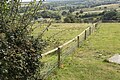 A sturdy fence - geograph.org.uk - 5827143.jpg 2 000 × 1 333; 2,92 MB
-
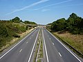
 A28 at marker B 460.6 - geograph.org.uk - 4046004.jpg 1 600 × 991; 277 KB
-
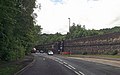
 A38 at Ripley - geograph.org.uk - 2046911.jpg 640 × 480; 69 KB
-
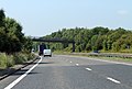 A38 heading south - geograph.org.uk - 4046006.jpg 1 600 × 1 079; 384 KB
-
 A6 at Ambergate - geograph.org.uk - 1810710.jpg 640 × 480; 68 KB
-
 A6 at Ambergate - geograph.org.uk - 5432900.jpg 1 280 × 960; 357 KB
-
 A6 bend at the south end of Dunge Wood - geograph.org.uk - 3530389.jpg 640 × 510; 166 KB
-
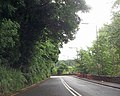
 A6 Derby Road near Dunge Wood - geograph.org.uk - 5137389.jpg 640 × 481; 54 KB
-
 A6 leaving Ambergate southbound - geograph.org.uk - 3530386.jpg 640 × 521; 125 KB
-
 A6 passing under railway bridge - geograph.org.uk - 3530346.jpg 640 × 458; 114 KB
-
 A6 south of Ambergate - geograph.org.uk - 5535105.jpg 1 600 × 1 066; 720 KB
-
 A610 at Buckland Hollow - geograph.org.uk - 1810719.jpg 640 × 480; 59 KB
-
 A610 at Bullbridge - geograph.org.uk - 1810716.jpg 640 × 480; 80 KB
-
 A610 at Codnor - geograph.org.uk - 1810733.jpg 640 × 480; 63 KB
-
 A610 near Buckland Hollow - geograph.org.uk - 1810717.jpg 640 × 480; 83 KB
-
 A610 near Butterley - geograph.org.uk - 1810729.jpg 640 × 480; 67 KB
-
 A610 near Butterley - geograph.org.uk - 1810731.jpg 640 × 480; 60 KB
-
 A610 near Hammersmith - geograph.org.uk - 1810728.jpg 640 × 480; 77 KB
-
 A610 near Ladygrove - geograph.org.uk - 5137376.jpg 640 × 480; 55 KB
-
 A610 near Ripley - geograph.org.uk - 1810732.jpg 640 × 480; 54 KB
-
-
-
 A610 towards Ambergate - geograph.org.uk - 2335150.jpg 886 × 636; 59 KB
-
 A610 towards Ambergate - geograph.org.uk - 2335160.jpg 891 × 654; 73 KB
-
 A610 towards Ambergate at Bullbridge - geograph.org.uk - 2335155.jpg 881 × 592; 56 KB
-
 A610, Ambergate - geograph.org.uk - 6066107.jpg 1 024 × 768; 121 KB
-
 Air shaft for Butterley Tunnel - geograph.org.uk - 2817159.jpg 2 048 × 1 536; 1,15 MB
-
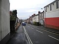 Alfred Street, Ripley - geograph.org.uk - 4814591.jpg 1 024 × 768; 125 KB
-
 Along the Cromford Canal - geograph.org.uk - 1210130.jpg 640 × 640; 119 KB
-
 Alpacas near Iron Works Farm - geograph.org.uk - 4723734.jpg 640 × 480; 82 KB
-
 Ambergate Country Furniture - geograph.org.uk - 2982249.jpg 640 × 360; 50 KB
-
 Ambergate former West Junction viaduct - geograph.org.uk - 5592811.jpg 1 280 × 960; 449 KB
-
 Ambergate Junction - geograph.org.uk - 4759364.jpg 640 × 426; 95 KB
-
 Ambergate Sawmill Ltd - geograph.org.uk - 2117311.jpg 640 × 480; 98 KB
-
 Apollo Engineering - geograph.org.uk - 2179949.jpg 640 × 480; 64 KB
-
 Approaching Bull Bridge (SPCB-47) - geograph.org.uk - 1191081.jpg 640 × 480; 91 KB
-
 Approaching Heage from Morley Park - geograph.org.uk - 3076641.jpg 4 000 × 3 000; 3,93 MB
-
 Approaching Poysers Bridge, near Ambergate - geograph.org.uk - 3362746.jpg 1 024 × 768; 204 KB
-
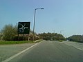 Approaching the A610-A38 junction - geograph.org.uk - 1810725.jpg 640 × 480; 48 KB
-
 Arbutusunedo03.jpg 2 816 × 2 112; 2,02 MB
-
 B6013 towards Belper - geograph.org.uk - 3112393.jpg 1 024 × 792; 271 KB
-
 B6441 entering Ripley - geograph.org.uk - 3013295.jpg 640 × 446; 80 KB
-
 Beighton Street, Ripley - geograph.org.uk - 4814574.jpg 1 024 × 768; 119 KB
-
 Bench from a tree trunk - geograph.org.uk - 3263196.jpg 4 000 × 3 000; 2,65 MB
-
 Bench mark, The Beehive Inn, Peasehill - geograph.org.uk - 5436354.jpg 1 280 × 1 280; 517 KB
-
 Bend in Coach Road - geograph.org.uk - 3390988.jpg 3 562 × 2 679; 2,75 MB
-
-
 Bernard Boam Flats, Ripley - geograph.org.uk - 5440501.jpg 1 024 × 768; 208 KB
-
 Birthplace of Sir Barnes Wallis, Ripley, Derbyshire - geograph.org.uk - 5577056.jpg 5 472 × 3 648; 5,22 MB
-
 Brick sculpture on the Ripley Greenway - geograph.org.uk - 319138.jpg 640 × 480; 104 KB
-
 Bridge at Sawmills - geograph.org.uk - 1231235.jpg 640 × 479; 129 KB
-
 Bridge at the Excavator - geograph.org.uk - 1231557.jpg 640 × 479; 112 KB
-
 Bridge Farm Cottage - geograph.org.uk - 1211841.jpg 479 × 640; 110 KB
-
 Bridge Supports - geograph.org.uk - 3133295.jpg 2 048 × 1 536; 1,43 MB
-
 Bridge Supports - geograph.org.uk - 3133308.jpg 2 048 × 1 536; 1,36 MB
-
 Bridle Lane - geograph.org.uk - 1307570.jpg 640 × 479; 126 KB
-
 Bridleway south of Waingroves - geograph.org.uk - 3281091.jpg 1 280 × 856; 397 KB
-
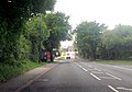
 Brook Lane - geograph.org.uk - 4723337.jpg 640 × 480; 49 KB
-
 Brook Lane roundabout off Derby Road - geograph.org.uk - 3013628.jpg 640 × 443; 59 KB
-
 Brook Street in Heage - geograph.org.uk - 3076645.jpg 4 000 × 3 000; 2,52 MB
-
 Buckland Hollow trail - geograph.org.uk - 1231509.jpg 640 × 479; 179 KB
-
 Buckland Hollow Tunnel - geograph.org.uk - 2117425.jpg 640 × 480; 126 KB
-
-
-
 Bullbridge - Drovers Way - geograph.org.uk - 1191162.jpg 640 × 480; 129 KB
-
 Bus at Ripley Market Place - geograph.org.uk - 3035453.jpg 1 024 × 768; 229 KB
-
 Bus stop and shelter on Parkside - geograph.org.uk - 4723765.jpg 640 × 480; 68 KB
-
 Bus stop and shelter on Parkside - geograph.org.uk - 4723775.jpg 640 × 480; 37 KB
-
-
 Bus stop and shelter on Street Lane - geograph.org.uk - 4723716.jpg 640 × 480; 59 KB
-

-
 Bus stop on Peasehill Road - geograph.org.uk - 4723330.jpg 640 × 480; 50 KB
-
-
 Bus stop on Ripley Road - geograph.org.uk - 4723750.jpg 640 × 442; 44 KB
-
 Bus Stop on the A610 at Bull Bridge - geograph.org.uk - 1191179.jpg 640 × 480; 88 KB
-
 Buterley Hill meets Lowes Hill - geograph.org.uk - 4993903.jpg 3 072 × 1 728; 4,41 MB
-
 Butterley Corner, Ripley - geograph.org.uk - 3005809.jpg 1 600 × 1 200; 403 KB
-
 Butterley Grange - geograph.org.uk - 3394656.jpg 3 478 × 2 629; 2,94 MB
-
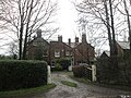
 Butterley Hall, Ripley, Derbyshire.jpg 3 026 × 1 985; 831 KB
-
 Butterley Ironworks wall.jpg 2 277 × 2 931; 1,31 MB
-
 Butterley Lane - geograph.org.uk - 1307433.jpg 479 × 640; 204 KB
-
 Butterley Park House - geograph.org.uk - 5314100.jpg 1 600 × 1 200; 843 KB
-
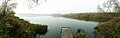 Butterley Reservoir - geograph.org.uk - 4775017.jpg 2 416 × 764; 409 KB
-
 Butterley Reservoir - geograph.org.uk - 4947383.jpg 800 × 600; 128 KB
-
 Butterley Reservoir and Midland Steam Centre - geograph.org.uk - 2435537.jpg 1 024 × 768; 166 KB
-
 Butterley Signal Box - geograph.org.uk - 6157651.jpg 5 219 × 3 479; 6,63 MB
-
 Bypass cut-off - geograph.org.uk - 1307542.jpg 640 × 479; 149 KB
-
 Canal Bridge - geograph.org.uk - 2663718.jpg 2 048 × 1 536; 1,78 MB
-
 Canal Bridge No 16 - geograph.org.uk - 2663722.jpg 2 048 × 1 536; 2,05 MB
-
 Canal bridge, Cromford Canal - geograph.org.uk - 1743164.jpg 640 × 480; 122 KB
-
 Car dealers at Marehay on Derby Road - geograph.org.uk - 3013634.jpg 640 × 379; 53 KB
-
 Car dealership at Codnor - geograph.org.uk - 1810734.jpg 640 × 480; 78 KB
-
 Car park off the A610 - geograph.org.uk - 3112294.jpg 768 × 1 024; 205 KB
-
 Car sales of Derby Road (B6179) - geograph.org.uk - 4723342.jpg 640 × 480; 42 KB
-
 Car Sales on B6179 - geograph.org.uk - 4566772.jpg 640 × 286; 51 KB
-
 Caravan Club site The Firs Belper facilities block - geograph.org.uk - 2515005.jpg 4 000 × 3 000; 3,22 MB
-
 Caravan Club site The Firs Belper information room - geograph.org.uk - 2515004.jpg 4 000 × 3 000; 4,11 MB
-
 Caravan Club site The Firs Belper reception - geograph.org.uk - 2515002.jpg 4 000 × 3 000; 3,31 MB
-
 Carved Bench Seat - geograph.org.uk - 534362.jpg 640 × 480; 154 KB
-
 Causeway across Butterley Reservoir, Ripley, Derbyshire - geograph.org.uk - 5575469.jpg 5 472 × 3 648; 4,66 MB
-
-
 Chapel Studio, Newbridge Road - geograph.org.uk - 5703509.jpg 640 × 480; 115 KB
-
 Chippy, pub and M.O.T - geograph.org.uk - 2179748.jpg 640 × 490; 53 KB
-
 Church Farm development - geograph.org.uk - 4349684.jpg 640 × 480; 62 KB
-
 Church Street, Ripley 2394754 88d17344.jpg 640 × 480; 73 KB
-
 Church Street, Waingroves - geograph.org.uk - 3263212.jpg 4 000 × 3 000; 2,43 MB
-
 Cliff Richards' first gig plaque, The Regal, Ripley - geograph.org.uk - 3005775.jpg 1 600 × 1 200; 399 KB
-
 Co-operative Society Building Ripley Derbyshire - geograph.org.uk - 5574795.jpg 3 648 × 5 472; 3,69 MB
-
 Coach Road - geograph.org.uk - 3390982.jpg 3 648 × 2 736; 2,6 MB
-
 Coach Road towards Butterley Police HQ - geograph.org.uk - 1833561.jpg 640 × 480; 127 KB
-
 Codnor Gate Business Park - geograph.org.uk - 4944883.jpg 3 072 × 1 728; 1,99 MB
-
 Come back in a couple of years and you'll see houses - geograph.org.uk - 4993866.jpg 2 970 × 1 516; 3,64 MB
-
 Communications mast at Greenwich, Ripley - geograph.org.uk - 4993889.jpg 3 072 × 1 728; 2,33 MB
-
 Cooperative Hall 1879 - geograph.org.uk - 841606.jpg 480 × 640; 78 KB
-
 Coppice Farmhouse, Ripley.jpg 1 280 × 871; 463 KB
-
 Cottage at Buckland Hollow - geograph.org.uk - 1810720.jpg 640 × 480; 124 KB
-
 Cottage at the junction - geograph.org.uk - 5703520.jpg 640 × 480; 70 KB
-
 Crich Chase Farm - geograph.org.uk - 5592786.jpg 1 280 × 960; 378 KB
-
 Cromford and Butterley - geograph.org.uk - 1450989.jpg 640 × 479; 136 KB
-
 Cromford Canal - geograph.org.uk - 1231555.jpg 640 × 479; 135 KB
-
 Cromford Canal leaving Butterley Tunnel - geograph.org.uk - 2679428.jpg 2 048 × 1 536; 1,02 MB
-
 Cromford canal near Ambergate - geograph.org.uk - 3112589.jpg 1 024 × 768; 337 KB
-
 Cromford Canal north west of Ambergate - geograph.org.uk - 3359810.jpg 1 024 × 768; 255 KB
-
 Cromford Canal Towpath - geograph.org.uk - 5703144.jpg 640 × 480; 147 KB
-

-
 Crossing the Main Line - geograph.org.uk - 1191125.jpg 640 × 480; 117 KB
-

-
 Derby Road (B6179) - geograph.org.uk - 4723339.jpg 640 × 480; 52 KB
-
 Derby Road (B6179) - geograph.org.uk - 4723344.jpg 640 × 480; 50 KB
-
 Derby Road - geograph.org.uk - 2435382.jpg 1 024 × 768; 229 KB
-
 Derby Road at Allissa Avenue - geograph.org.uk - 3013632.jpg 640 × 436; 54 KB
-
 Derby Road at roundabout at Marehay - geograph.org.uk - 3013375.jpg 640 × 451; 52 KB
-
 Derby Road by the Fish Bar - geograph.org.uk - 3013371.jpg 640 × 525; 69 KB
-
 Derby Road, Ripley - geograph.org.uk - 4333743.jpg 1 600 × 1 071; 426 KB
-
 Derby Road, Ripley - geograph.org.uk - 5440496.jpg 1 024 × 768; 151 KB
-
 Derby to Little Eaton and Ripley.png 502 × 418; 241 KB
-
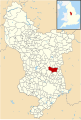 Derbyshire UK parish map highlighting Ripley.svg 888 × 1 308; 2,34 MB
-
 Derbyshire Windmill - geograph.org.uk - 2672503.jpg 800 × 530; 71 KB
-
 Derwent Viaduct, Ambergate - geograph.org.uk - 5432898.jpg 1 280 × 960; 365 KB
-
 Disused in preservation - geograph.org.uk - 1773393.jpg 2 592 × 1 944; 2,85 MB
-

-
 Do androids dream of electric sheep^ - geograph.org.uk - 2179767.jpg 640 × 480; 70 KB
-
 Drovers Way, Bull Bridge - geograph.org.uk - 1231188.jpg 640 × 479; 135 KB
-
 Drovers Way, Bull Bridge - geograph.org.uk - 1231191.jpg 640 × 520; 97 KB
-

-
 Dungeley Hill from Heage, towards Nether Heage - geograph.org.uk - 3112353.jpg 1 024 × 768; 264 KB
-
 Dungley Hill - geograph.org.uk - 833785.jpg 640 × 406; 145 KB
-

-
 Dwelling at Heage Firs - geograph.org.uk - 4255498.jpg 3 971 × 2 958; 3,43 MB
-
 Eagle Street on a very bright morning - geograph.org.uk - 5827132.jpg 2 000 × 1 333; 2,22 MB
-
 East end of Elms Avenue, Ripley - geograph.org.uk - 5440504.jpg 1 024 × 768; 149 KB
-
 Emerging crop, south-east of Butterley Grange - geograph.org.uk - 4236590.jpg 1 024 × 768; 149 KB
-
 End of Cromford Canal - geograph.org.uk - 2047855.jpg 600 × 800; 170 KB
-
 Entering Heage - geograph.org.uk - 4723754.jpg 640 × 480; 46 KB
-
 Entering Ripley on Cromford Road - geograph.org.uk - 2459859.jpg 640 × 480; 82 KB
-
 Entering Ripley on Derby Road - geograph.org.uk - 4567298.jpg 640 × 371; 52 KB
-
 Entrance to haulage firm - geograph.org.uk - 1231240.jpg 640 × 479; 118 KB
-

-
 Farm yard, Knob Farm - geograph.org.uk - 2180760.jpg 640 × 480; 137 KB
-
 Farm, Golden Valley - geograph.org.uk - 1833557.jpg 640 × 480; 65 KB
-
 Farmland at Morley Park - geograph.org.uk - 1483045.jpg 640 × 479; 72 KB
-
 Farmland near Wingfield Park - geograph.org.uk - 2117397.jpg 640 × 480; 75 KB
-
 Farmland south of Butterley Grange - geograph.org.uk - 4236593.jpg 1 024 × 768; 127 KB
-
 Farmland, with stream and bridge - geograph.org.uk - 2046499.jpg 640 × 480; 137 KB
-
 Field and Communications Mast near Toadmoor - geograph.org.uk - 4255509.jpg 4 000 × 3 000; 2,02 MB
-
 Field of alpacas and view to Nether Heage - geograph.org.uk - 3112402.jpg 1 024 × 689; 141 KB
-
 Fields at Lower Hartshay - geograph.org.uk - 4255658.jpg 4 000 × 3 000; 2,59 MB
-
 Fields at Upper Hartshay - geograph.org.uk - 4255642.jpg 4 000 × 3 000; 2,43 MB
-
 Fields from Spanker Lane - geograph.org.uk - 5827125.jpg 2 000 × 1 333; 2,55 MB
-
 Fields near Heage Common Farm - geograph.org.uk - 4255483.jpg 4 000 × 3 000; 2,43 MB
-
-
 Food for thought - geograph.org.uk - 1451055.jpg 620 × 436; 100 KB
-
 Footbridge over the A38 - geograph.org.uk - 4723741.jpg 640 × 480; 56 KB
-
 Footbridge over the A38 Road - geograph.org.uk - 4254330.jpg 4 000 × 3 000; 2,95 MB
-
 Footbridge over The River Amber at Sawmills - geograph.org.uk - 4841501.jpg 5 184 × 3 888; 6,5 MB
-
 Footbridge, Ripley Greenway - geograph.org.uk - 2179957.jpg 640 × 480; 103 KB
-
 Footpath at Butterley - geograph.org.uk - 3392961.jpg 3 648 × 2 736; 3,18 MB
-
 Footpath beside The Ripley Academy - geograph.org.uk - 4989014.jpg 800 × 600; 134 KB
-
 Footpath descending to Butterley Station - geograph.org.uk - 4236592.jpg 1 024 × 768; 262 KB
-
 Footpath from Ambergate to Fritchley - geograph.org.uk - 2117331.jpg 640 × 480; 99 KB
-
 Footpath near Knob Farm - geograph.org.uk - 4254327.jpg 4 000 × 3 000; 3,08 MB
-
 Footpath near Marehay - geograph.org.uk - 4254348.jpg 4 000 × 3 000; 2,64 MB
-
 Footpath to Butterley Park Farm - geograph.org.uk - 2972278.jpg 1 024 × 768; 247 KB
-
 Footpath with gate wired up - geograph.org.uk - 2046919.jpg 480 × 640; 114 KB
-

-
 Former Butterley Iron Works on Derby Road - geograph.org.uk - 2899025.jpg 3 296 × 2 472; 1,26 MB
-
 Former Butterley Works - geograph.org.uk - 4794667.jpg 640 × 424; 90 KB
-
 Former Butterley works - geograph.org.uk - 4794675.jpg 640 × 423; 56 KB
-
 Former chapel - geograph.org.uk - 2046878.jpg 640 × 480; 59 KB
-
 Former Cromford Canal at Bridge Farm - geograph.org.uk - 1211735.jpg 640 × 479; 108 KB
-
 Former Three Horsehoes Pub - geograph.org.uk - 1211414.jpg 640 × 480; 88 KB
-
 Former Waingroves Brickworks site - geograph.org.uk - 5436369.jpg 1 280 × 842; 245 KB
-
 Formerly Ridgeway School - geograph.org.uk - 2046494.jpg 640 × 480; 72 KB
-
 From the main line to Sheffield - geograph.org.uk - 5522021.jpg 2 000 × 1 333; 1,97 MB
-
 Frozen Pond - geograph.org.uk - 2179992.jpg 1 600 × 1 200; 678 KB
-
 Garages off Derby Road - geograph.org.uk - 4723333.jpg 640 × 463; 78 KB
-
 Gate and stile - geograph.org.uk - 1485191.jpg 640 × 479; 69 KB
-


_-_geograph.org.uk_-_1191081.jpg)


_-_geograph.org.uk_-_4723743.jpg)


,_Heage_-_geograph.org.uk_-_4723758.jpg)


_-_geograph.org.uk_-_4723342.jpg)


_(Geograph-2428206-by-Dave-Bevis).jpg)
_-_geograph.org.uk_-_4723339.jpg)
_-_geograph.org.uk_-_4723344.jpg)


_lay-by_heading_south_towards_Derby_-_geograph.org.uk_-_1537412.jpg)


_Heage_windmill_-_geograph.org.uk_-_5109003.jpg)


