Category:Riseley, Bedfordshire
Aller à la navigation
Aller à la recherche
village britannique  | |||||
| Téléverser des médias | |||||
| Nature de l’élément | |||||
|---|---|---|---|---|---|
| Lieu | Bedford, Bedfordshire, Angleterre de l'Est, Angleterre | ||||
 | |||||
English: Riseley is a village and civil parish in north Bedfordshire, about nine miles north of Bedford. It is near the county boundary with Northamptonshire and about eight miles southeast of the Northamptonshire town of Rushden.
Sous-catégories
Cette catégorie comprend seulement la sous-catégorie ci-dessous.
Média dans la catégorie « Riseley, Bedfordshire »
Cette catégorie comprend 65 fichiers, dont les 65 ci-dessous.
-
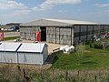
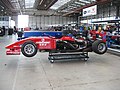
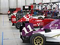
 Bedford Autodrome at Thurleigh Airfield - geograph.org.uk - 1825102.jpg 2 592 × 1 944 ; 1,51 Mio
-
 Bedford Autodrome at Thurleigh Airfield - geograph.org.uk - 1832081.jpg 1 024 × 768 ; 121 kio
-
 Bedford Autodrome at Thurleigh Airfield - geograph.org.uk - 1832084.jpg 1 024 × 768 ; 131 kio
-
 Bedford Autodrome at Thurleigh Airfield - geograph.org.uk - 1832086.jpg 1 024 × 768 ; 135 kio
-
 Bedford Autodrome at Thurleigh Airfield - geograph.org.uk - 1832087.jpg 1 024 × 768 ; 115 kio
-
 Bedford Autodrome at Thurleigh Airfield - geograph.org.uk - 1832090.jpg 1 024 × 768 ; 104 kio
-
 Bedford Autodrome at Thurleigh Airfield - geograph.org.uk - 1832093.jpg 1 024 × 768 ; 128 kio
-
 Bedford Autodrome at Thurleigh Airfield - geograph.org.uk - 1832095.jpg 1 024 × 768 ; 121 kio
-
 Bedford Autodrome at Thurleigh Airfield - geograph.org.uk - 1832097.jpg 1 024 × 768 ; 144 kio
-
 Bedford Autodrome at Thurleigh Airfield - geograph.org.uk - 1832099.jpg 1 024 × 768 ; 67 kio
-
 Bedford Autodrome at Thurleigh Airfield - geograph.org.uk - 1832101.jpg 1 024 × 768 ; 139 kio
-
 Bedford Autodrome at Thurleigh Airfield - geograph.org.uk - 1832103.jpg 1 024 × 768 ; 112 kio
-
 Bedford Autodrome at Thurleigh Airfield - geograph.org.uk - 1832104.jpg 1 024 × 768 ; 110 kio
-
 Bedford Autodrome at Thurleigh Airfield - geograph.org.uk - 1832106.jpg 1 024 × 768 ; 118 kio
-
 Bedford Autodrome at Thurleigh Airfield - geograph.org.uk - 1832109.jpg 1 024 × 768 ; 135 kio
-
 Bench Mark on the Bridge at Riseley - geograph.org.uk - 1805154.jpg 3 648 × 2 736 ; 2,26 Mio
-
 Bridge over the Cedar Brook - geograph.org.uk - 1805131.jpg 3 648 × 2 736 ; 2,21 Mio
-
 Bridleway by Willow Spinney - geograph.org.uk - 1987287.jpg 640 × 480 ; 85 kio
-
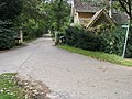 Bridleway to Sackville Cottage - geograph.org.uk - 1551431.jpg 640 × 480 ; 118 kio
-
 Bridleway towards Willow Spinney - geograph.org.uk - 4570716.jpg 640 × 480 ; 69 kio
-
 Bridleway towards Willow Spinney - geograph.org.uk - 4570719.jpg 480 × 640 ; 73 kio
-
 Cameron Balloons C-80 Concept AN1472643.jpg 1 024 × 681 ; 416 kio
-
 Cameron Balloons C-80 Concept AN1481497.jpg 1 024 × 720 ; 196 kio
-
 Cameron Balloons V-90 Viva AN1474365.jpg 1 024 × 741 ; 463 kio
-
 Cottage on Gold Street - geograph.org.uk - 3131710.jpg 640 × 480 ; 121 kio
-
 Cyclone Pegasus Quantum 15-912 AN1472619.jpg 1 024 × 685 ; 556 kio
-
 Faces through the wire fence - geograph.org.uk - 1806753.jpg 640 × 480 ; 81 kio
-
 Farmland and Keysoepark Wood - geograph.org.uk - 3131692.jpg 640 × 480 ; 77 kio
-
 Farmland near Bourne End - geograph.org.uk - 3131729.jpg 640 × 480 ; 103 kio
-
 Farmland near Mill Farm - geograph.org.uk - 3131703.jpg 640 × 480 ; 81 kio
-
 Farmland near Riseley (3) - geograph.org.uk - 1626705.jpg 640 × 480 ; 160 kio
-
 Farmland near Riseley - geograph.org.uk - 3131693.jpg 640 × 480 ; 67 kio
-
 Farmland, High Barn Farm - geograph.org.uk - 3131724.jpg 640 × 480 ; 64 kio
-
 Farmland, Riseley - geograph.org.uk - 3131699.jpg 640 × 480 ; 87 kio
-
 Footpath sign at crossroads - geograph.org.uk - 4570712.jpg 480 × 640 ; 139 kio
-
 Footpath to Church Lane - geograph.org.uk - 1551385.jpg 640 × 480 ; 88 kio
-
 Fox ^ Hounds, Riseley - geograph.org.uk - 5081254.jpg 640 × 480 ; 55 kio
-
 Gold Street, Riseley - geograph.org.uk - 3131711.jpg 640 × 480 ; 90 kio
-
 High Street, Riseley - geograph.org.uk - 3131698.jpg 640 × 480 ; 94 kio
-
 High Street, Riseley - geograph.org.uk - 3131709.jpg 640 × 480 ; 63 kio
-
 Keysoe Road towards Riseley - geograph.org.uk - 3131694.jpg 640 × 480 ; 99 kio
-
 Keysoe Road, Riseley - geograph.org.uk - 1420739.jpg 640 × 480 ; 216 kio
-
 Knotting Lane - geograph.org.uk - 1551487.jpg 640 × 480 ; 87 kio
-
 Raj Hamsa X'Air 512(5) AN1472644.jpg 1 024 × 728 ; 465 kio
-
 Riseley church - geograph.org.uk - 5081257.jpg 480 × 640 ; 66 kio
-
 Riseley Playing Fields - geograph.org.uk - 1551418.jpg 640 × 480 ; 56 kio
-
 Riseley village sign - geograph.org.uk - 1420756.jpg 480 × 640 ; 253 kio
-
 Riseley village stores - geograph.org.uk - 1420750.jpg 640 × 480 ; 234 kio
-
 Riseley, aerial 2017 (2) - geograph.org.uk - 5444447.jpg 800 × 533 ; 98 kio
-
 Riseley, aerial 2017 - geograph.org.uk - 5444437.jpg 640 × 427 ; 74 kio
-
 Riseley, All Saints - geograph.org.uk - 5472816.jpg 4 608 × 3 456 ; 3,96 Mio
-
 Road towards Bletsoe - geograph.org.uk - 3131721.jpg 640 × 480 ; 87 kio
-
 Road towards Bourne End - geograph.org.uk - 3131727.jpg 640 × 480 ; 64 kio
-
 Road towards Bourne End - geograph.org.uk - 3131730.jpg 640 × 480 ; 79 kio
-
 Road towards Swineshead - geograph.org.uk - 3131701.jpg 640 × 480 ; 95 kio
-
 Road towards Swineshead - geograph.org.uk - 3131704.jpg 640 × 480 ; 63 kio
-
 Satellite dishes - geograph.org.uk - 405833.jpg 640 × 480 ; 115 kio
-
 Springtime on the Butts - geograph.org.uk - 1805017.jpg 3 648 × 2 736 ; 2,29 Mio
-
 Stores, Riseley - geograph.org.uk - 3131707.jpg 640 × 480 ; 96 kio
-
 Stubble in the field - geograph.org.uk - 1551506.jpg 640 × 480 ; 58 kio
-
 Thatched cottage, Riseley - geograph.org.uk - 3131697.jpg 640 × 480 ; 55 kio
-
 The Fox and Hounds, Riseley - geograph.org.uk - 3131708.jpg 1 024 × 596 ; 123 kio
-
 Towards Riseley church - geograph.org.uk - 5081255.jpg 640 × 480 ; 65 kio
-
 Trees beside the Riseley to Bletsoe road - geograph.org.uk - 3131723.jpg 640 × 480 ; 83 kio
-
 War Memorial, All Saints Church, Riseley - geograph.org.uk - 3131714.jpg 640 × 480 ; 87 kio


_-_geograph.org.uk_-_1626705.jpg)


_AN1472644.jpg)


_-_geograph.org.uk_-_5444447.jpg)


